Sunday, July 29, 2018

Junction West RV Park, June 2 to June 8, 2018


Rating:  4.0 on a scale of 5

Location: We stayed in Grand Junction because it was halfway between Estes Park, CO, and Capital Reef National Park in Utah. Once we were here, though, we found fun things to see and do. This RV park was a great home base for our adventures.

Lot size: Most of the sites here are pull through, full hook ups, which is always very convenient. We were in site 37.


The roads are wide enough to make pulling in and out easy enough with the RV towing our car. There are also park units available for rent in the park. 


Amenities: Both wifi and cable TV are provided at the park. There is a small dog park with picnic area nearby. 


There is a playground and a splash pad behind it for kids. 


The laundry room is in the office building, as are the bathrooms. 


The park also offers Boat and RV Storage. 


Propane can purchased onsite. And I really like all of the Colorado RV parks because they promote recycling (this is not the case in all states). 


Cost: $311.74; $44.53/night

Management: The folks in the office were very friendly. Check in was fast and easy. 
The park is very well maintained.


General Comments:  Overall we really liked this park. The location was convenient to Colorado National Monument, Grand Mesa, and the town of Grand Junction. I did think it was a bit expensive, but we enjoyed our stay here. 

Website: www.junctionwestrvpark.com

Hiking at Great Mesa National Forest, 6/06/2018

About 20 minutes from Grand Junction is Grand Mesa, the largest flat-top mountain in the world covering 500 square miles! It rises about 6,000’ above the surrounding river valleys to an elevation of over 11,000’. Hard volcanic basalt (formed about 10M years ago) tops the mesa (which has protected it from erosion). There are over 300 lakes on the mesa. 


The Grand Mesa National Forest (346.555 acres) was the third forest reserve established in the US (in 1892). It is bordered by White River National Forest (north) and Gunnison National Forest (east). We drove the Grand Mesa Scenic and Historic Byway (aka Highway 65) to the Visitor Center. A plaque in front of it commemorates the first 100 years of the forest reserve.


Native Americans (Ute tribe) lived in this area for centuries. They raised crops in the valleys and hunted wildlife in the lush forests of the mesa. Settlers arrived in the 1880s, and they, too, pursued agricultural and livestock industries. Today local ranchers continue to move their herds of cattle to Grand Mesa National Forest in the spring for grazing until early fall (permits issued by National Forest Service).

We picked up a brochure with maps the Grand Mesa National Forest and of hiking trails in the Mesa Lakes Recreation Area.


We decided to explore the Ward Lake Hiking Trails. After a short drive from the Visitor Center, we parked in the lot near Ward Lake.


After the Ward Lake Trail, we continued on the Baron Lake Trail to Alexander Lake.


Our doggie, Sadie, had a great time checking out the stream between Ward and Alexander Lakes. If you like to hike with your dog (as we do), National Forests are the perfect place to do so. 


Baron Lake Trail runs along the banks of Alexander Lake and beautiful meadows were on the other side. It was wonderful to be in the cooler temperature at the higher altitude...quite a contrast from the valleys. 


Sadie had a blast swimming in Alexander Lake!


The trail continued through a forested area to Baron Lake. It was well marked with red blazes. 


Continuing on the trail to the far end of Baron Lake, we were amazed at all of the fish we saw in the water. We learned that mature rainbow trout are stocked in the lakes in early summer


We retraced our steps on the Baron Lake Trail back to our car at Ward Lake. Driving on the Scenic Highway, we stopped to snap some photos of Island Lake. There were lots of fishing boats on the lake, and we saw that one had landed on the island. 


Beautiful views of the surrounding area could be seen from several overlooks along the scenic drive. 


The Grand MesaUncompahgre and Gunnison National Forests are managed together. Go to the following site to learn about campgrounds, fishing, hiking and other activities in national forests: www/fs.usda.gov/gmug. We loved the alpine forests and lakes here.

Saturday, July 28, 2018

A Hike at Dinosaur Hill, 6/05/2018

Wanting to go for a hike (where our sweet doggie, Sadie, could join us), we decided to check out Dinosaur Hill. But first, we stopped at a dog park at Canyon View Park for some play time. In addition to the large fenced in area, there is a large pond. 


Swimming is one of Sadie’s favorite activities, especially when it is hot. But swimming with a friend is even better!


Located in the McInnis Canyon National Conservation Area is Dinosaur Hill. A one-mile, self-guided trail with interpretive signs about the geology and paleontology of the area begins near the parking lot. 


In 1900, Elmer Riggs discovered bones of a 70’ long, 30-ton, apatosaurus at what is now called Dinosaur Hill (west of Grand Junction, CO). Returning in 1901 with an excavation crew, they transported the bones they found to the Field Museum in Chicago where they have been one display since 1908.

The bench at the information kiosk is a model of the two 600-pound apatosaurus thigh bones found by Riggs and his crew. 


We followed the well-marked trail around and to the top of the hill. 


From this vantage point you can see the Colorado River below that was used to transport the 6-tons of dinosaur bones to the Fruita railroad dock. First a wagon road was built from the hill to the river; then, Riggs had a flat-bottom boat constructed to carry the bones (protected by plaster of paris) downriver. Free transport was provided by the Denver and Rio Grande Railroad to Chicago (because the bones were scientific specimens). Some bones from other apatosaurus excavation sites in Utah and Wyoming were used to construct the dinosaur skeleton on display at Field Museum of Natural History in Chicago. 


There’s a great view of the surrounding area from the top of the Dinosaur Hill.


This is the quarry where the dinosaur bones were found. 


tunnel was blasted into the hillside to aid in the excavation. In 1938 Riggs returned to the site to dedicate a plaque commemorating the historic discovery.


John wanted to explore the tunnel, but, of course, it is secured with a metal gate and locks. In 1991-1992, local paleontologist excavated the site again finding four more apatosaurus bones. 


After exploring the hill, we enjoyed our picnic lunch at this pavilion. Very interesting hike!

Friday, July 27, 2018

Beautiful Colorado National Monument, 6/04/2018

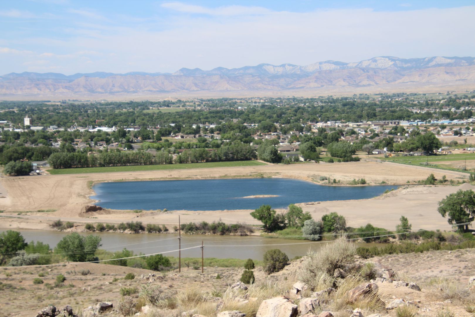
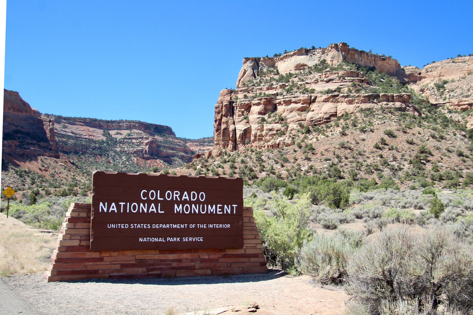
The town of Grand Junction, CO, is about halfway between Rocky Mountain National Park and Capitol Reef National Park, so we made plans to stay here for a week. When I started looking at stuff to do in the area, the Colorado National Monument was #1 on the list. 


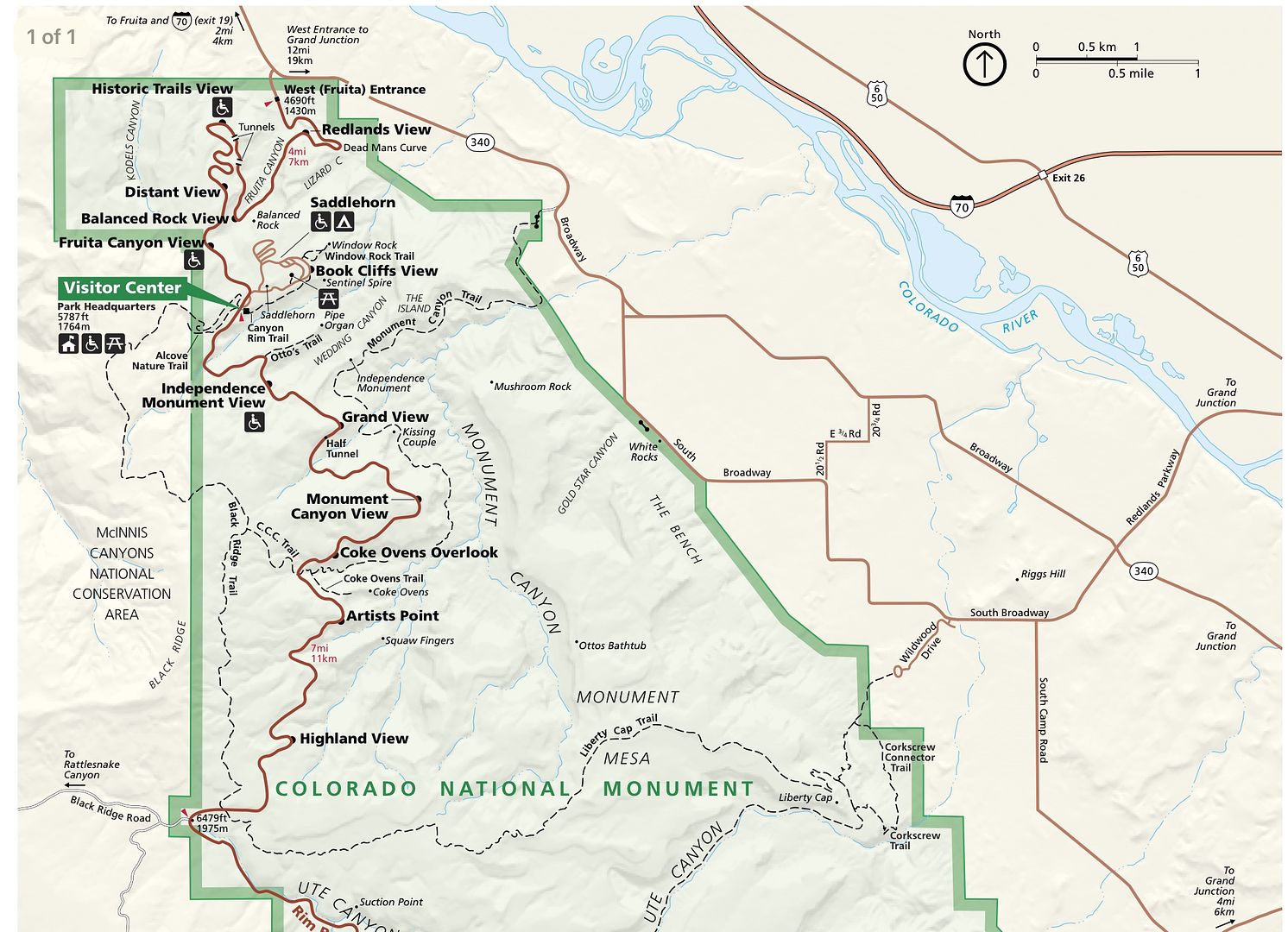
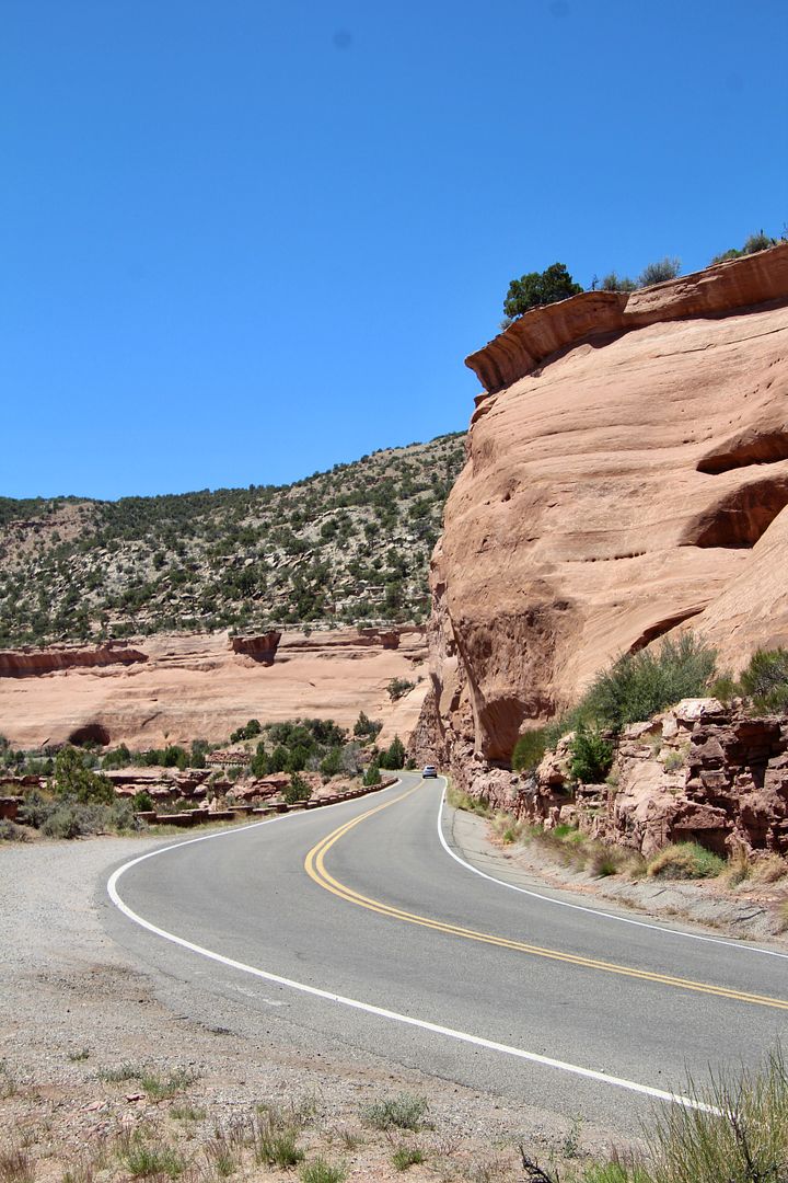
Established in 1911 by President Taft, the monument encompasses 32 square miles of plateauscanyons, and massive sculpted rocks. A great way to experience the Colorado National Monument is by driving the 23-mile Rim Rock Drive


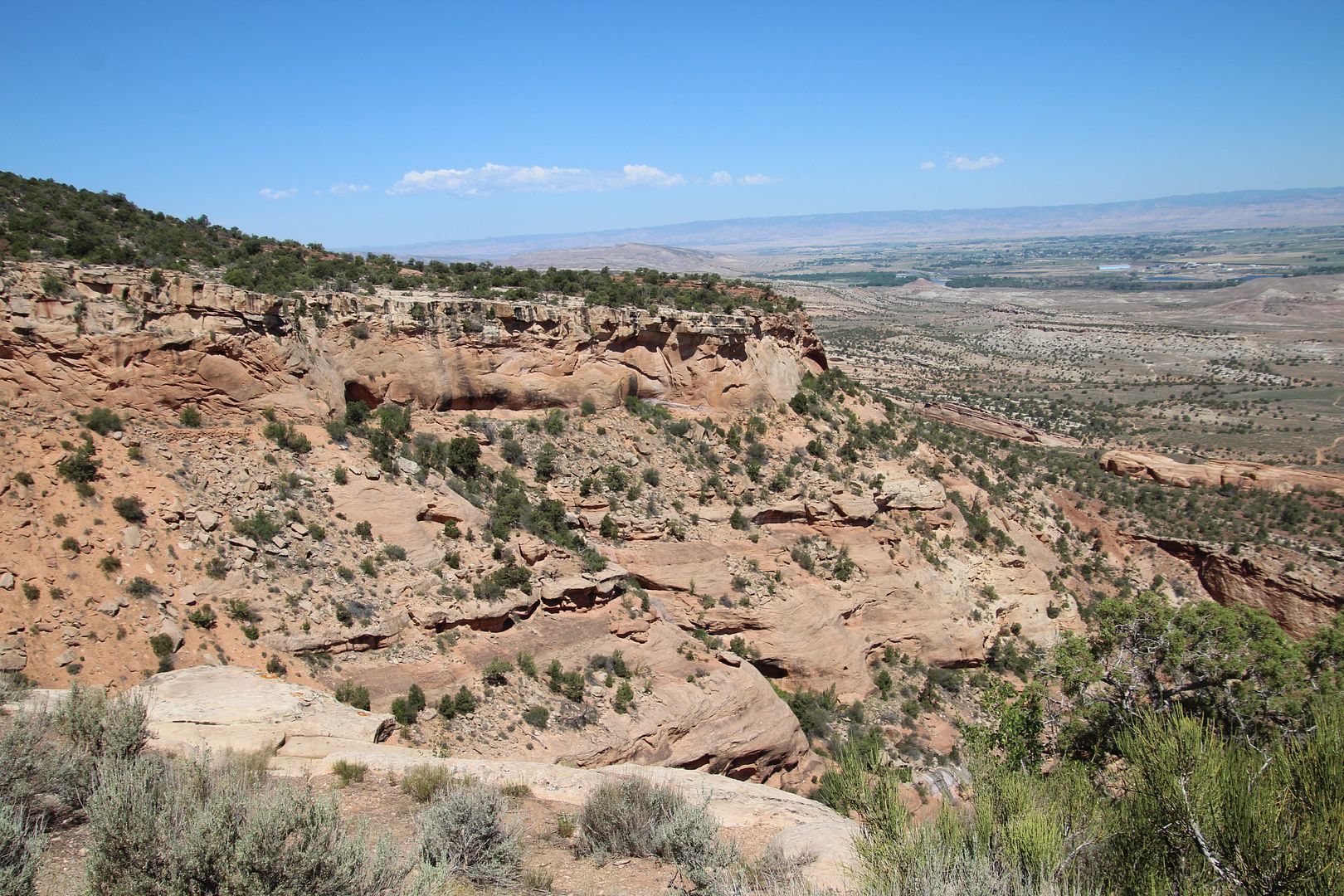
We entered from the west side, where we passed through the Redlands Fault. Erosion along the base of the fault has formed steep cliffs. 


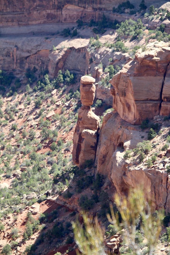
Below is Balanced Rock, a 600-ton boulder that sits atop a pedestal. Erosion has caused most of the rock that once surrounded it to weather away. Flash floods have done most of the canyon carving here.


From the Fruita Canyon View, you can see for miles.


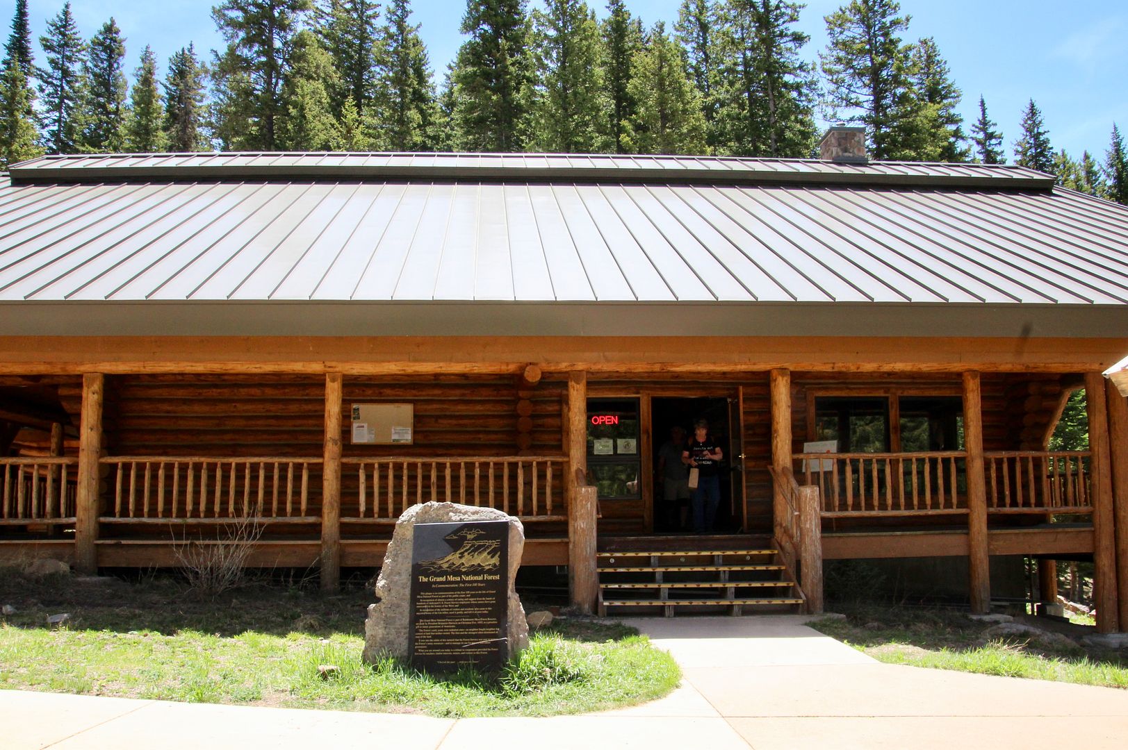
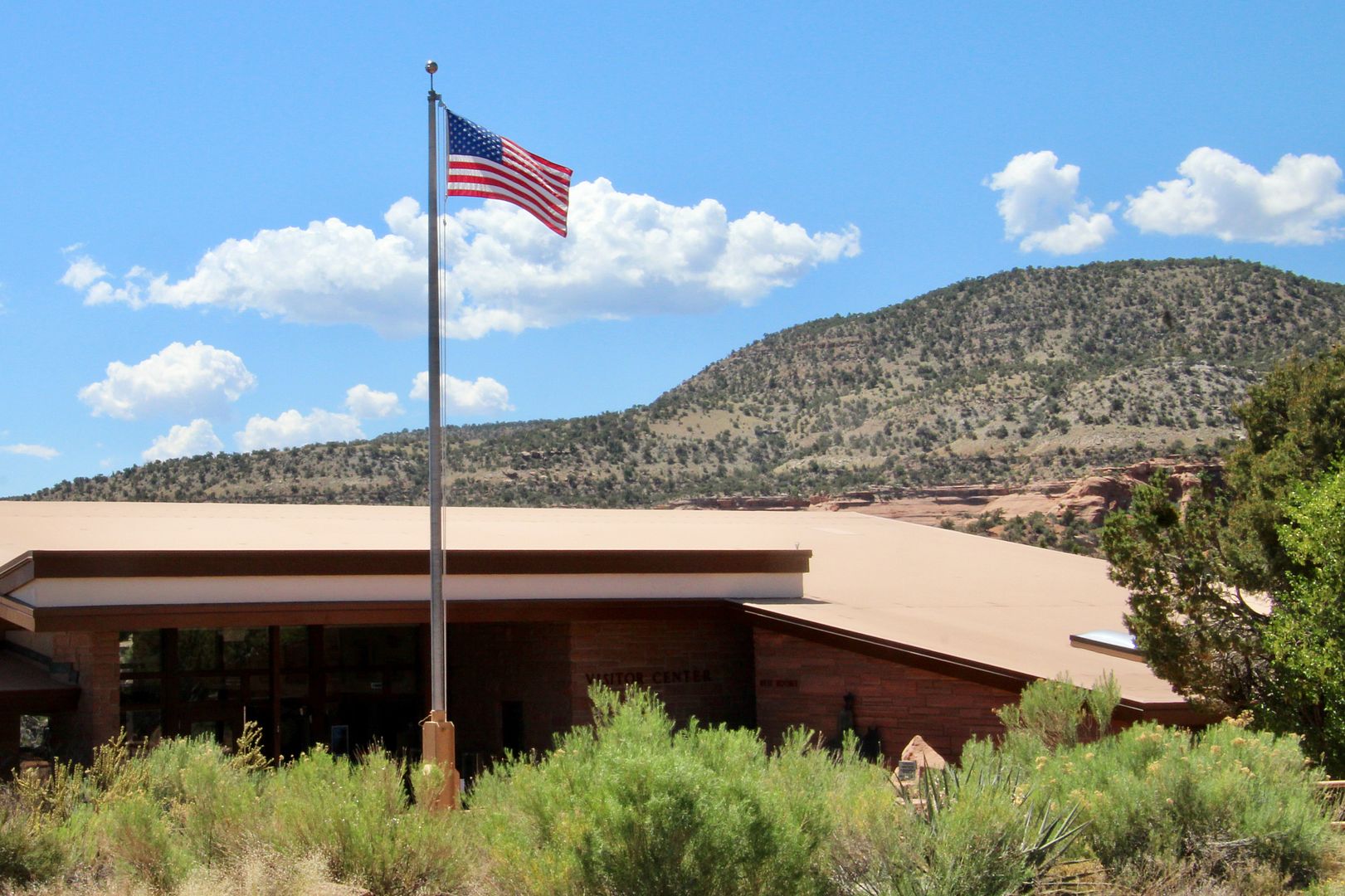
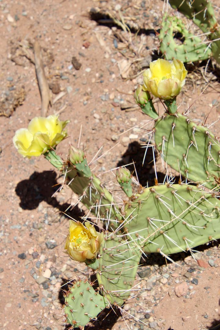
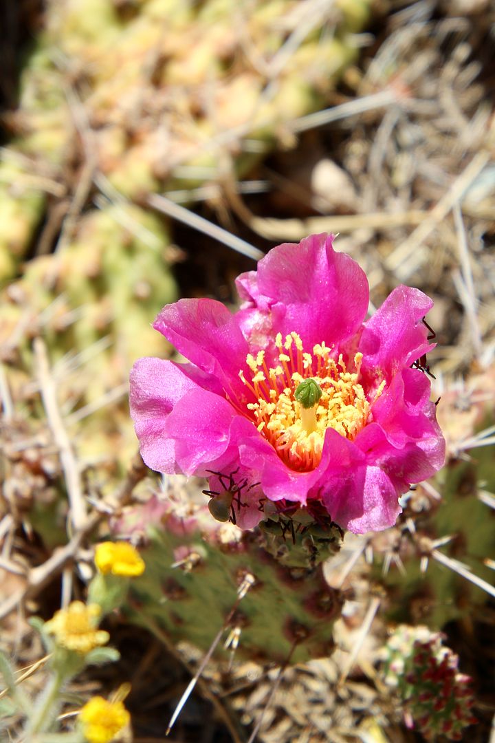
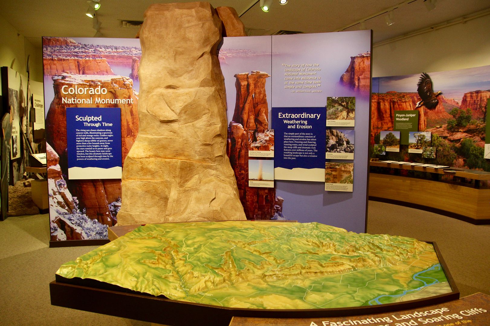
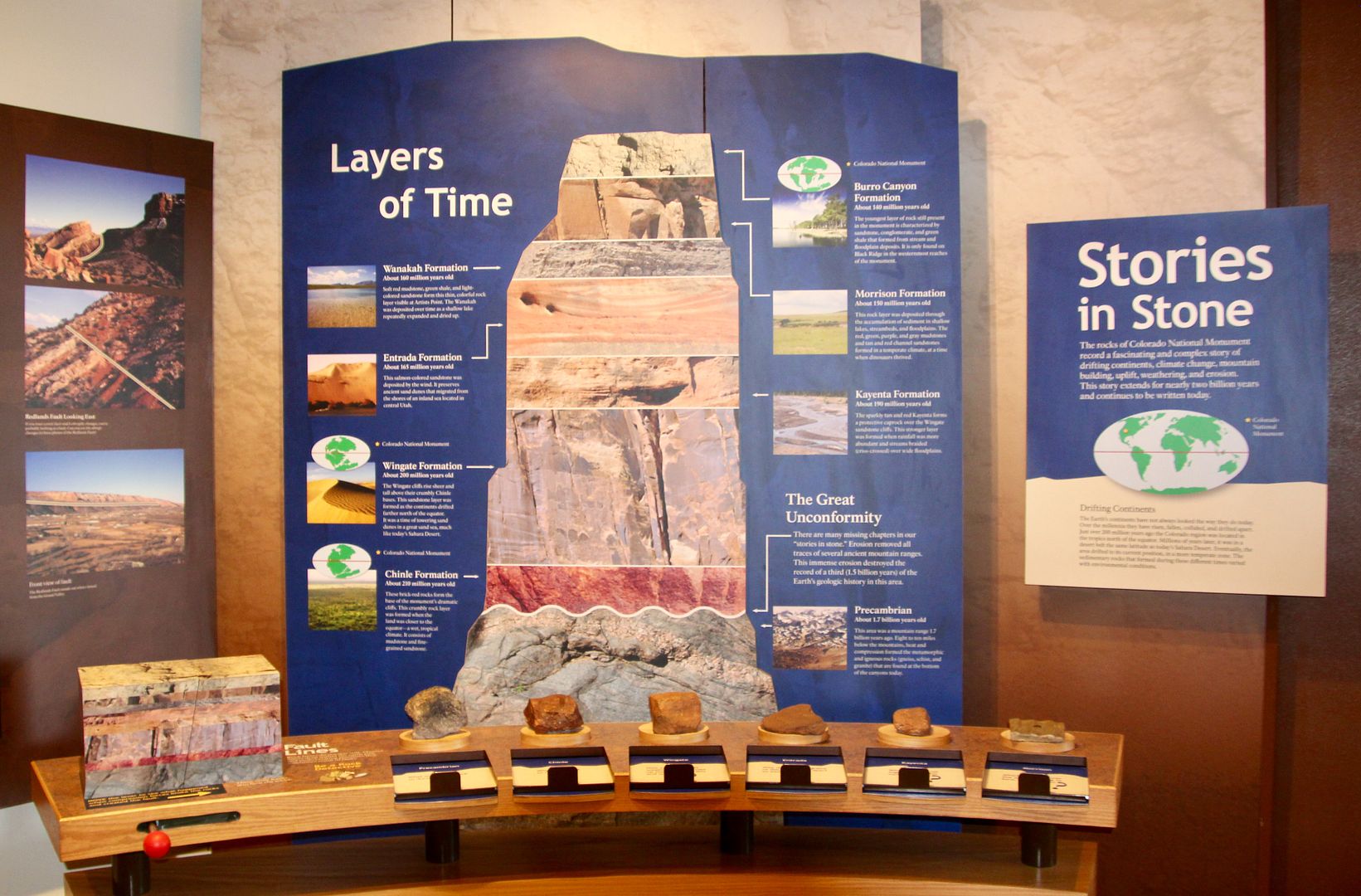
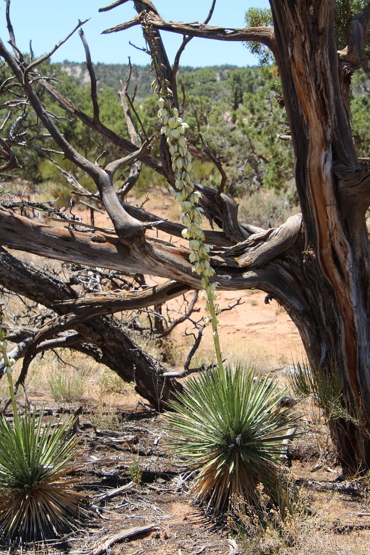
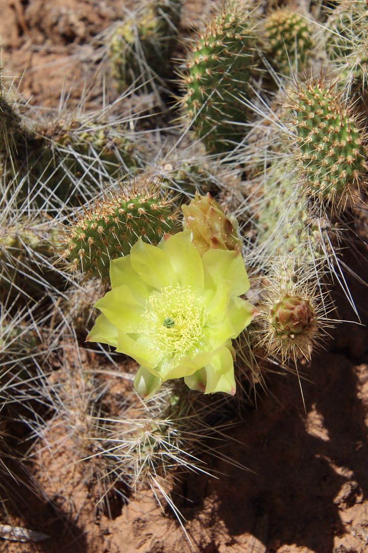
Our next stop was the Visitor Center that is located on a huge sandstone ledge, the Kayenta Formation. Cacti were in bloom outside and we spent time inside checking out the exhibits here. 


The displays about the geology of the area were fascinating. 


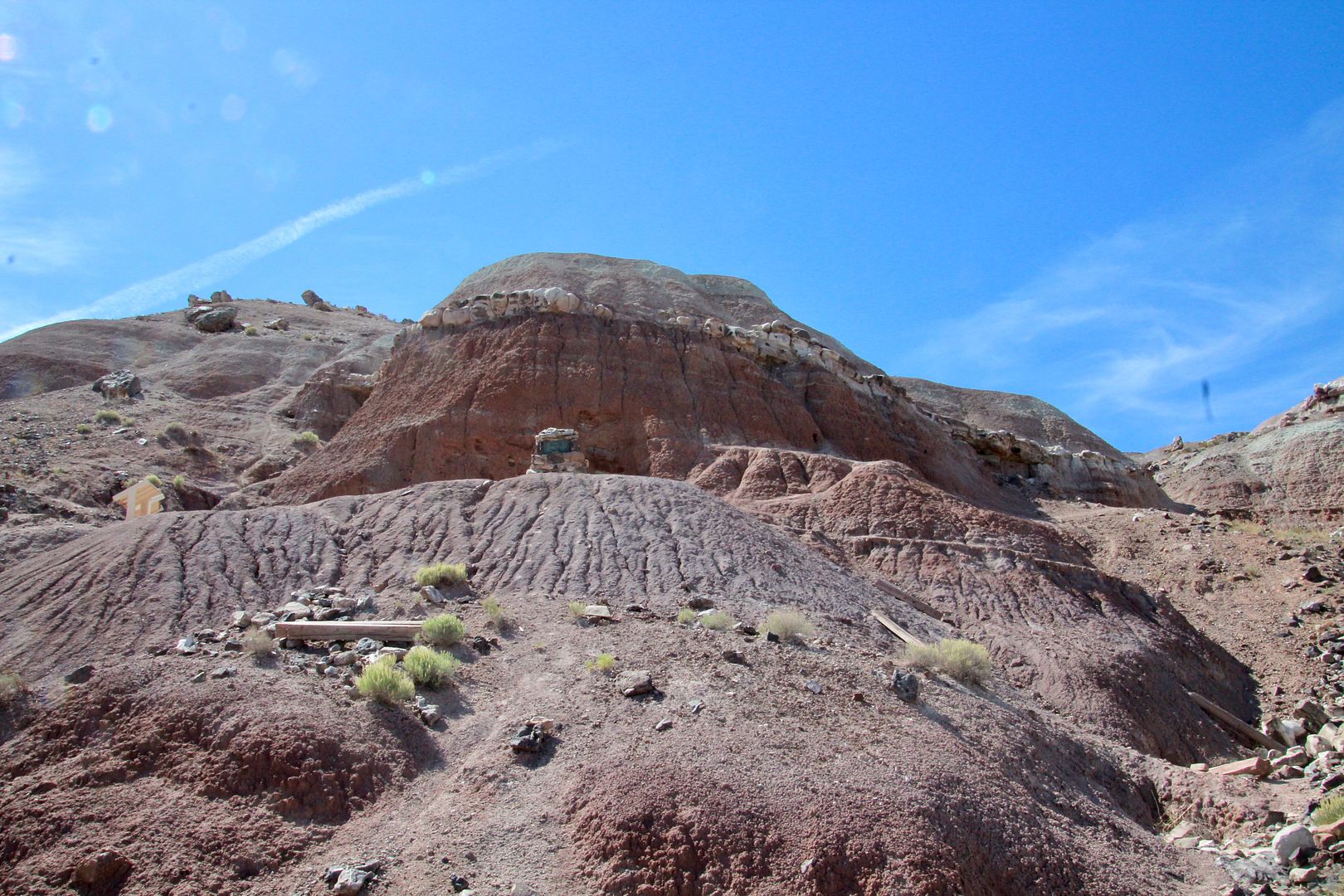
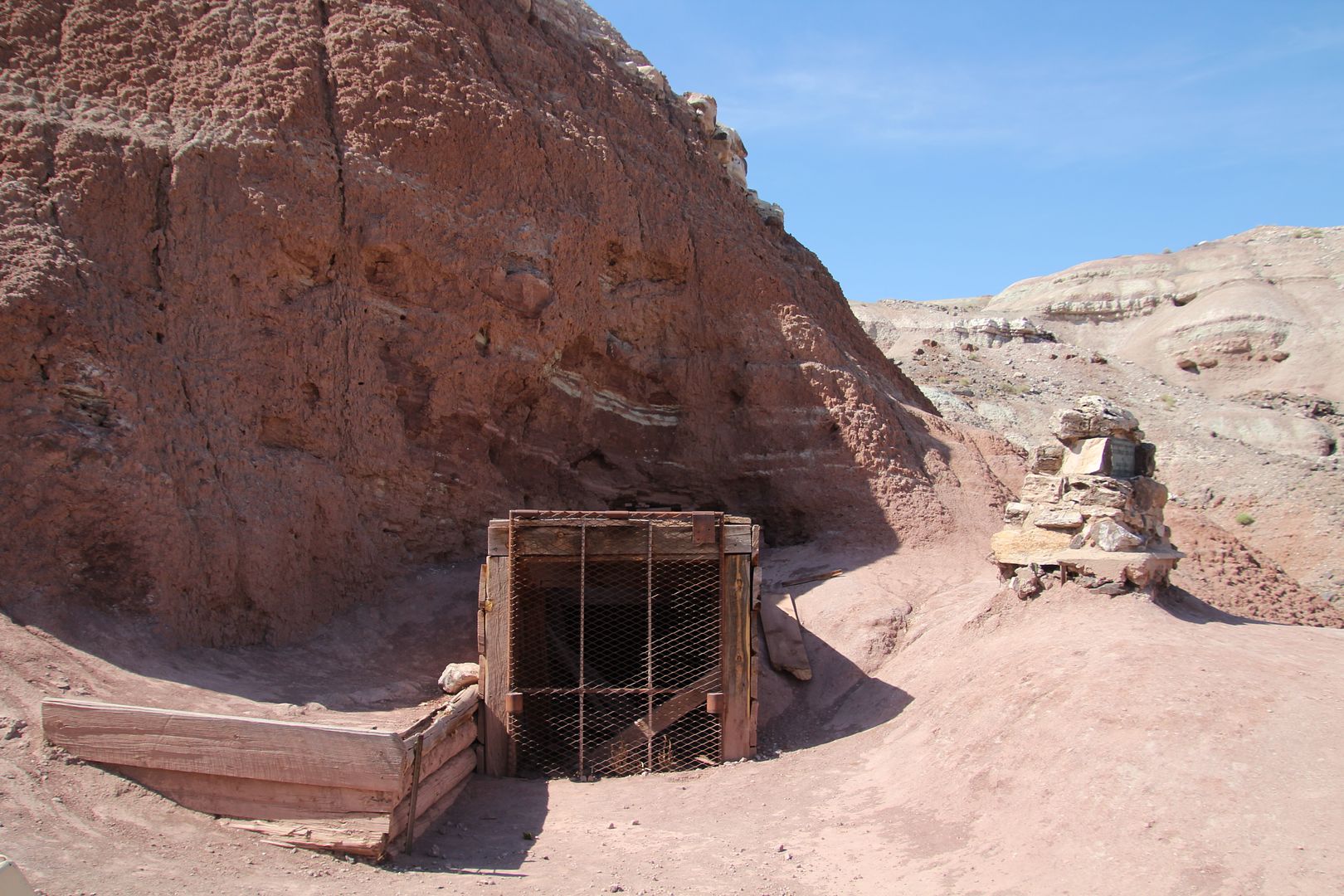
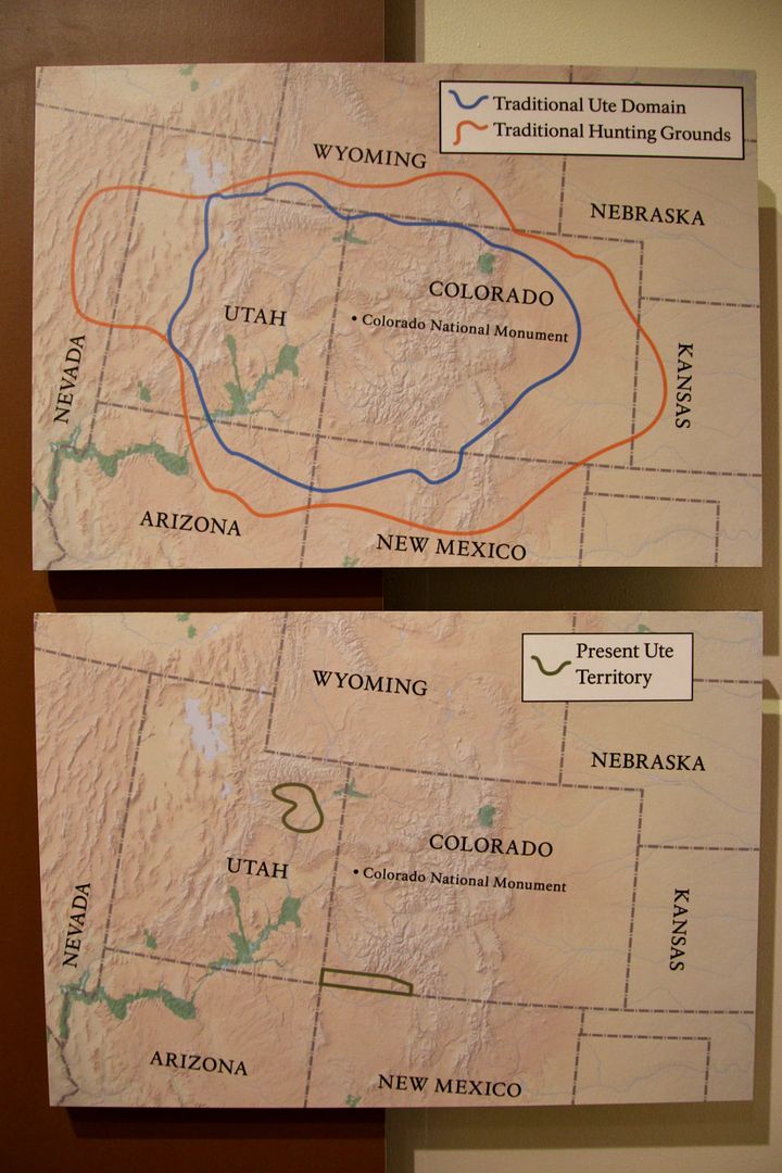
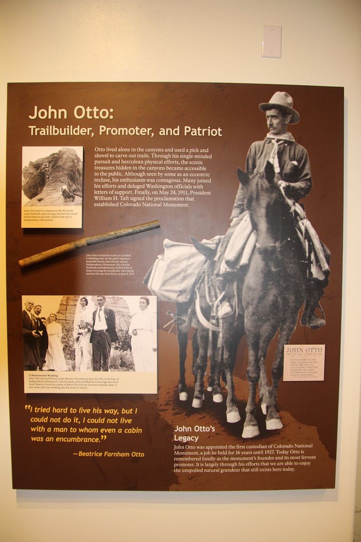
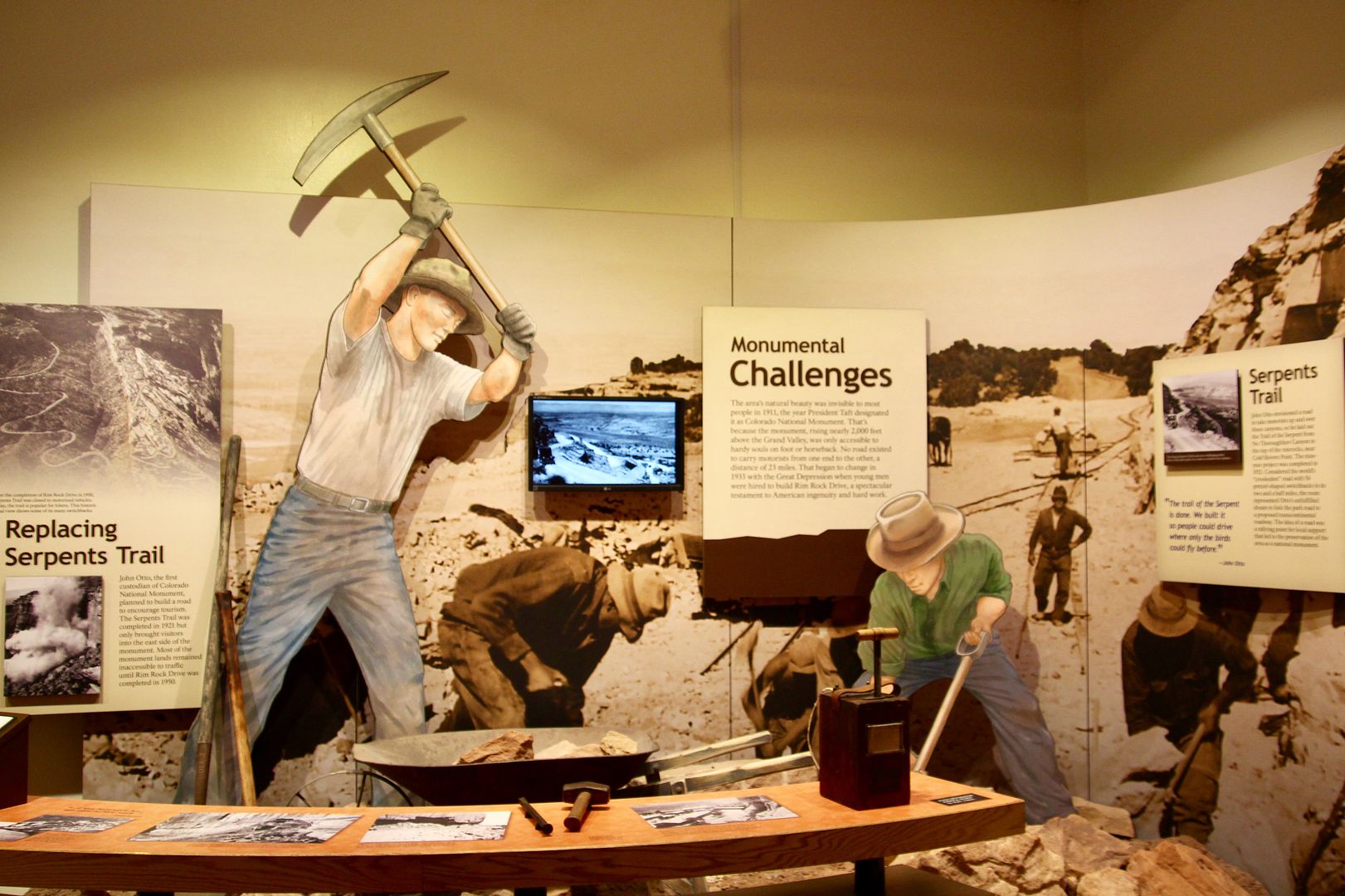
Native Americans inhabited this region for thousands of years. The two maps in the first photo show the region where the Utes lived and hunted; and, the second shows the tiny space that is their present-day Ute reservation. In 1906, John Otto, first saw this land and fell in love with it. He lived in a tent for years while building trailsscaling towering rock formations, and building the Serpent Trail on the eastern side of the park (enabling automobiles to venture into the monument for the first time). He led fundraising efforts and was instrumental in gaining recognition for the region as a national monument. 


The Serpent Trail road took 9 years to build and was completed in 1921. It had 54 switchbacks in just 2.5 miles! It was a staggering effort at the time. Most of the land only became accessible by vehicles when Rim Rock Drive was opened in 1950. 


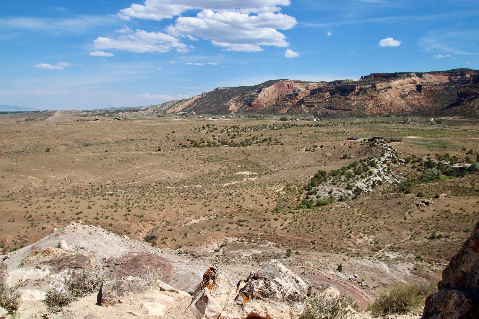
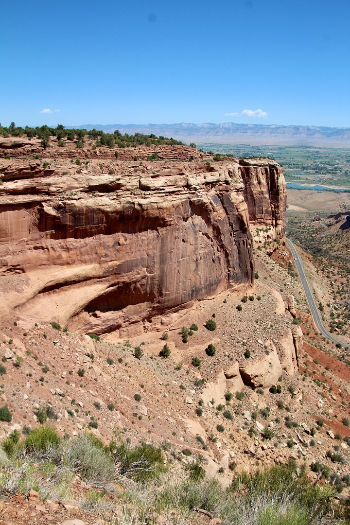
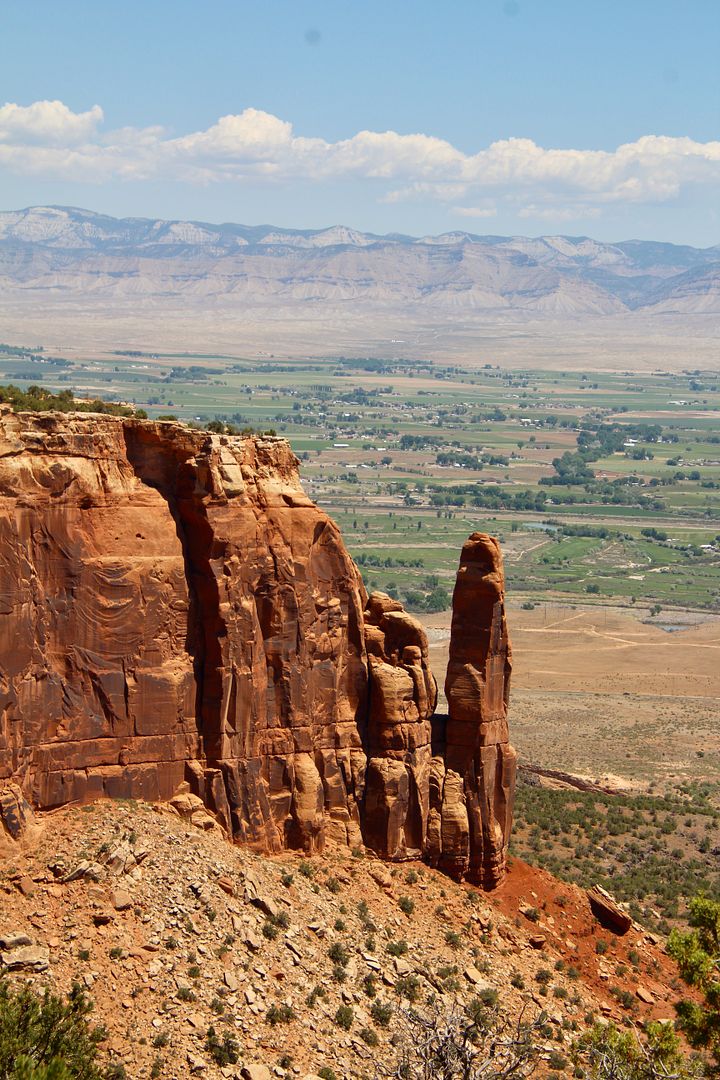
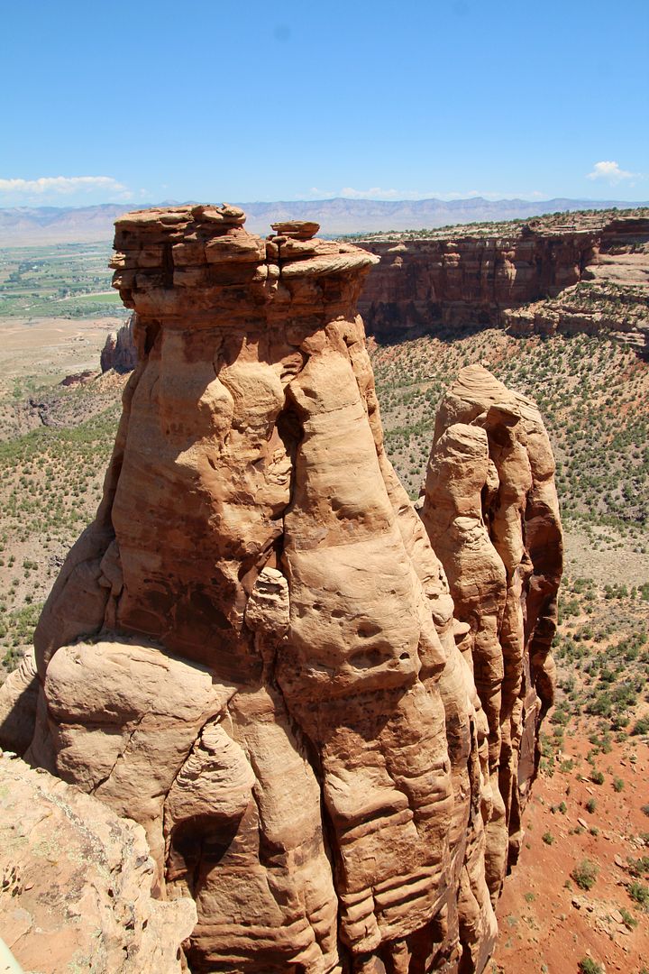
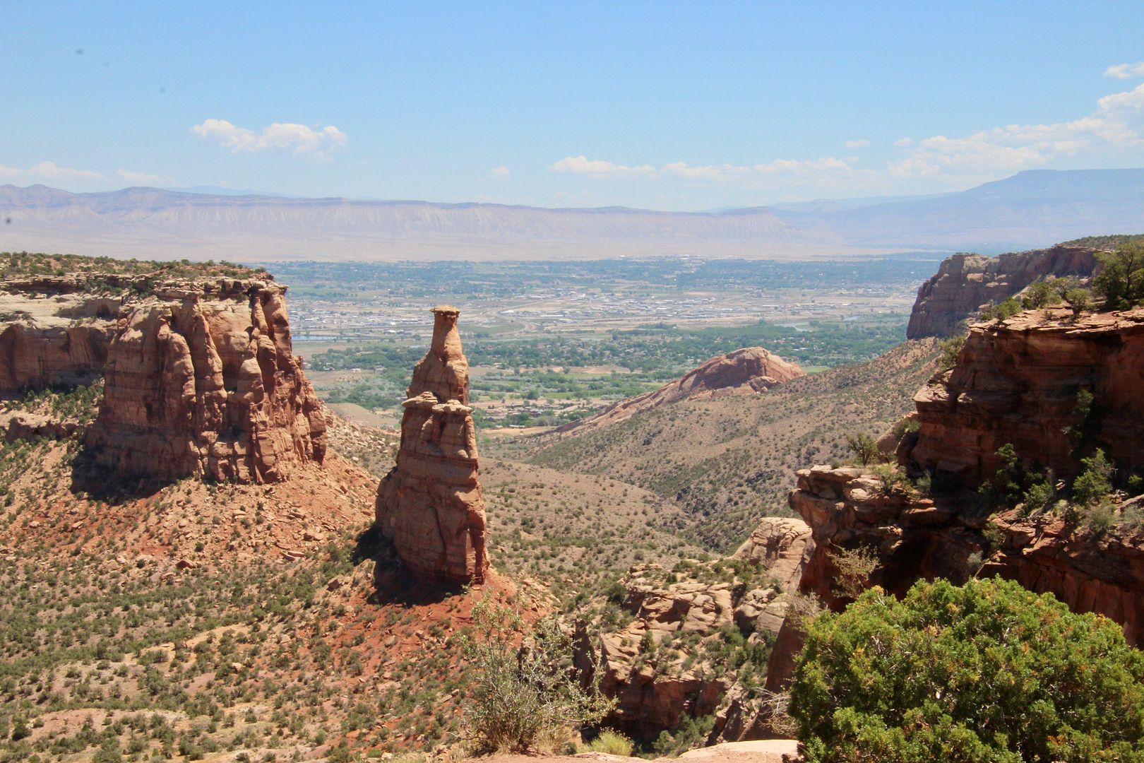
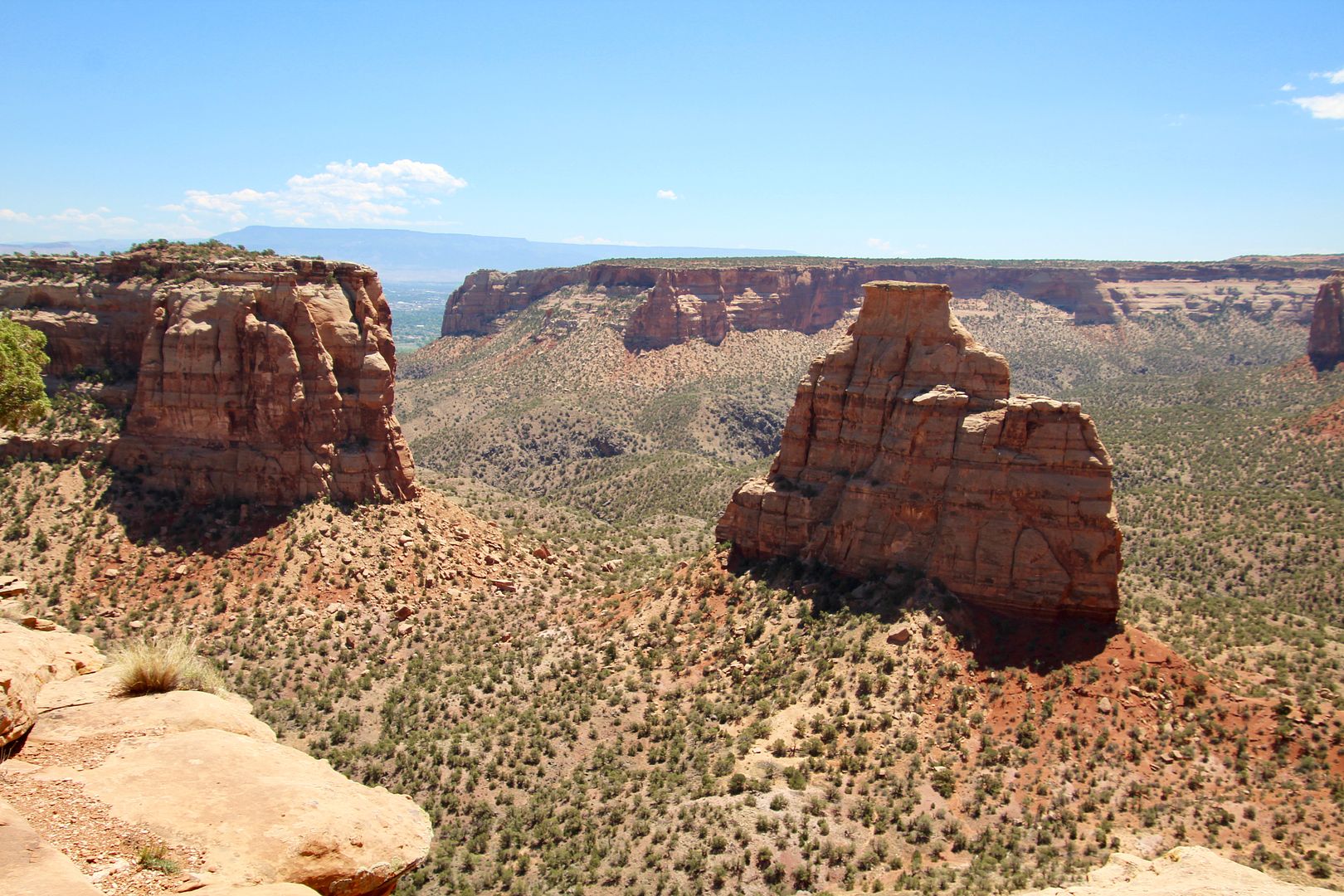
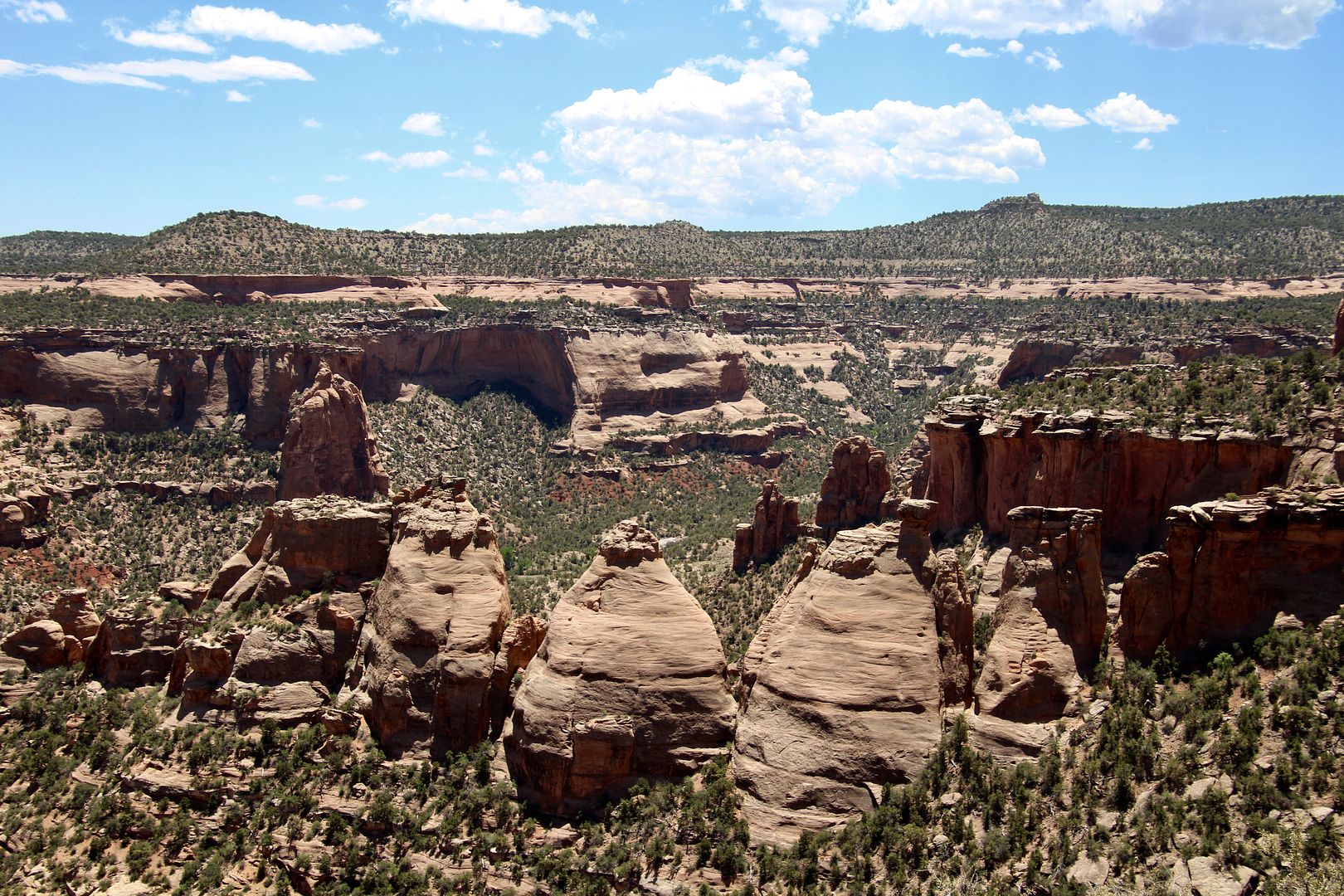
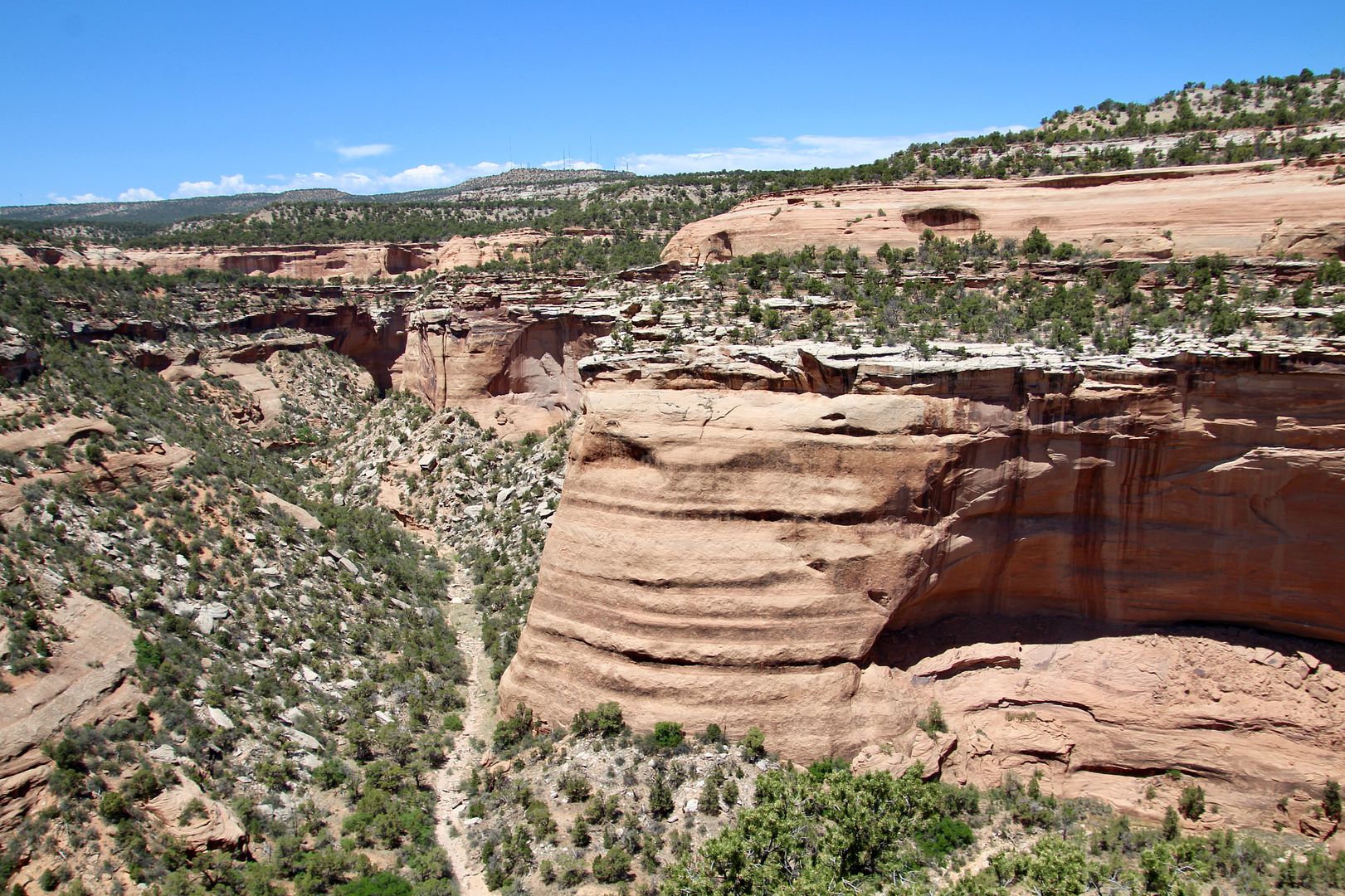
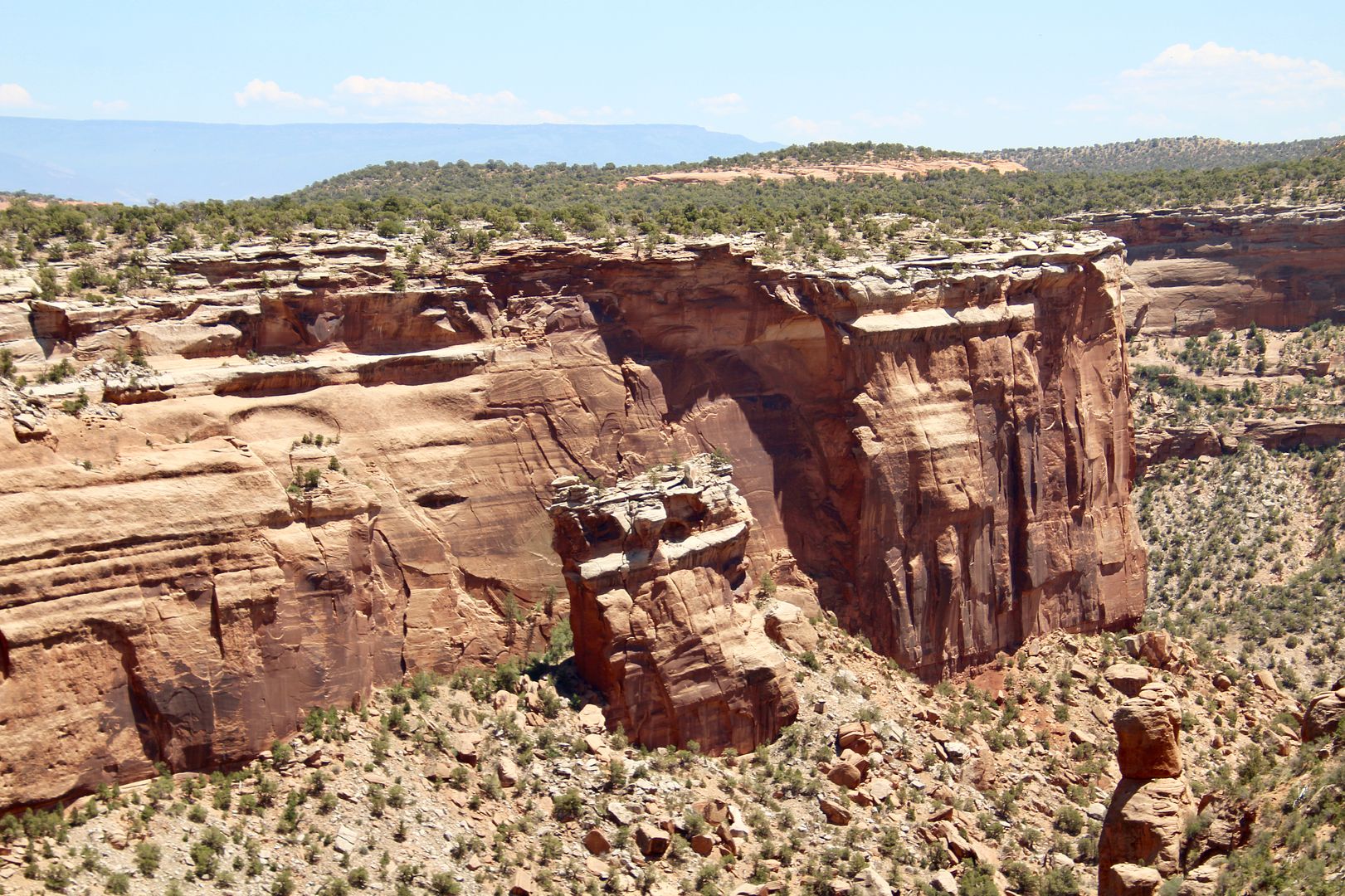
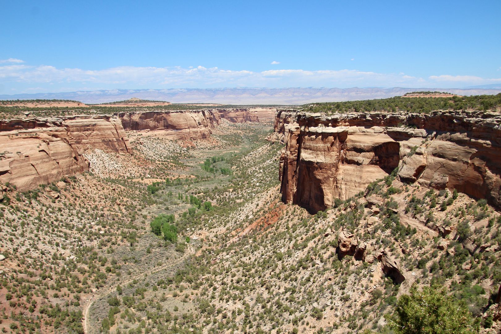
We continued on Rim Rock Drive to Monument Canyon. The rock formations here continued to amaze us!


Independence Monument was once part of a continuous ridge along the mesa. The formation is 450’ tall and is one of the most popular rock-climbing destinations. Every July 4th, local climbers raise the American flag on top, in recognition of a tradition John Otto began in 1909.


In 1911, John Otto married Beatrice Farnham near the base of the Independence Monument. Unfortunately, their marriage ended after only a few weeks when Otto refused to move from his tent (also located nearby). 


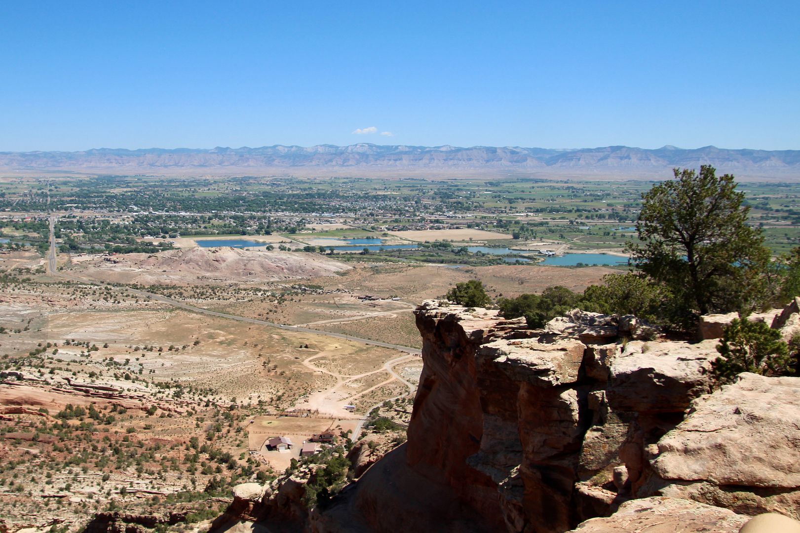
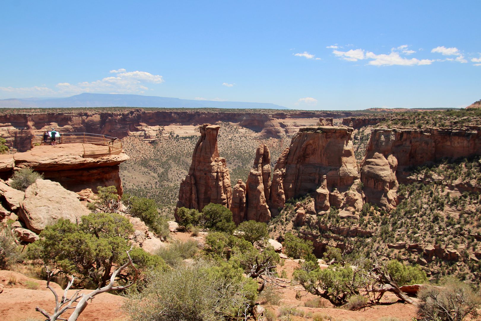
There are short hikes to some of the viewpoints, as you can see in the photo below. All of the views are spectacular.


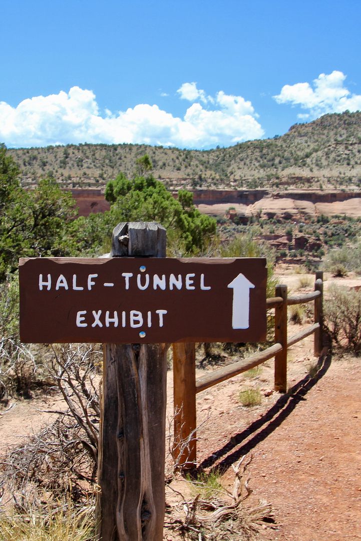
Be sure to check out the Half-Tunnel Exhibit here. Rim Rock Drive was carved out of solid rock (39,000 cubic yards of rock were removed per mile). Twenty minutes after a dynamite-blasting event, 9 workers (of 20 working here at the time) were killed while clearing rubble at Half Tunnel when a huge slap of rock gave way. Two others were killed in separate incidents. The tunnel was subsequently blasted leaving open road. 


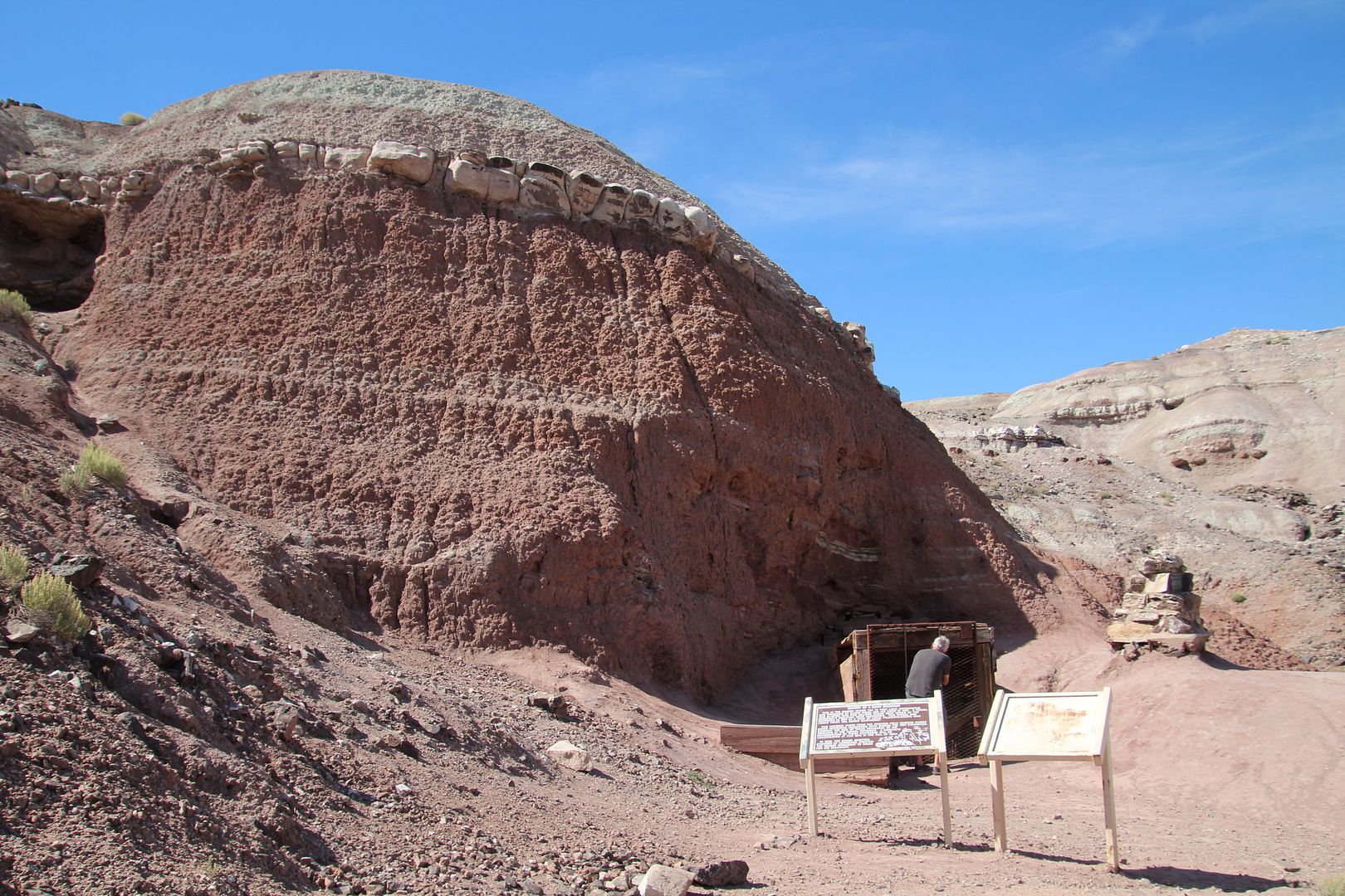
These interesting rock formations are called Coke Ovens as they resemble those built  by early miners to convert wood into charcoal for mining. 


Beautiful panoramic views of the canyons, cliffs and rock formation can be seen from Artists Point


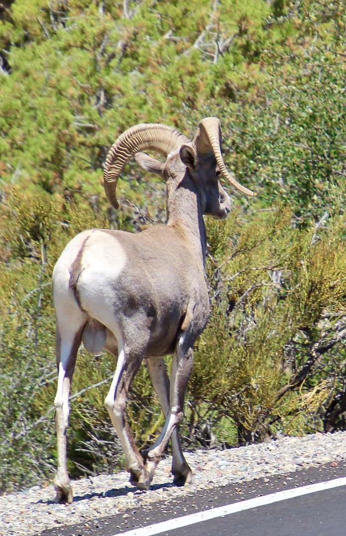
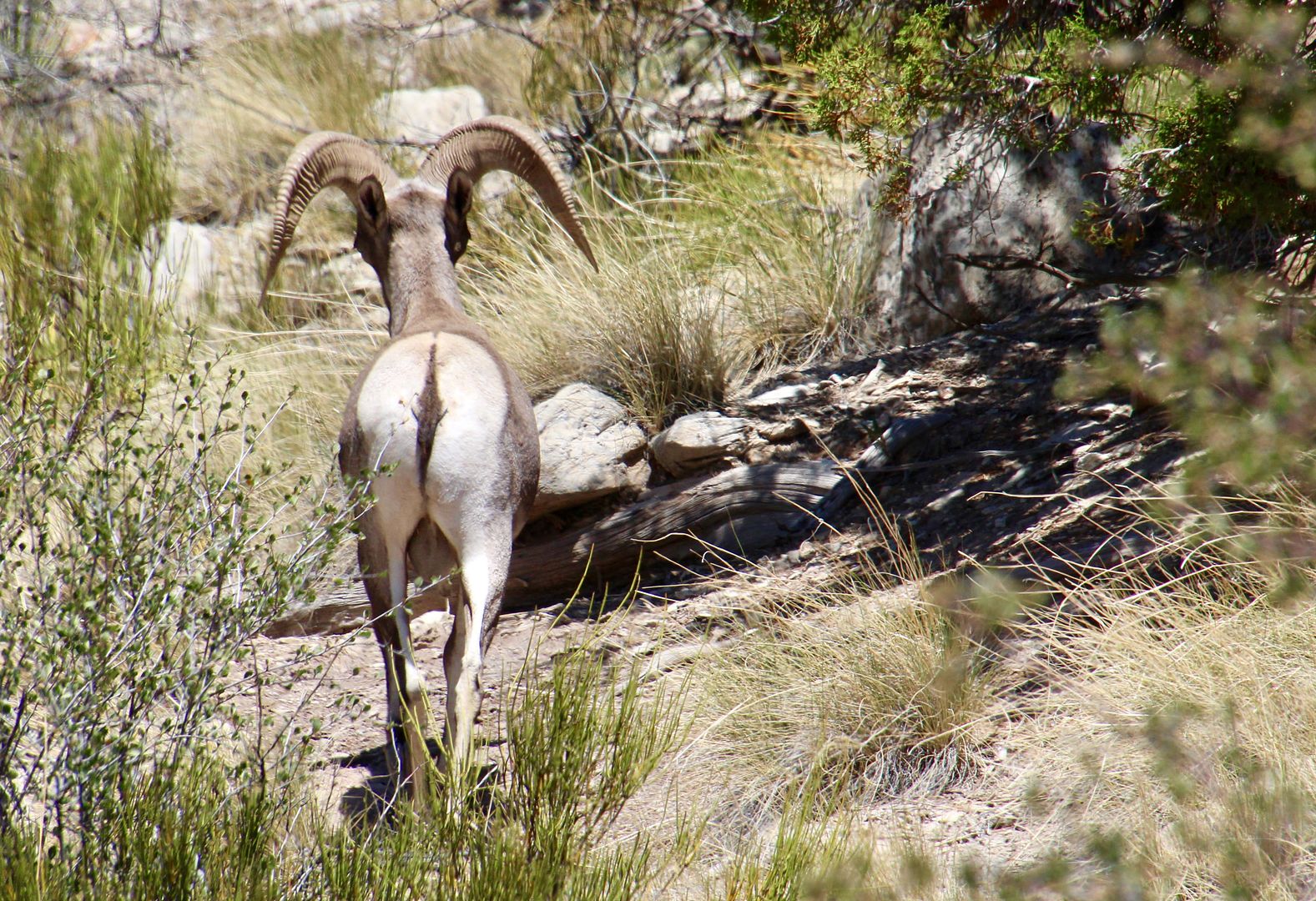
We were thrilled to see this big horn sheep crossing Rim Rock Drive. He promptly disappeared into the vegetation. 


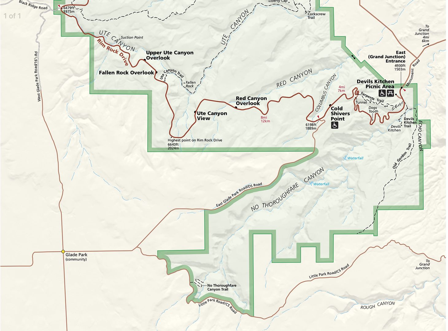
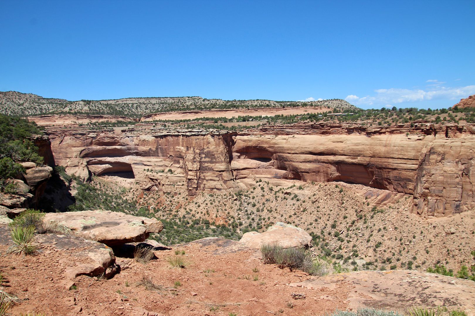
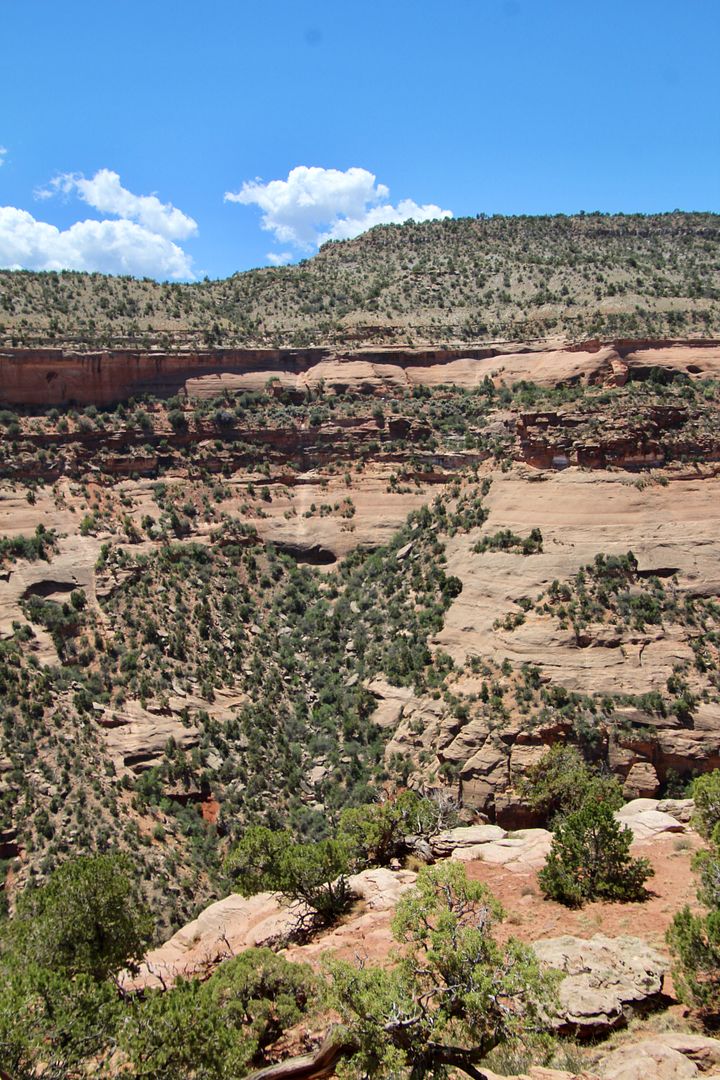
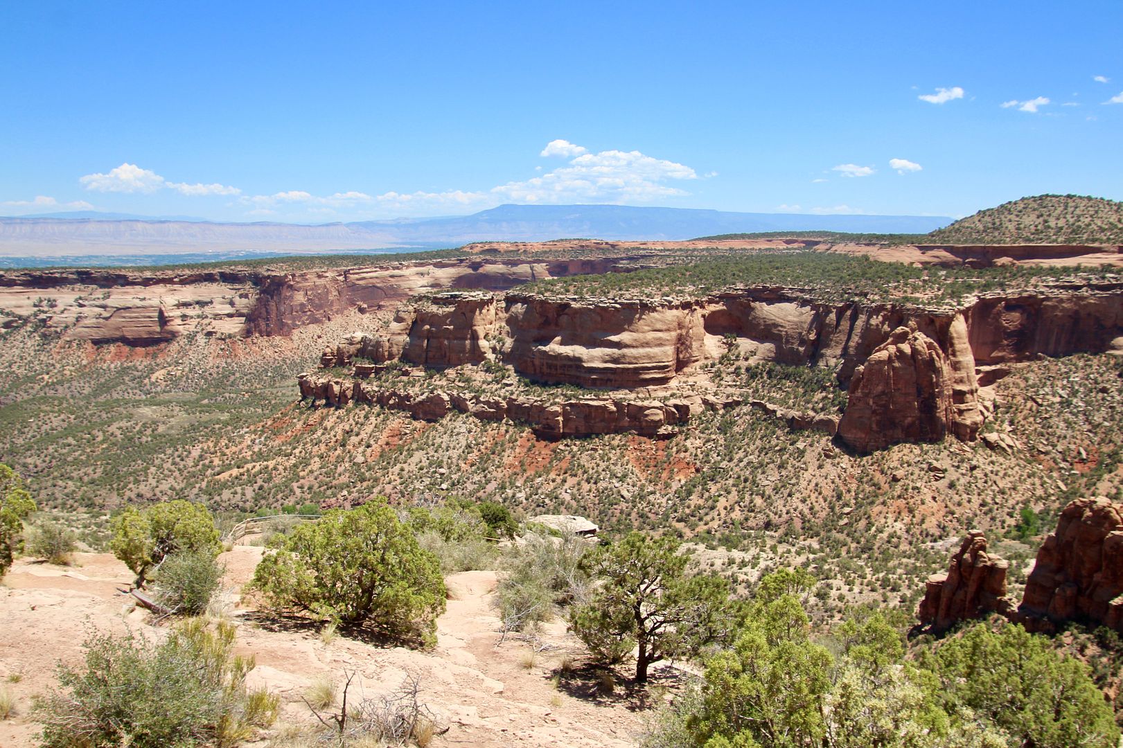
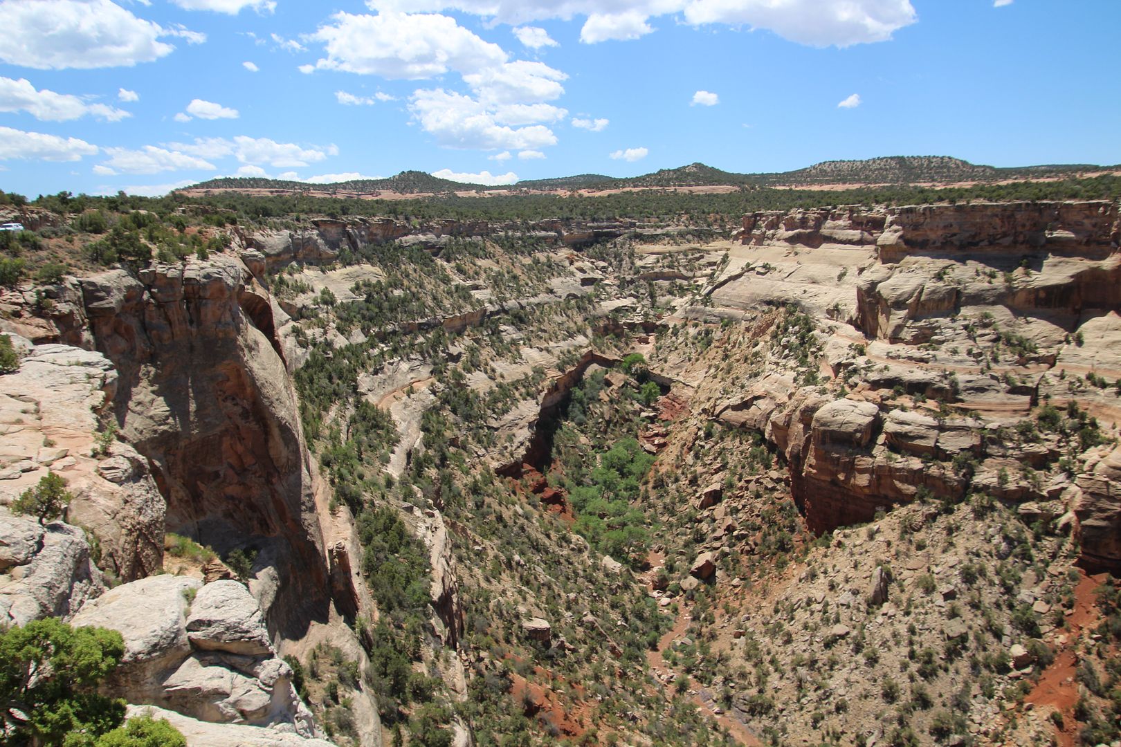
Continuing on Rim Rock Drive, the views at Upper Ute Canyon are fantastic. 


An amazing example of a giant slab of sandstone breaking away from the cliff wall (and sliding down the canyon wall) can be seen at Fallen Rock Overlook. The forces of erosion relentlessly affect the canyons here.


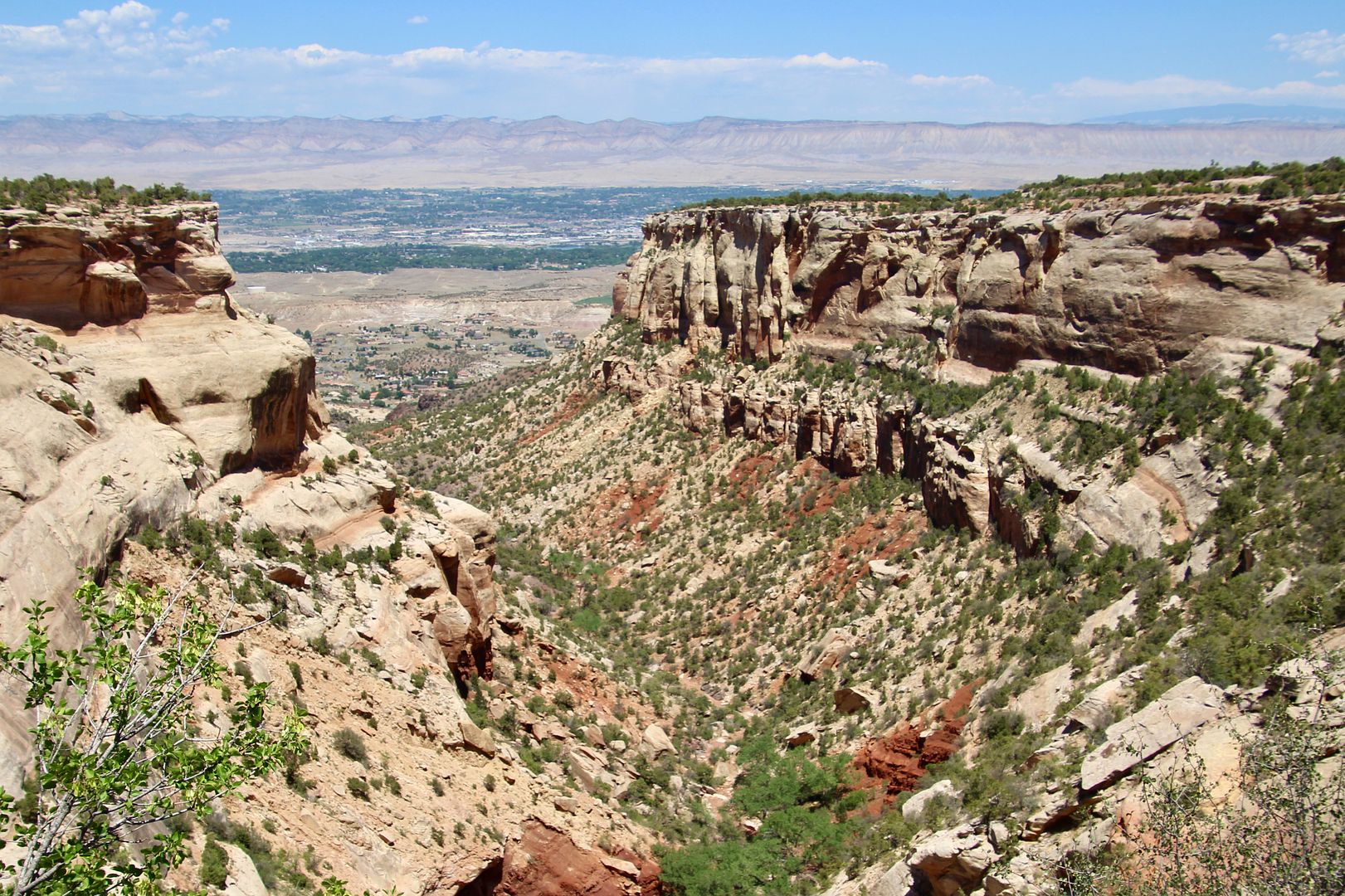
At the Ute Canyon View is the Ute Garden Interpretive Trail (in addition to the views of the canyon). 


From the Red Canyon Overlook, you can see a U-shaped canyon with a smaller V-shaped canyon below. Water erosion caused the “canyon within a canyon” seen below.


The last stop on the Rim Rock Drive was Cold Shivers Point. From this overlook you can see Columbus Canyon (one of the smaller canyons in the monument). 


Wow, we were in awe of the beautiful canyons and rock formations here! This is one of the most beautiful national monuments we have visited thus far. Both backcountry and short hiking trails can be found here. Because dogs are not permitted, we did not do any of the longer trails. 

For reservations at Saddlehorn Campground, or for additional information, go to www.nps.gov/colm.