Sunday, September 29, 2019

Touring Monument Valley Navajo Tribal Park, 9/06/2019

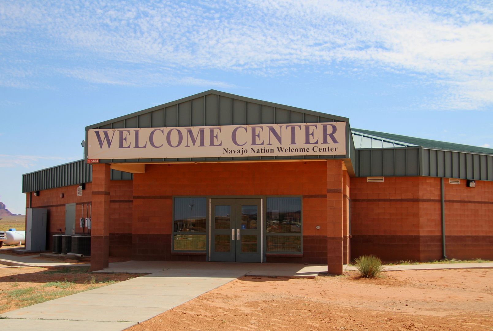
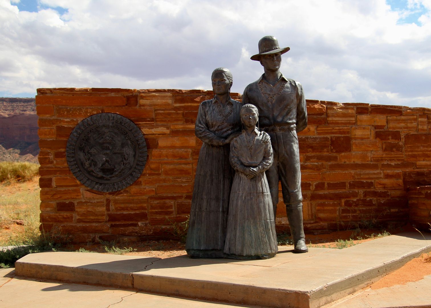
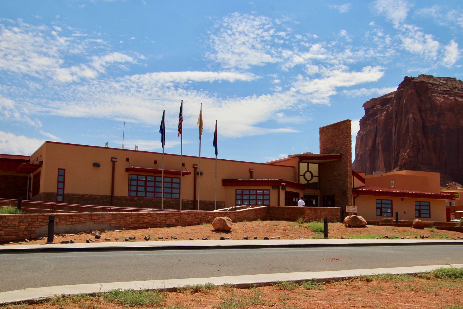
Excited to visit the tribal park (only 4 miles from the KOA where we were staying), we made a quick stop first at the Navajo Nation Welcome Center 


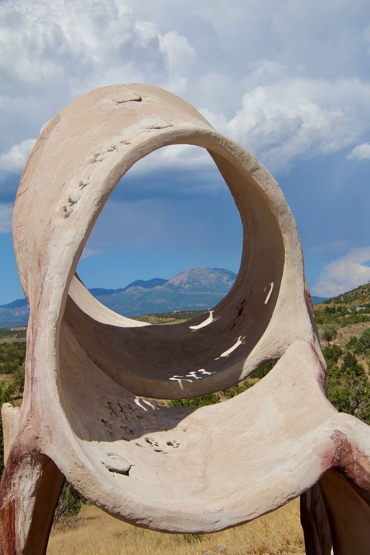
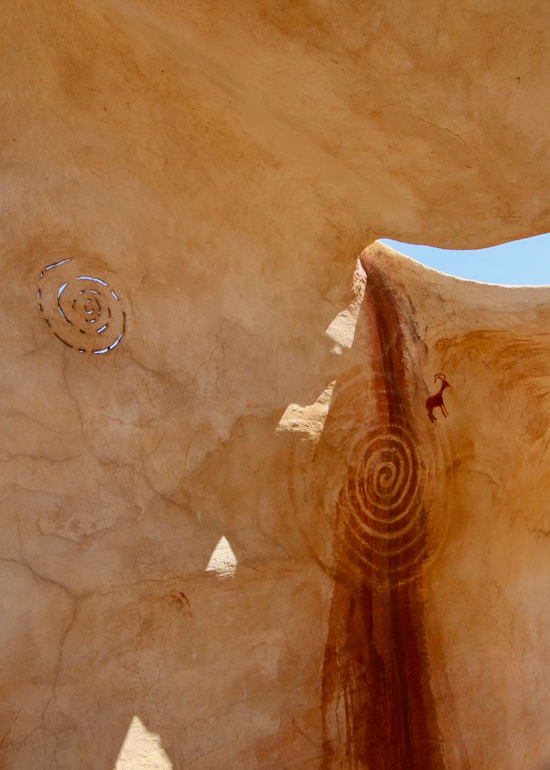
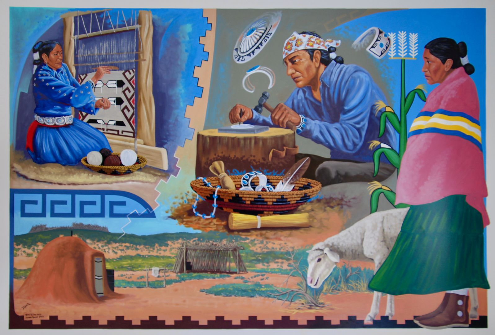
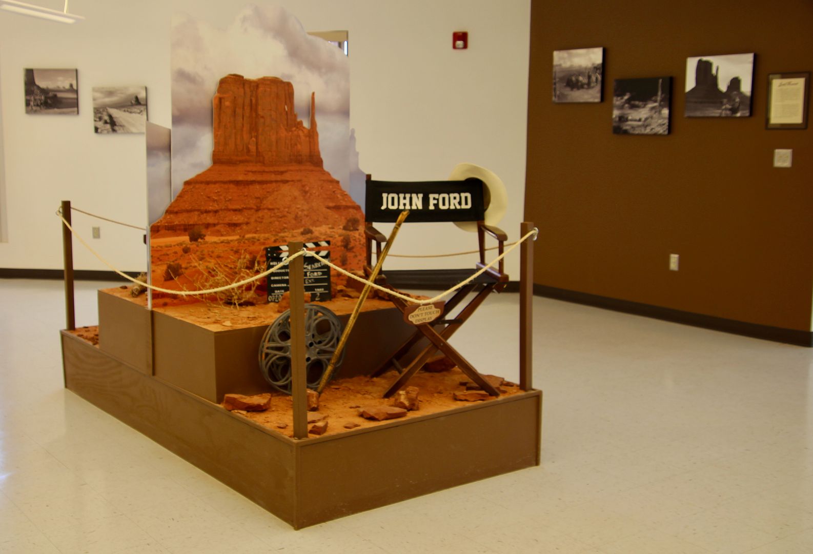
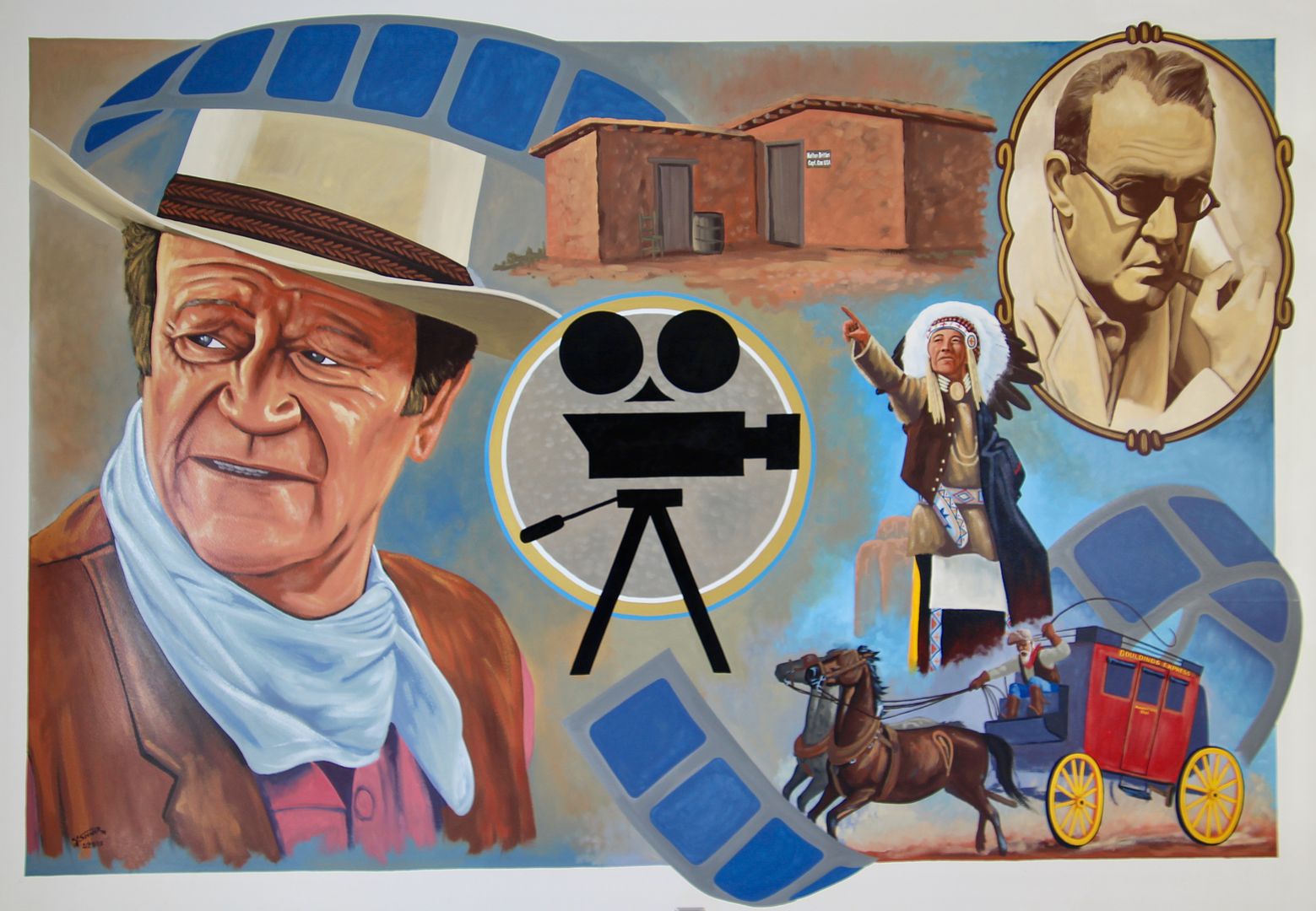
Entrance to the park is just a short drive down the road from the Welcome Center. Entrance fee is $20/vehicle for 2-days. Admission can be purchased here or at the entrance. A large Navajo Market s located next to the Welcome Center for those interested in purchasing jewelry and other goods made by the local Navajo. Several exhibits and murals can be seen inside.


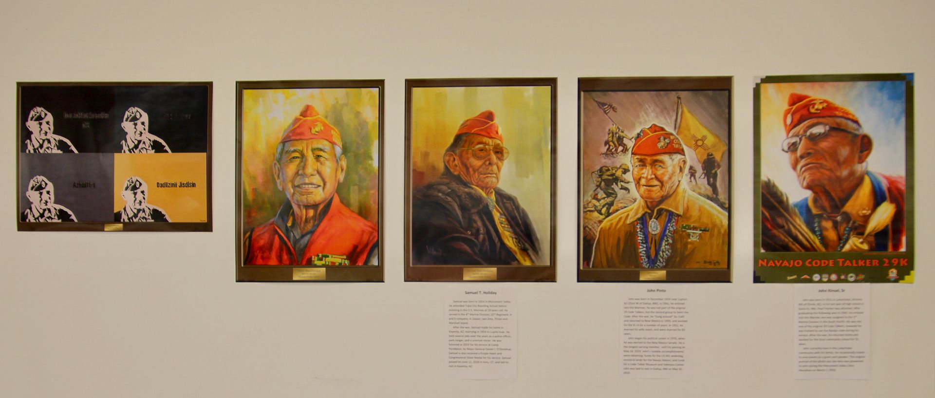
The Navajo Code Talkers, who played an important role in our victory in the Pacific during WWII, are commemorated here. The first 29 to serve came from this part of the country; others followed. The Navajo language is still widely spoken on tribal lands (that are the size of West Virginia). 


More than 50 movies have been filmed in Monument Valley beginning in 1925. Director, John Ford, filmed 10 Westerns here, including Stagecoach (1939), She Wore a Yellow Ribbon (1949), The Searchers (1956), How the West Was Won (1962) and more, with many starring John Wayne. 


Many recent movies have also been filmed here: Back to the Future III (1990), Thelma and Louise (1990), Wild Wild West, (1999), Mission Impossible II (2000), The Lone Ranger (2013). That’s why we all recognize so many of the rock formations here!

Entering the tribal park, we stopped first at the Visitor Center to obtain information about the scenic drive, hiking trails, and tours


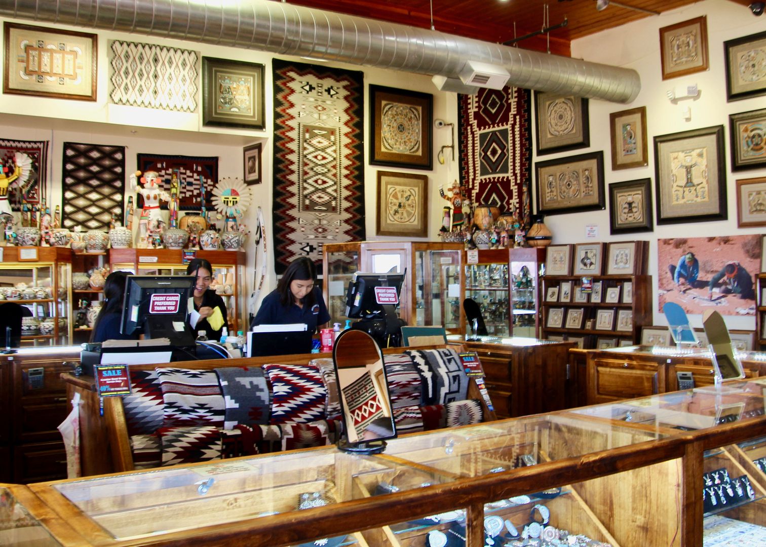
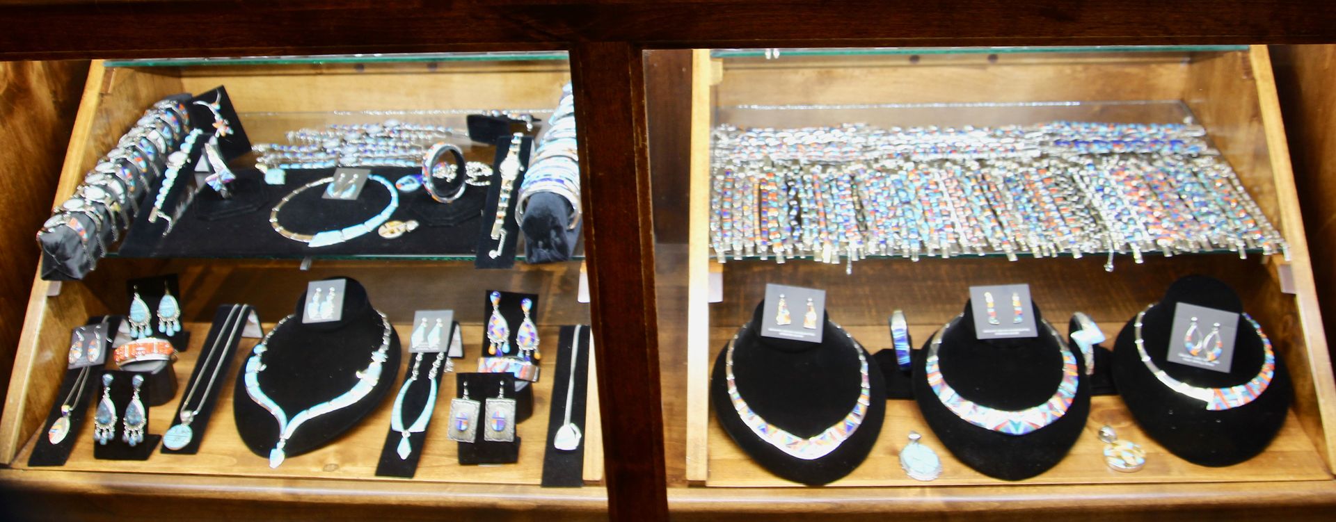
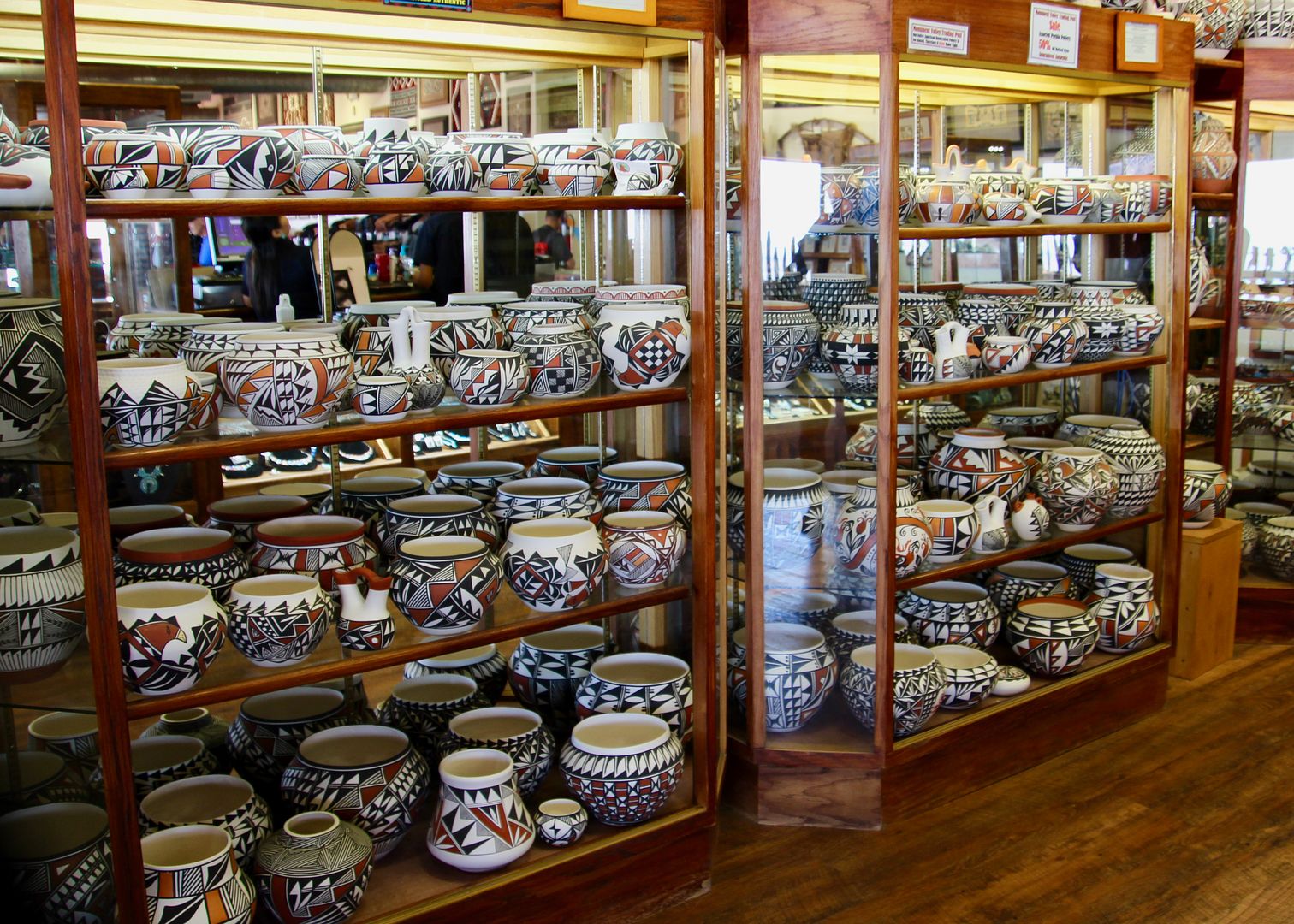
The View Hotel, View Restaurant and Monument Valley Trading Post can all be found here. There is a huge array of authentic Navajo items for sale including hand-woven textiles, jewelry, pottery, sand paintings, and more.


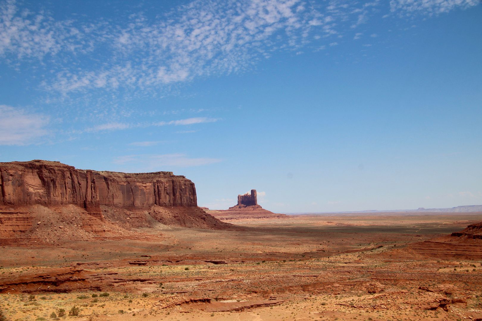
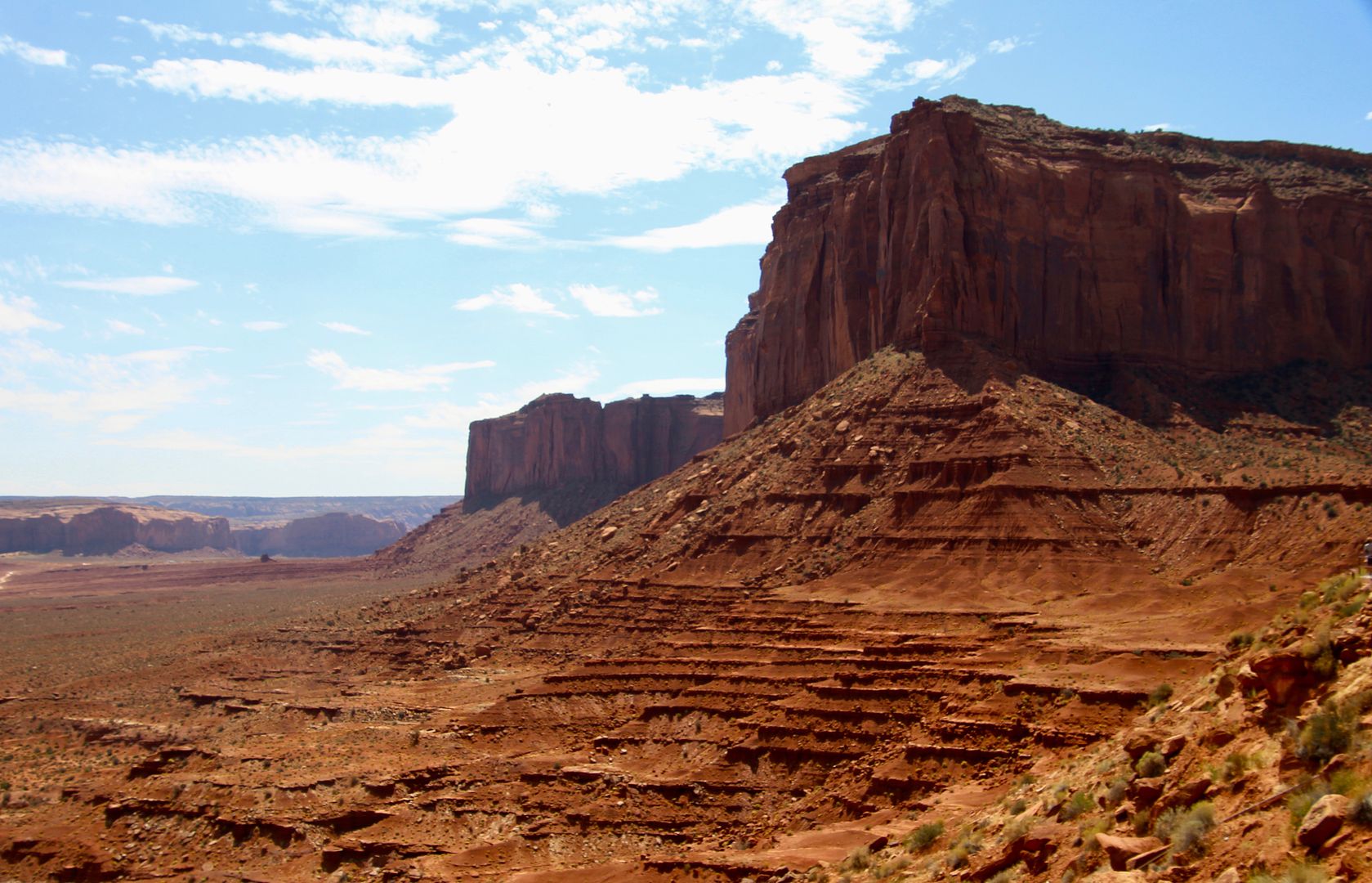
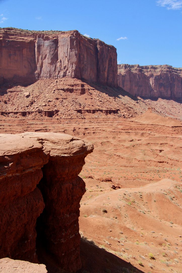
Views of the valley from the observation deck are amazing! The monuments here show the three stages of erosion: 
  • Mesa: a rock formation that looks like a table; they are usually wide. Stable, and are the first stage of erosion.
  • Butte: smaller than a mesa and is the second stage of erosion
  • Spire: the final stage of erosion, it is a rock formation that has become narrow and free standing.
Sentinel Mesa (left) and Castle Butte

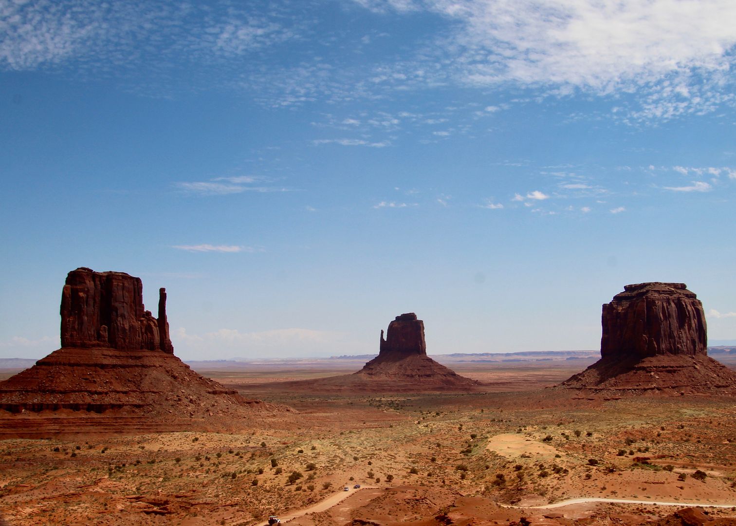
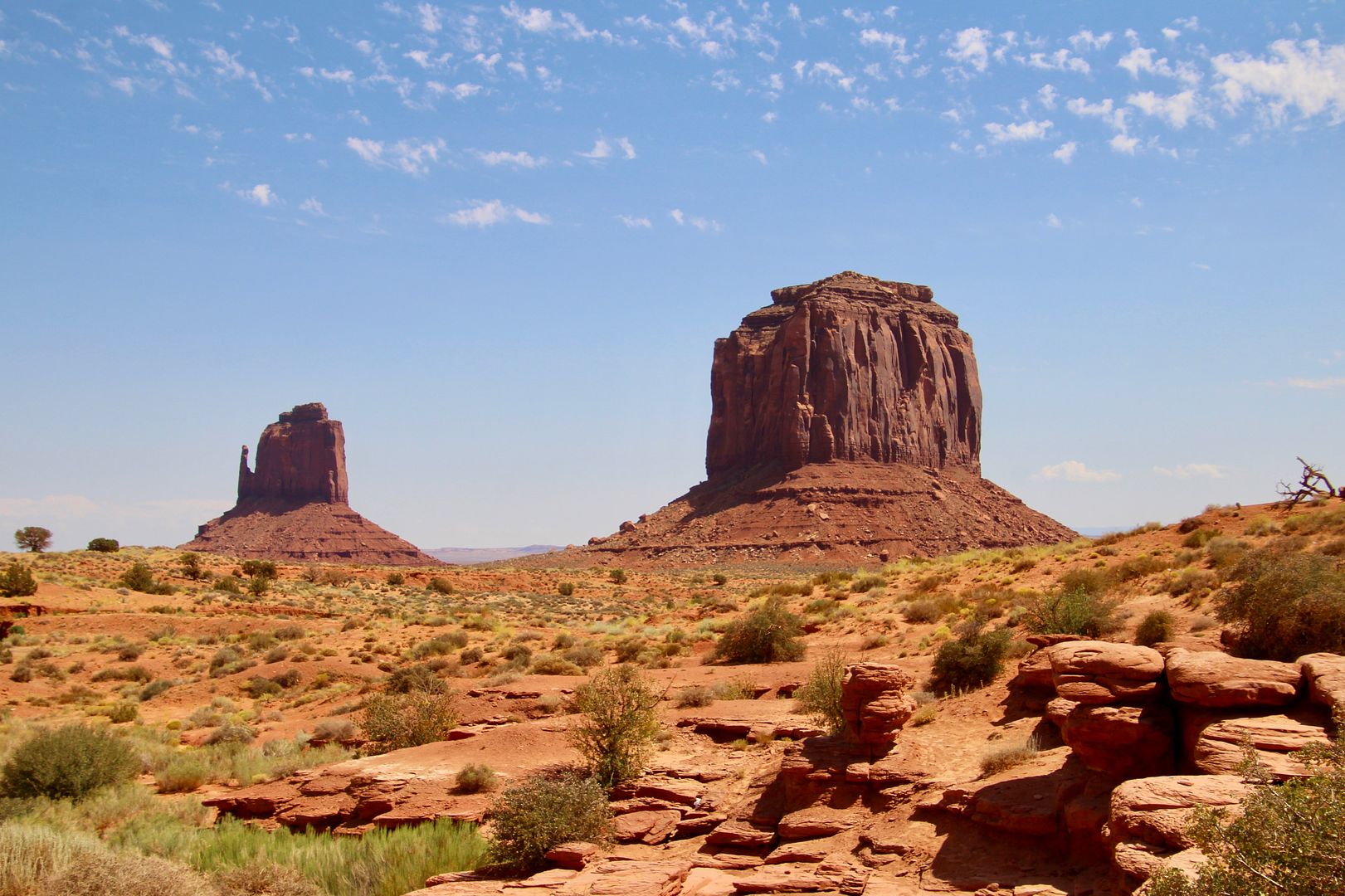
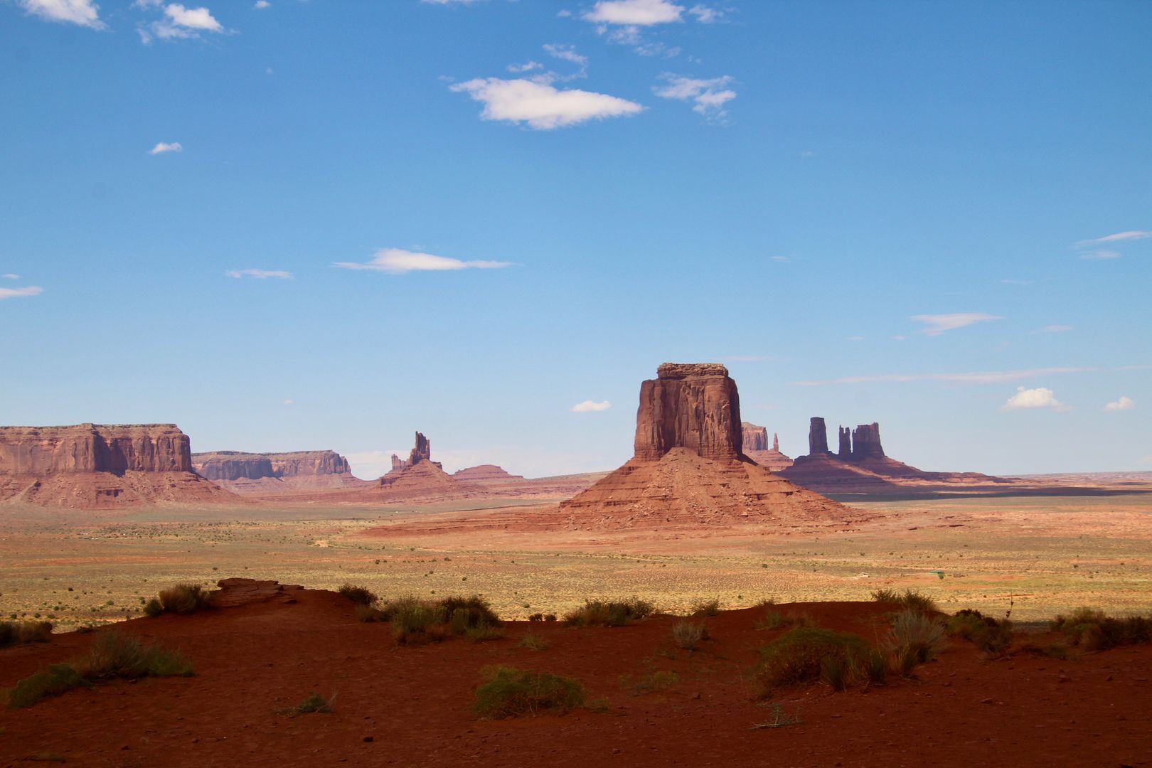
West Mitten Butte, East Mitten Butte and Merrick Butte

Mitchell Mesa (foreground)

The scenic drive through the valley is on a 17-mile unpaved dirt road that takes around 2 hours (depending on how many times you stop and for how long). Because the road is pretty rough in some areas, many chose to take a tour in a park vehicle. The guides are all Navajo and provide interesting commentary along the way. We decided to drive because we had our doggie, Sadie, with us. Leashed pets are permitted, but not on tours.

There are 11 stops along Valley Road, but there are many places where you can just pull over. Navajo families still live in the valley (as they have for hundreds of years); therefore, some parts of the park are private property (off limits).  

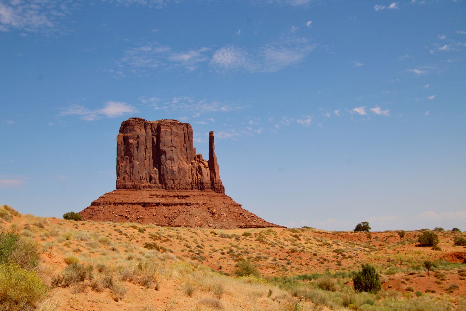
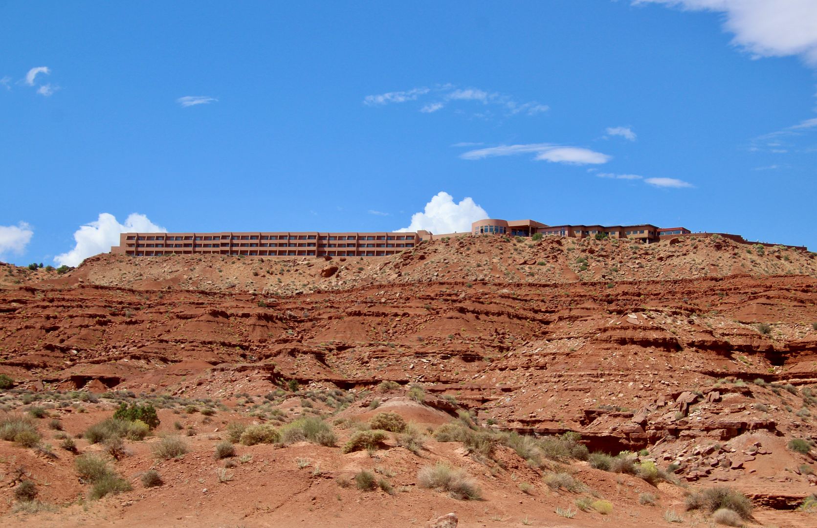
Our first stop was near the Mitten Buttes…so named because they look like a hand with the thumb sticking out. The Navajo, however, believe these monuments are spiritual beings watching over the valley. Below is West Mitten Butte and Merrick Butte (named for an ex-calvary man turned silver prospector). The second photo is East Mitten Butte; and, the third is The View Hotel and Visitor Center. All rooms have balconies providing fabulous views of Monument Valley. Sweet!


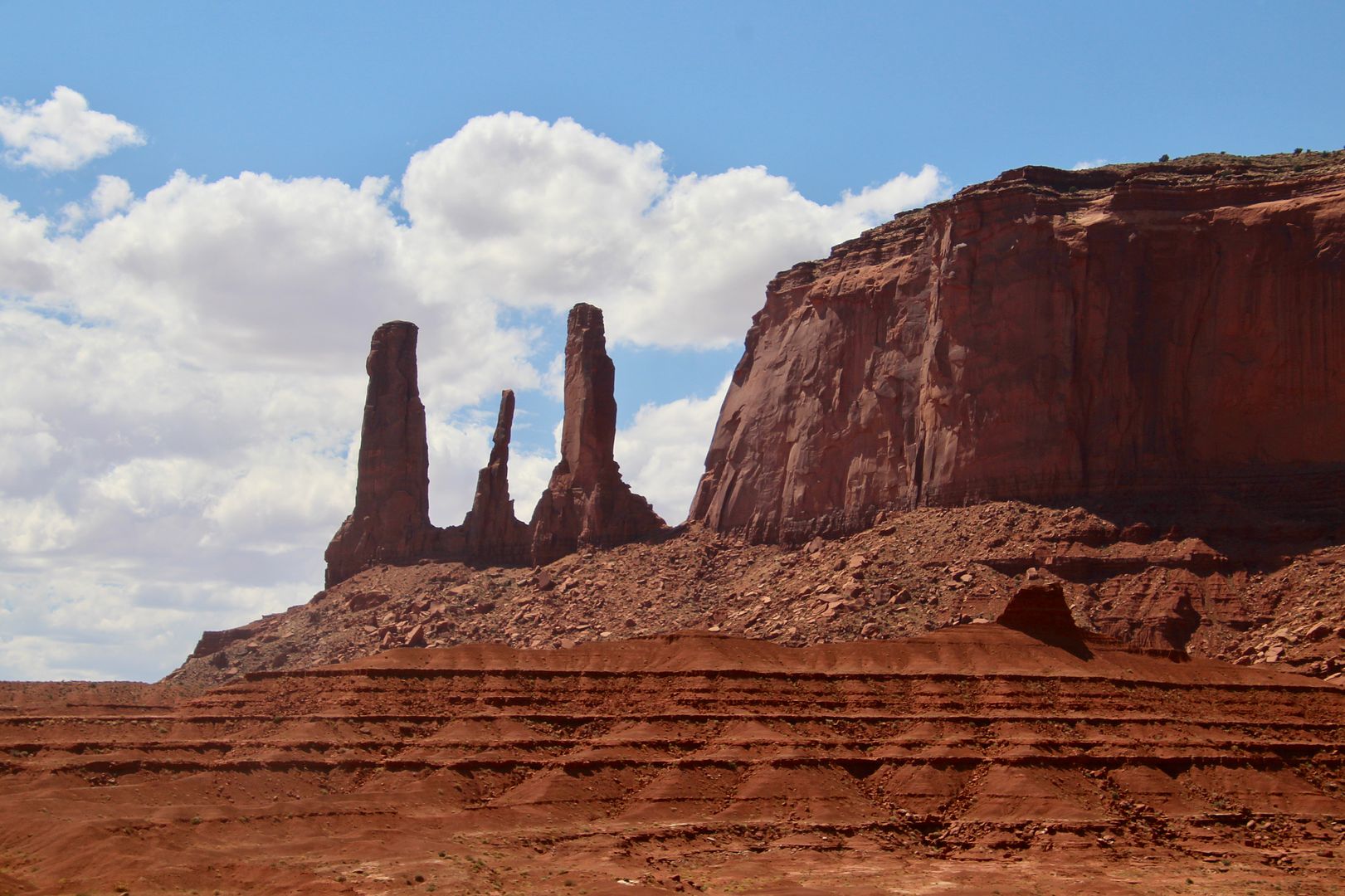
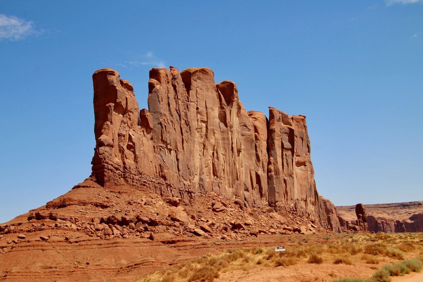
Below are rock formations: Three Sisters (a Catholic nun facing her two pupils); and, Camel Butte (can you see why it is named this?)


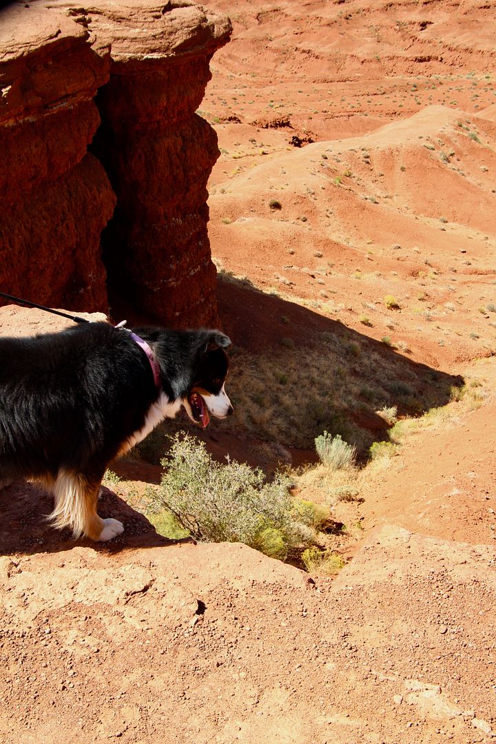
This is called John Ford’s Point because, you guessed it, lots of movie scenes were filmed here. Our doggie, Sadie, is always interested in looking over the edge. She seems to know not to get too close…


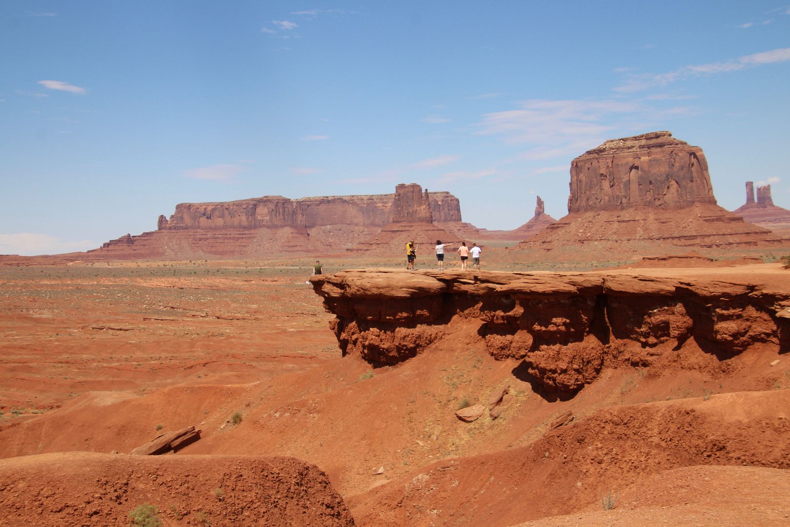
From the Point, you can also see the Three Sisters. Look for this background when you are watching old westerns!


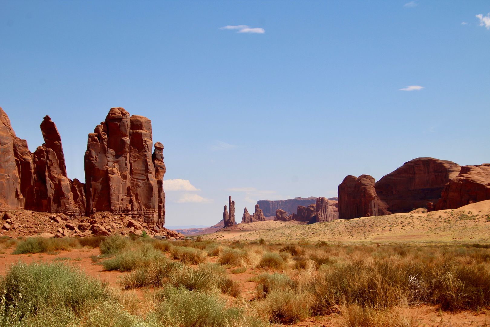
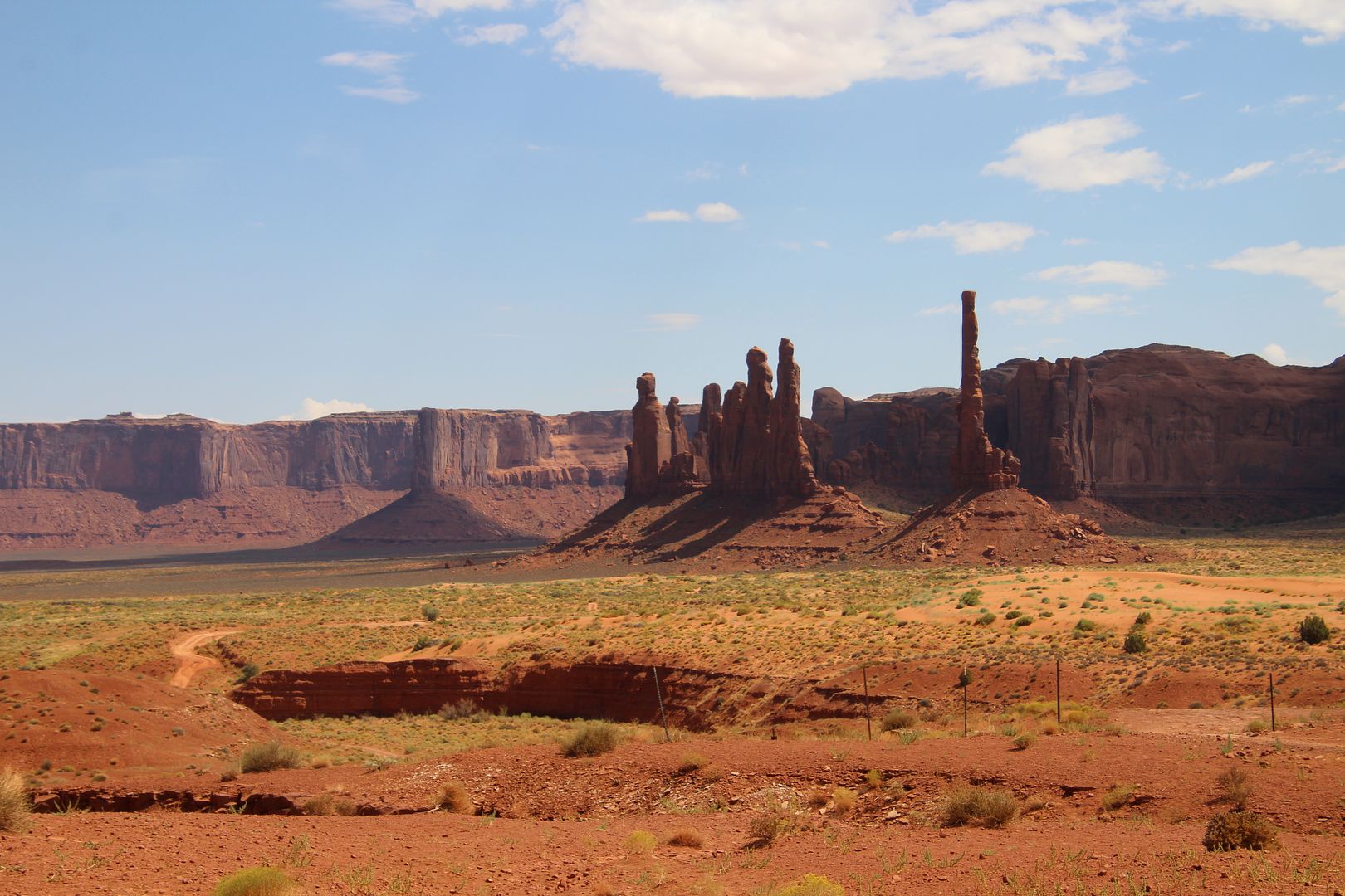
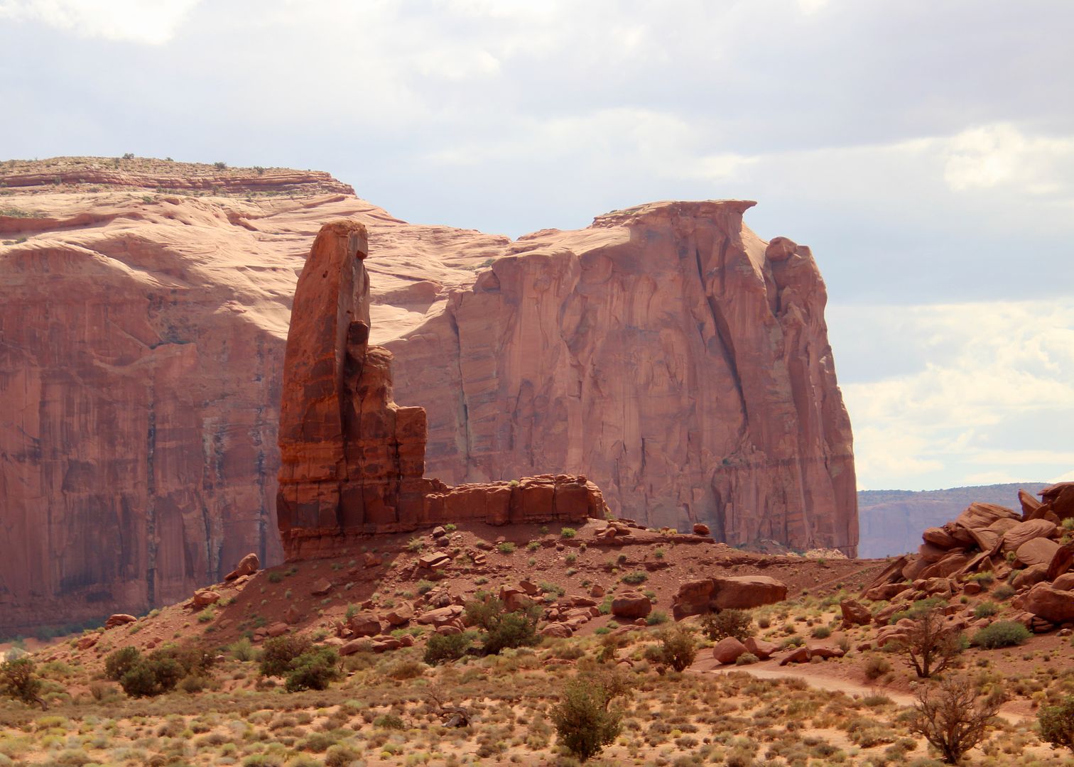
This iconic view is of Totem Pole, a spire. To the left are the Yei Bi Chei (Navajo spiritual gods) that represent dancers emerging from a hogan (Navajo home).


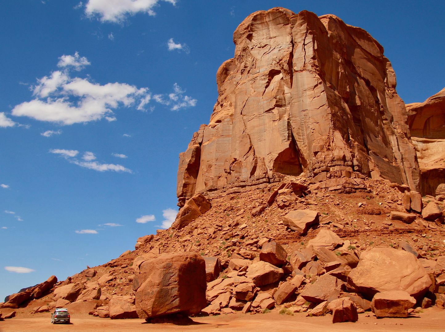
Look how tiny our Mini Countryman looks next to Cly Butte (named after a well-known Navajo medicine man). 


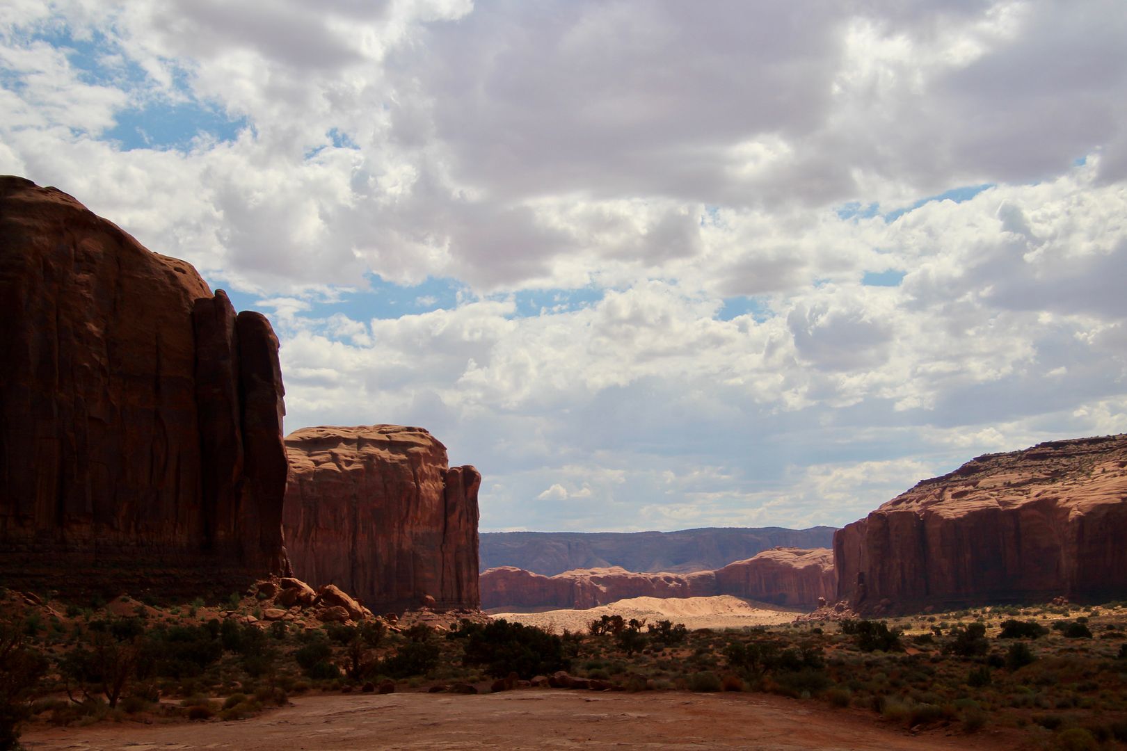
A small trail at the North Window Overlook leads to stunning views of another part of the valley.


A free-standing spire, this is the Thumb. Most think it looks like a cowboy boot!


Photos do not convey the amazing beauty of Monument Valley. Anxious to experience the buttes and spire close up, we decided to return the next day to hike the Wildcat Trail

This is one of my absolute favorite places that we have visited in the last 5.5 years! The geologic and cultural history is fascinating. Do not miss the chance to visit if you are in the region. For additional information about the park, go to www.mavajoparks.org.

Friday, September 27, 2019

Sunset in Monument Valley, 9/05/2019

On this day we made the short drive (90 miles) to our next destination, Monument Valley. We have both been looking forward to seeing this place in person. Driving from Monticello to Monument Valley, we passed through the town of Mexican Hat, UT. Then we passed this rock formation…and it all made sense. A sombrero!


Twenty miles south, we pulled into the Monument Valley KOA where we had reservations for the week. After setting up, we walked around the campground as the sun began to set.


We had a great view of the sunset from our site. 


What a serene and beautiful setting. This is why I love our RV lifestyle! 

Thursday, September 26, 2019

Mountain View RV Park & Campground, Aug 22 to Sept 5, 2019


Rating: 5 on a scale of 5

Location:  Monticello, UT, turned out to be a great home base to see the many sights in the area. Many points of interest are about an hour away (Arches National Park, Canyonlands National Park, Natural Bridges National Monument, Valley of the Gods, Goosenecks State Park, Edge of the Cedars, Mule Canyon, and so much more). With very little traffic in the region, it was an easy drive from this park. 

Lot: Because we were staying for two weeks (and I had made the reservations months ago), we had a great lot (#13). It was a pull-through and shaded. With neighbors on only one side, there was a grassy area and picnic table outside our door…perfect. 


With three horses in the pasture to the right and another three in the pasture to the left, this was a very pleasant place. Tent camping sites are also available.


Amenities:  The free wifi and cable were great. And the bathrooms/showers here are new (2018) and super nice. In the same building is the laundry room, also very nice with 4 washers/4 dryers.  


Our doggie, Sadie, enjoyed spending time in the fenced off-leash dog park, too!


Cost:  $471.32 for 14-day stay (the owner gave us a deal); $33.67/day

Management: The folks that run this place, and their son, are very nice and friendly. Check in was a breeze. The park is very-well maintained. Information about points of interest in the area are available in the office or at the nearby Monticello Visitor Center. We met some nice people who were staying here as well. Generally, this place has a nice vibe. 


General Comments: The day after our arrival we had a problem with our plumbing…no hot water. We searched for local mobile RV repair options in the area. There were none! In desperation, I called the office to ask if they had any suggestions. The owner was not home when I called but his wife said she would ask him. Shortly thereafter, he stopped by to see if he could help. He was able to diagnose and resolve the problem (debris in the hot water line). Wow!!! What a bonus. Thank you, Rick! After that, our 2-week stay was lovely. 

Wednesday, September 25, 2019

Visiting Edge of the Cedars State Prk, 9/02/2019

Everyone we met in Monticello told us we should visit the museum at the Edge of the Cedars State Park, so we made the trip to Blanding to check it out before leaving Utah. The two primary attractions here are the Museum and Ancestral Puebloan village. But the first thing that caught my eye were these rock art sculptures (steel and plaster by Joe Pachak, 1989). All of these figures have been found in rock art in the region. 

Curled Desert Bighorn Sheep (an important clan symbol)

Vegetable Smoke Man                       Ant Man on Kiva Ladder
(anthropomorphic figure)                  (insect-like figures are common)

Figure Running through Time(figure in action found in Grand Gulch)

Flute Player (clan symbol seen      Figure Having Spiritual Vision
                       seen from Canada to Peru,         (figure holding ceremonial object 
                         different from Kokopelli)                       with figure above)

The museum has the largest collection of Ancestral Puebloan pottery in the Four Corners region. And it is really impressive!


The pottery shown here were found in archeological sites identified in various locations identified on the map.


Displays of spearheads and arrowheads as well as woven items (mats, sandals, etc.) used between AD 500-1200 are very interesting. 


Apparently, turkey feather blankets were a common household item for the Ancestral Puebloans. Turkeys were raised for their meat, eggs, bones, and feathers. Warp (vertical) and weft (horizontal) made of double-stranded yucca fiber yarn. Turkey feathers were stripped and wrapped around the warp while yucca fiber was used to weave them into the framework…forming a very soft, warm, lightweight and (somewhat) water repellent fabric


And the second floor is this one-of-a-kind sash made of macaw feathers (AD 1150). The feathers are from a Scarlett Macaw found in Mexico and were highly prized. This sash is evidence that the trade network of the Ancestral Puebloans extended well beyond the local region. Buried macaws have been found in some ruins, indicating that live birds were also traded and kept. The sash is next to the Visible Storage area, where you can see pottery in the archeological research section of the museum.


Take your time in the museum because there is so much more to see! I was anxious to get outside to see the ruins. Leashed pets are permitted at the park, so we our girl, Sadie, was allowed on the path through the ruins. 

This small community began as a pit house village from AD 825-950. It was abandoned for a time, but a new group of people lived here until AD 1125. It is the second group that built the great kiva, two smaller kivas, and pueblo.


The great kiva has been restored including a roof built in the traditional fashion. Of course, I had to climb down to take peak (although I have seen many of them). These were used for ceremonial activities and still are in some communities.


This Solar Marker sculpture illustrates the concepts of archeoastronomy (my new word for the day!). It is, as you would assume, the study of prehistoric cultural connections with the sun, moon, and stars. There are many examples of Puebloan rock art correlating to the movement of light and shadow of summer and winter solstice. These dates were important to planting and harvesting cycles as well as the timing to gather wild medicinal plants.


Admission to the state park (including museum) is $5/adult. We thought it was well worth it. For additional information about Edge of the Cedars, go to www.stateparks.utah.gov/parks/edge-of-the-cedars/.