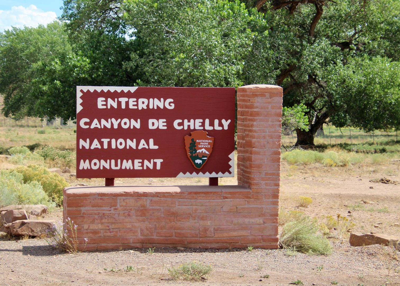
Canyon De Chelly National Monument has been on my bucket list for several years! We finally drove to this remote location on the Navajo Reservation (90 miles from Gallup, NM, where we are staying). We have stayed in four places in the Four Corners Region (in NM, UT, AZ), in the last month or so and this is the closest we have been to the Canyon.
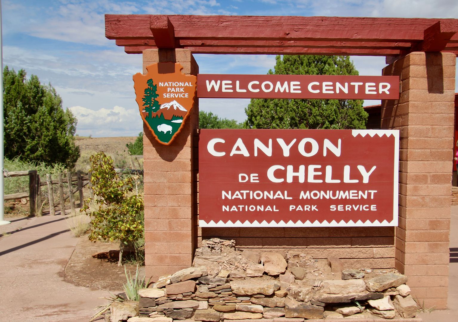
The Welcome Center has information, exhibits, and a bookstore. We picked up a guide for the overview of the overlooks along the North and South Rim drives of the monument.
People have lived here 5,000 years…longer than any other area on the Colorado Plateau. Here’s a timeline:
- 2500-200 BC: Archaic describes the earliest people who lived here in seasonal camps in rock shelters. They were hunter/gatherers on the canyon floor and plateaus above.
- 200 BCE-CE 750: Basketmaker people made incredible baskets (as you would surmise) but were also farmers (growing the three sisters – corn, squash, and beans). They built communities, stored food, and participated in communal activities.
- 750-1300: Pueblo era gave rise to villages where people raised turkeys for food and grew cotton (that influenced weaving techniques. Beautiful pottery was also made. Social interactions and trade increased.
- 1300-1600: Hopi describe this as a migratory cycle when only seasonal farming, pilgrimages, and occasional stays happened in the canyon.
- 1700-1863: Navajo brought domesticated sheep and goats to the canyon and became known for its fine corn and peach orchards. War broke out (late 1700s) among other tribes and Spanish colonists with the Navajo seeking refuge here. Despite fortified trails, stockpiled supplies, etc., the Spanish, Ute, and US military breeched their lines causing loss of life for many Navajo.
- 1863-1868: The Long Walk Col. Kit Carson led a brutal campaign against the Navajo, capturing or killing many of them in the canyon. Sheep, hogans, orchards, and crops were also destroyed. Forced (at gunpoint) to walk 300 miles to Fort Sumner (NM), the Navajo were incarcerated until 1868 when the US government allowed them to return home.
- 1868-1925: Trading Days The Navajo faced starvation when they returned to their homeland. Trading posts helped them survive by providing a market for their jewelry, rugs, crafts, etc., that they exchanged for staples. It was years before cash was used at the trading posts.
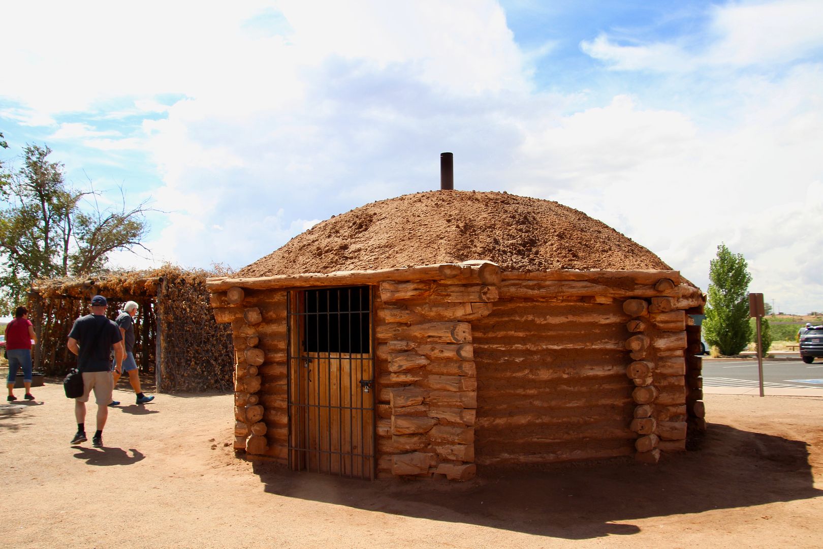
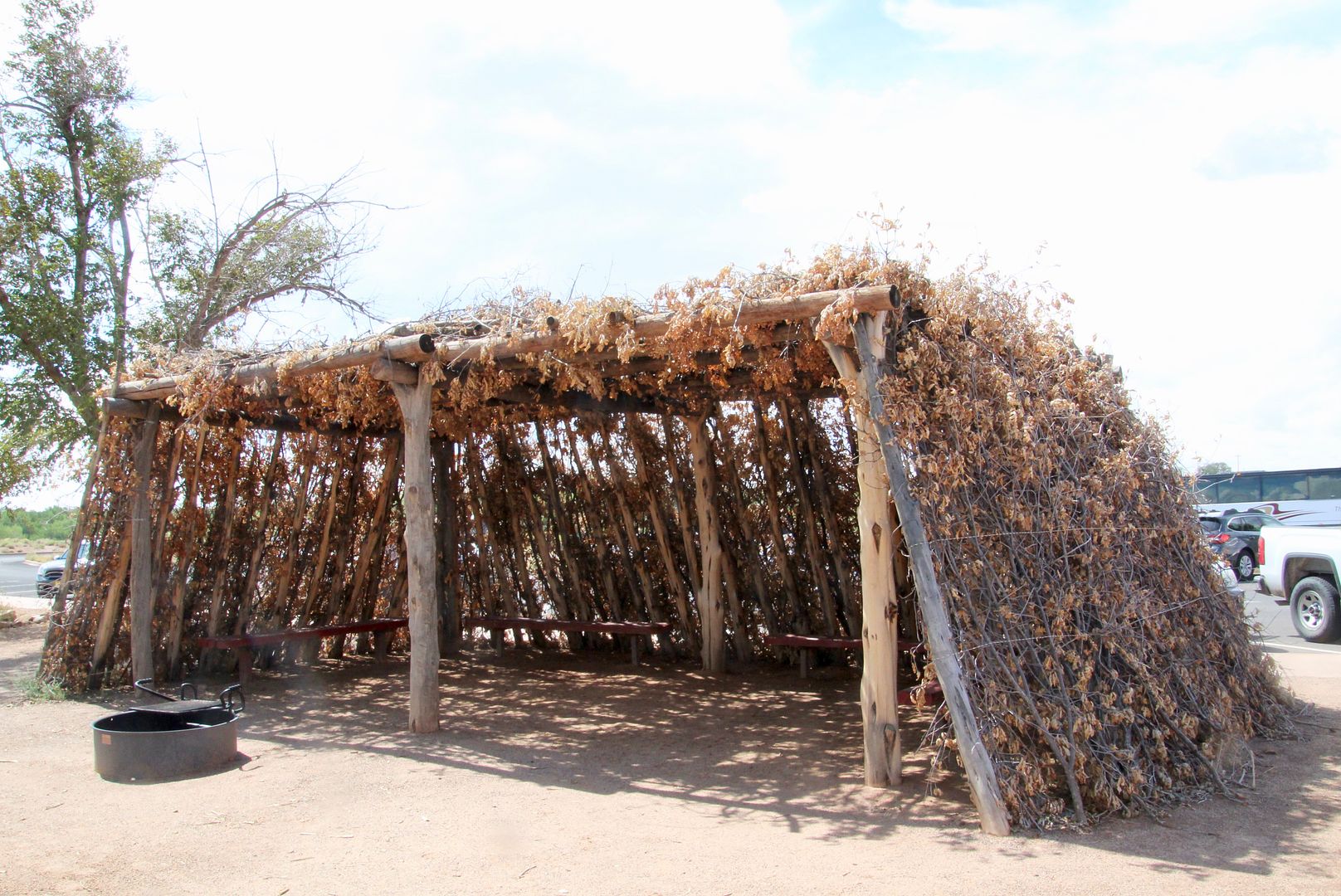
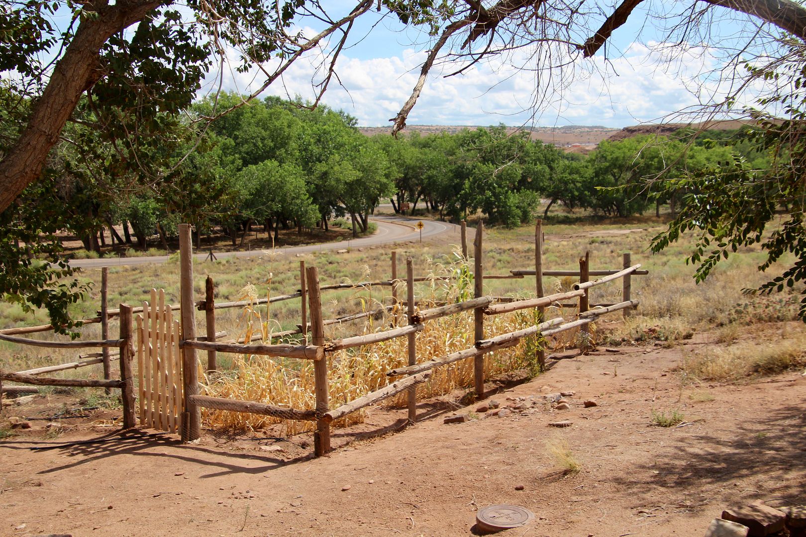
Outside the visitor center is a Hogan (traditional family home) and a summer shelter. Also shown is a typical family garden.
Two scenic drives, one on the South Rim (Canyon de Chelly), and the second on the North Rim (Canyon del Muerto) are the easiest way to see the canyons on a one-day visit. Private companies offer a wide variety of tours (hiking, back-country camping, horseback, and jeep) into the canyon. Only vendors registered with the Navajo Nation and the National Park Service are allowed. Multiple nighttime stargazing programs are offered by park rangers, as well.
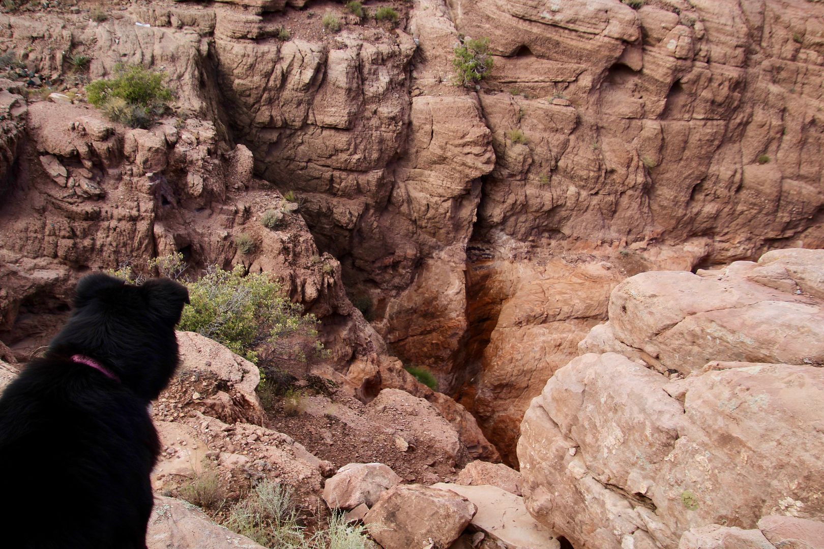
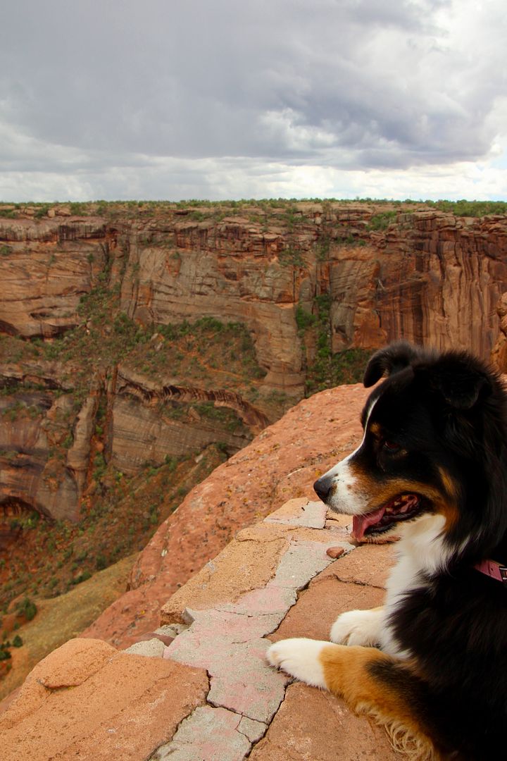
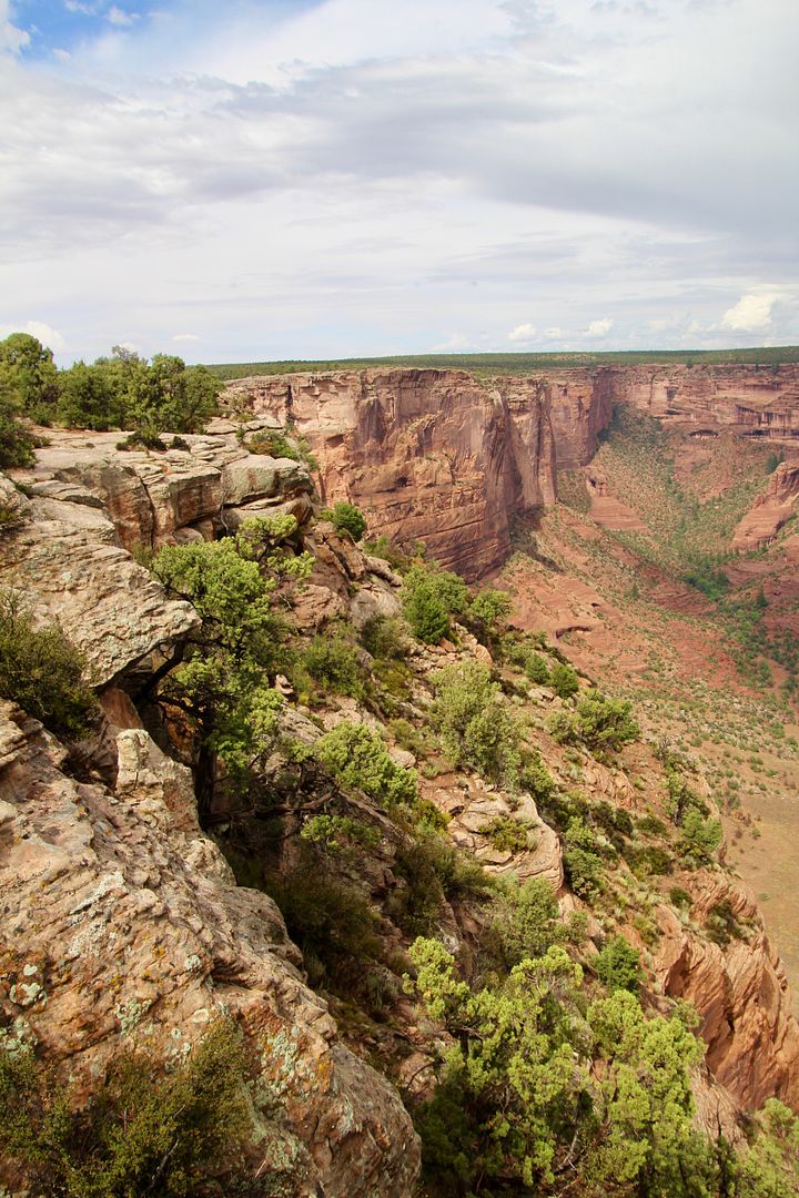
Beginning with the South Rim Drive (34 miles with 7 overlooks), this was our first view into the canyon. Leashed pets are allowed on the overlooks along the rim. Our girl, Sadie, always likes to stand near the edge to see what’s down there.
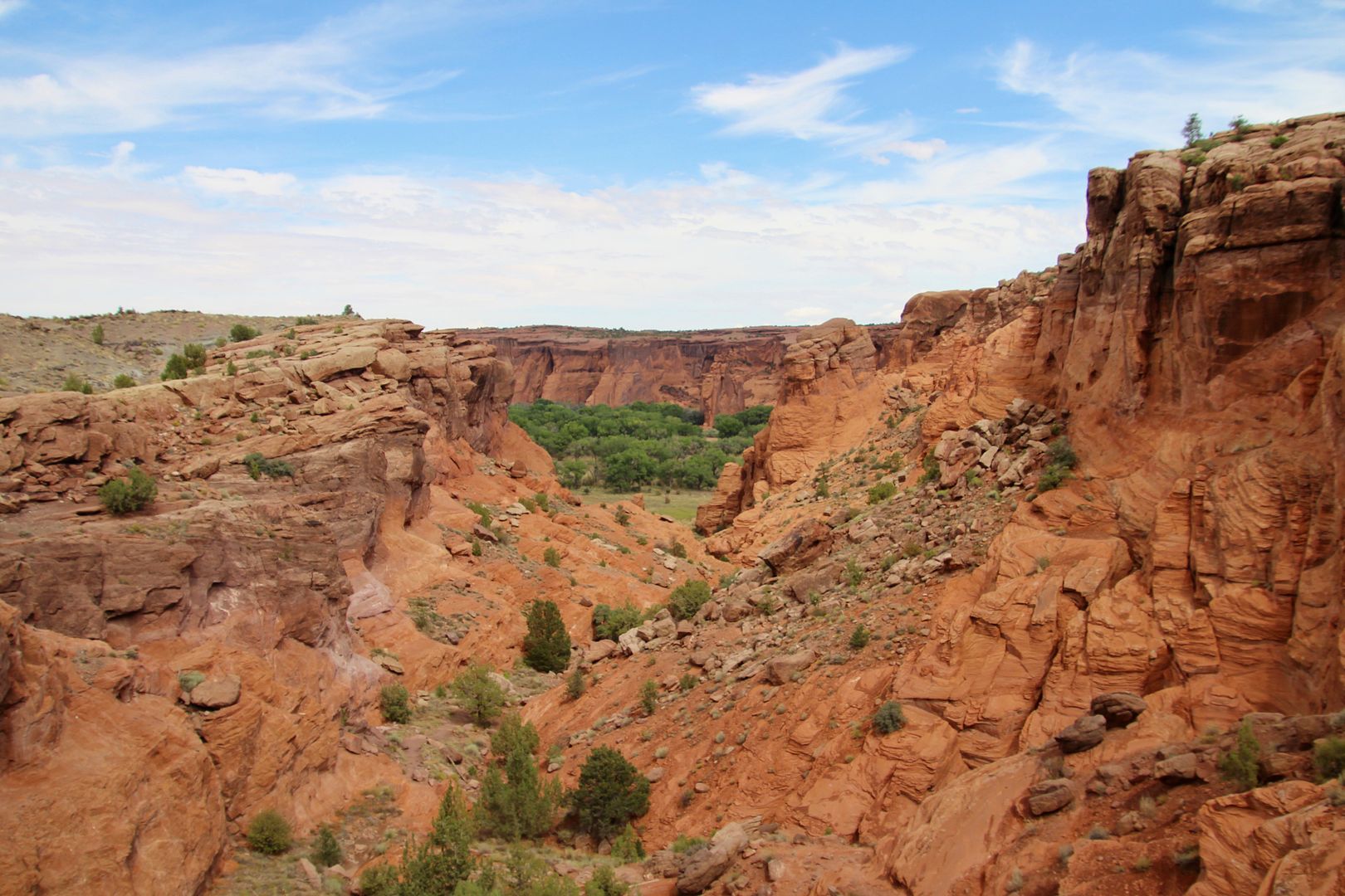
At Tsegi Overlook, farmlands of the Navajo can be seen on the canyon floor.
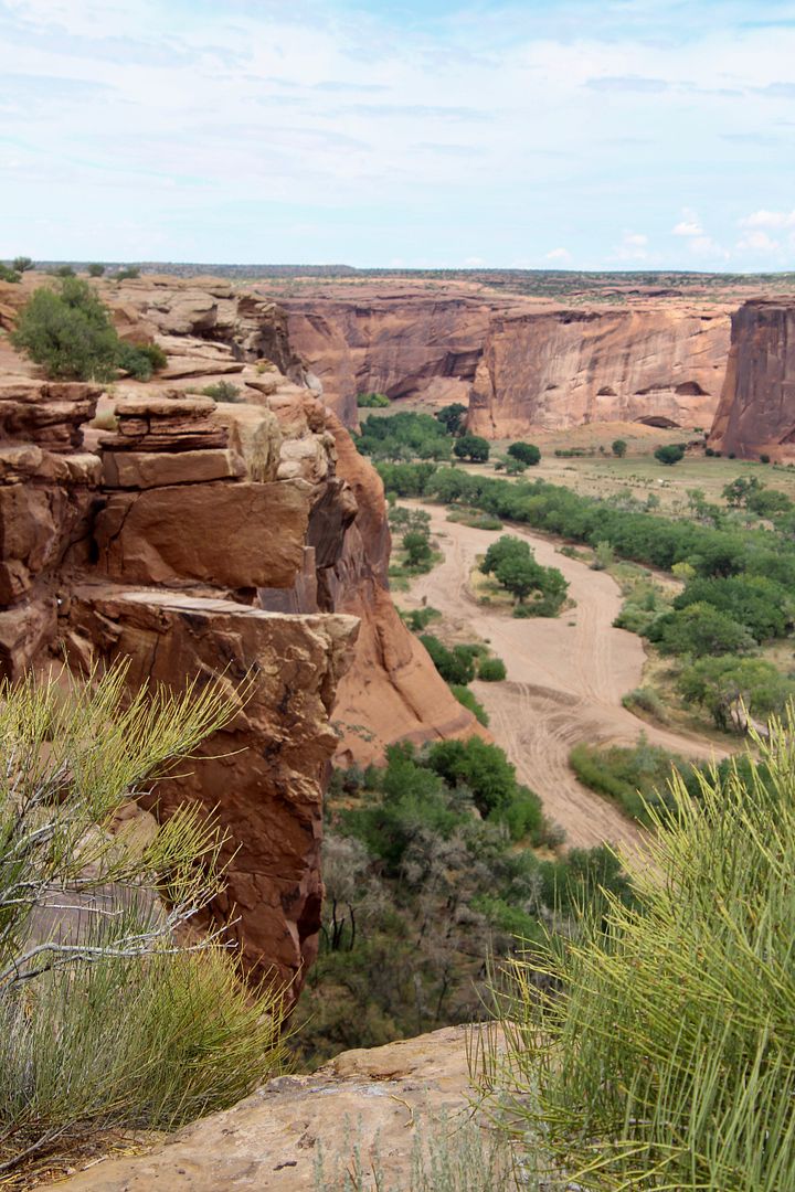
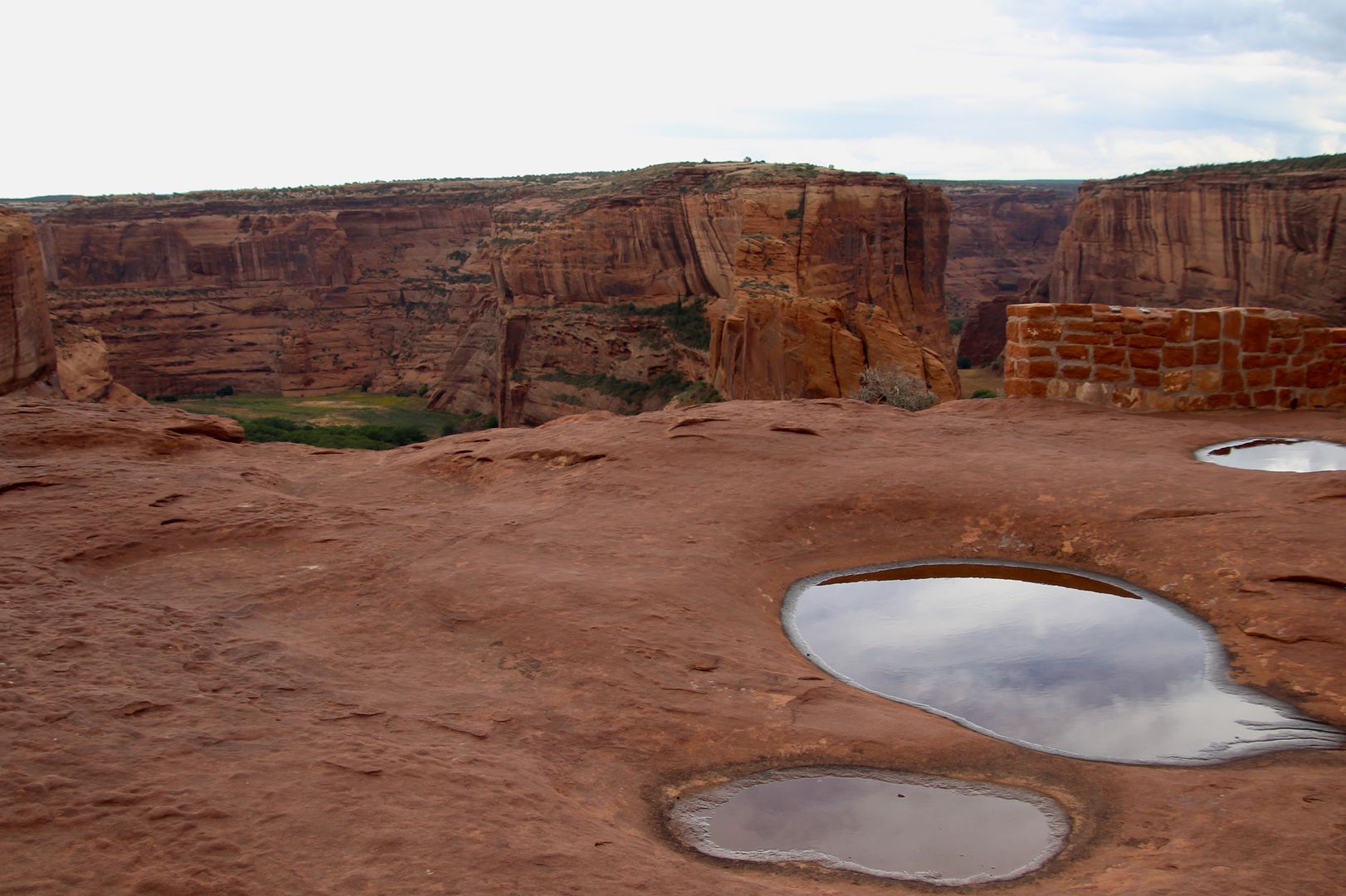
Junction Overlook has views of the confluence of the Canyon de Chelly and Canyon del Muerto. The potholes in the rocks teem with life for the short time they exist. Be careful not to get too close to the edge!
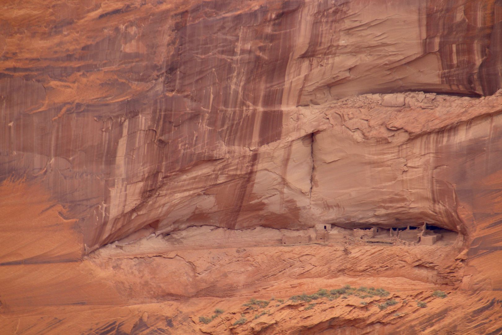
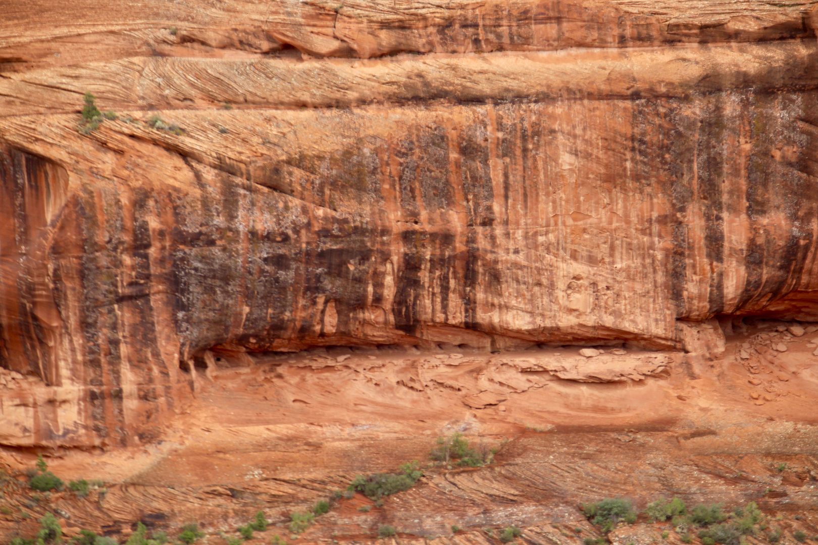
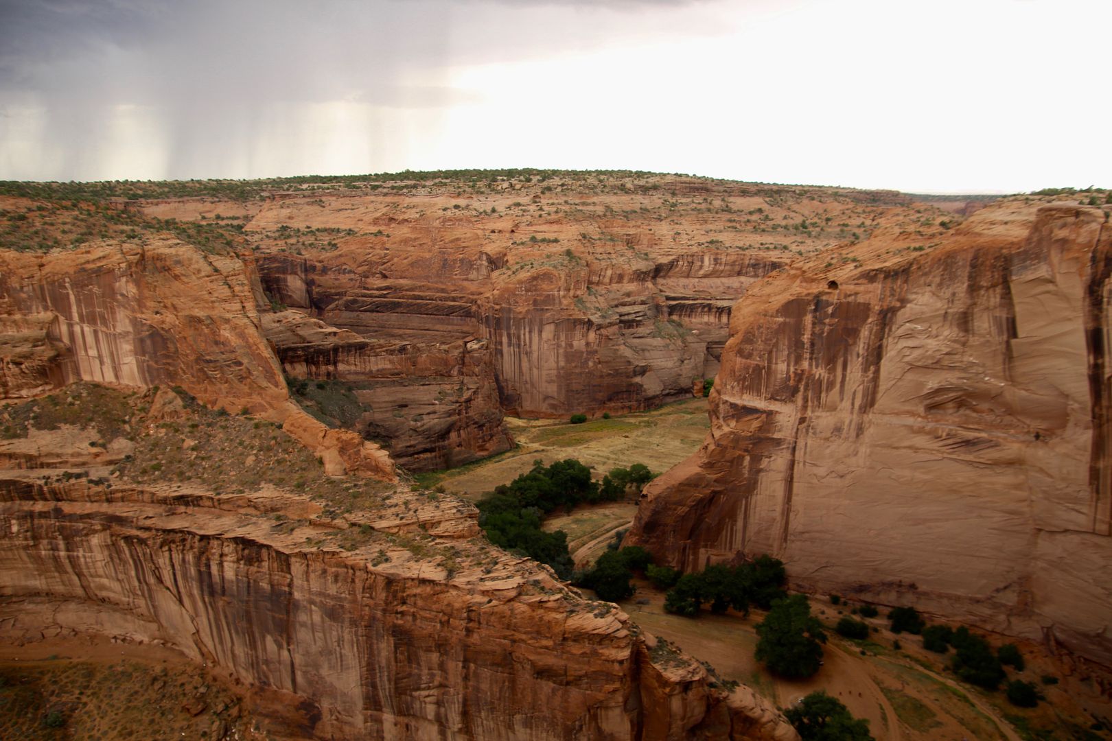
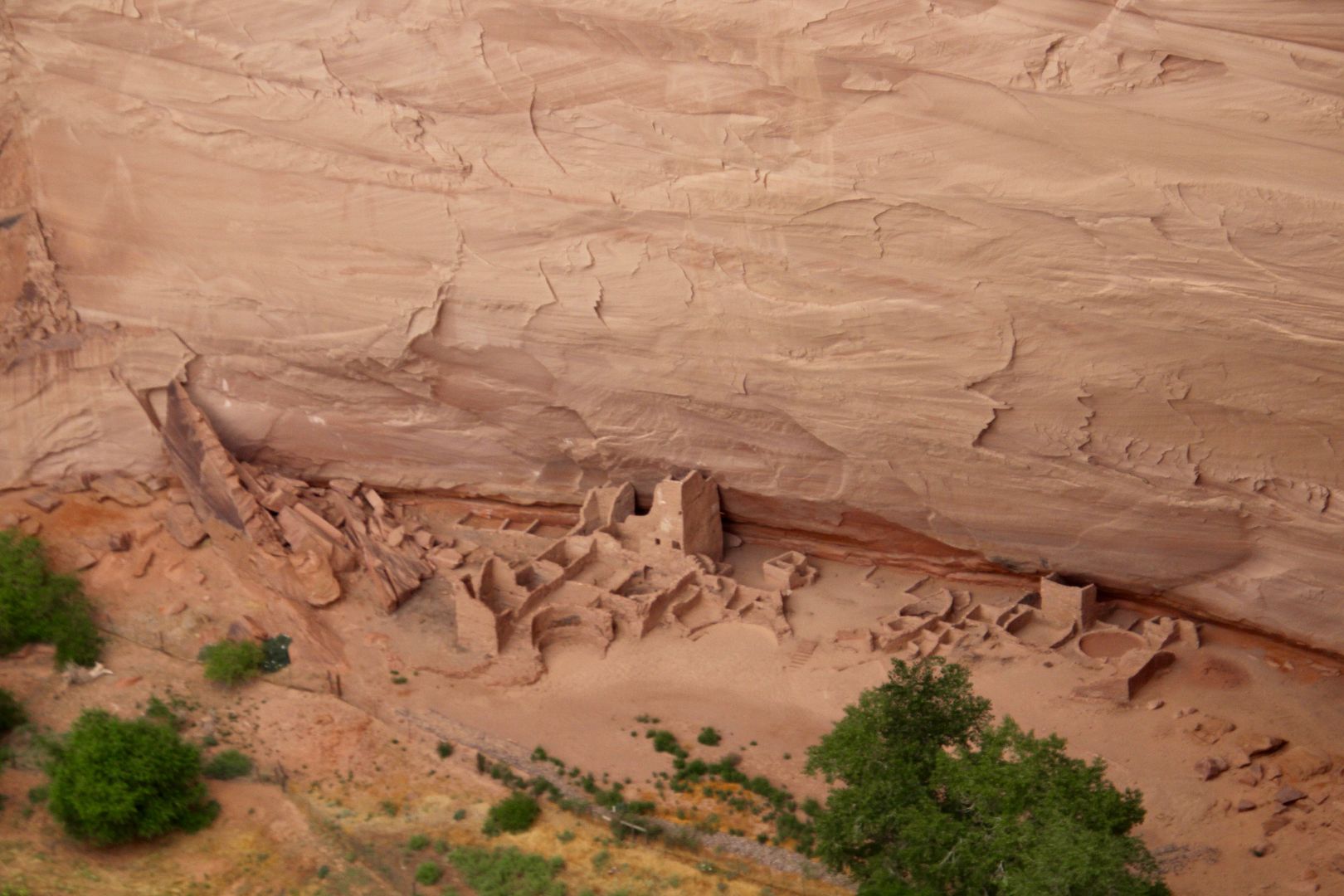
Also visible from the Junction Overlook is First Ruin, discovered in 1882 by archeologist Mindeleff. It was occupied between that late 1000s and early 1200s and had residential rooms and two kivas. On the far side of the canyon is Junction Ruin occupied around the same time. Most of the large cliff dwellings are on the south-facing wall where sunlight provided warmth and sunlight.
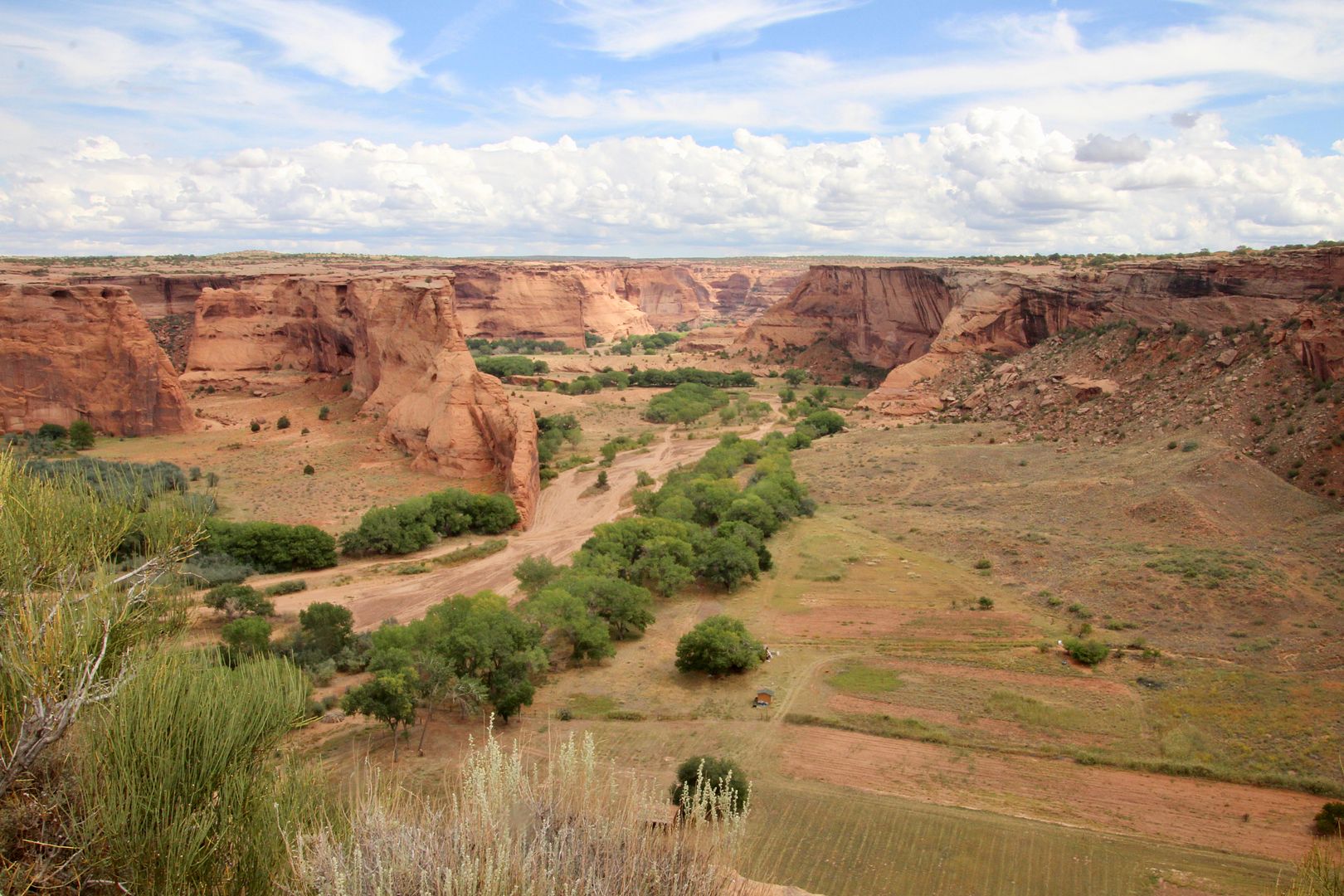
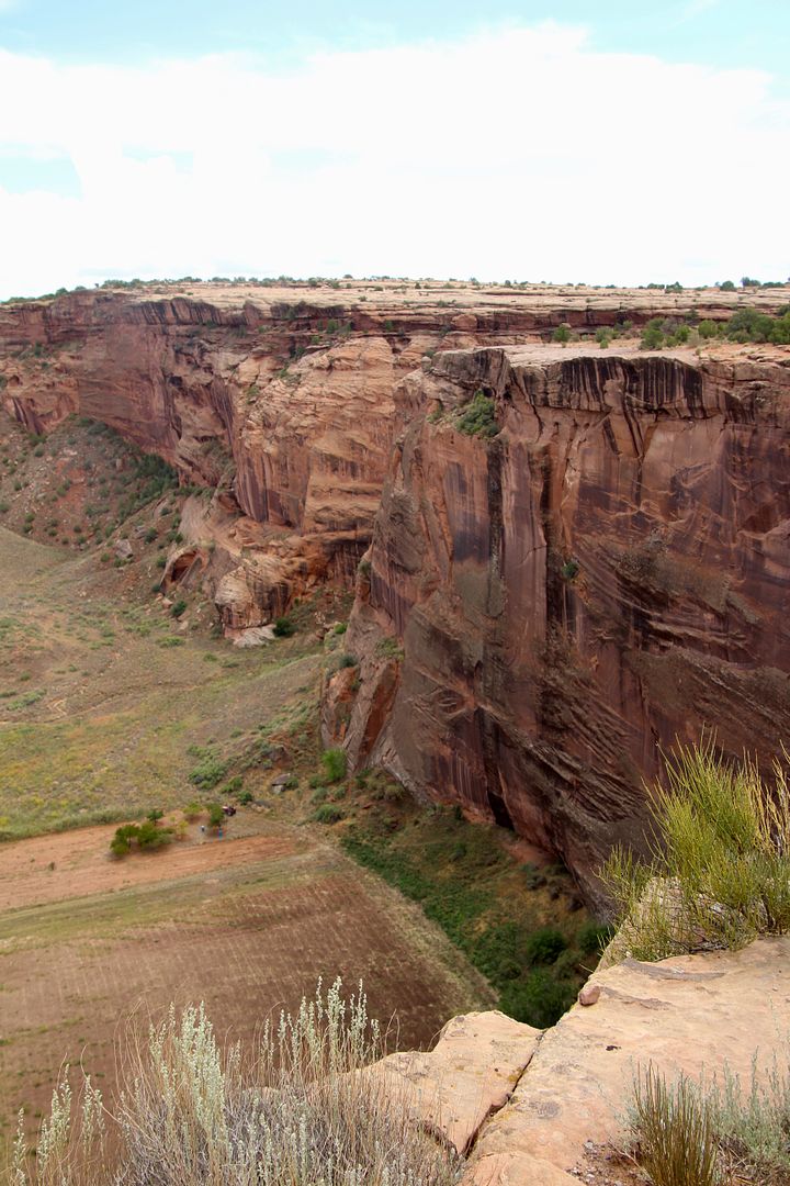
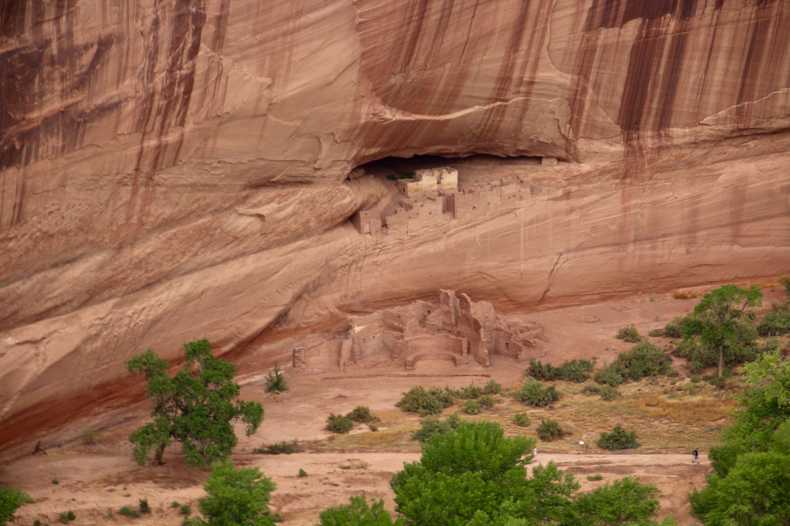
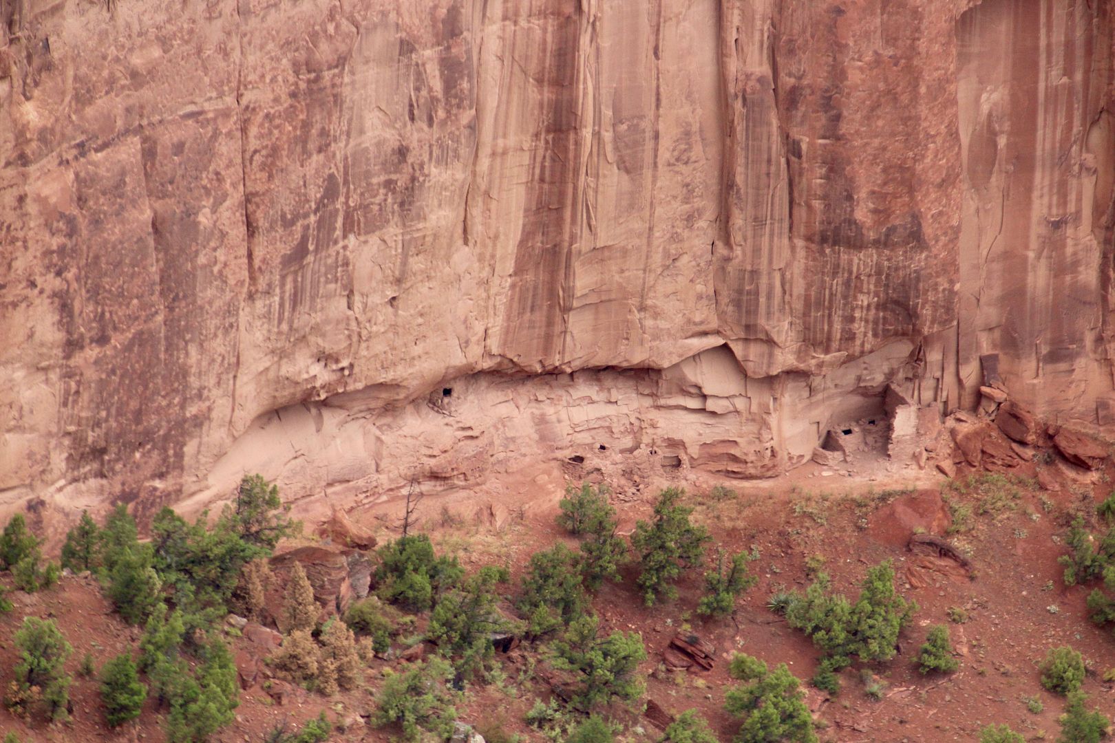
At the White House Overlook, the White House Ruin is visible across the canyon. So named for the white plaster walls of the cliff dwelling, there is also a masonry pueblo on the canyon floor. A 2.5-mile trail leads to the ruin (no pets allowed) where about 40 of the original 80 rooms remain. This is the only trail where hiking is permitted without a licensed guide.
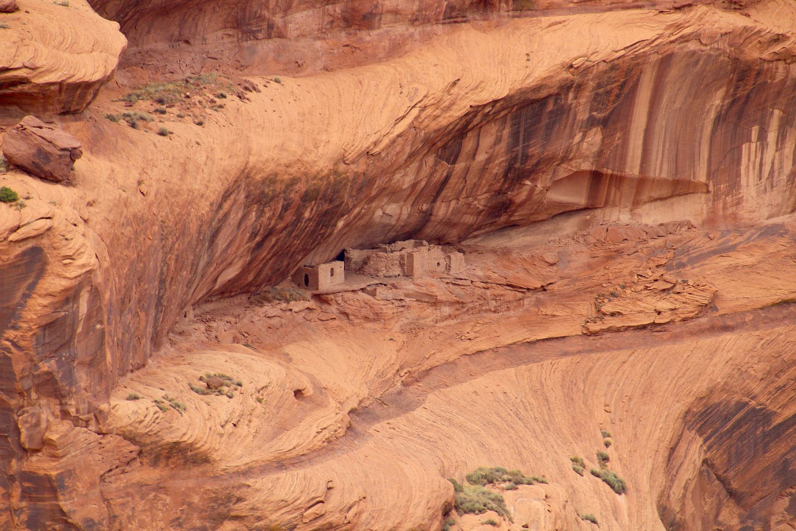
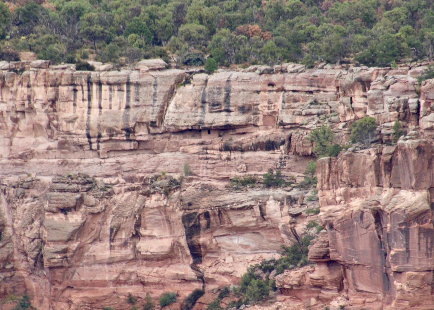
Sliding House is visible from the next Overlook. Retaining walls were built to stabilize the structures in the alcove. Originally there were up to 50 rooms and three kivas here. I was thankful for the stone wall at the edge of the overlook, too!
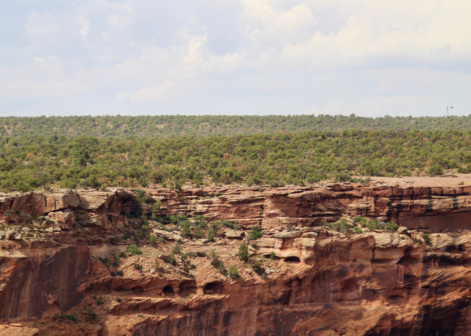
Several small sites can be seen in the alcoves at Face Rock Overlook. Large steps were carved into the cliff face (center of second photo) to reach structures built above and below. Some of the cliff dwellings were accessed from the plateau above and some from the valley below (or both).
In the center of the first photo is Face Rock. Navajo oral history says that Face Rock reports the names of misbehaving children to Spider Woman (a rock visible at the next overlook). Sadie was curious about the canyon far below.
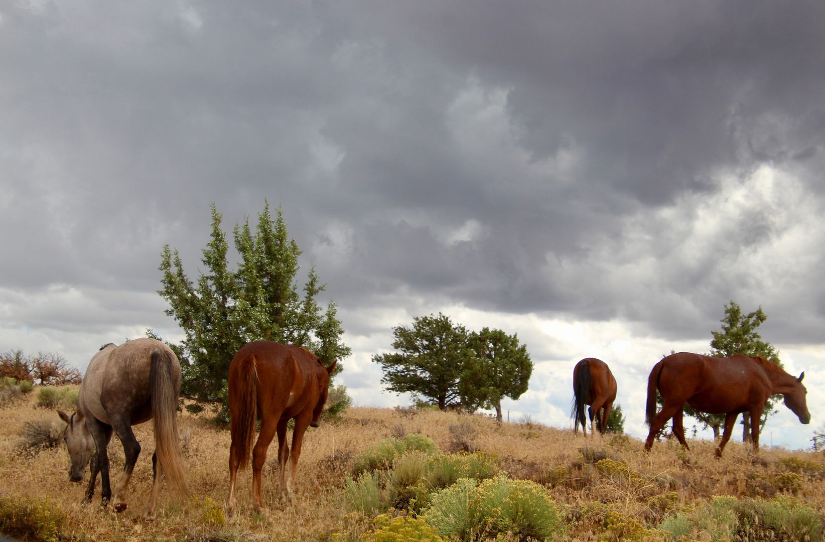
And we spotted some free-range horses on our drive to the next overlook.
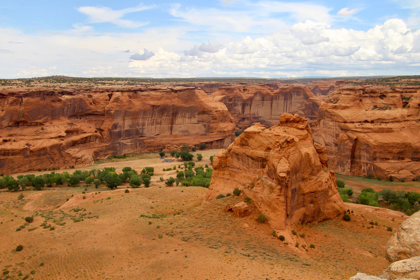
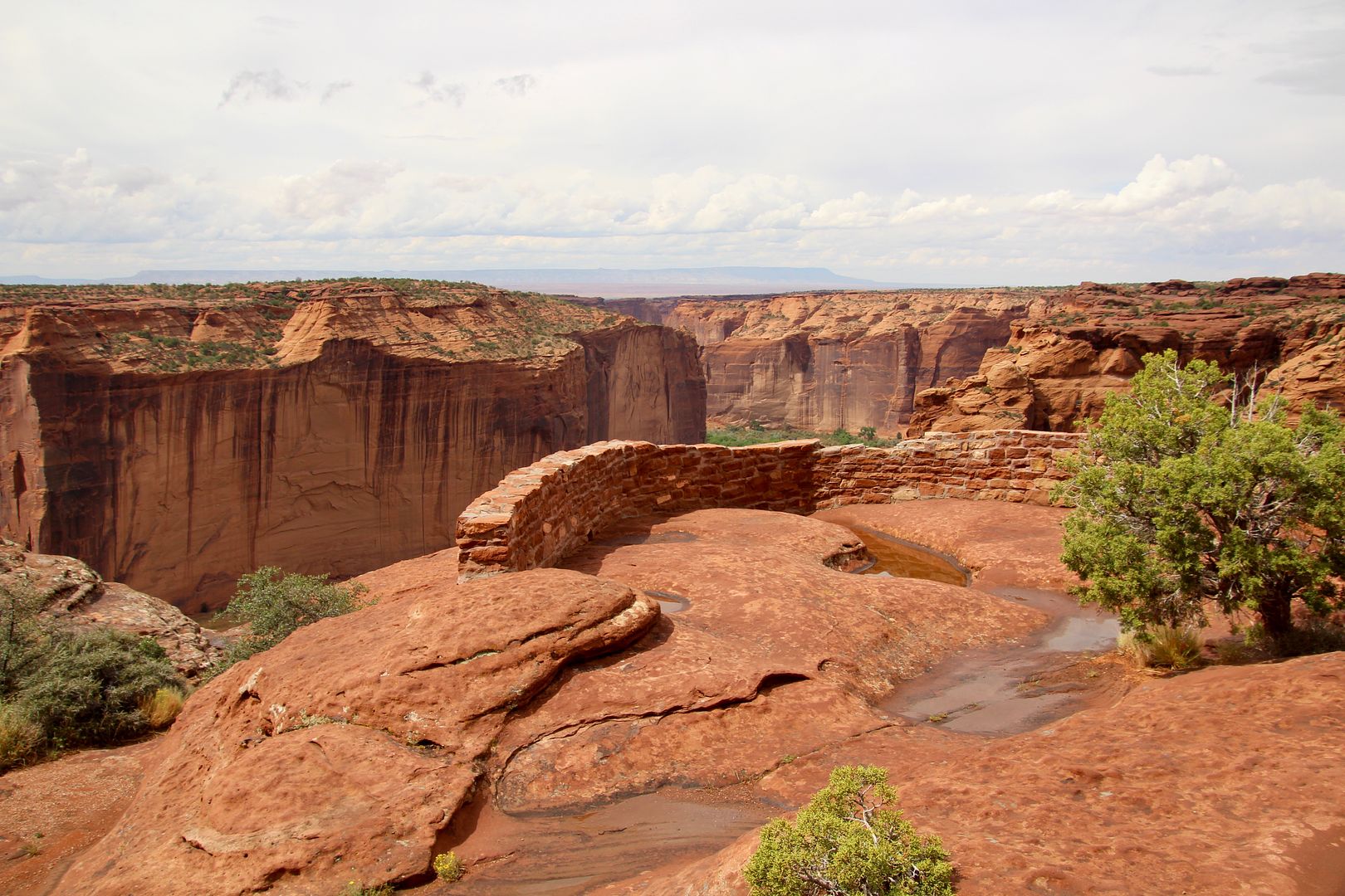
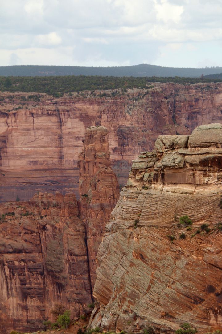
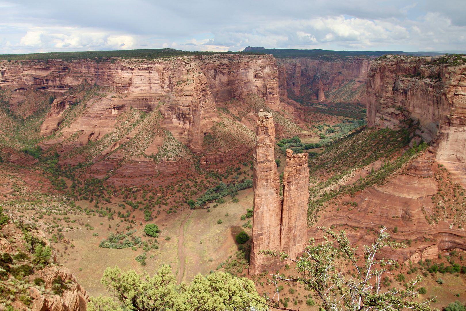
Spider Rock Overlook is the last stop on the South Rim Drive. Spider Rock is a prominent 800’ tall landmark. Navajo oral history says she taught Navajo women how to weave and lives atop the rock. When Face Rock informs Spider Woman of naughty children, she carries them to the top of the rock. If you look at the base of the rock, you will see several small structures. The overlook is about 1,000’ above the canyon floor.

We retraced our route to the Visitor Center and then proceeded to the North Rim Drive (15 miles with 3 overlooks).
The Antelope House Ruin Overlook is the first stop. There is a ¼ mile rocky trail to the Antelope House Ruin to the right and Navajo Fortress to the left.
The Antelope House was 3-4 stories high with 80+ rooms in 2 major room blocks connected by a circular plaza. It was abandoned by about 1275.
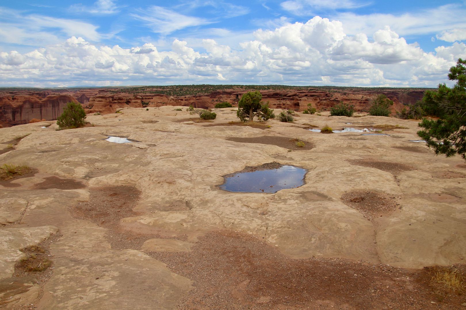
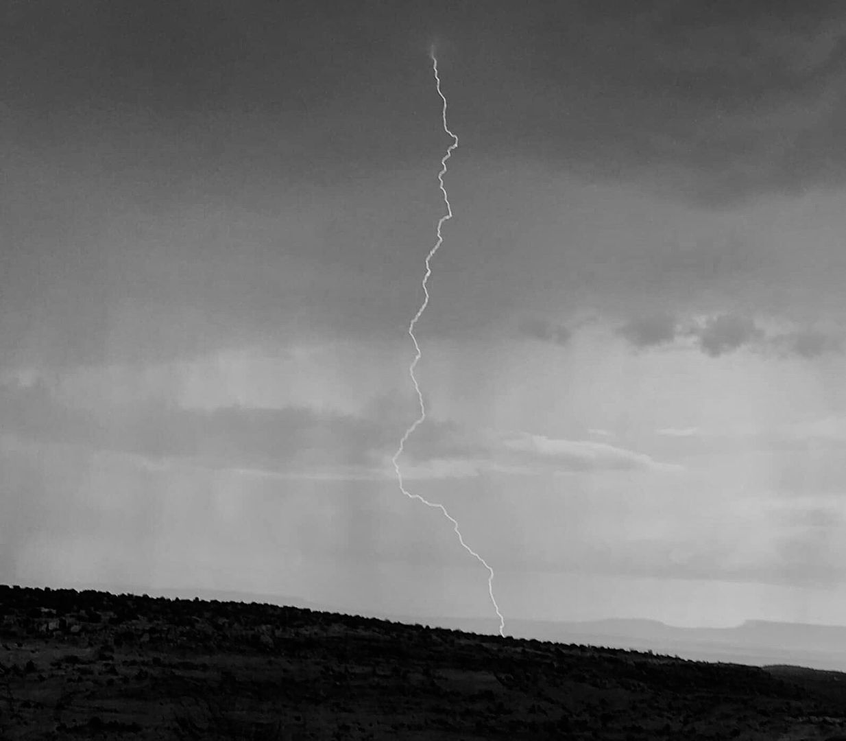
The day had been overcast, and we saw the storm in the distance. The sky grew darker and darker as it drew closer.
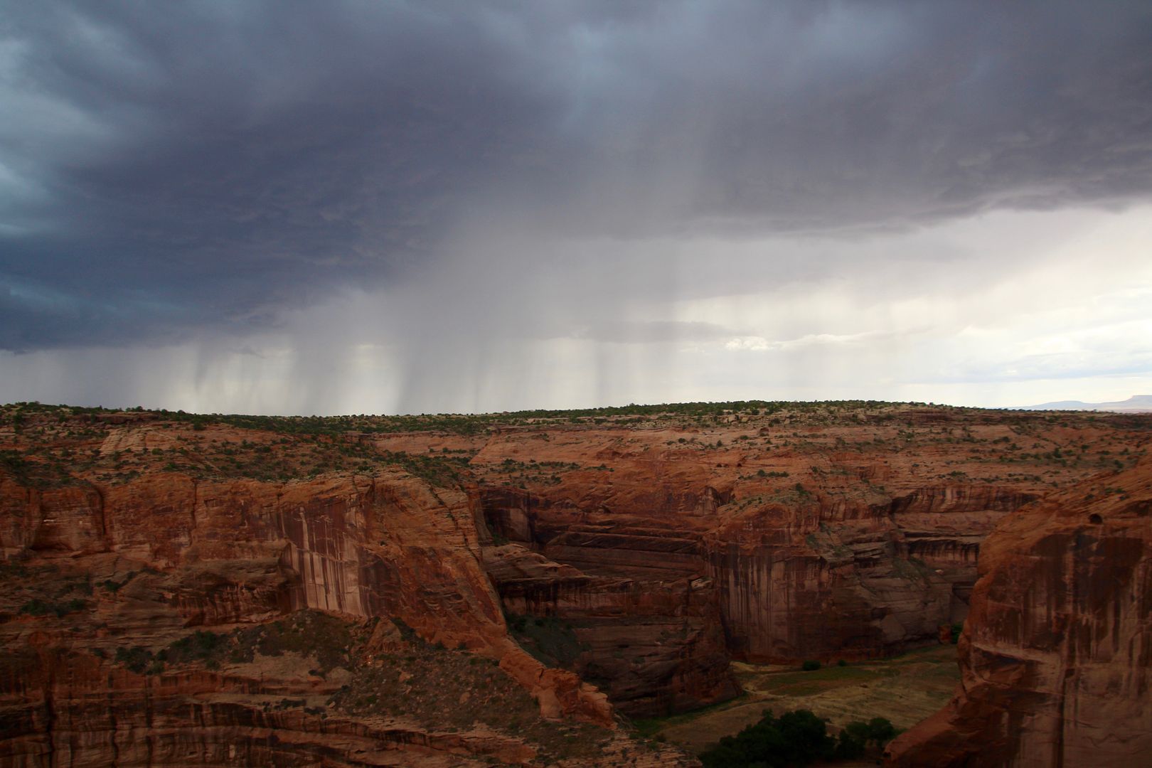
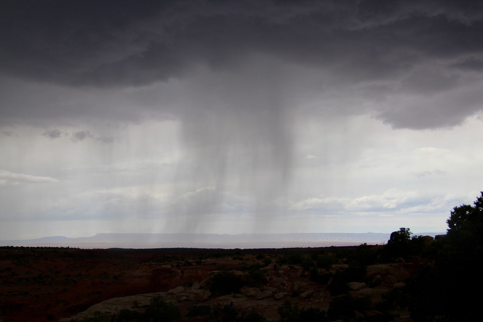
There were warning signs not to be on the bluffs during a thunderstorm. John was determined to catch a lightning strike (I was running for the car when the rain began), and he did. I hope you can see it!
This ended our drive along the North Rim (although we would have liked to see the other two overlooks). The canyons here are amazing with steep cliff walls and many archeological sites of cliff dwellings. I had heard so much about this place, and it did not disappoint!
For additional information about Canyon de Chelly National Monument, go to www.nps.gov/cach.
One of our favorites. We loved the tour of the canyon floor.
ReplyDelete