Sunday, September 18, 2016

Foothills RV Park and Cabins, September 209, 2016


Rating:  3.5 on a scale of 5

Location: This small RV park is located in Pigeon Forge on a hillside featuring both full-hook up RV sites and cabins of various sizes. It is on the edge of town and only about 4 miles from Dollywood and close to the countless tourist attractions in Pigeon Forge. The Sugarlands Visitor Center at Great Smoky Mountains National Park is about 8 miles away (after driving through Gatlinburg). Since our primary interest in this area was the national park, the location of the park was convenient for us. The Riveredge RV Park is located next to this park. 


Lot size: The lot sizes here are not very large, but we had enough room to stow our tow dolly next to the motor coach and just barely enough room to park the MINI Countryman in front of the RV. We were in a perimeter site that backed up to a fence (with another RV park on the other side). It was much nicer than the sites in the center of the loop. The park as full over the Labor Day Weekend, but was much nicer once most of the crowd cleared out. There is a concrete pad at each site with a picnic table and fire ring. 


Below are some of the cabins that are located in various parts of the park. 


Amenities: Cable TV and wifi are included in the cost of a stay here. One of the nicest amenity here is the lovely pool. 


The laundry room was very nice and roomy with 4 washers and 4 dryers. Change is available in the office. 


There is no dog park, but we just took our doggy, Sadie, for walks around the park and in the area. 

A trolley stop is located at the front of the park (near the office) which is convenient for those that don't want to drive in the terrible traffic here during weekends to get to the attractions.

Cost: $296/week with holiday weekend

Management: The folks here are very nice and helpful. Our check in was quick and efficient and there is lots of information/brochures available in the lobby. We were escorted to our site, which is always convenient. 


General Comments: Pigeon Forge is so commercial that I wished we had stayed somewhere a little less crowded. When we drove to Cades Cove in the national park (about an hour drive), we saw lots of RV parks near Townsend, TN. If we visit this area again, I would likely look for an RV park there. I originally made the reservations here because we were hoping John's sister and brother-in-law would join us for part of our stay and they would have stayed in a cabin. Nonetheless, we very much enjoyed the time we spent in the Great Smokies. 


Friday, September 16, 2016

Touring Cades Cove, 9/07/2016

The 11-mile, one-way, loop road through Cades Cove is the most popular destination in the Great Smoky Mountains National Park. It is a treasure trove of the cultural and natural history of the region. Knowing this area would be terribly busy over the Labor Day Weekend, we waited until Wednesday to visit Cades Cove. 

As the most visited National Park (9M visitors annually), it is advisable to plan your time here with that in mind (unless you deal with crowds and traffic jams better than I do!) Honestly, I did a 1.5 hour commute each way, each day, for many, many years, so in this phase of my life I avoid it, when possible. 

Because we had done some advance planning by purchasing a brochure ($1) about the Cades Cove Tour at Sugarlands Visitor Center the first day we were in the area, we drove directly to the Cove (via Highway 321 to Highway 73 to Laurel Creek Road to Caves Code Road...all well marked). You can also reach Cades Cove by driving through the National Park. 

There is an Orientation Shelter when you arrive in Cades Cove. Because we already had a guide, we made our first stop the John Oliver Place. John Oliver and his wife, Lucretia, arrived in the cove in 1818, one of the first settlers in the area. They had 9 children (2 died early in life) and 57 grandchildren! Their 1.5 story house is one of the oldest structures in the park. They purchased the land in 1826 and lived here until the National Park Service bought it 100+ years later. 


The Primitive Baptist Church was established by the early settlers of Cades Cove in 1827. Turn left onto a gravel road to drive to the parking lot of the church Initially a log building was constructed; it was replaced in 1887 by this one. The church closed during the Civil War as members of the congregation supported the Union. We spent some time wandering through the graveyard here.


A short distance on the other side of the Cades Cove Road is the Methodist Church. There were fewer Methodists in the cove than Baptists, but a group of them got together and established this church in the 1820s. Like the Baptist church, it was a log building that was replaced by this one in 1902. As we walked through the cemetery, it was heartbreaking to see all of the young women and many infants/small children that died in those years. The last photo in the group below is that of a marker for three sons born to the same parents. 


The Missionary Baptist Church was established (1839) by a group that split from the Primitive Baptist Church because they favored missionary work. This building was constructed in 1915. The Sunday School started here in 1898 continued until 1944 when the church closed. Like the other churches in the cove, it closed during the Civil War.


Elijah Oliver was born in 1824, one of John and Lucretia Oliver's nine children. When he married, he and his wife left Cades Cove, returning to the area after the Civil War. The house is 1/2 mile from the road and you can take the path through the woods or the one through a meadow to reach it. Restoration efforts are currently underway on the house. In addition to the house, the corn crib and smokehouse are shown below.


We spent the most time at the Cable Mill Area where there is a Visitor Center, a grist mill (located on its original site), and multiple other structures of the 1800s that were relocated to this area from other places in the National Park. Also, this is the only place along the Cades Cove loop road where there are bathrooms. 

The Visitor Center was built in 1972 and has information about the park, the Cable Mill Area, books, souvenirs. We were delighted to learn that dogs are permitted on the walkways when touring the area. It was so hot, that our doggy, Sadie, was thrilled to discover Mill Creek. She promptly hopped in and laid down on the cool rocks in the creek. 


The LeQuire Cantilever Barn provided shelter for livestock (both inside and under the overhangs) during bad weather. The additional space also provided storage for farm equipment. This style of barn originated in Europe centuries ago. 


John PCable built this grist mill and a saw mill after acquiring land in the Cove in the late 1860s. The same wheel provided power for both mills. His son, James, inherited the mill and continued operations into the 20th century. 


This house was built in 1879 by Leason Gregg after he purchased an acre of land from John Cable. The lumber used to build the house was sawed at Cable's sawmill. The family ran a store on the first floor while continuing to live in the house. Rebecca Cable and her brother purchased the house in 1887. They subsequently closed the store and used the house as a boarding house and residence. Rebecca eventually owned 600 acres of land and died in 1940 at age 96. 


This type of barn featured a drive-through center with stalls on each side. It was a more common design in the Cove than the cantilevered barns. Hay wagons were driven under the barn and bales were loaded into the loft while standing in the wagon. 


There are several other buildings of interest along the walking tour of the Cable Mill Area. 

Dan Lawson purchased land from his father-in-law, Peter Cable, and built this house in 1856. A unique feature for the time was the brick chimney (all others we had seen were stone). The bricks were made on site. A large barn is also located on the property


Our last stop on our tour of the Cove was "ColHumpTipton's place. He had served in the Mexican War. This house was built in the early 1870s. All of the buildings we have seen are built on stacks of rocks. It seemed that this could be a bit "wobbly," but none of the structures were! 


Across the road is another cantilevered barn that is a replica of an earlier one that originally stood in the same place. This is one of the most photographed structures in the park. 


We thoroughly enjoyed learning about Southern Appalachian culture and lifestyle during our tour of the churches, houses, barns, and mill in Cades Cove. If you visit the Great Smoky Mountains National Park, be sure not to miss this scenic drive. This post only represents a portion of all there is to see here. 

For additional information about Cades Cove and all other aspects of the park, check it out online at www.nps.gov/grsm.

Tuesday, September 13, 2016

Newfound Gap, Clingmans Dome, & Oconaluftee Valley, 9/06/2016

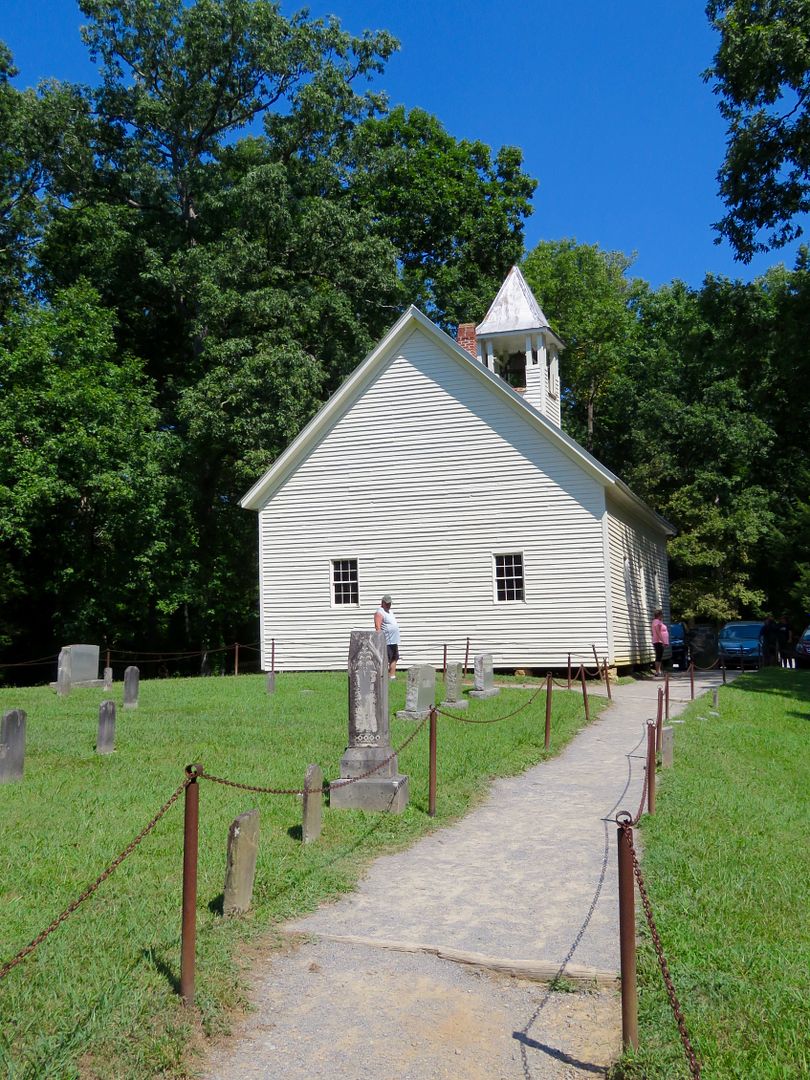
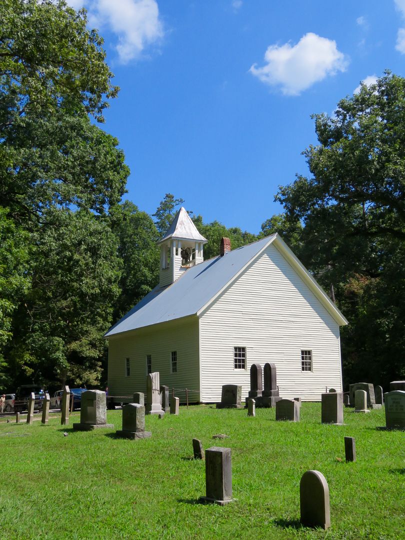
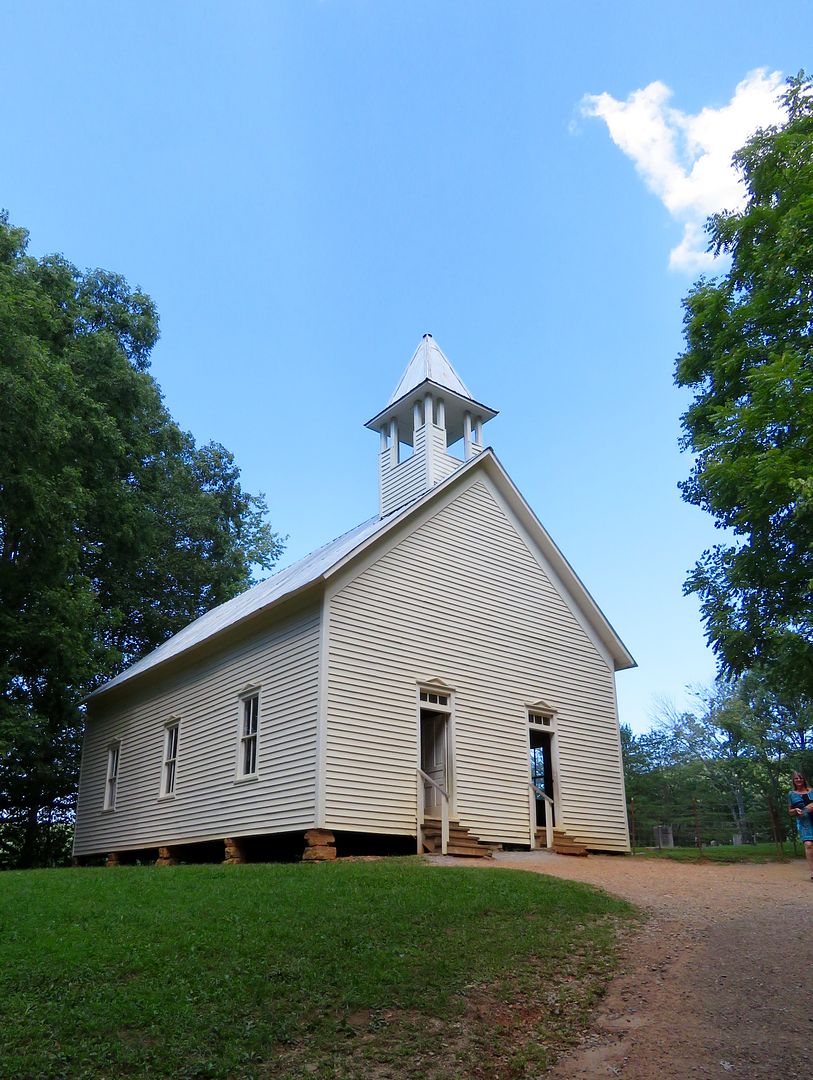
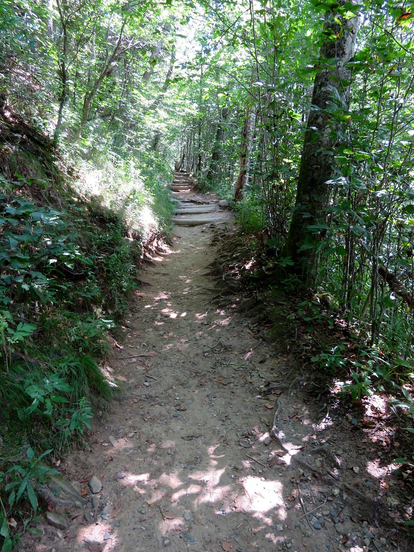
The Newfound Gap Road runs from Gatlinburg, TN, to Cherokee, NC, through the Great Smoky Mountains National Park. The distance is just 31 miles, but with the many overlooks it takes quite some time to enjoy all there is to see along the way. This route was "discovered" in the late 1800s as a passage through the mountains and the paved road was completed in 1932. 

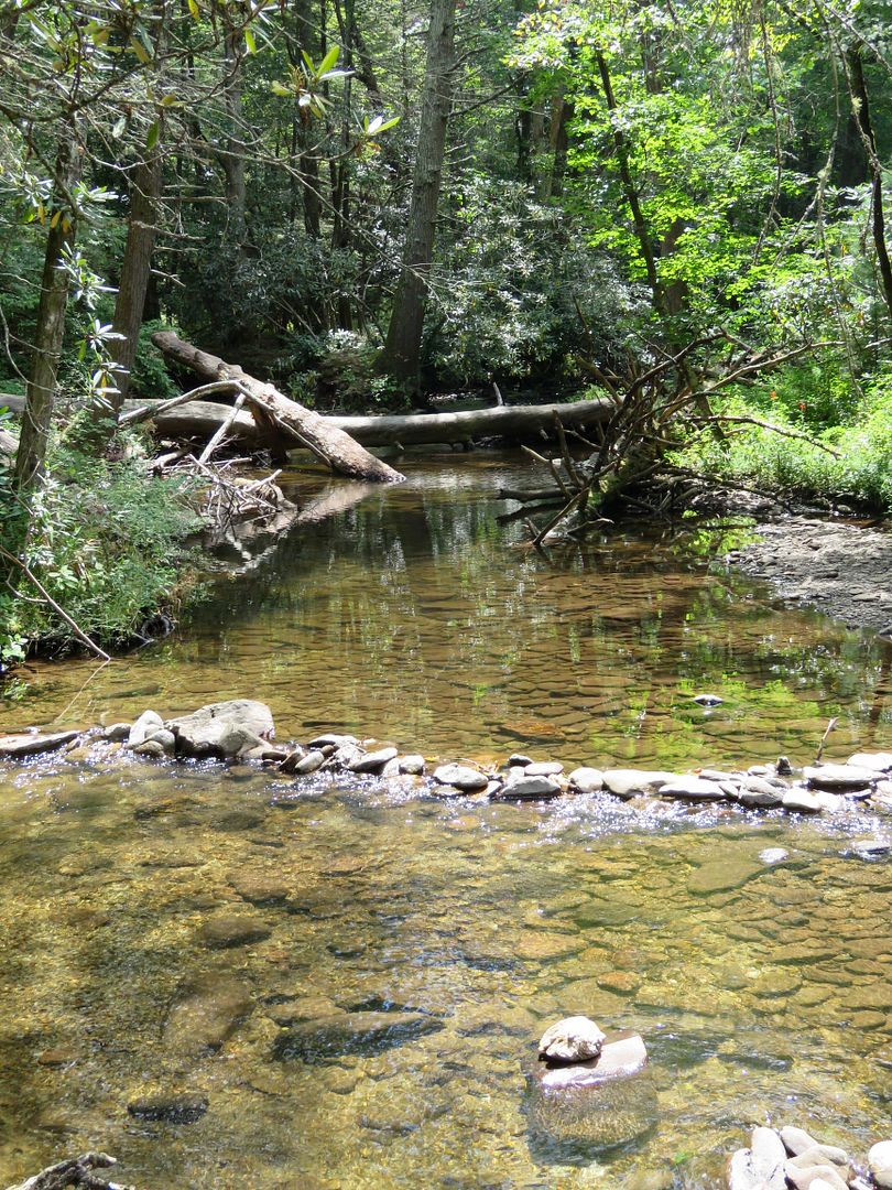
The road follows the West Prong of the Little Pigeon River in the western part of the park. 


Below is the view from the Morton Overlook, named for mayor and park supporter, Ben Morton. 
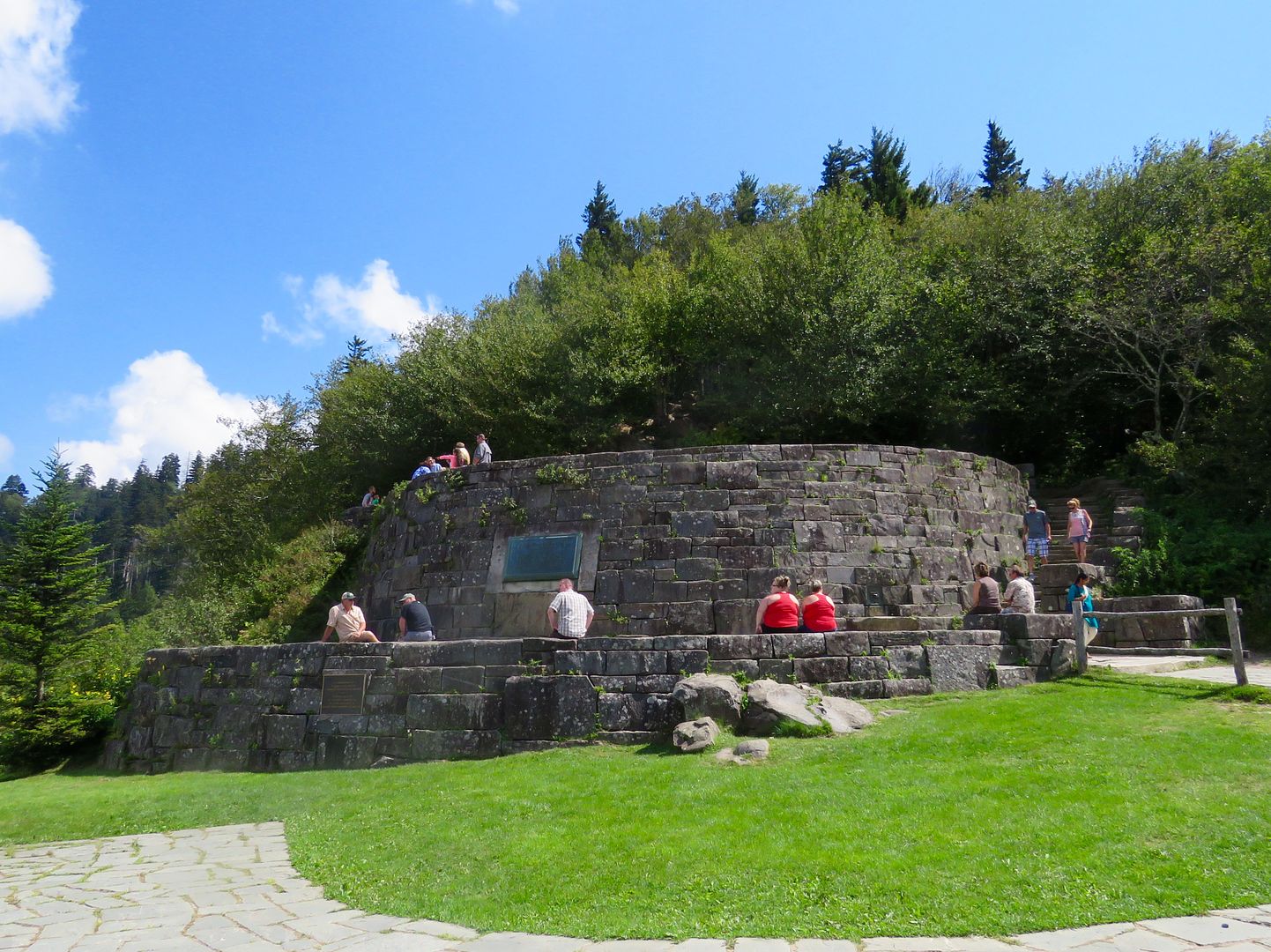

President Franklin DRoosevelt dedicated the Great Smoky Mountains National Park at this site, the Rockefeller Memorial, in 1940 although the park was established six years earlier. The memorial commemorates those who helped establish the park, in particular, John D. Rockefeller's mother who donated $5 million of the $12 million used to purchased most of the parks 520,000 acres. Thousands of people gathered for the dedication.


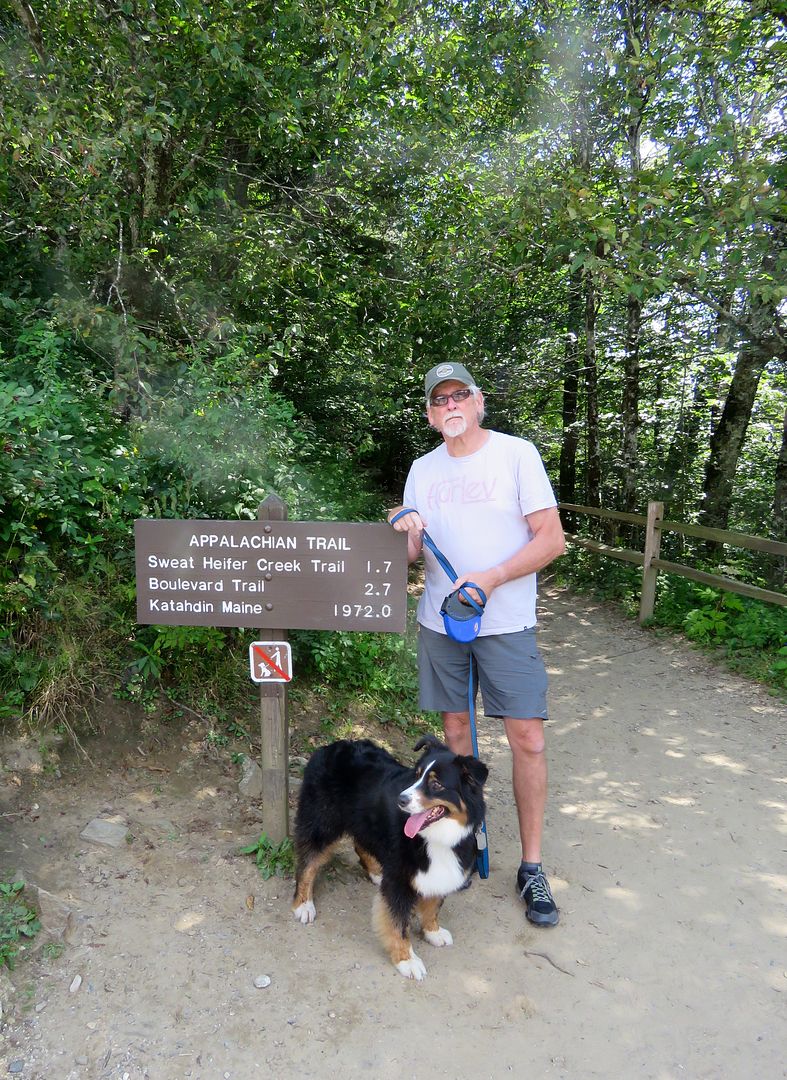
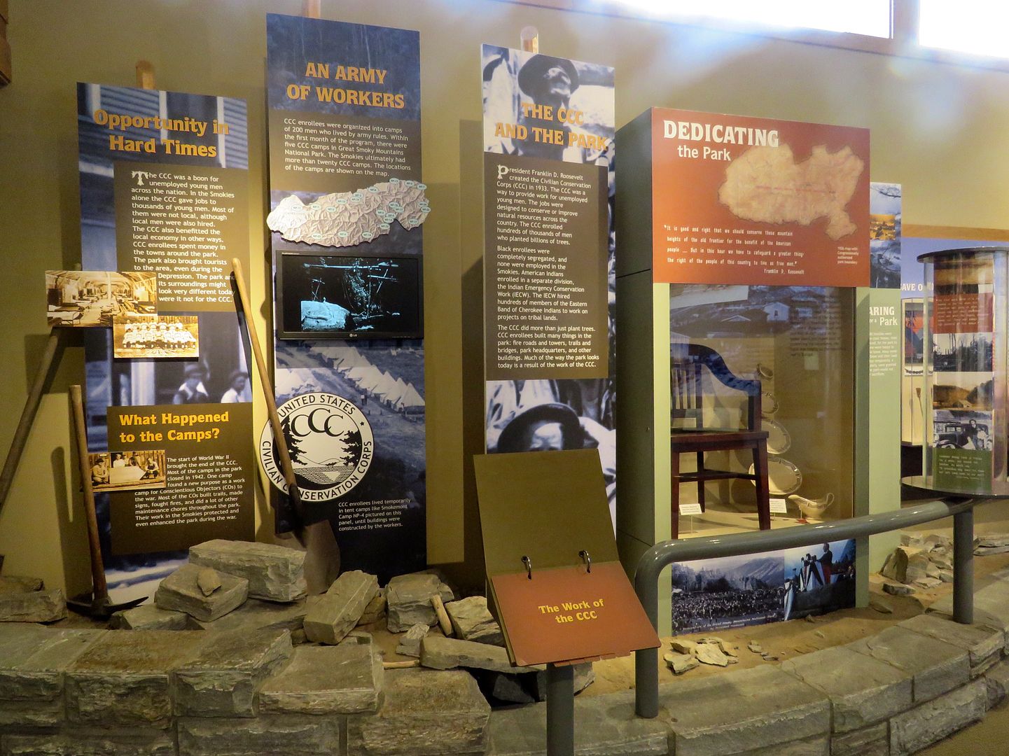
The Appalachian Trail that runs from Georgia to Maine (2,150 miles and 14 states) is next to the memorial. As you can see in the sign, Maine is 1,972 miles from this point. During the 1930s, the Civilian Conservation Corp, built this trail through the Great Smoky Mountains. The CCC was created in 1933 and employed more than 3 million men 18 to 25 years old. They built roads, campgrounds, trails, and buildings in many of our national parks. Many of the shelters built by the CCC are still in use today along the Appalachian Trial.


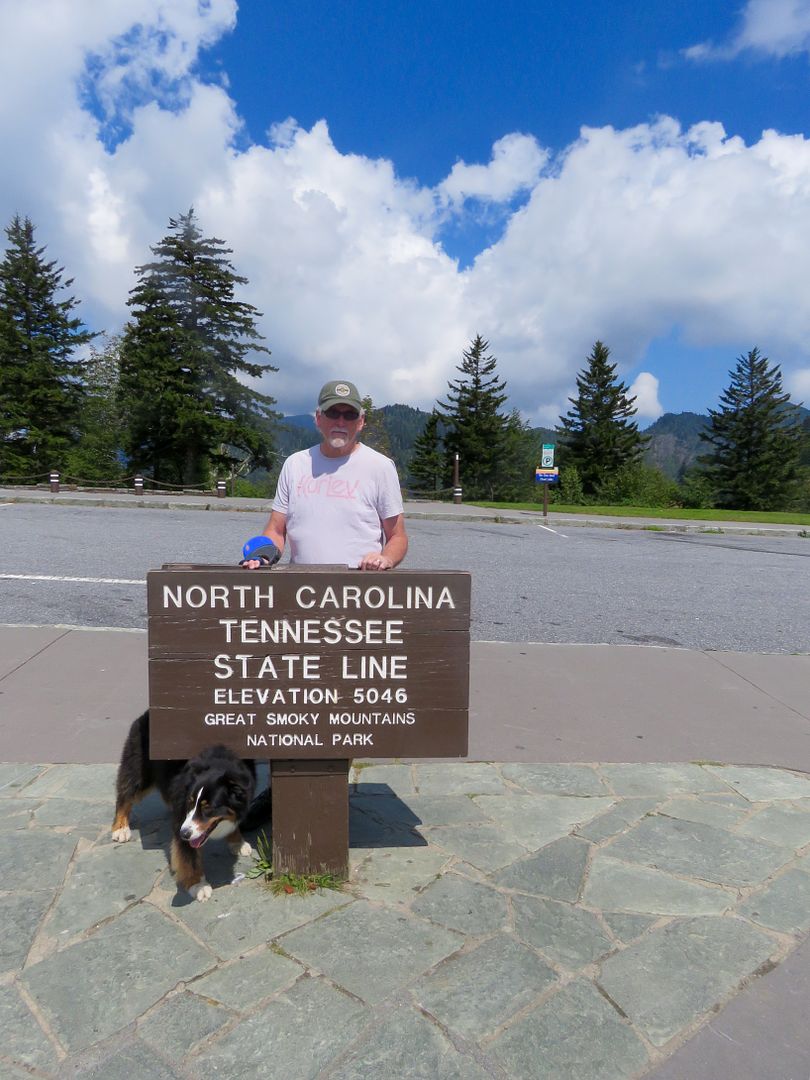
The Newfound Gap is located between Tennessee and North Carolina. Here are two photos of us straddling the state line! In the first, Sadie is in NC and John is in TN. I have one foot in each state. You can also see the beautiful Oconaluftee Valley from the overlook here.


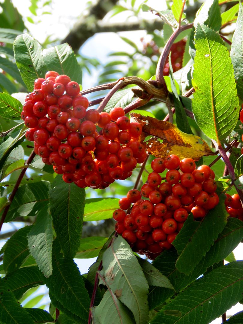
I love the colorful berries on the mountain ash trees. They grow in abundance here. The berries must be cooked to be edible by humans, but is a food source for birds as the weather gets colder. 


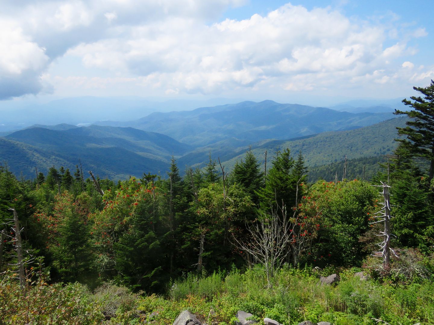
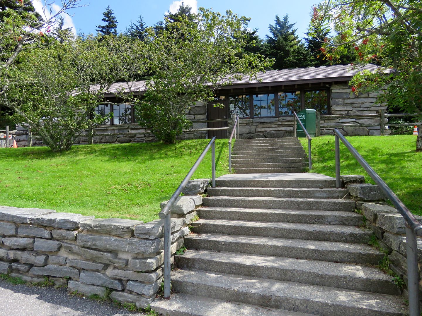
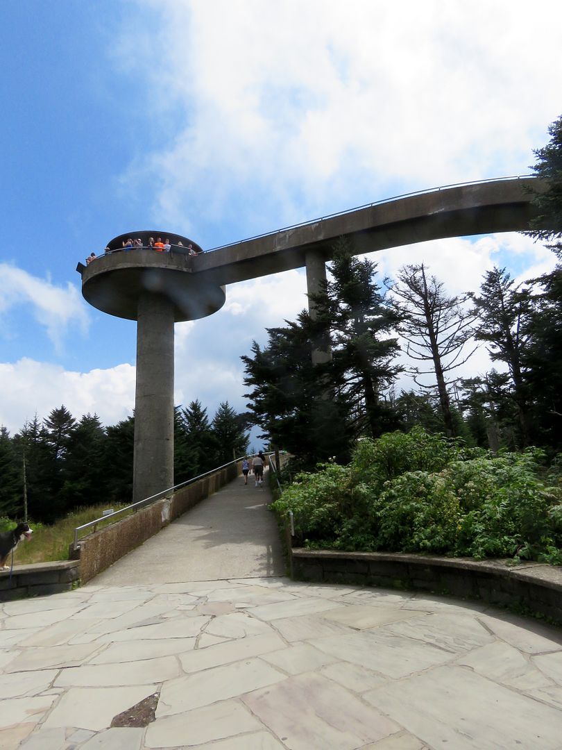
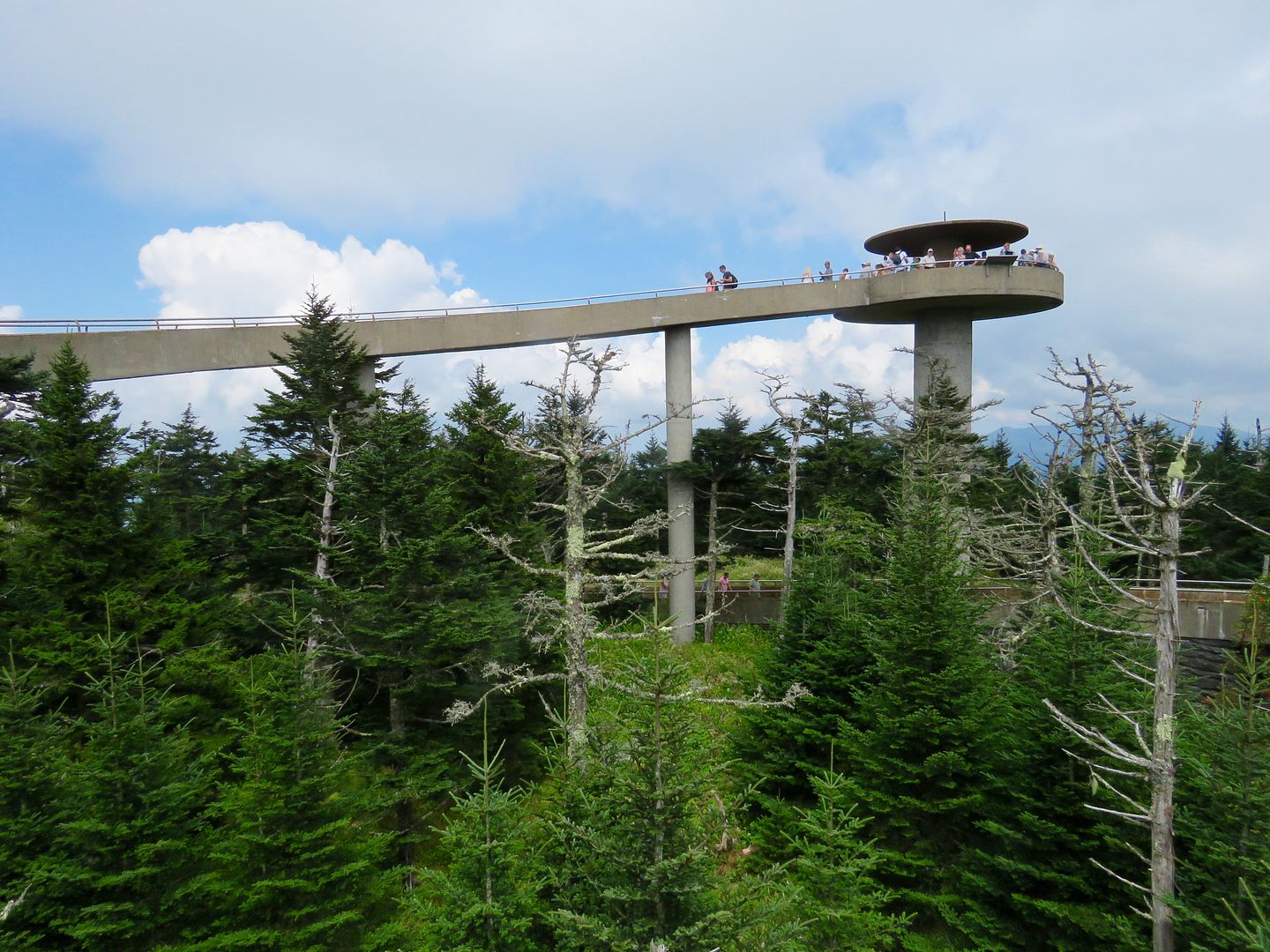
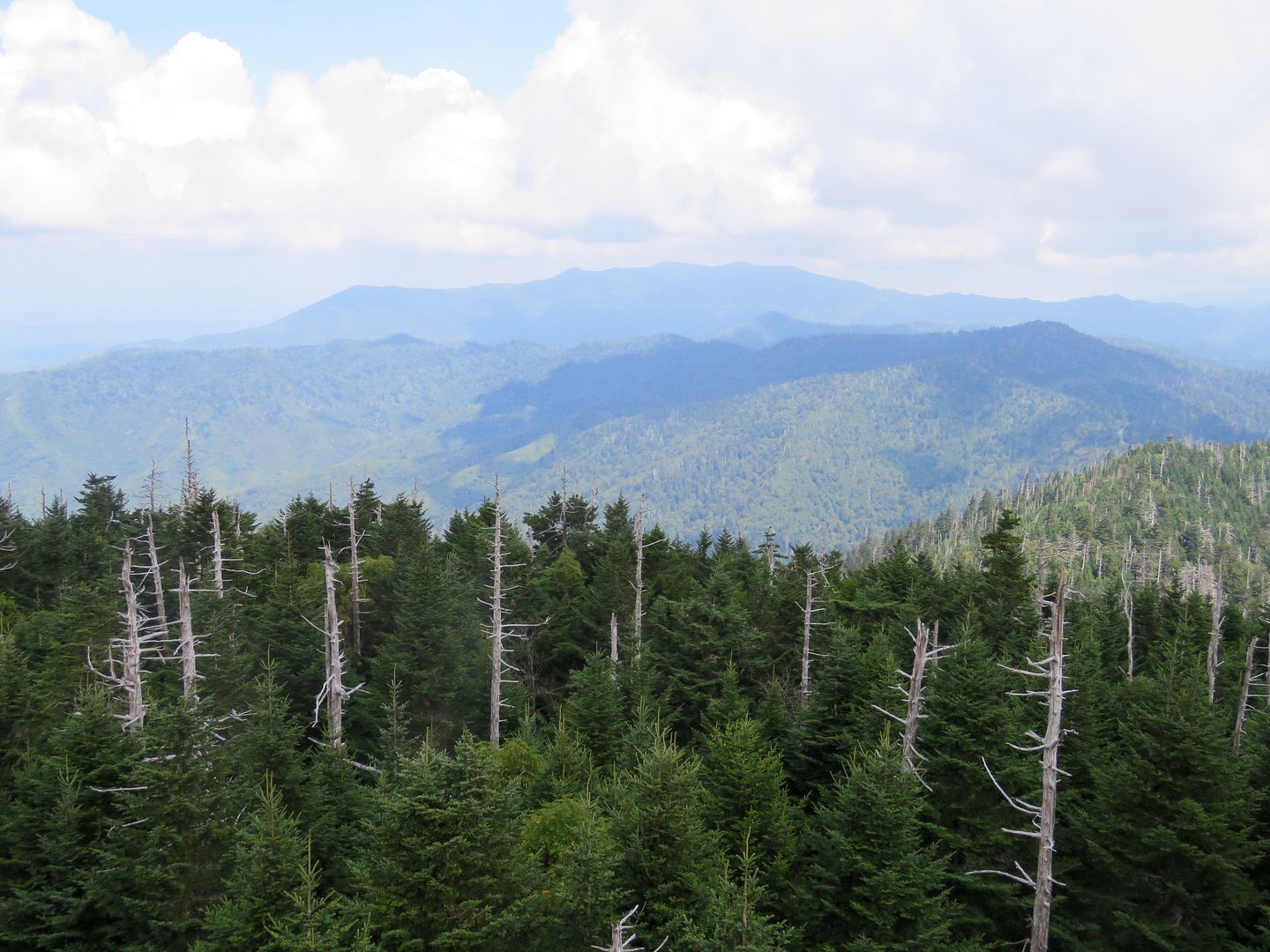
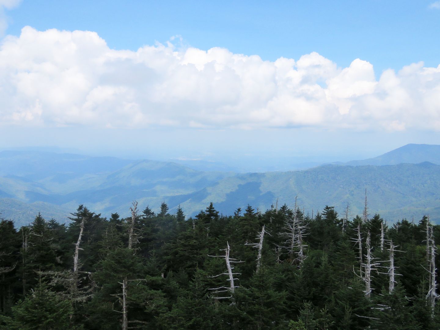
Take the right turn onto Clingmans Dome Road after this stop to travel 7 miles to the Observation Tower at Clingmans Dome, the tallest mountain in the Great Smokies at 6,643' and the 3rd tallest east of the Mississippi. There is a steep, 1/2 mile, paved trail to the Observation Tower at the top (ascent of 330'). The CCC built a wooden, enclosed tower at this location in the 1930s. That structure was replaced with the current 45' circular observation deck. The Clingmans Dome Visitor Center was closed for renovations when we visited. 


You can see for 100 miles from the observation tower including 5 states. Interpretive signs identifying the mountains seen in the distance are located around the deck. 


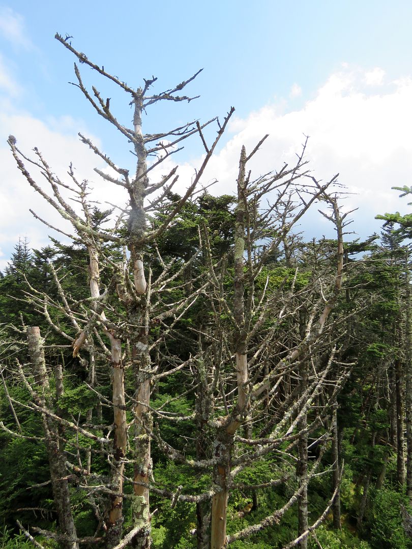
The dead trees seen in the forests are Fraser firs that grow at the highest elevation of the Smokies. An insect, the balsam wooly adelgid, inadvertently introduced to the US from Europe in the 1950s, have killed nearly 70% of the park's mature fir trees. 


The Appalachian Trial runs along the ridge here as well and is the highest point of the entire 2,000+ mile trail.


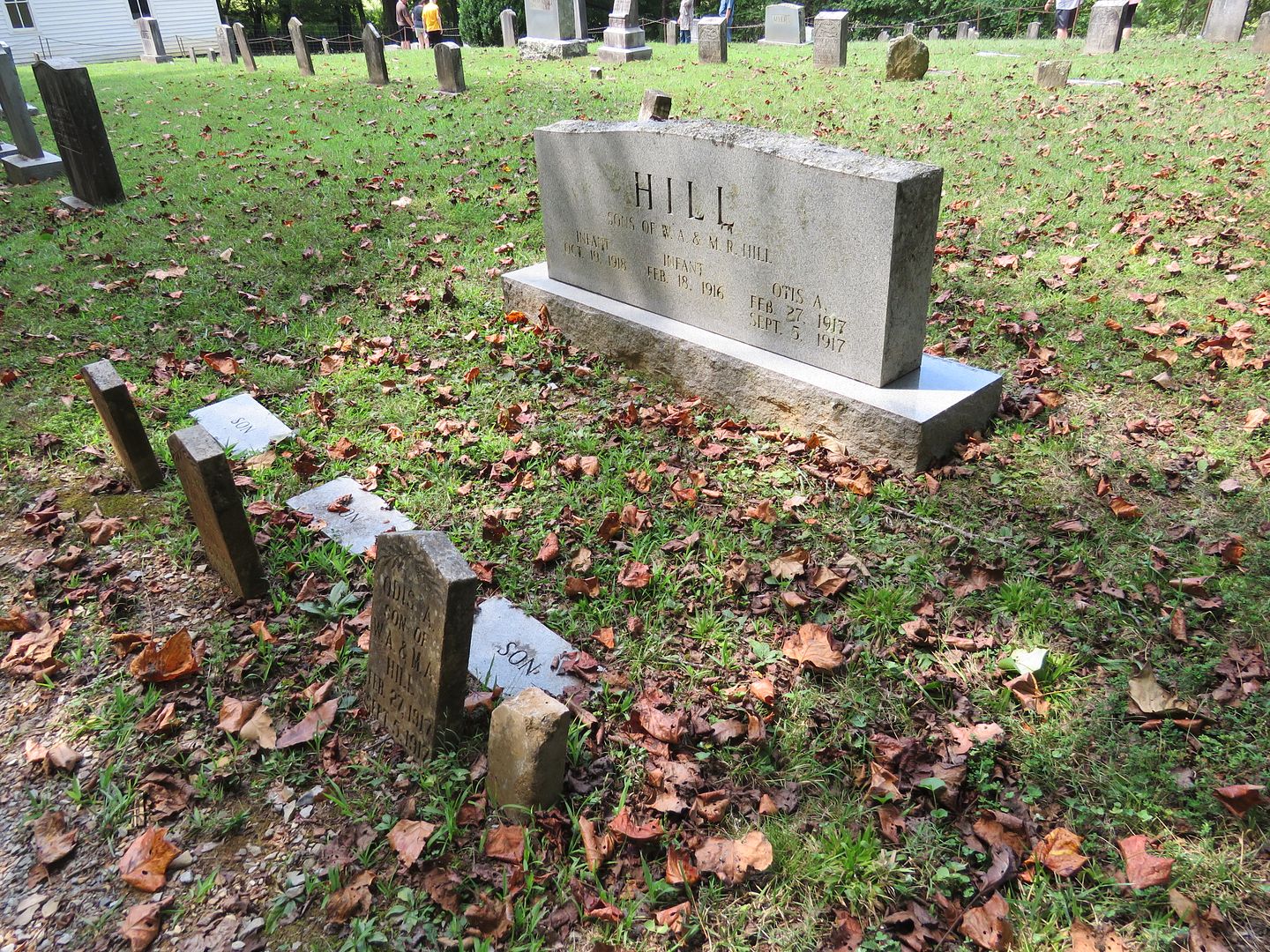
The Cherokee worked the land and hunted these forests for centuries before the Europeans arrived. They were forced westward when the federal government enacted the Indian Removal Act of 1838. Known as a the Trail of Tears the majority of the Cherokee were relocated to Oklahoma. Today, there is a small Cherokee Reservation around the town of Cherokee, NC.

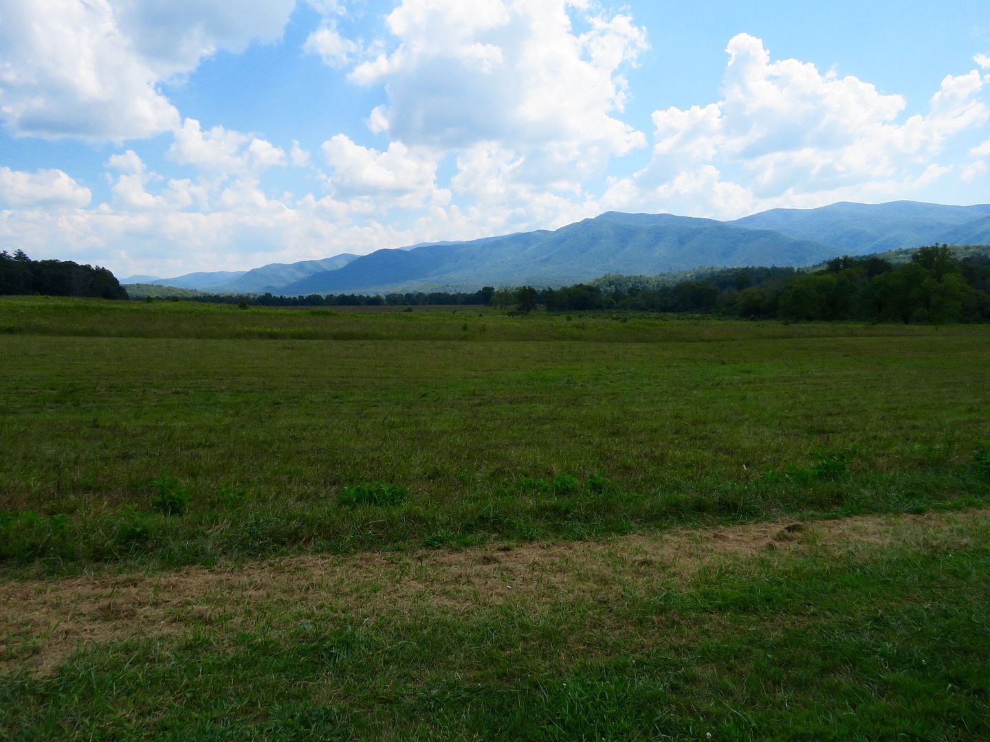
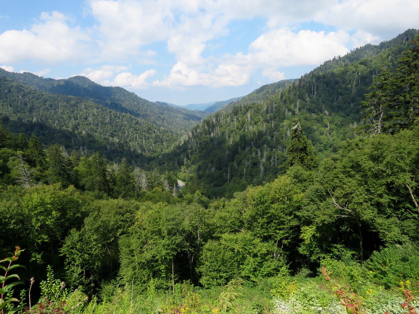
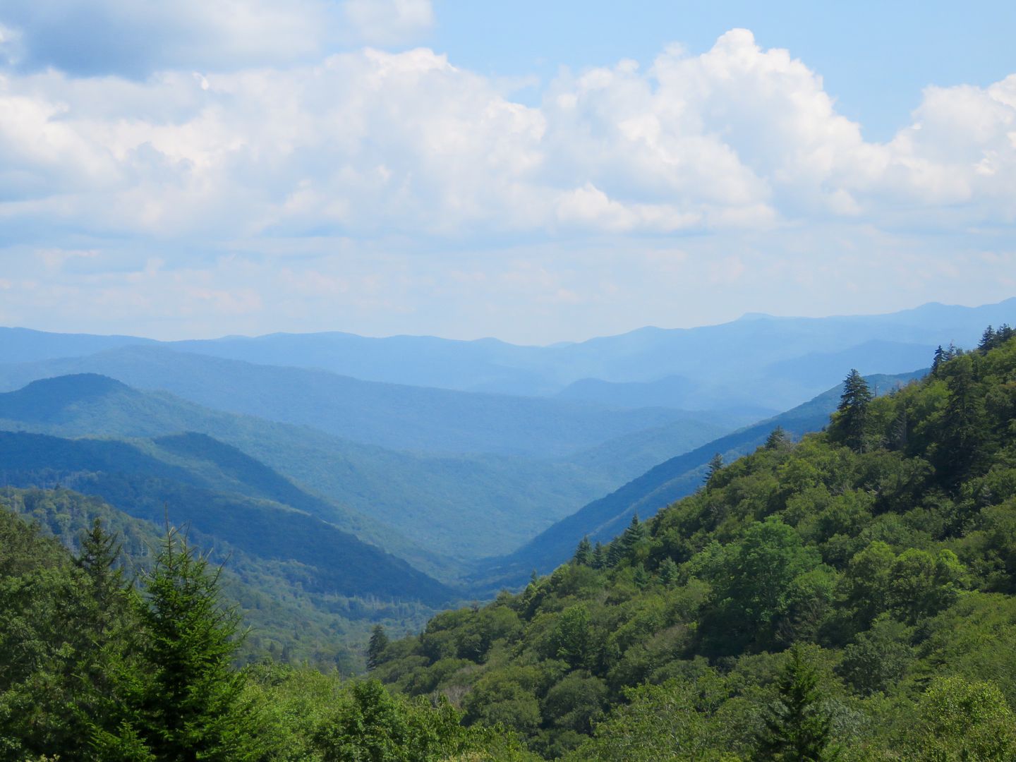
The view from the Oconaluftee Valley overlook was fantastic, one of my favorite! 


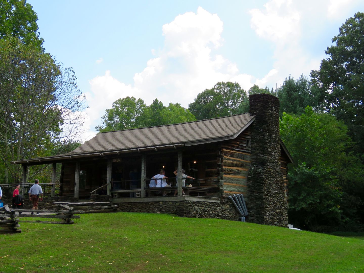
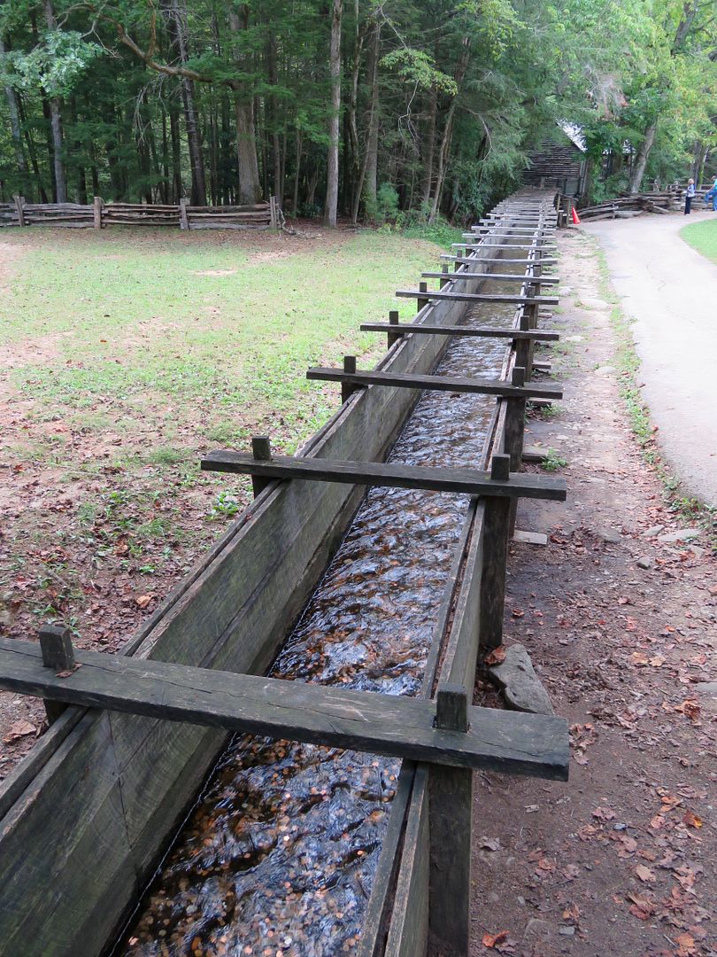
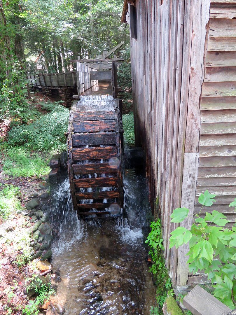
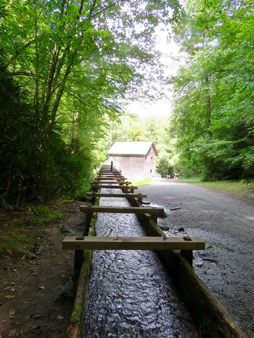
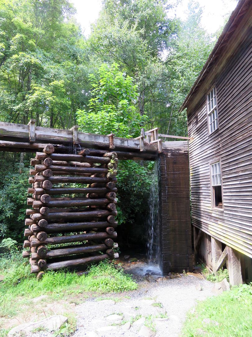
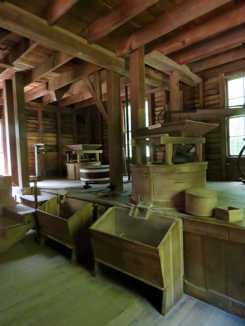
The Mingus Mill (1886) was the largest gristmill in the Smokies with a wooden flume 200' long. It was equipped with a small mill turbine, instead of a water wheel, to provide the power to run the machinery. The mill was used to grind corn into meal and wheat into flour for the nearby mountain community of Mingus Creek. Customers were charged a toll of 1/8 of the grain they brought to the mill.


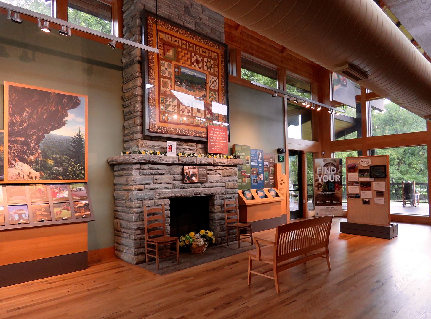
The Oconaluftee Visitor Center is located at the eastern border of the park in North Carolina. 


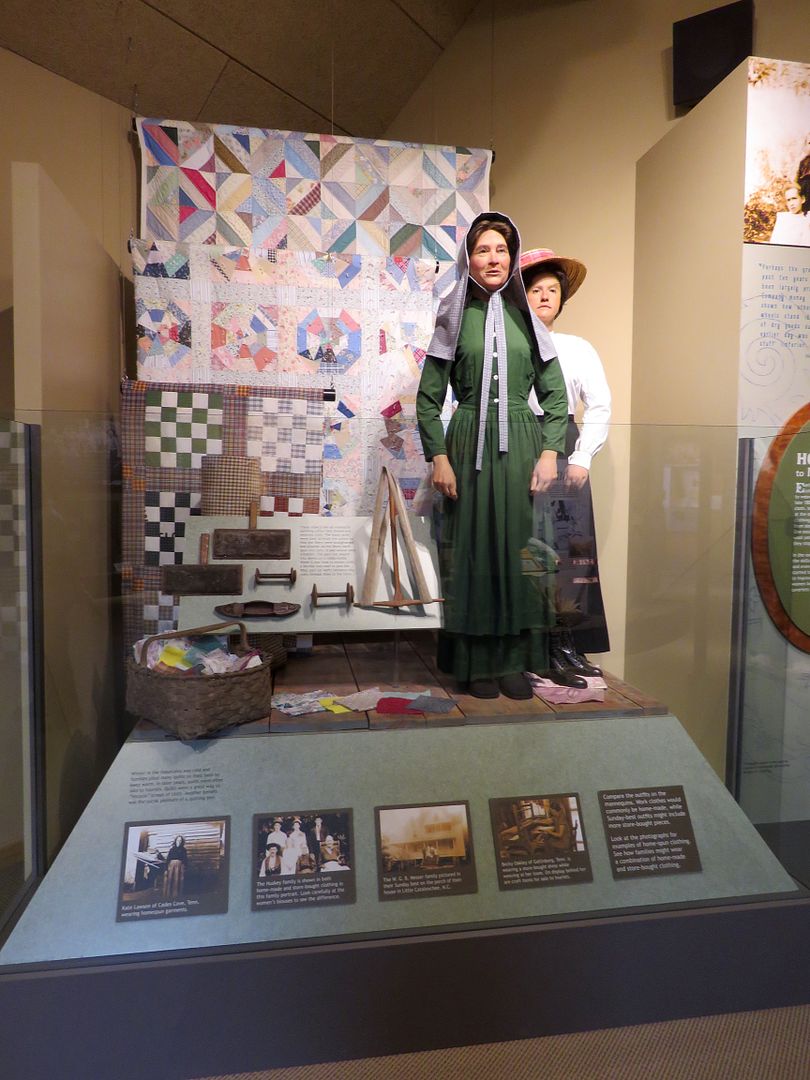
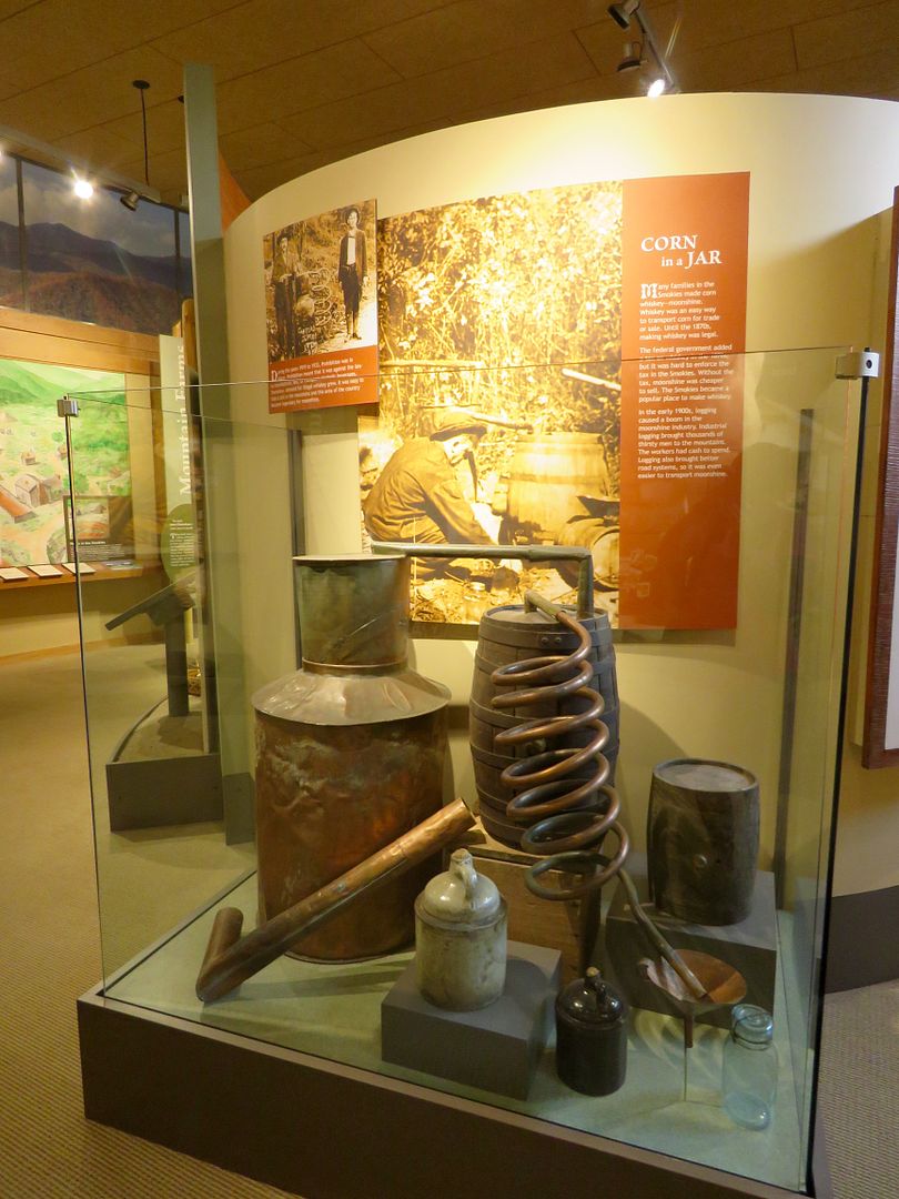
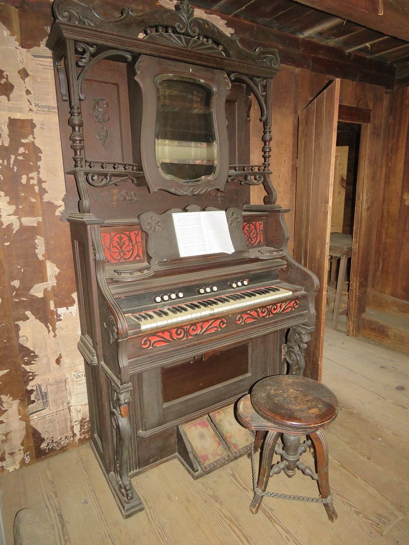
There are many interesting exhibits that we spent some time exploring. Below are several about the hard lives of women in the Smokies; the many stills in the mountains to make whiskey from corn (particularly profitable during 1919-1933, the prohibition years); and the work of the Civilian Conservation Corps here.


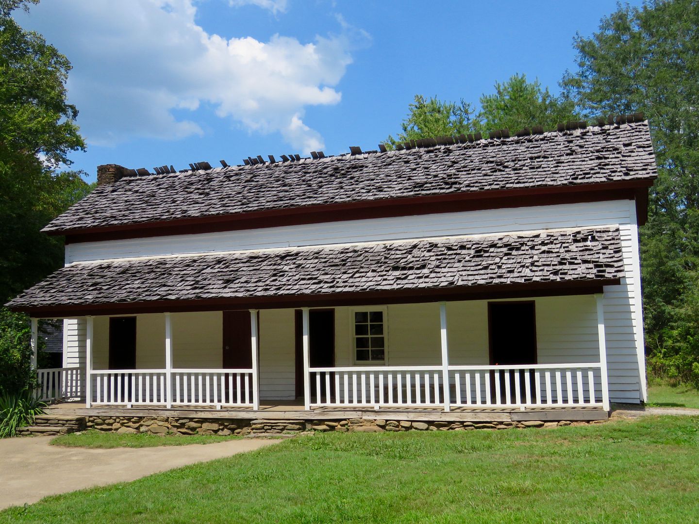
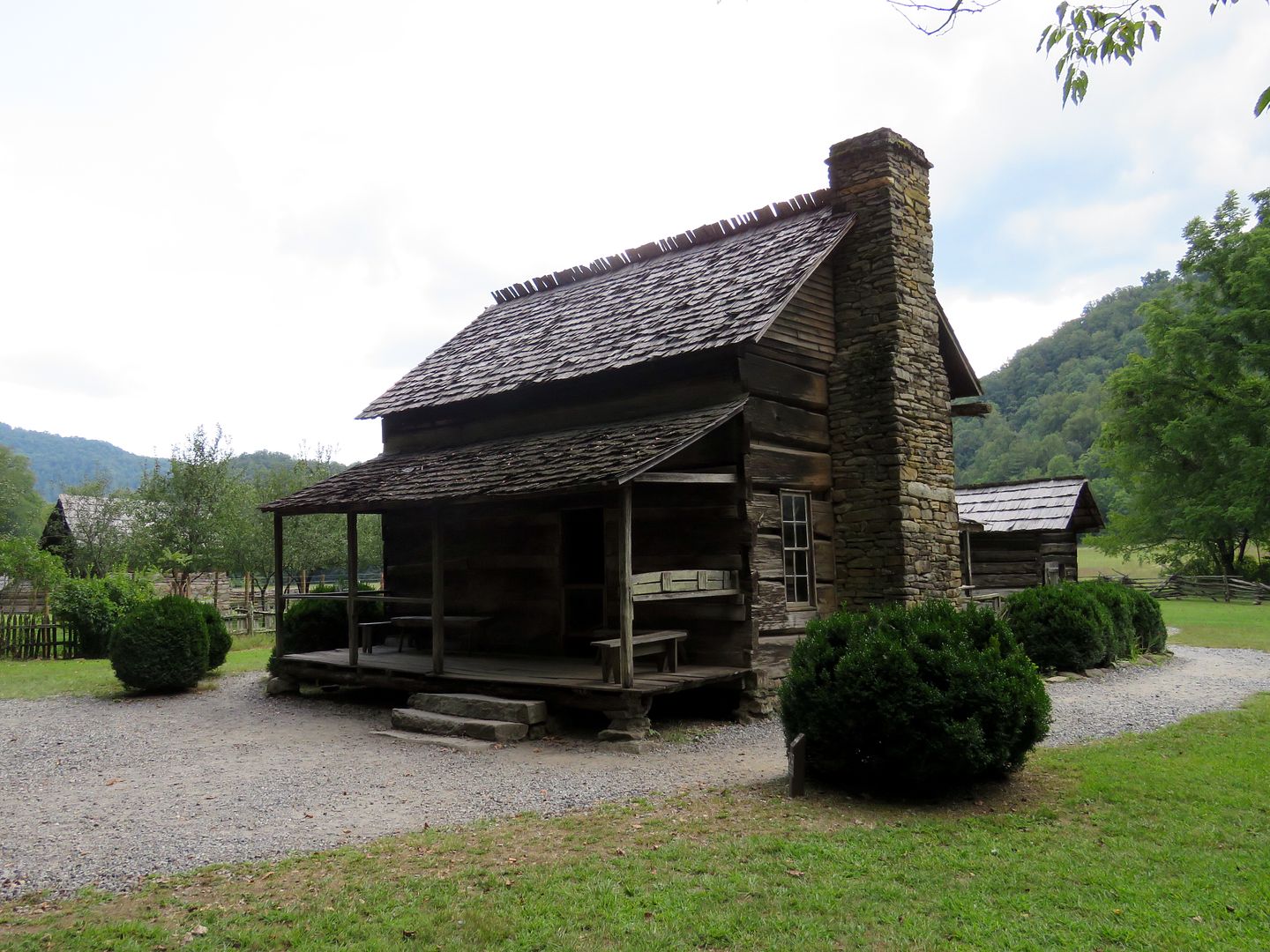
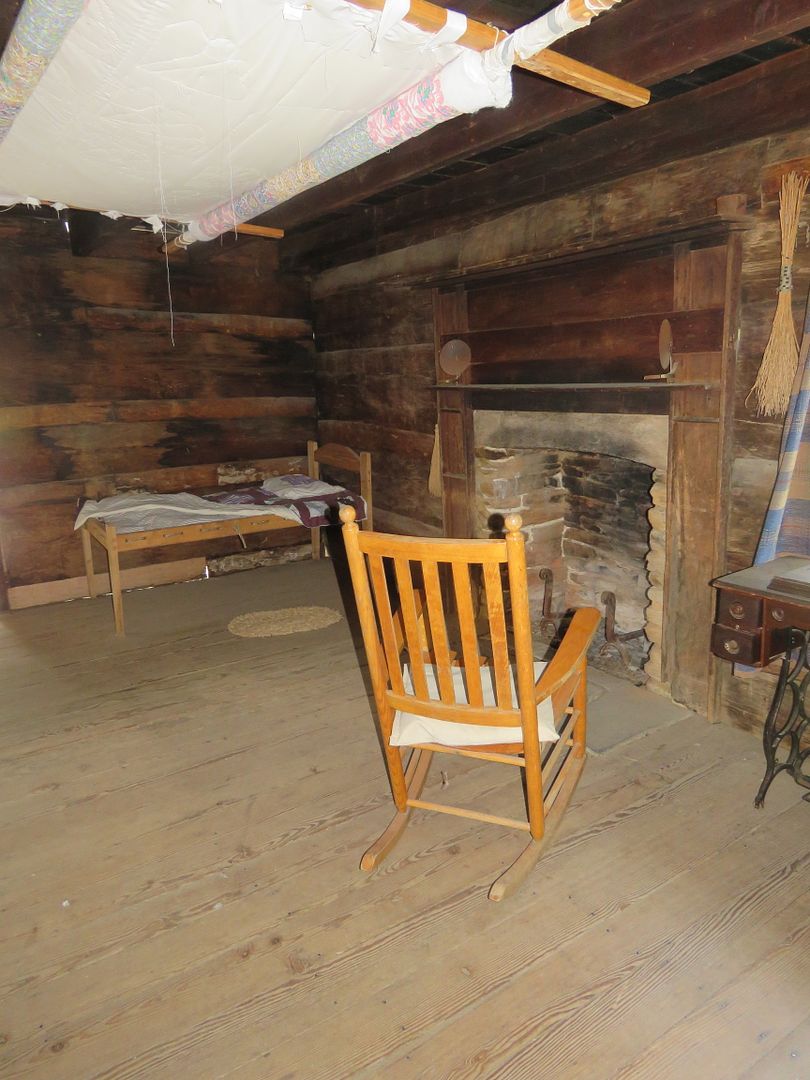
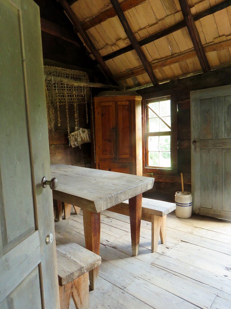
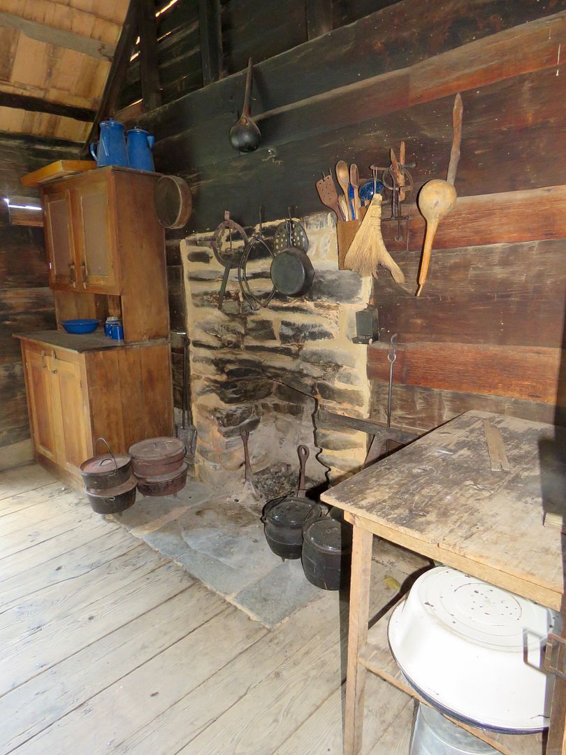
Also, located at the Oconaluftee Visitor Center is the Mountain Farm Museum. The historic buildings were moved here from other areas of the park by the National Park Service in the 1950s. John Davis completed building this house in 1900. He lived here with his wife and five children. The kitchen was a separate room at the rear of the house. I am always interested to learn more about how the women handled all of their chores including food preparation for her family.


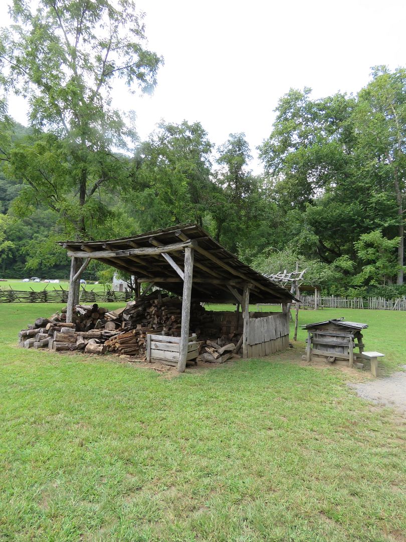
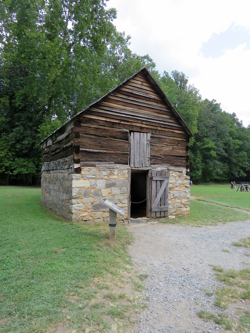
Most of the buildings here related to one of the most basic needs of the families that lived in the Smokies, preserving food. It was a constant chore to keep the woodshed full. Wood was used for heat during the cold weather and for cooking year-round. The ashes were also used to add nutrients to the garden soil and to produce lye for soap-making. Also, the meat house is located near the house. Hogs were butchered in the fall and was the primary source of meat. A smoky fire that lasted a week or longer was used to smoke the pork or salt was used to cure it. It was stored in the meathouse through the cold months of the year.


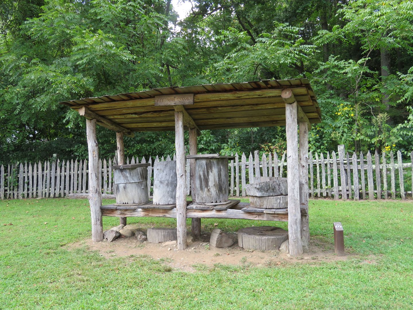
Many farmers kept hives of bees to produce honey for their use and, sometimes, to sell. Hollow black gum trees were cut, a wooden bottom, and hinged top added to created the beehives. They were called beegums locally. 


Most farms had chickens that were kept in chicken houses or simply allowed to roam free. In addition to the eggs and meat provided by the chickens, their feathers were used for mattress and pillow stuffing. Apples were the most common fruit found in mountain communities. They were eaten raw and used to make lots of other edibles like cider, vinegar, apple sauce, pies, apple butter, and sometimes dried to preserve them through the winter months. Below is a chicken house and an apple house. 


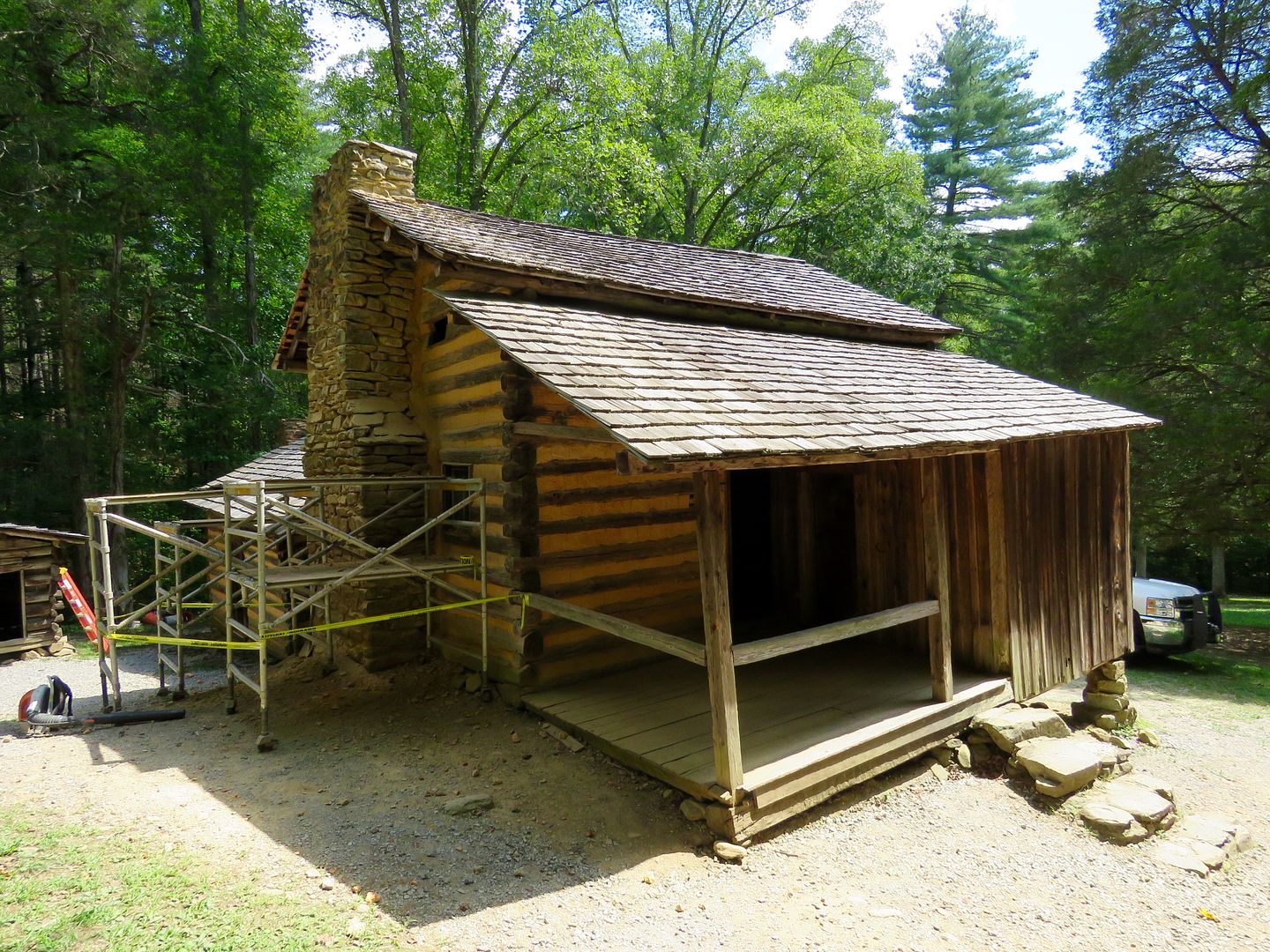
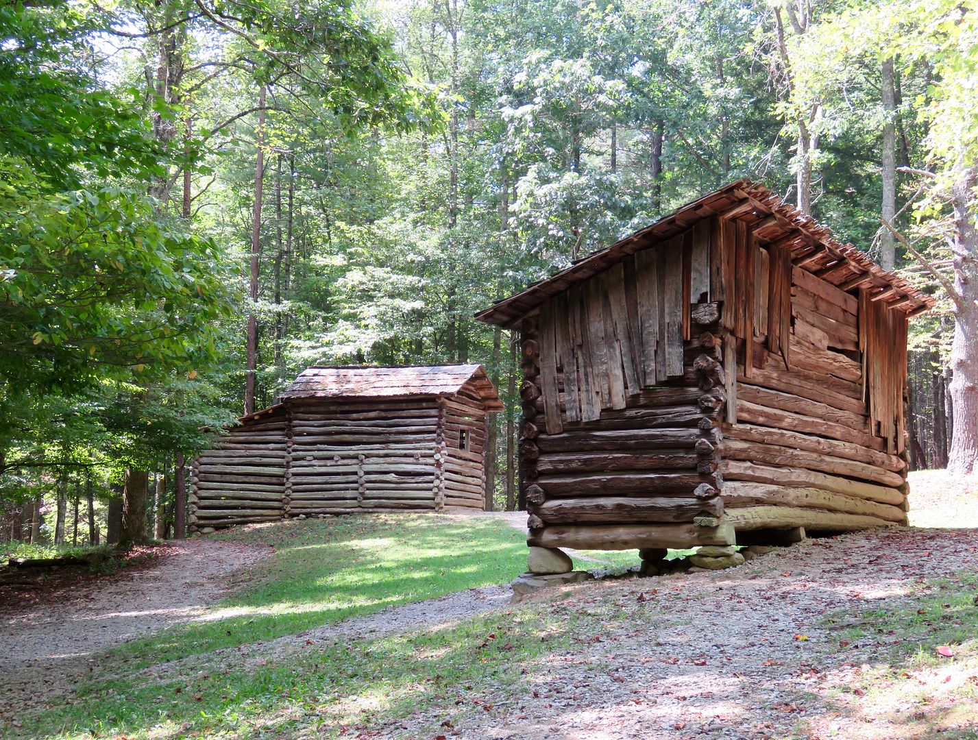
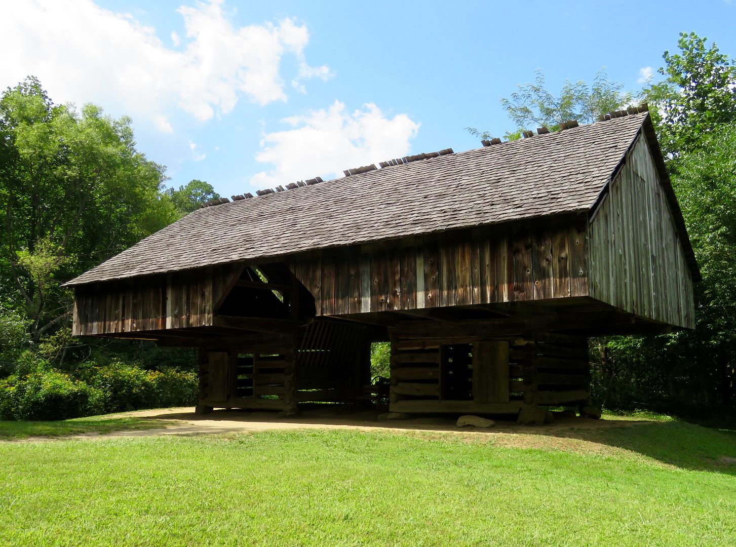
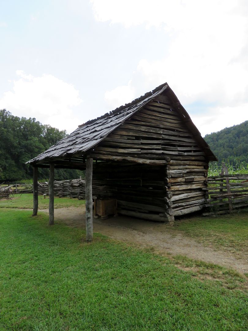
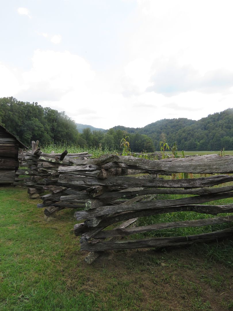
Corn was the most important crop on a mountain farm and almost every one had a corn crib to store it. It was not only food for the family, but also the livestock. The shucks were used to stuff mattresses, weave chair seats, make hats, rugs, dolls, and more. Below is a corn crib that also served as a tool shed. There were usually located close to the garden or fields. 


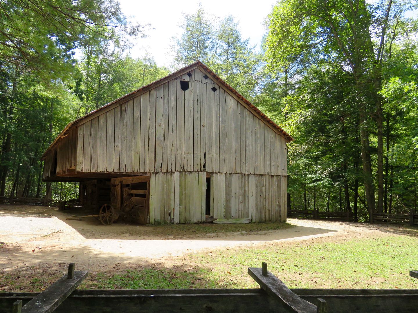
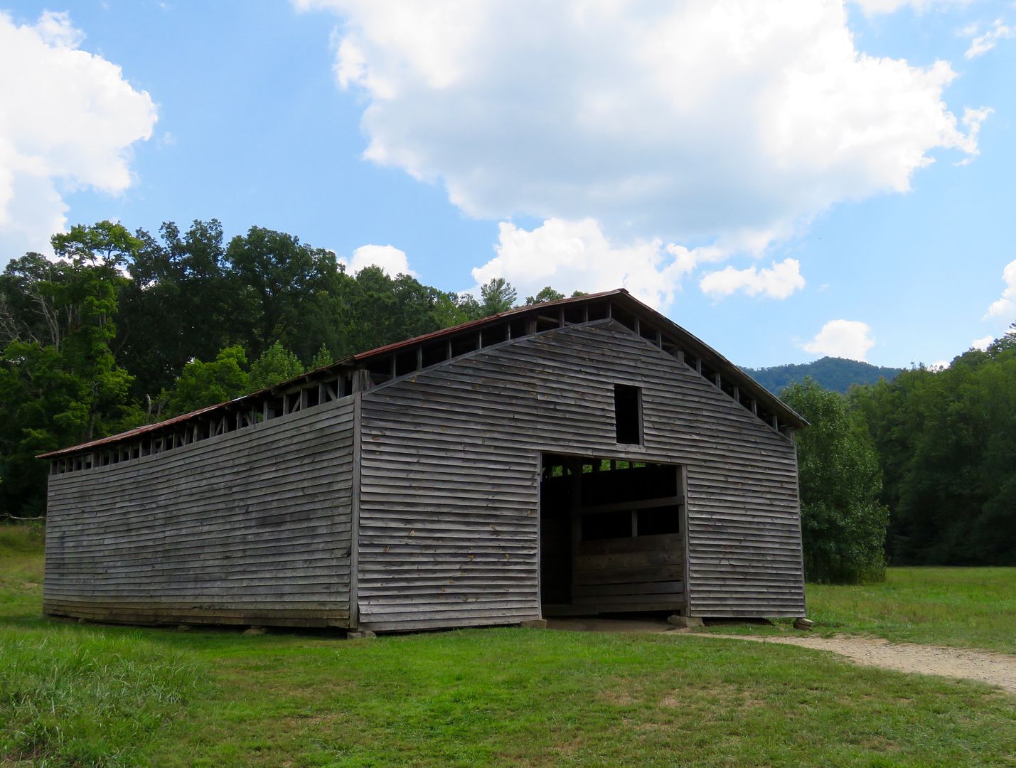
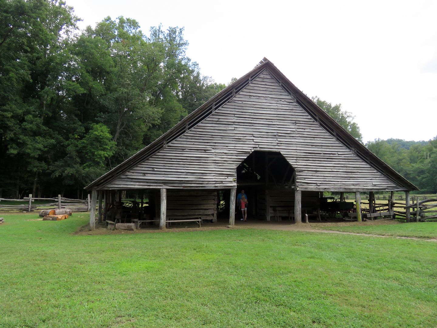
The barn was a stable for the livestock on the farm. Most of the feed for animals was stored in the loft.


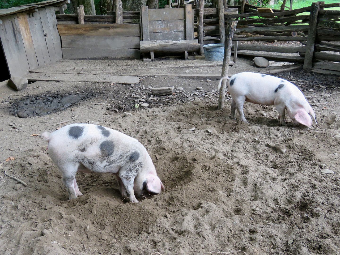
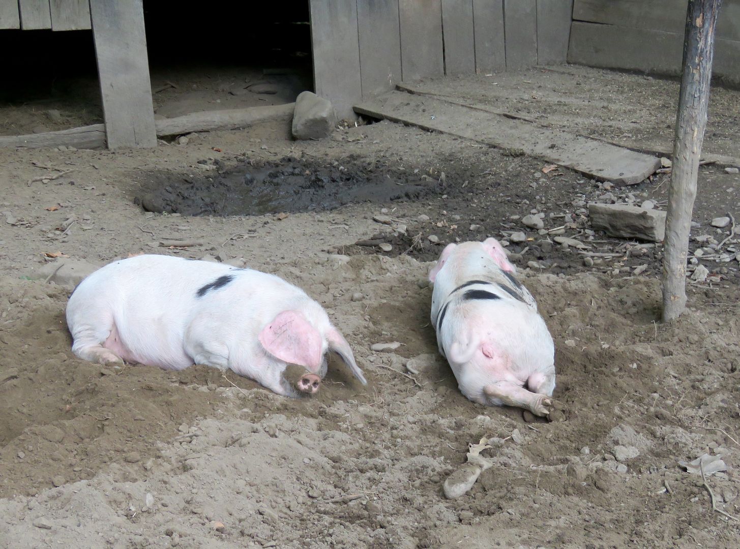
These adorable pigs, Honey Baked and Maple Bacon, were in a pen next to the barn. They are of the historic Gloucestershire Old Spot breed (white with black spots). Hogs were the main source of meat in the mountains. They roamed freely to forage their own food, but several were captured, fattened up, butchered, and used for meat, lard, and soap each year.


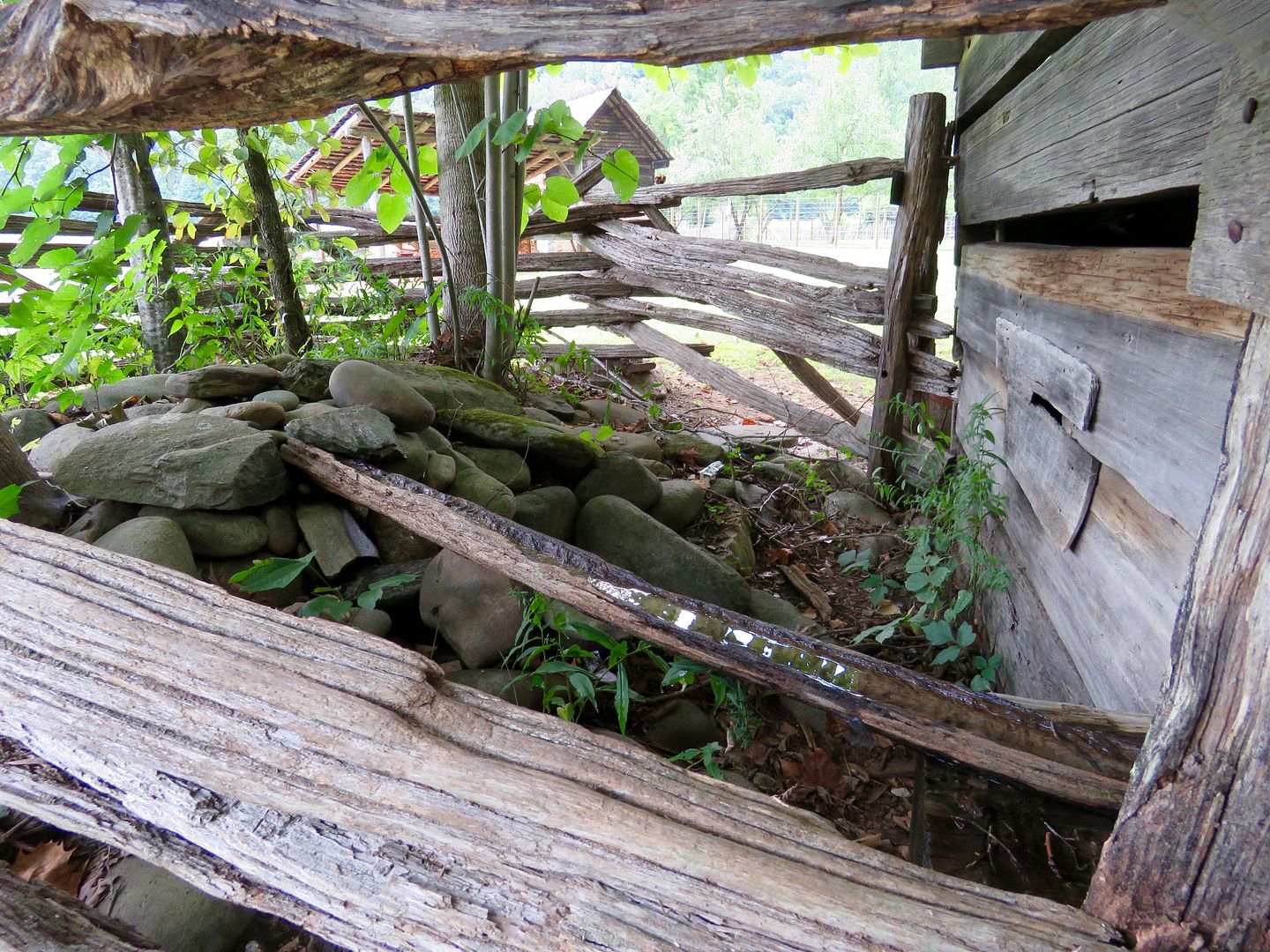
A reliable water source was crucial to every farm. On display is a spring house where water from a spring was channeled through it via a wooden or stone trough. Perishables could be kept cool by the flowing water. 


The Farm Museum provided so much insight into the daily lives of the families that lived in the Great Smokies. While it seems like so much hard work, the land could provide almost everything needed to survive and thrive here. 

We made the return trip (31 miles) along the Newfound Gap Road to the western boundary of the national park in Gatlinburg, TN. 

For additional information about the Newfound Gap Road, Clingmans Dome, or the Farm Museum, check out the park's website at www.nps.gov/grsm.