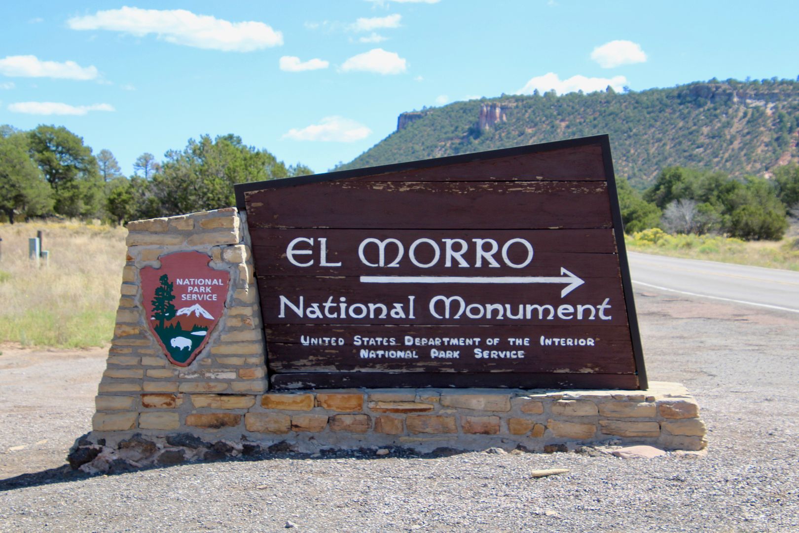
About an hour drive from Gallup, NM, is El Morro National Monument, an oasis along an ancient east-west trade route.
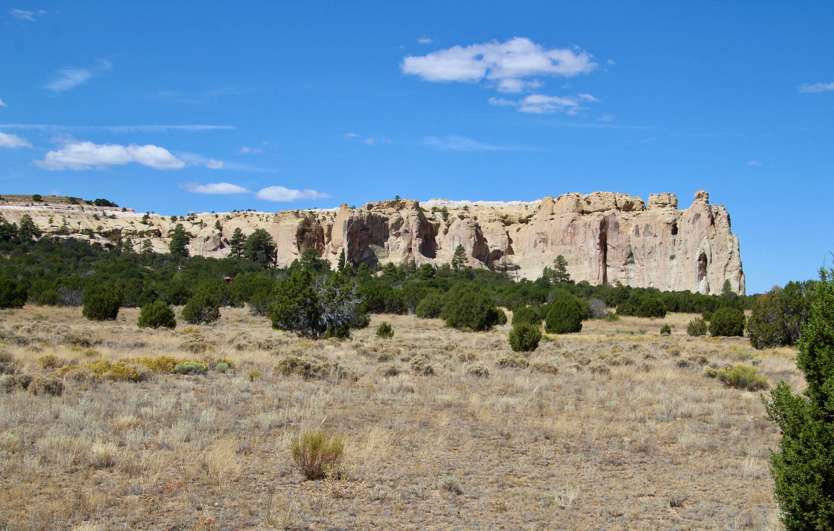
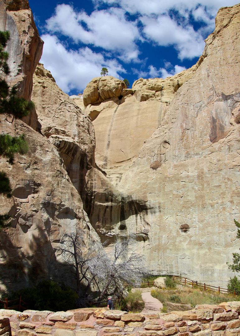
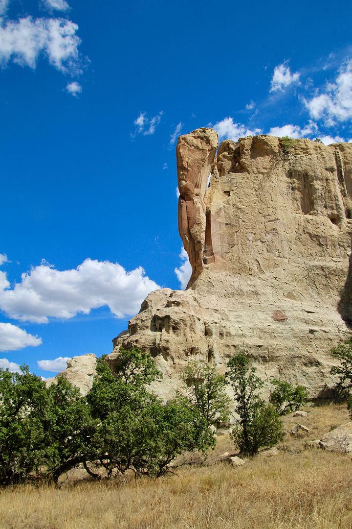
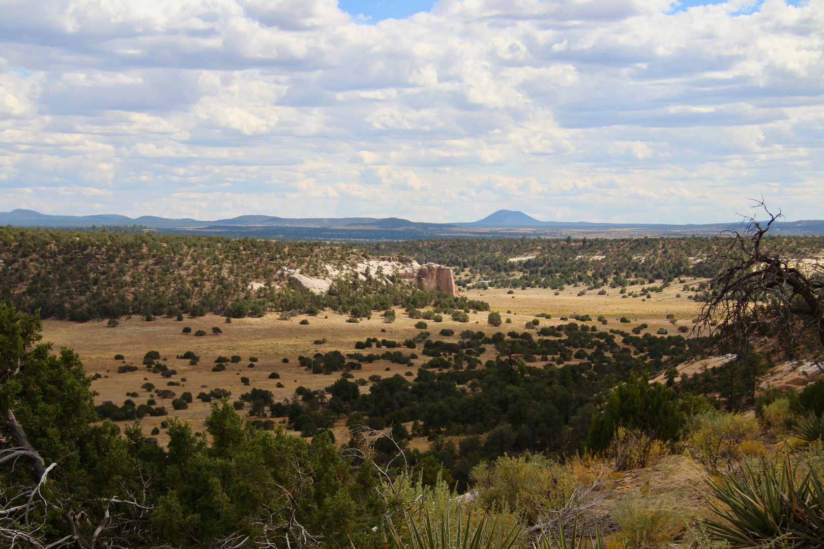
Driving to the Visitor Center, we saw the huge rock formation called a cuesta (my new word for the day!) It is a long rock formation gently sloping upward at one end and a steep drop-off at the other.
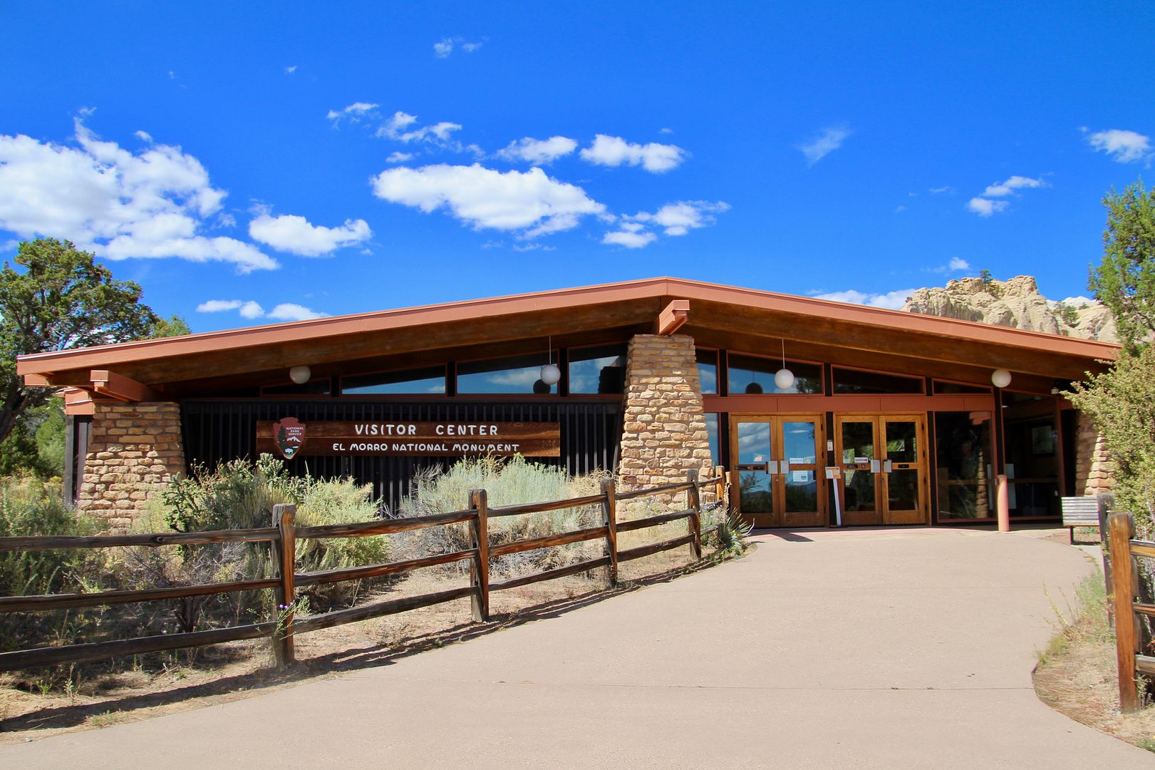
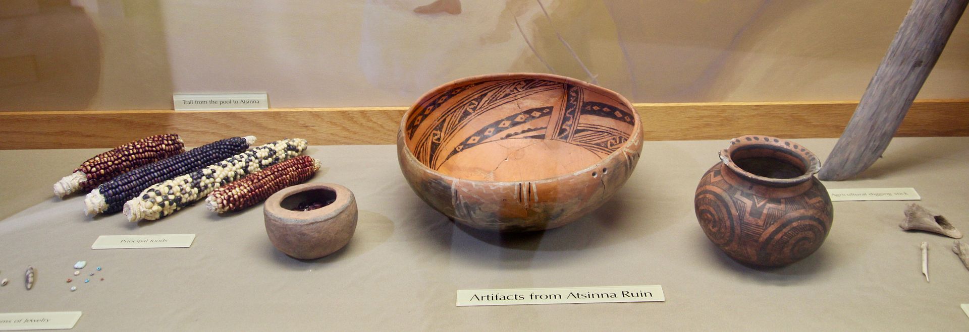
Our first stop, as always, was the Visitor Center, where there are exhibits about the cultural history of El Morro (The Headland in Spanish). Atop the cuesta is Atsinna, built and inhabited by Ancestral Puebloans from AD 1275 to 1400 (people moved to larger villages in the Zuni Valley). Below are artifacts found there.
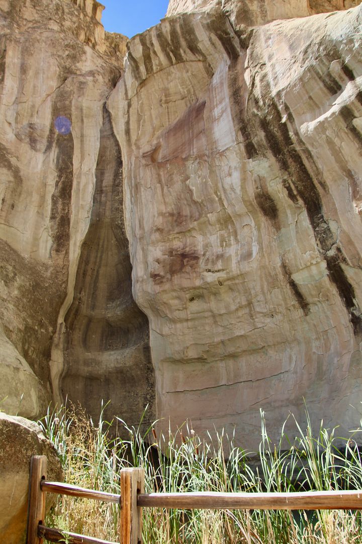
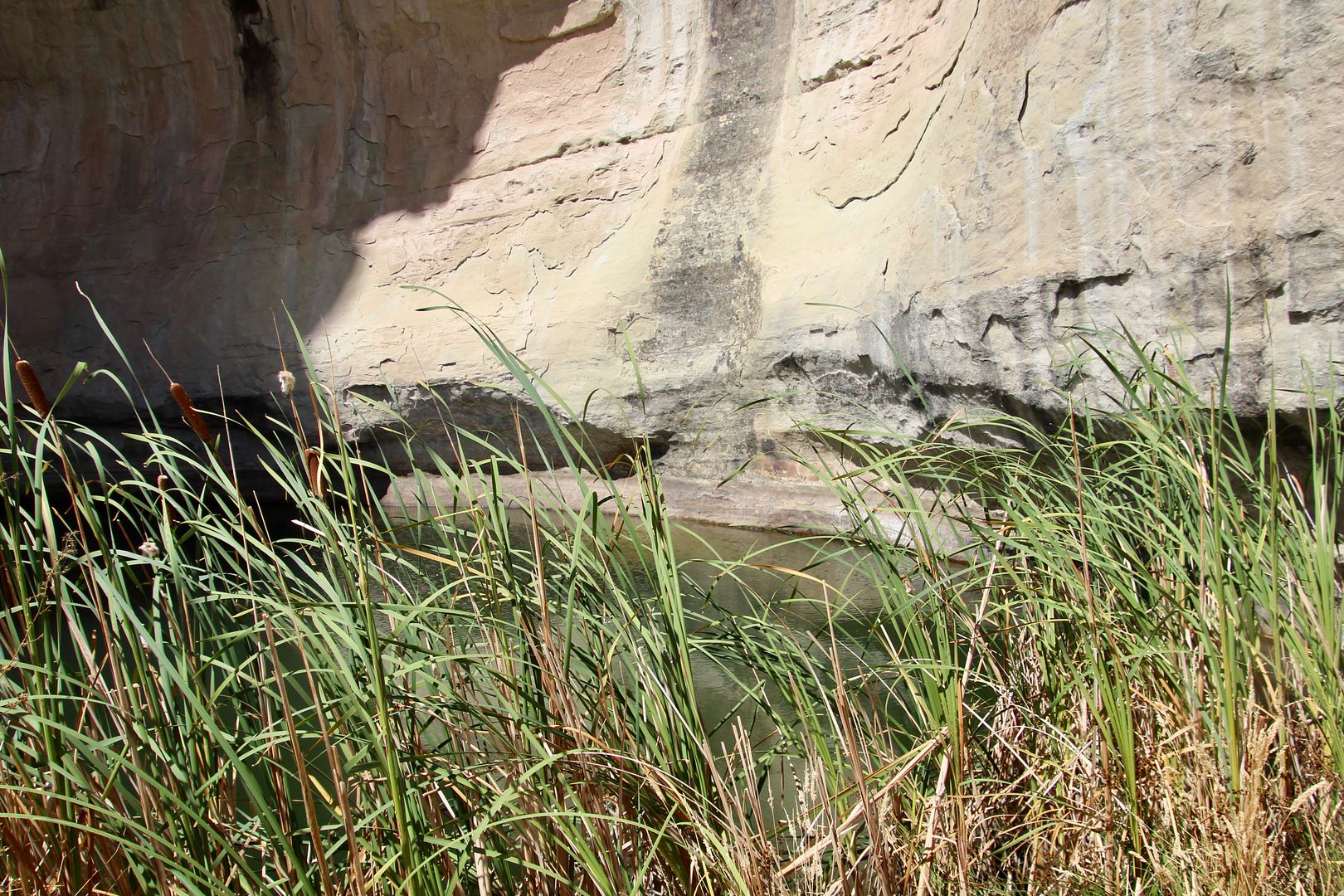
Fed by rainwater and snowmelt, is a hidden pool at the base of a sandstone bluff. This reliable, year-round source of water drew inhabitants and then travelers to this spot since at least AD 1000.
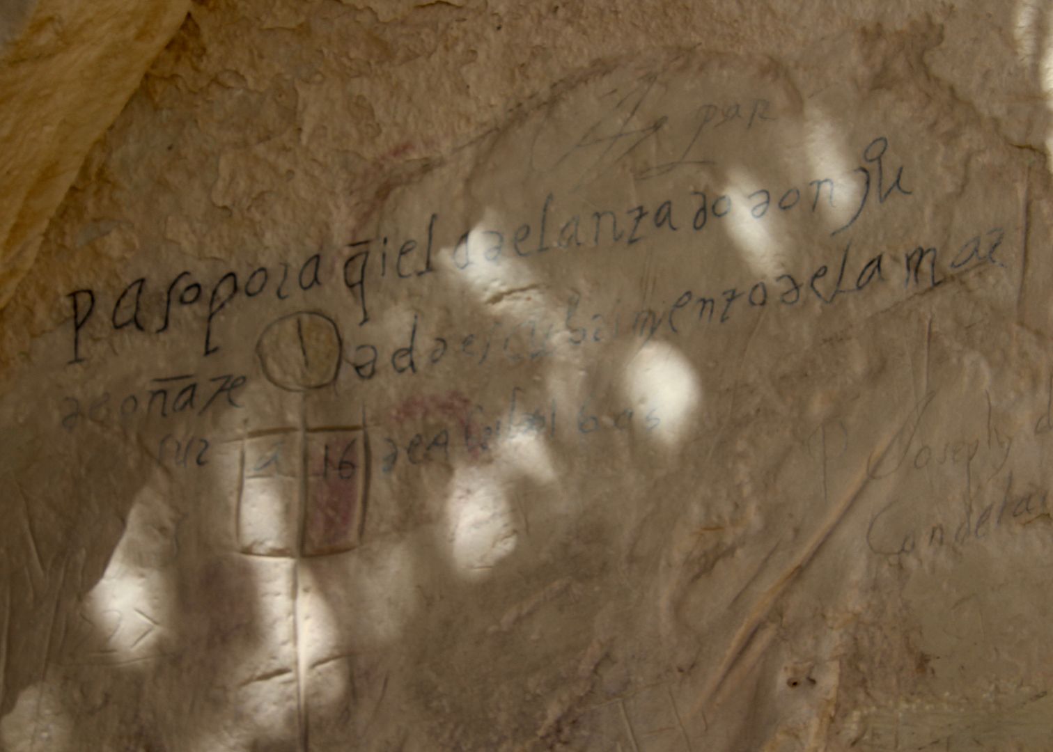
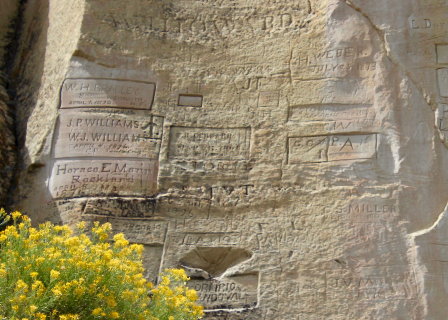
Native Americans, Spanish explorers, missionaries, American soldiers, and pioneers left their mark on the sandstone bluffs. Over 2,000 images and signatures are etched into the cliff walls earning it the name Inscription Rock.
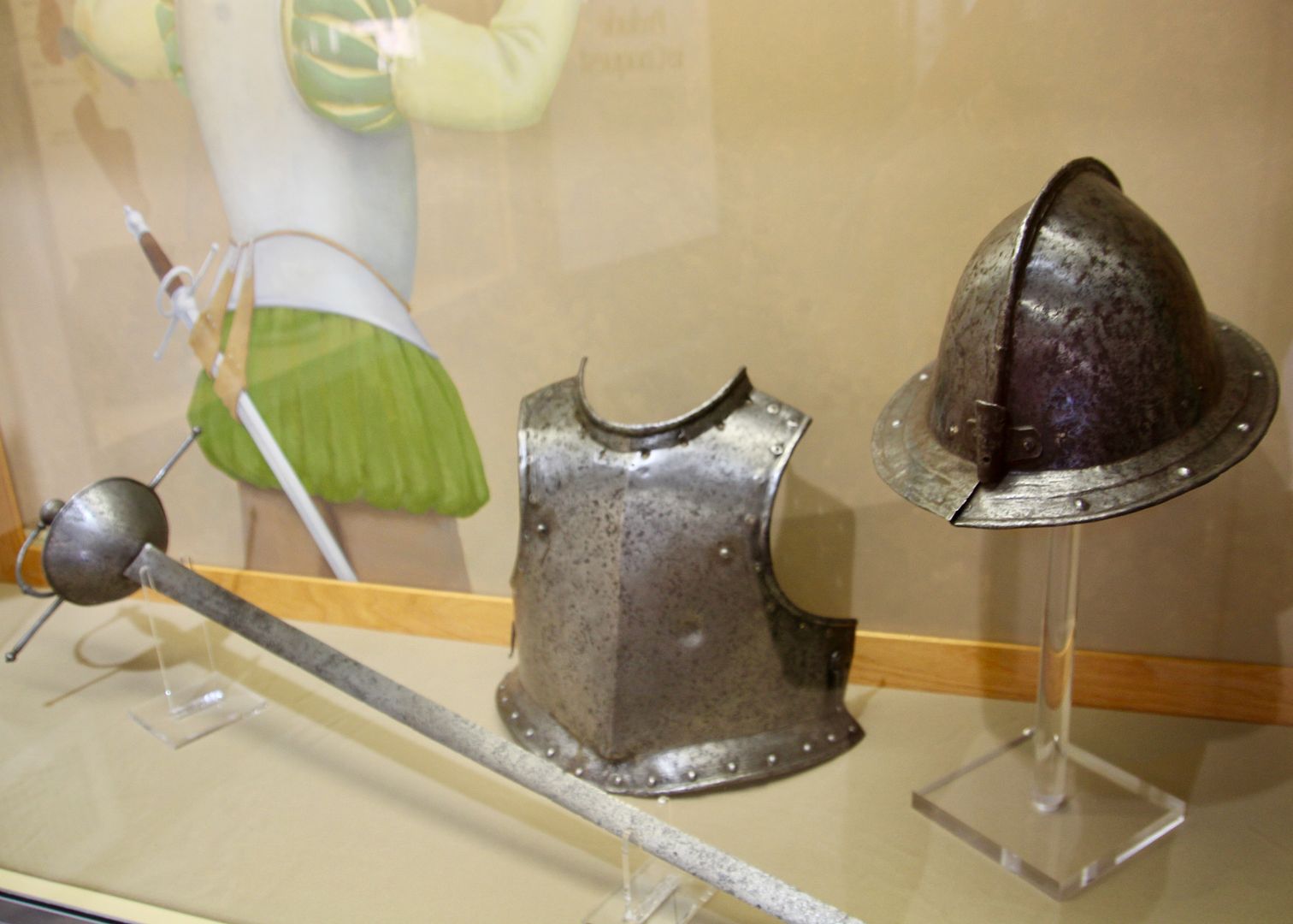
Spanish expeditions came into New Mexico from 1539 to 1774. Spanish armor and a sword found here are on display.
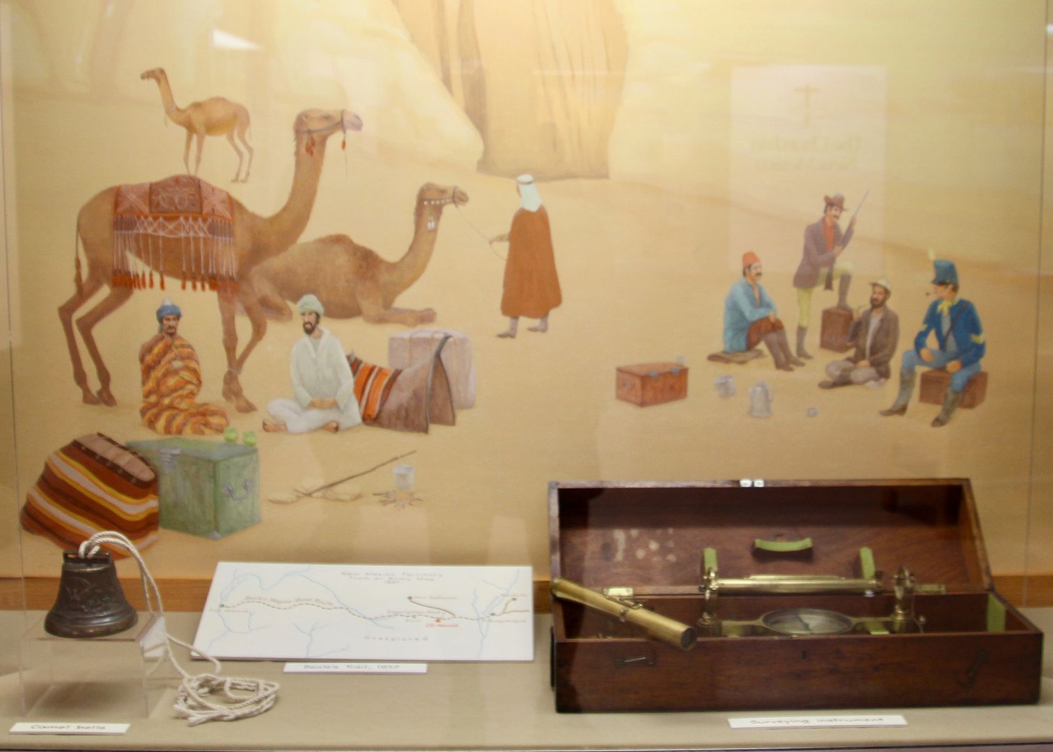
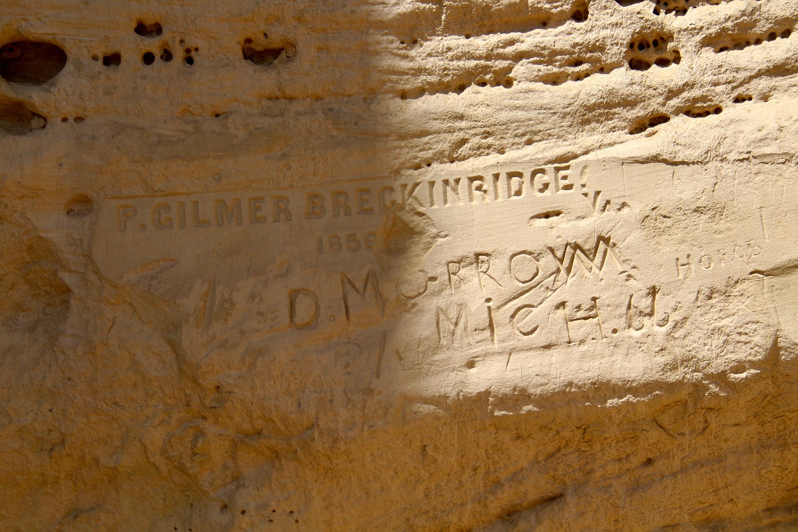
Next US military expeditions came to the area from 1846 to 1906. In the mid-1850s, the US Army experimented with the use of camels in the desert environment and passed by El Morro. When the Civil War began, the camel corps was ended. Most of the camels were sold, but some escaped to the desert. In the early 1900s, there were still reports of feral camel sightings from Mexico to Arkansas!
We purchased a trail guide ($2) for the ½ mile, paved Inscription Rock Trail. We walked from the Visitor Center to the trail and came to the pool of water. It is now protected by a fence. When full, the pool is about 12’ deep and holds about 200,000 gallons. Evaporation has an impact on the water level, but the pool has never been dry. There is no spring, but precipitation will refill it.
Below are a few of the many petroglyphs etched into the sandstone.
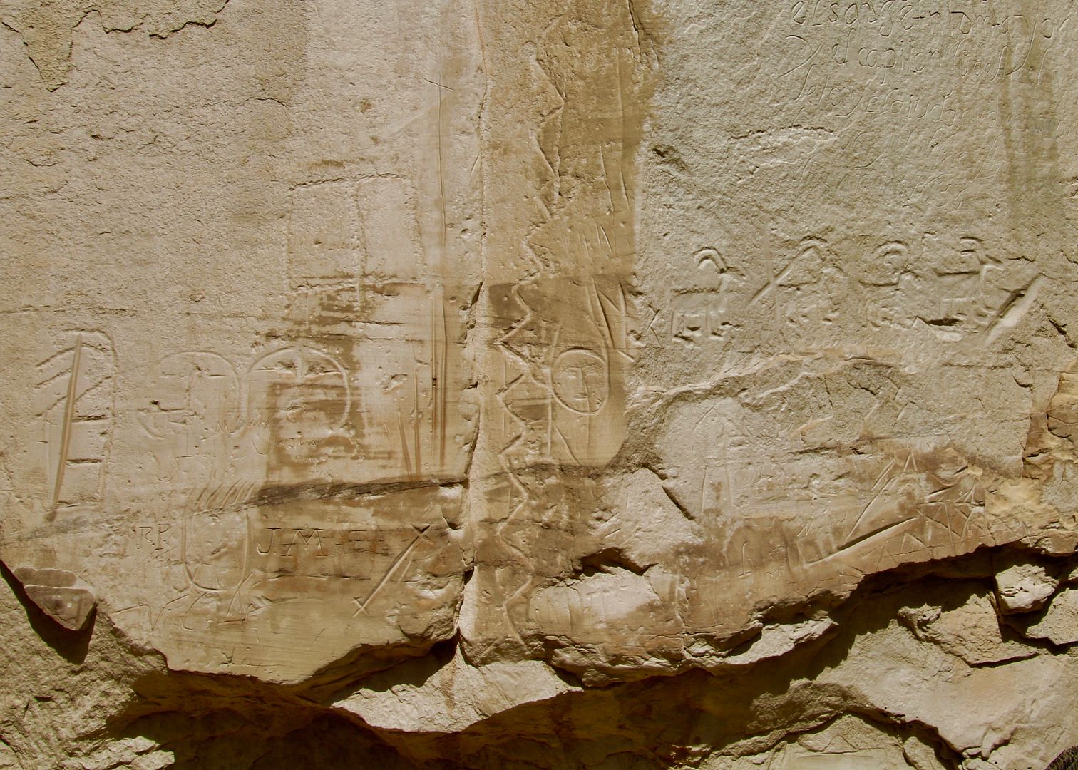
This is an inscription by the first governor of New Mexico, Don Juan De Onate, created in 1605. It is one of the oldest (and more famous) inscriptions.
Breckenridge (US Army) was in charge of the 25 camels that passed through here in 1857. He was killed as a Confederate soldier during in 1863.
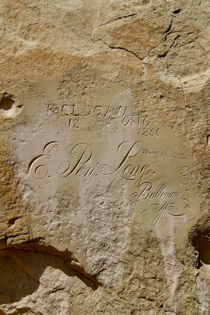
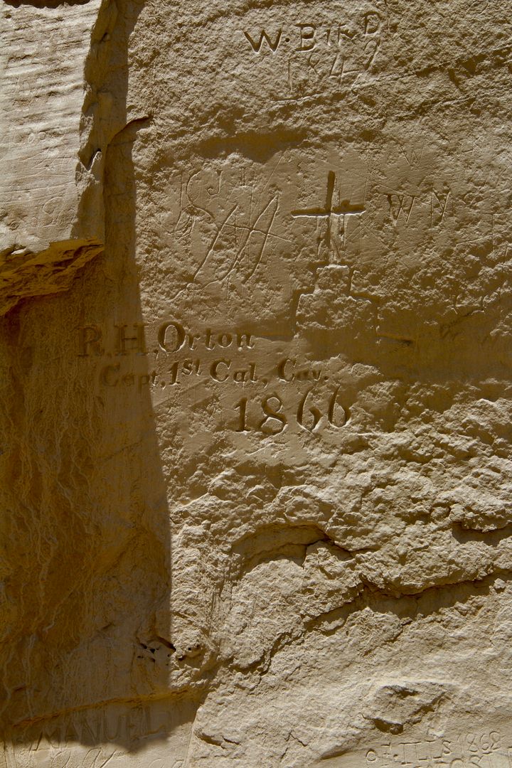
E. Penn Long made his mark during a US Army Expedition searching for a wagon route from Fort Smith, AK, to the Colorado River in 1859. The second inscription was made by Caption R. H. Orton of the California Column (Civil War) on his return trip to CA.
There are so many interesting inscriptions here, each with its own story of a traveler that passed this way. President Theodore Roosevelt designated El Morro a National Monument in 1906. Since that time, the inscriptions and ruins have been protected. I am always so thankful for those before us that had the foresight to preserve these treasures.
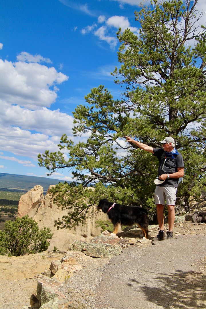
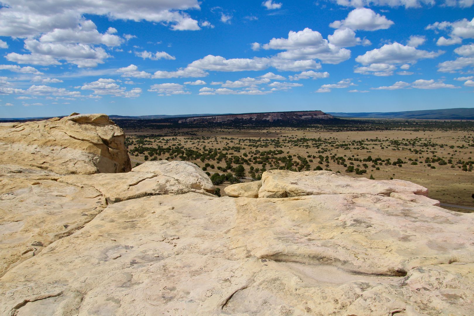
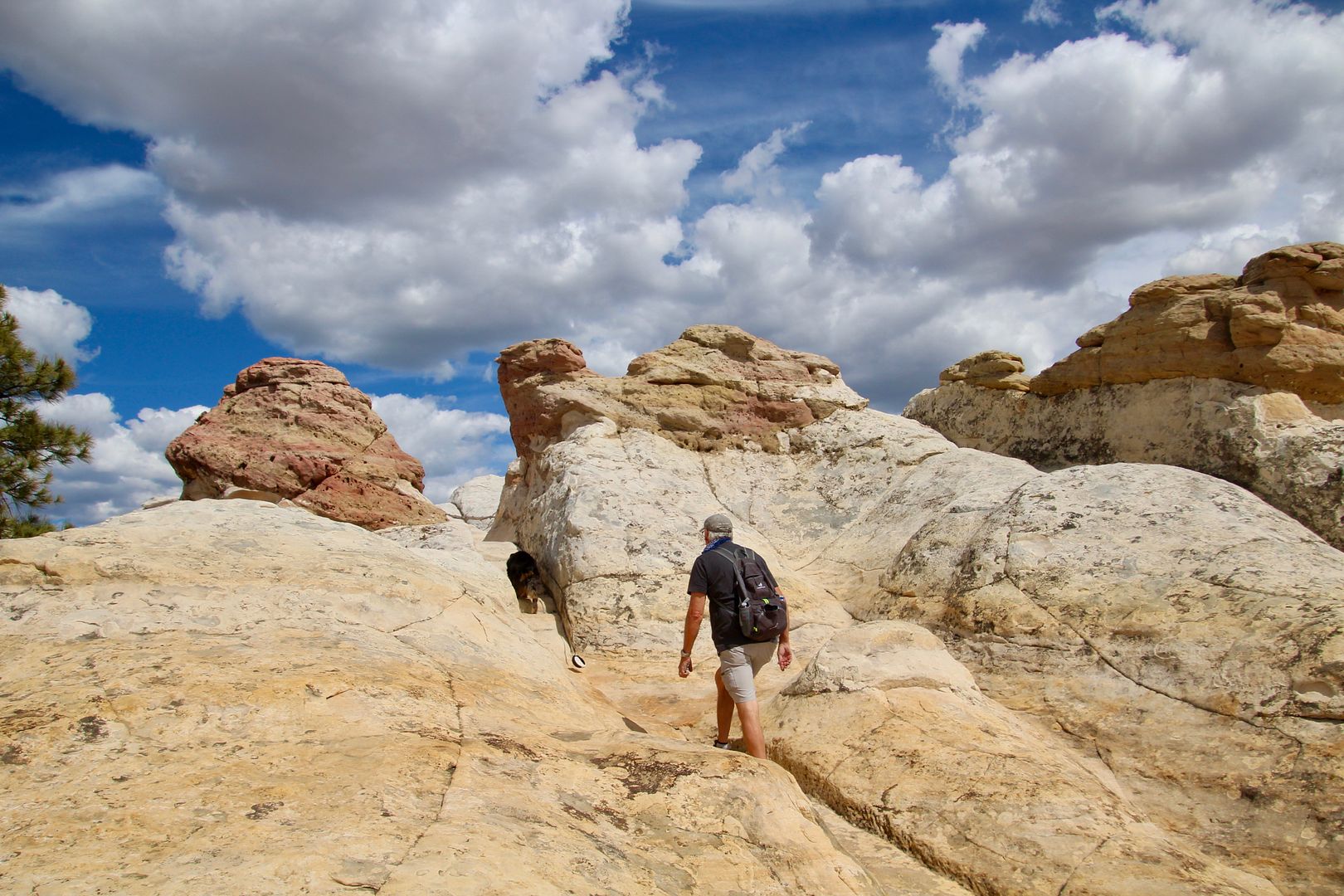
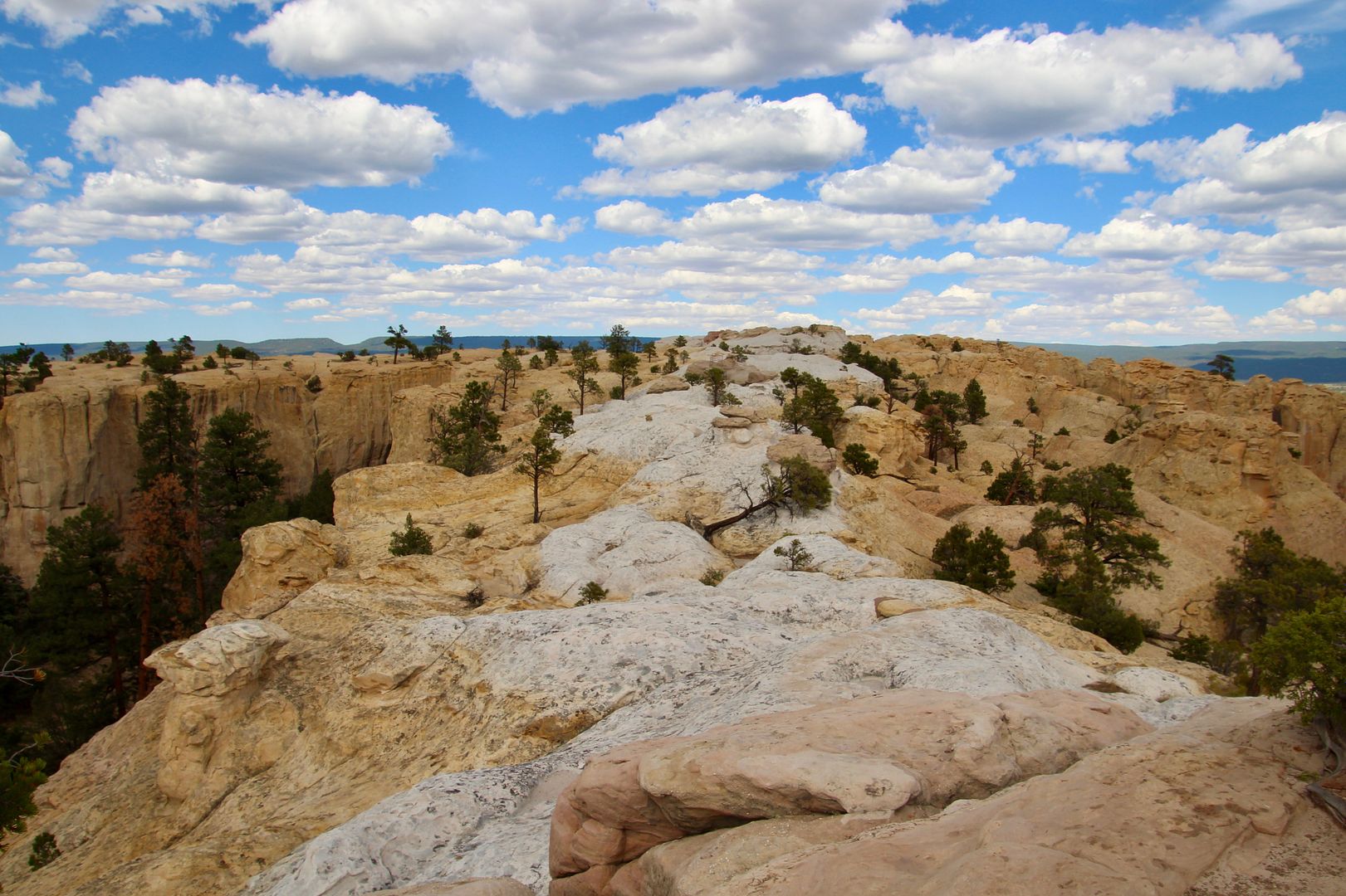
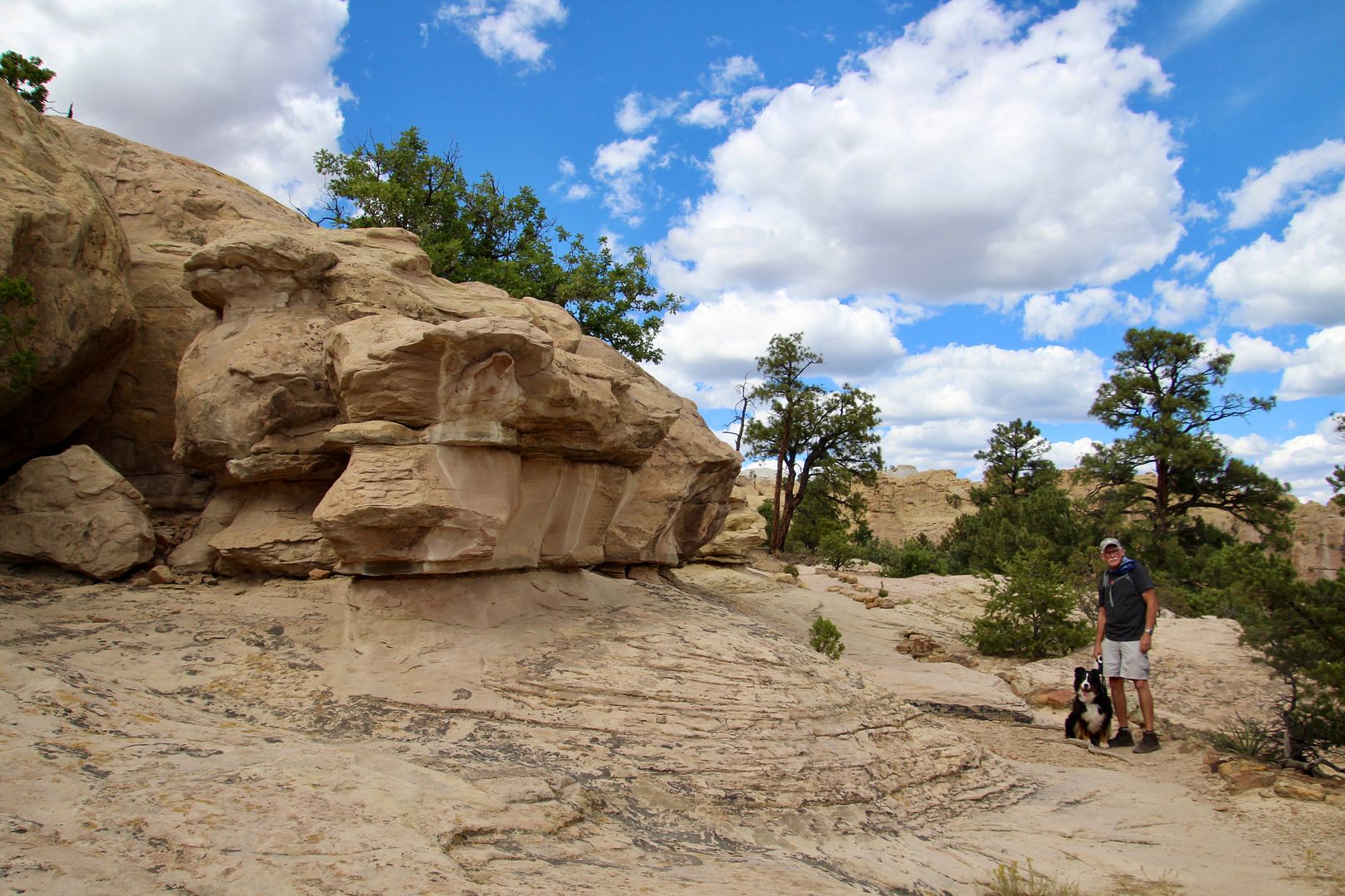
We continued to the Mesa Top Trail (2 mi). It is a loop trail with a steep climb over uneven terrain to reach Atsinna Pueblo and then back down the other side of the cuesta. We followed the trail to the top (leashed dogs permitted) of the bluff where we were rewarded with expansive views. Here’s John telling our doggie, Sadie, all about it.
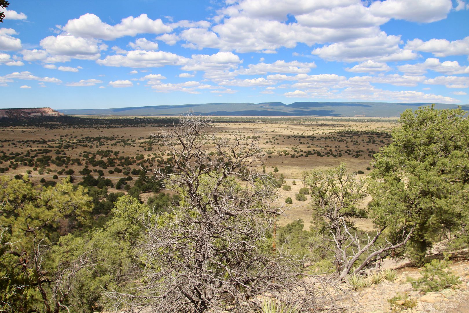
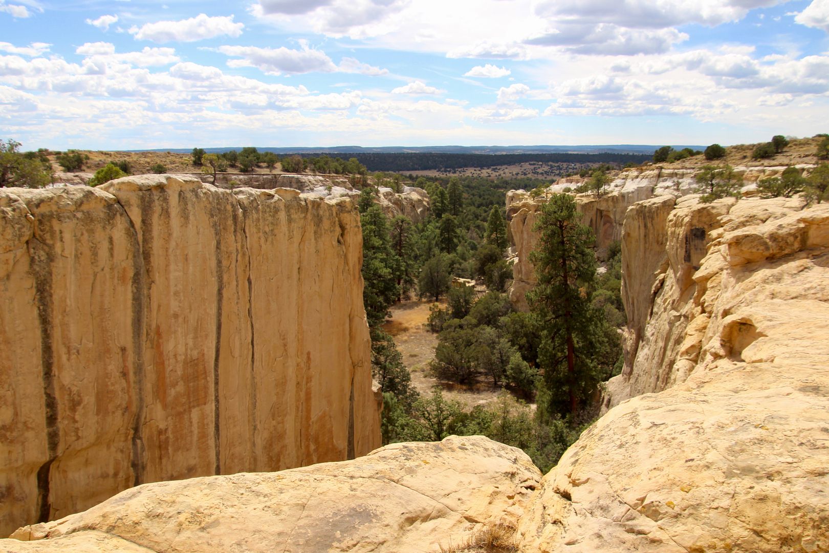
The canyon on the opposite side of the bluff came into view. And I was thankful for the railings along the trail here.
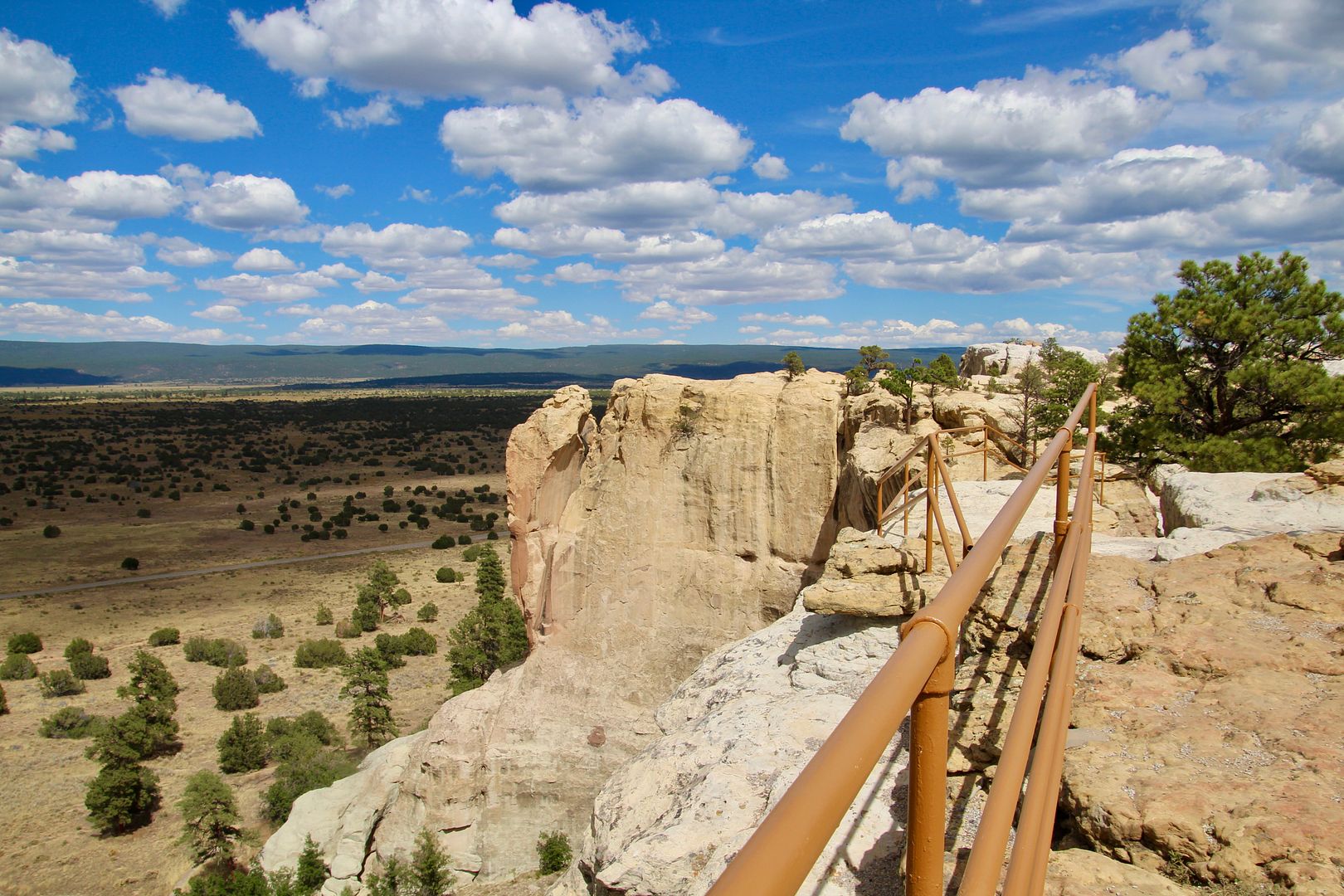
You definitely need to stick to the trail and be wary of the cliffs to the valley on one side or canyon on the other.
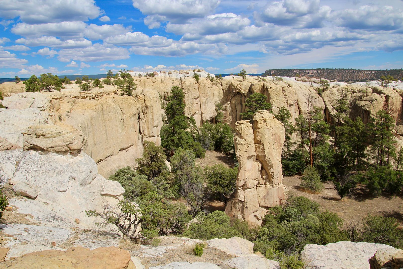
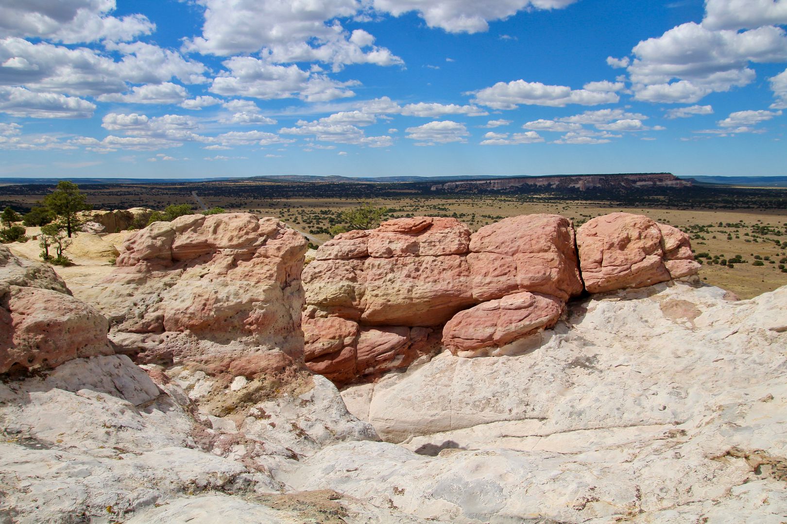
The trail continued across slickrock, but Sadie is really good at following a trail. Steps have been carved into some areas of rock of the trail. And there are many interesting rock formations on top.
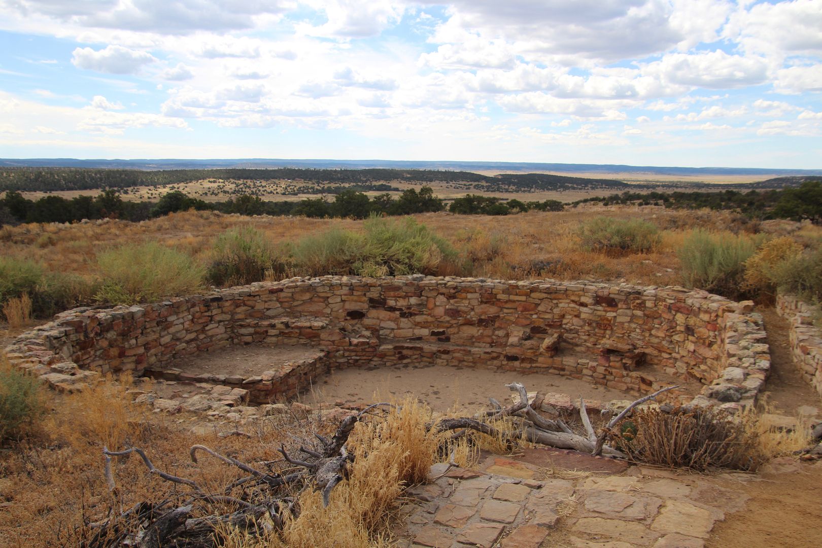
Atsinna Pueblo was discovered by an archeologist in 1950. Originally, it was 200’ by 300’ with approximately 875 rooms and an open courtyard. It is estimated that 1,000 to 1,500 people lived here. Crops were grown on the plains. Toe and hand holds in the cliff face to the pond below indicate that water was brought up to the pueblo, but cisterns also captured rain water on top. Both square and round kivas were found. By 1400, Atsinna was abandoned.
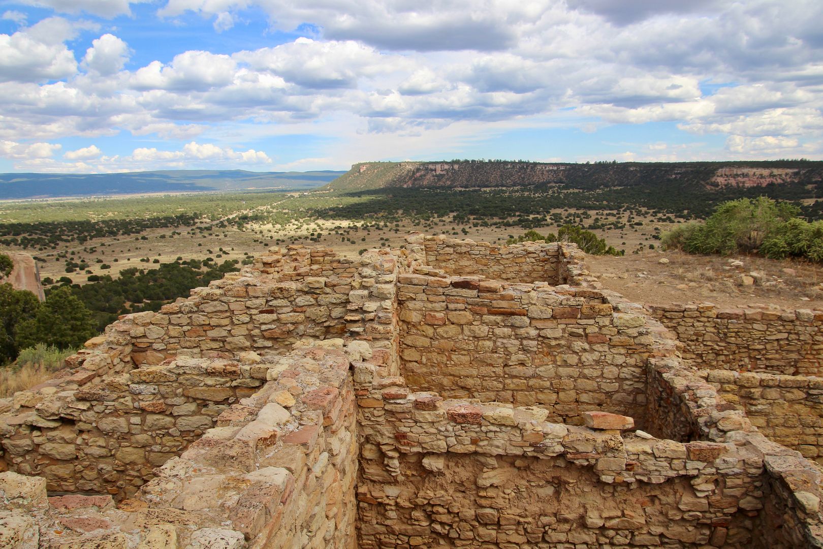
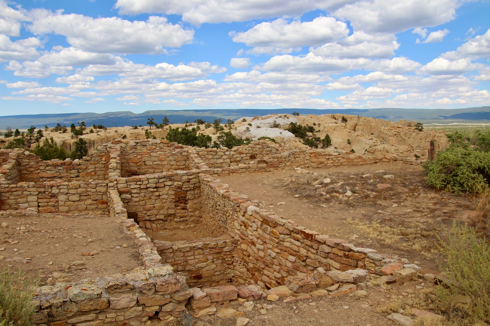
This was a great location due to the reliable water supply and the expansive views of the surrounding area.
It was a gentle descent at the end of the loop trail. We really enjoyed seeing the inscriptions, Atsinna ruins, and the amazing rock formations along the trail.
This is a small national monument with only two trails, but there is a lot to see and experience here. For additional information about El Morro, go to www.nps.gov/elmo.
No comments:
Post a Comment