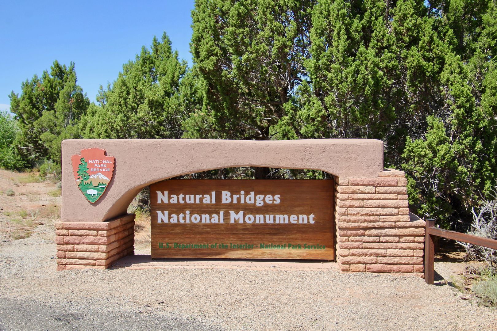
Natural Bridges National Monument is about 65 miles from Monitcello, UT, (where we were staying), but there is very little traffic in this remote part of the country. So, we packed a lunch, and set out with our sweet doggie, Sadie.
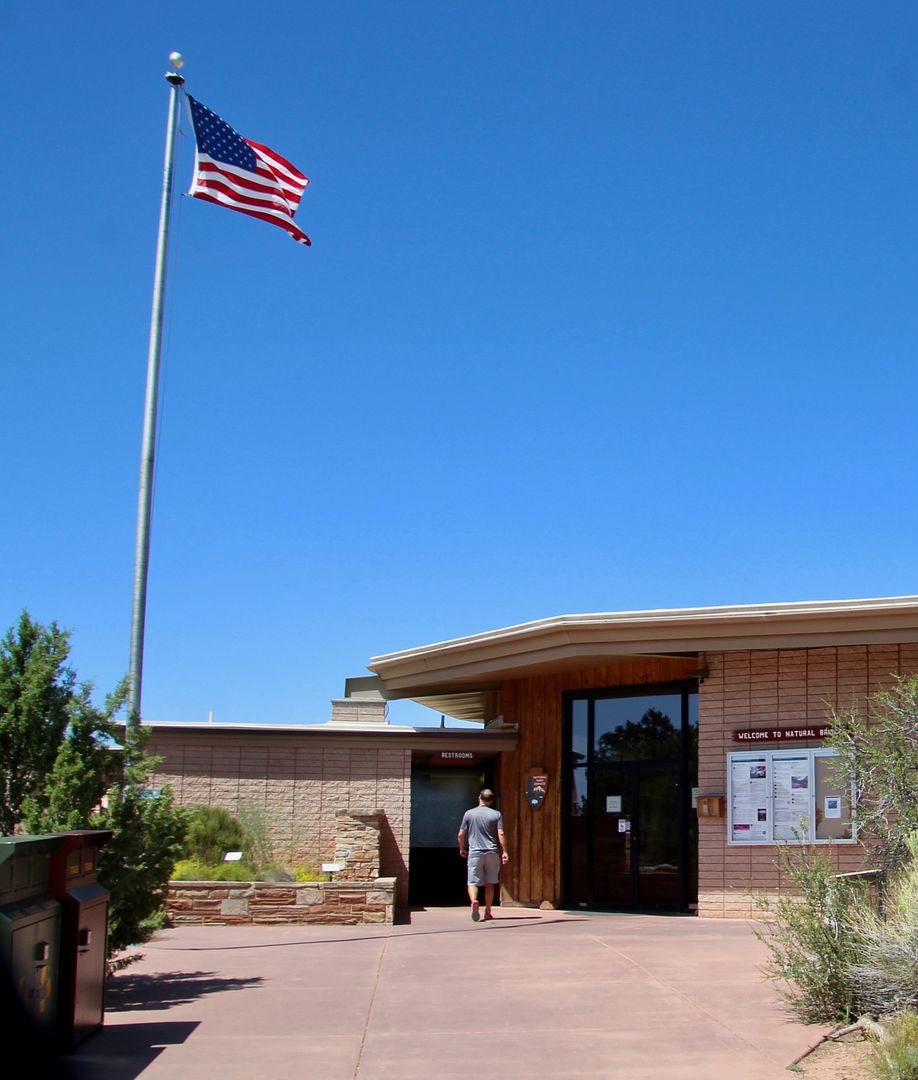
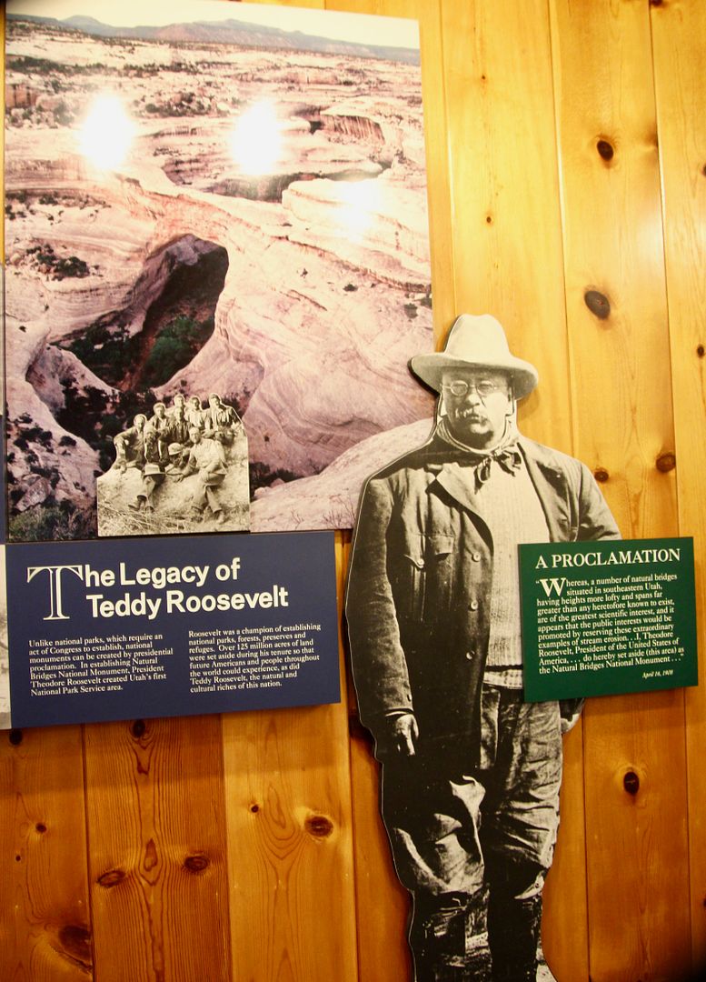
We stopped, as always, at the Visitor Center to pick up a map and learn more about the national monument. The bridges were "discovered" by a gold prospector (Cass Hite) in 1883. They were featured in National Geographic in 1904; and, President Theodore Roosevelt proclaimed this area Natural Bridges National Monument in 1908. It was the first designated National Park Service site in the state of Utah. Now there are five national parks and many more national monuments here.
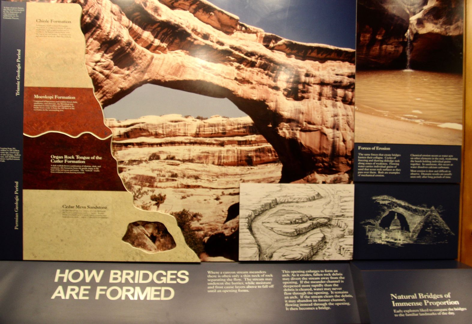
An exhibit about the geology of the area provides information about how natural bridges are formed (meandering streams eroded canyon walls). Natural bridges are formed by the erosive action of moving water (streams, rivers, etc.), while arches are formed by other erosive forces (freeze/thaw cycles, wind) and seeping moisture.
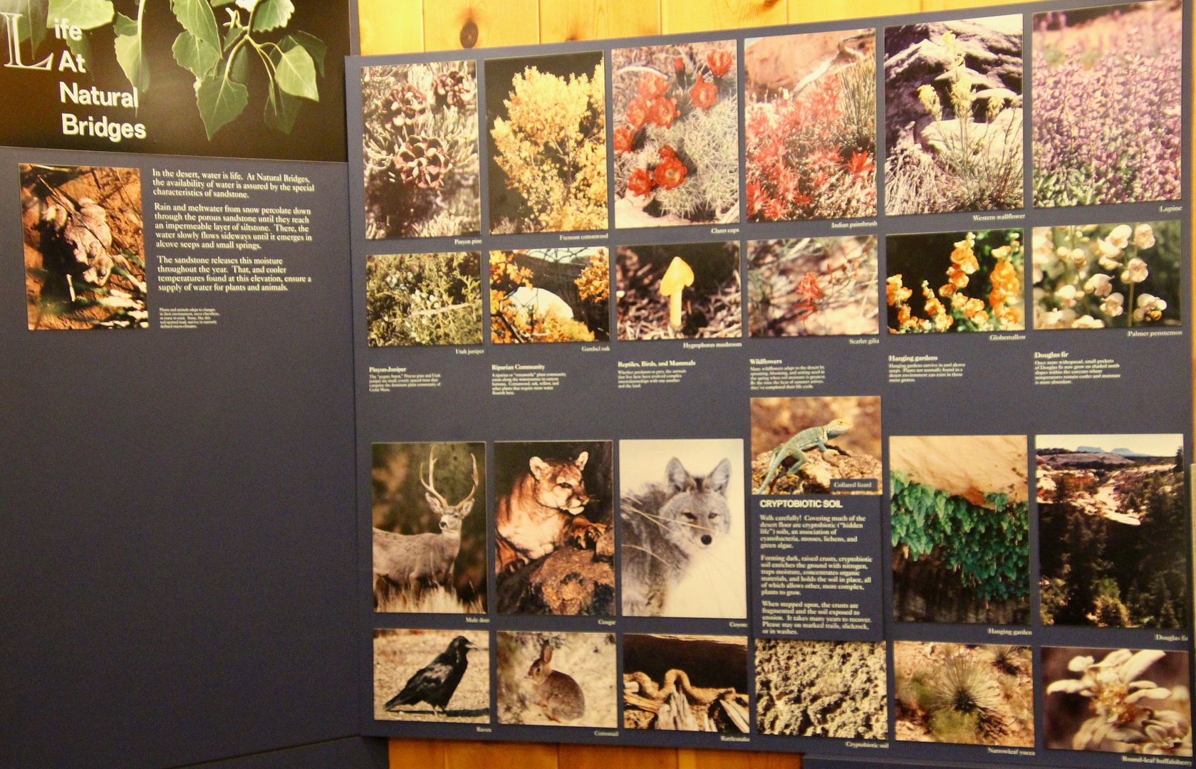
And we are always interested in the flora and fauna found in the parks we visit (so we know what we should be looking for...)
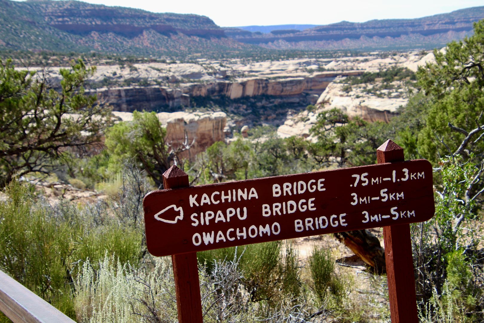
The nine-mile scenic Bridge Loop Drive has viewing areas for each of the three natural bridges here. The overlooks are a short walk from the parking lots. Trailheads to the bridges can also be found at each overlook.
Here are some stats to give you an idea of the massive size of these natural bridges.
Here are some stats to give you an idea of the massive size of these natural bridges.
Bridge
|
Height
|
Span
|
Width
|
Thickness
|
Stage/Age
|
(in feet)
| |||||
Owachomo
|
106
|
180
|
27
|
9
|
Old age
|
Sipapu
|
220
|
268
|
31
|
53
|
Mature
|
Kachina
|
210
|
204
|
44
|
93
|
Young
|
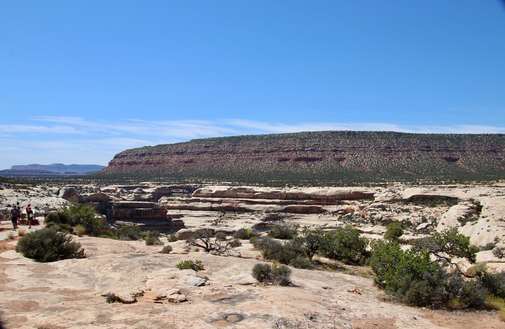
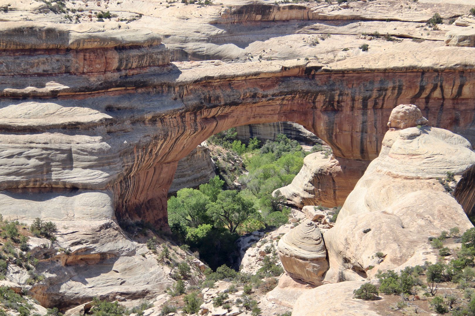
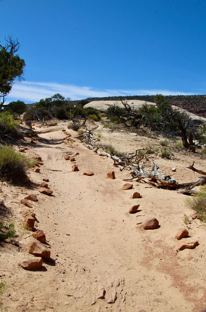
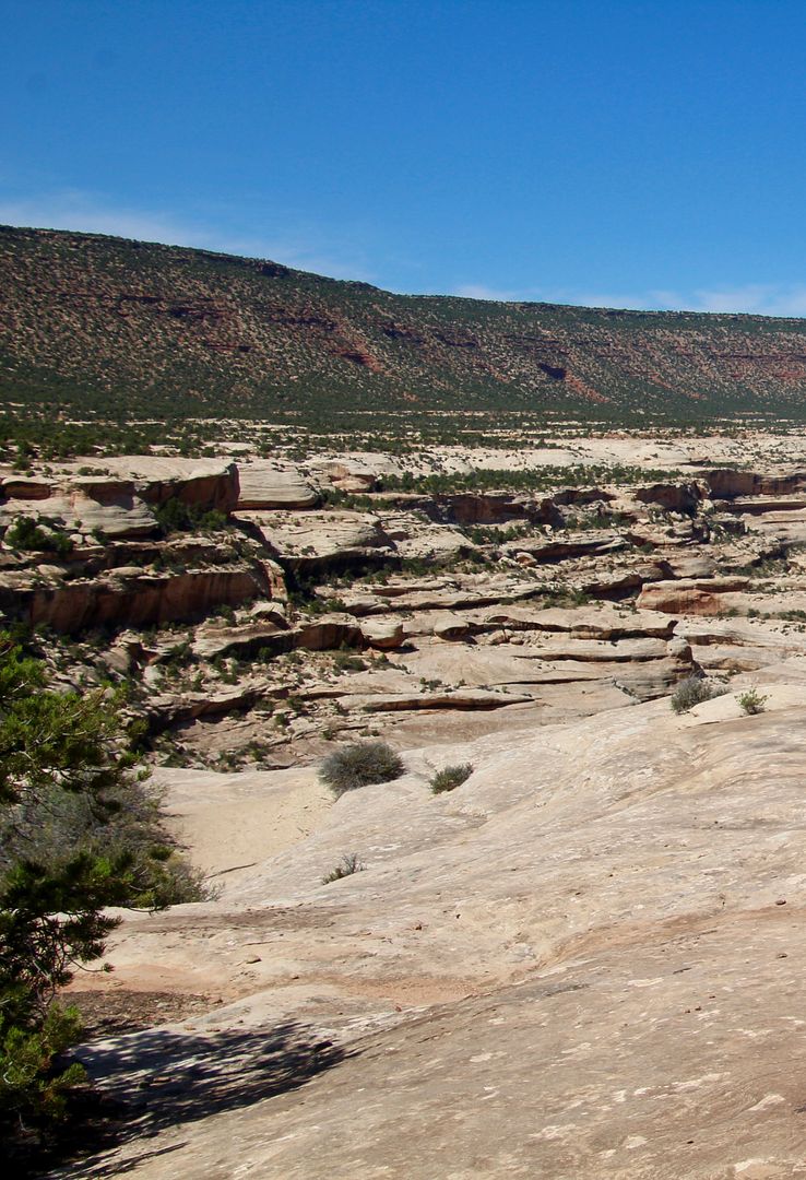
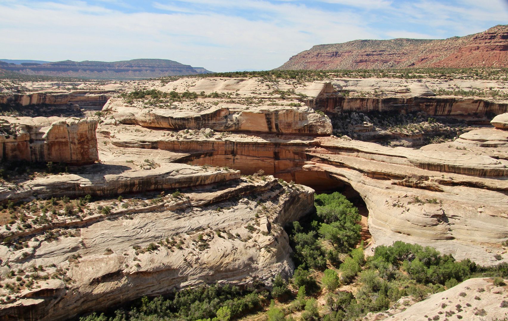
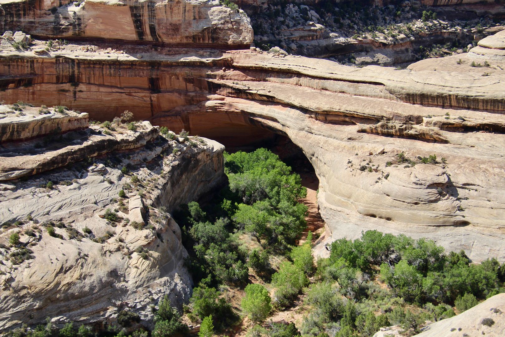
Our first stop was at Sipapu Bridge, the world’s second highest natural bridge. Walking along slickrock, we came to the canyon overlook. At first, the huge bridge is not immediately recognizable. Can you see it in the second photo?
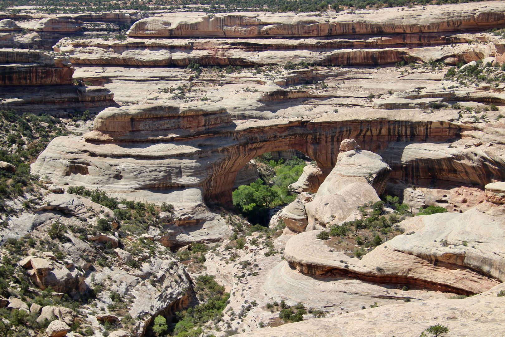
A trail from here will provide an up close view of the bridge, but it is a strenuous .6 mile hike with a 500’ elevation change (each way). Pets are not permitted on the trail, so we did not pursue it.
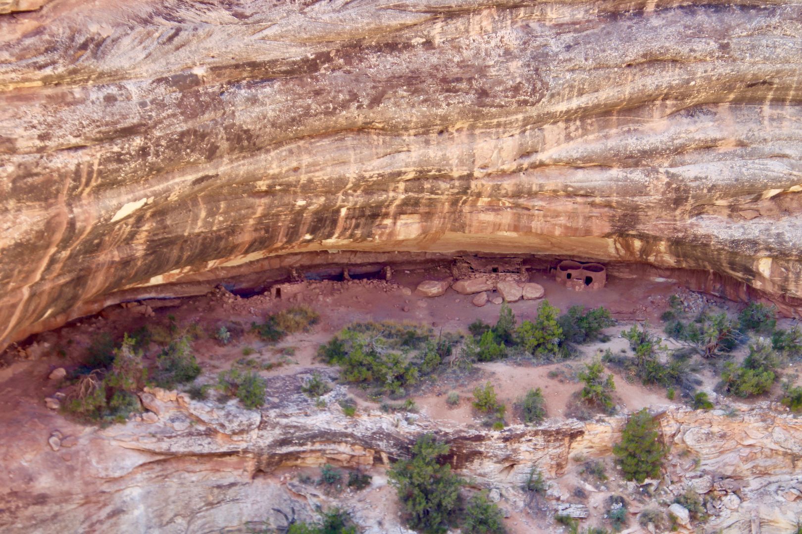
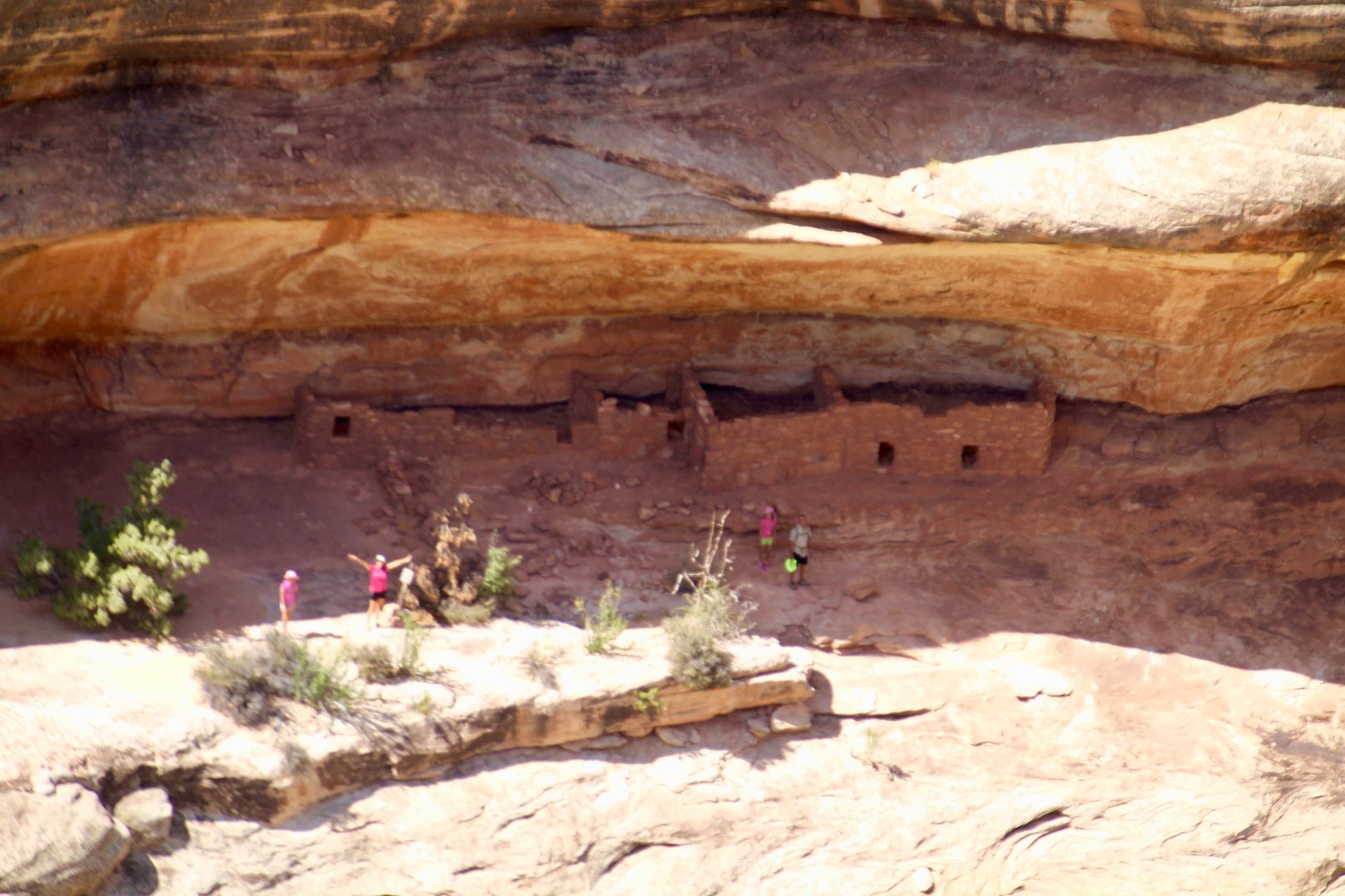
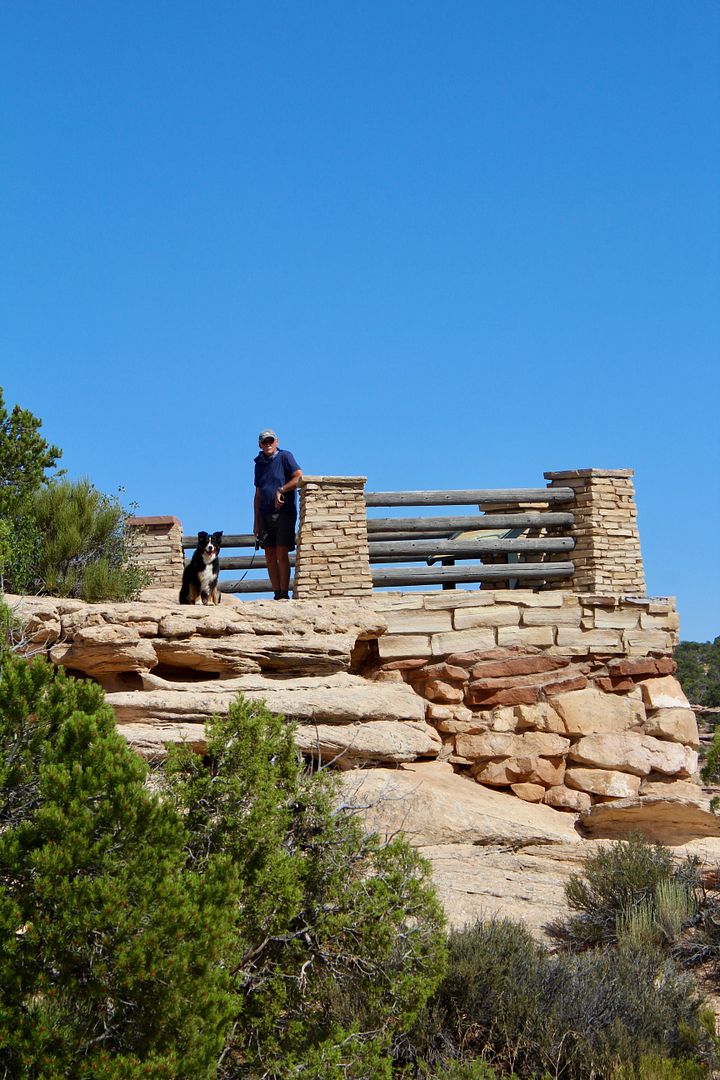
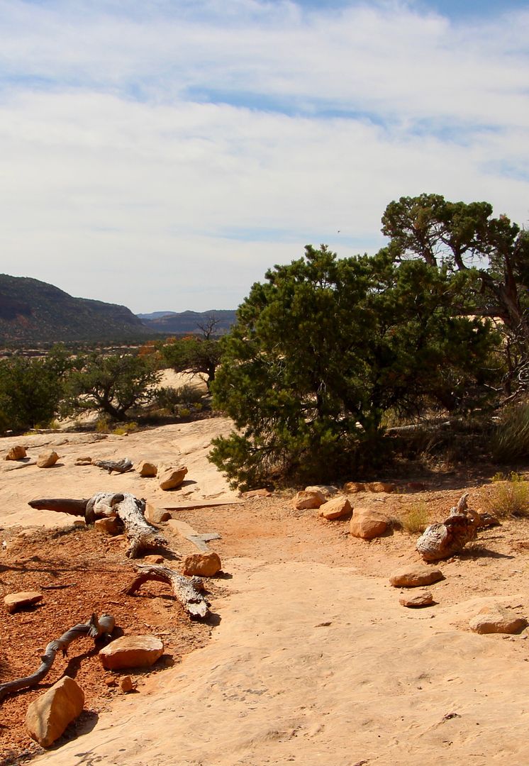
Our next stop on the loop drive was Horse Collar Ruin, an Ancestral Puebloan archeological site. A .3 mile hike (from the parking area) leads to an overlook to an alcove on the opposite side of the canyon where you can see the site. John stayed with our doggie, Sadie, while I hiked the short distance to the overlook to snap some photos. The trail to the overlook was at first sandy, and then across slickrock.
A railing has been installed along the trail where it is close to the canyon rim (thankfully!) Be cautious, especially if you are hiking with children.
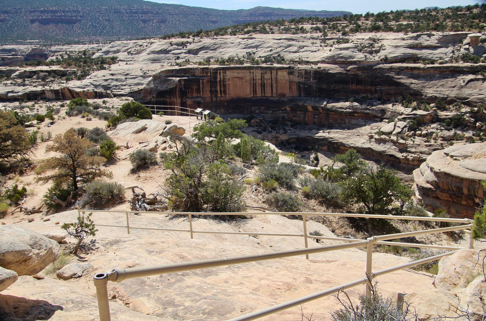
The ruins can be seen in several alcoves from the overlook. And I could see several hikers exploring one set of ruins…that is quite a hike!
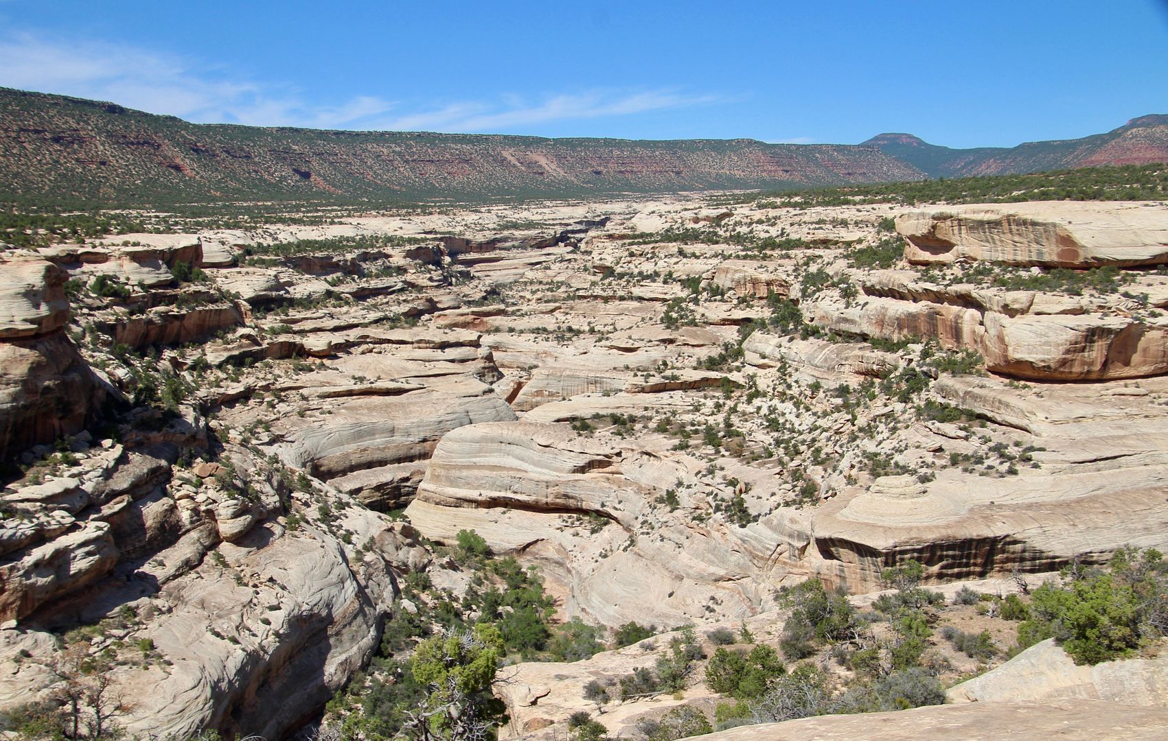
Views of the canyon were amazing during the return hike.
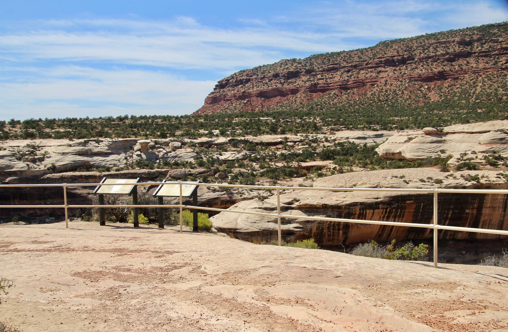
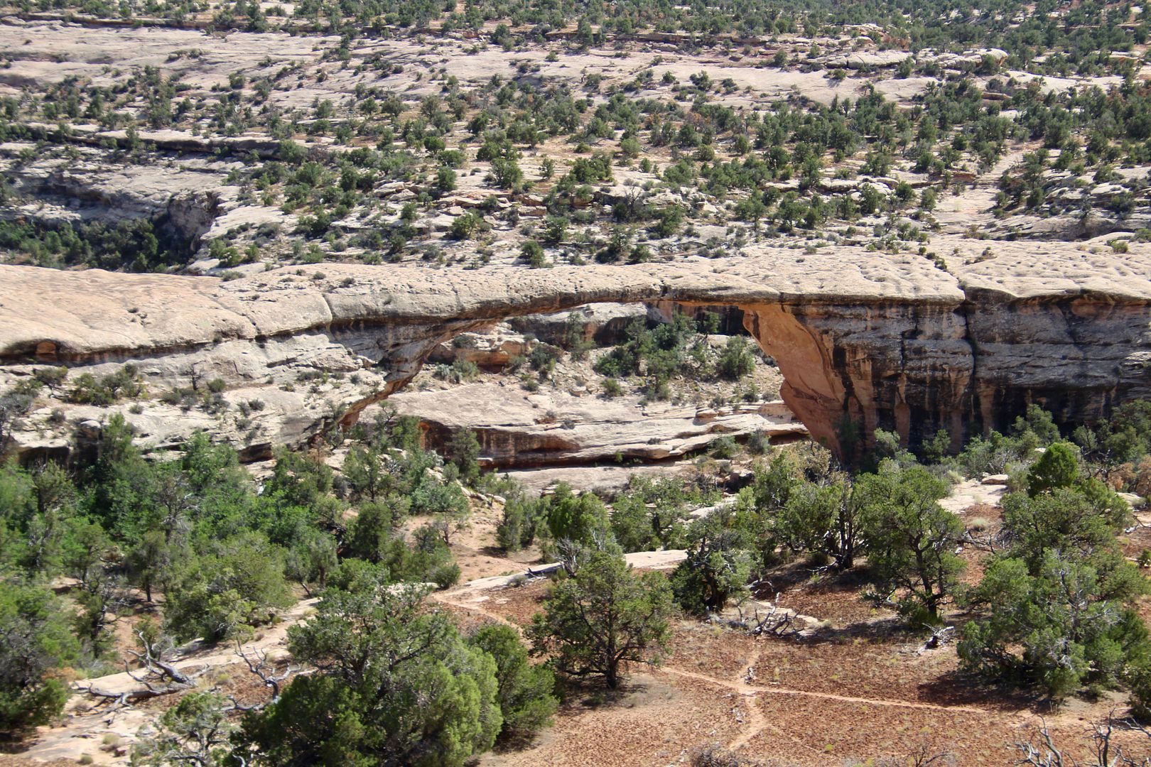
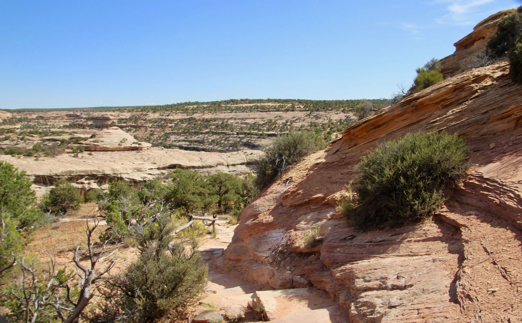
The Kachina Bridge overlook was next on the Bridge View Drive. The trail to the bridge is a strenuous hike (.75 mi, 400’ elevation change, each way). This trail connects to the other trails to the other two bridges (for those prepared for some strenuous hiking). We passed on that. And, leashed pets are not permitted.
Kachina Bridge is big and bulky in the canyon below. Floodwaters of White Canyon still erode the rocks thereby enlarging its span. This is the youngest of the three natural bridges here.
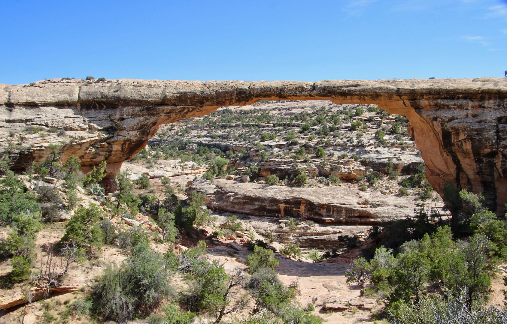
The third bridge on the loop drive is Owachomo Bridge, an Hopi word for “rock mound.” This mound is visible on the left side of the bridge. This is the smallest and oldest (geologically speaking) of the three.
A short trail will take you to the overlook. John and Sadie stayed at the overlook while I hiked down the trail for a closer look. You can see the rock mound in the third photo.
It was pretty amazing to see Owachomo Bridge up close. And it helped me to realize how big the other two bridges are that we saw earlier.
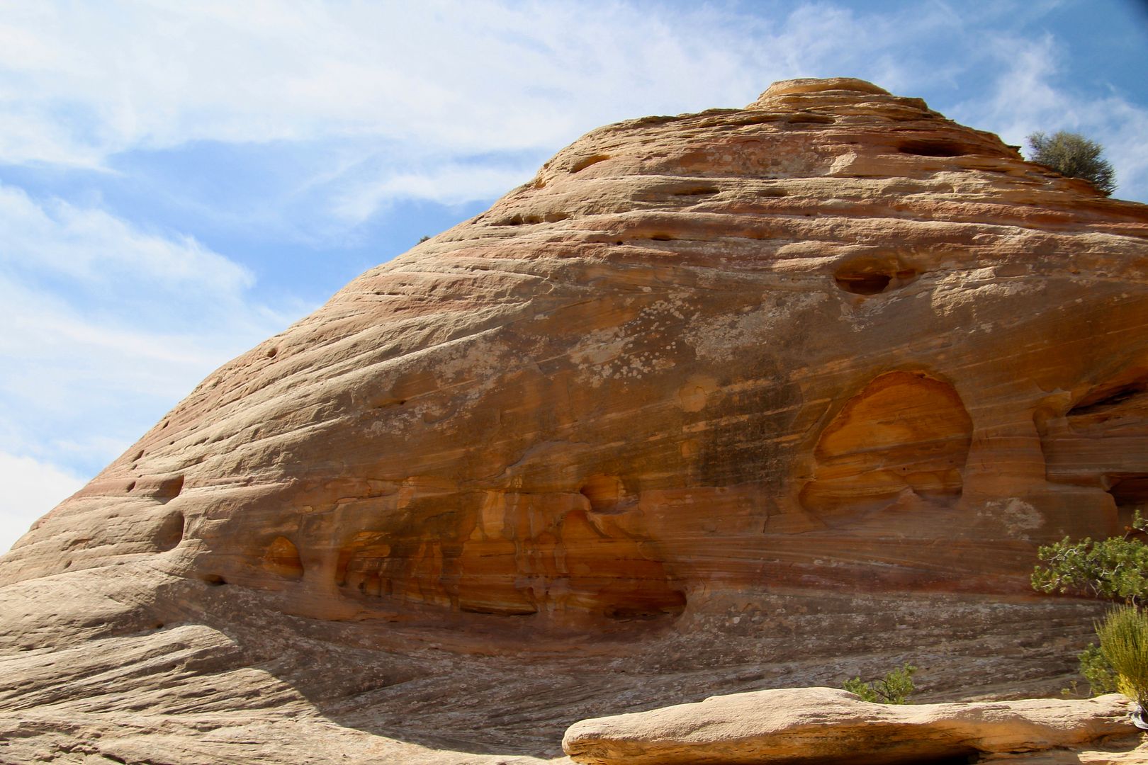
On the hike back to the parking area, I passed this rock that is similar to many others we have seen here. Spaceships…that’s what I think they look like. Such interesting shapes have been created by erosive forces here.
The two buttes in the distance are called Bears Ears and are sacred to multiple Native American tribes (Navajos, Utes, and Pueblos). Various tribal oral histories tell of this distinctive geological formation.
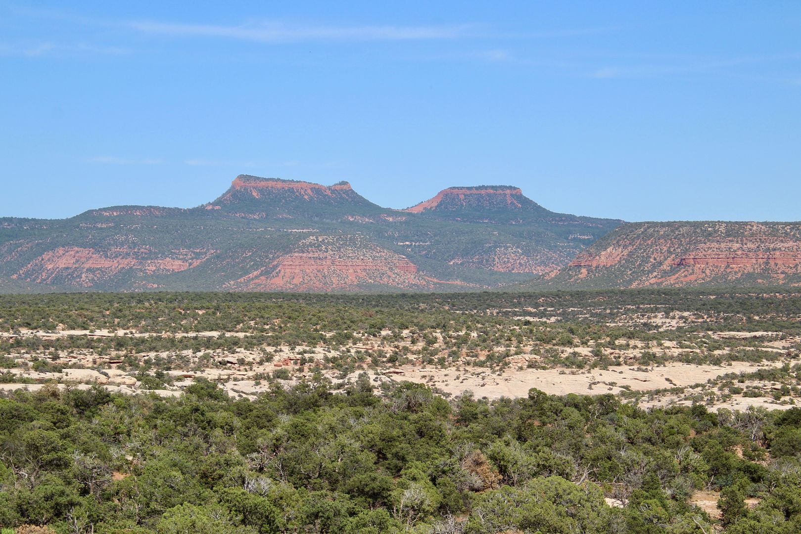
The region around Bears Ears was proclaimed a National Monument in 2013. The Trump administration has, sadly, reduced the size of the National Monument by 75% for mining rights. This is a real tragedy for those who cherish their sacred lands and those of us who are enchanted by the natural beauty of this place and the cultural ruins that can be found here.
The Bridge Loop Scenic is a great way to see the three bridges. There are many arches to be found in the monument, as well. Located in the Four Corners region, we love the Native American and geological history here. Also, this area is one of the darkest skies in the country. Park rangers provide scheduled star-watching programs. For additional information about the monument and ranger-led programs, go to www.nps.gov/nabr
No comments:
Post a Comment