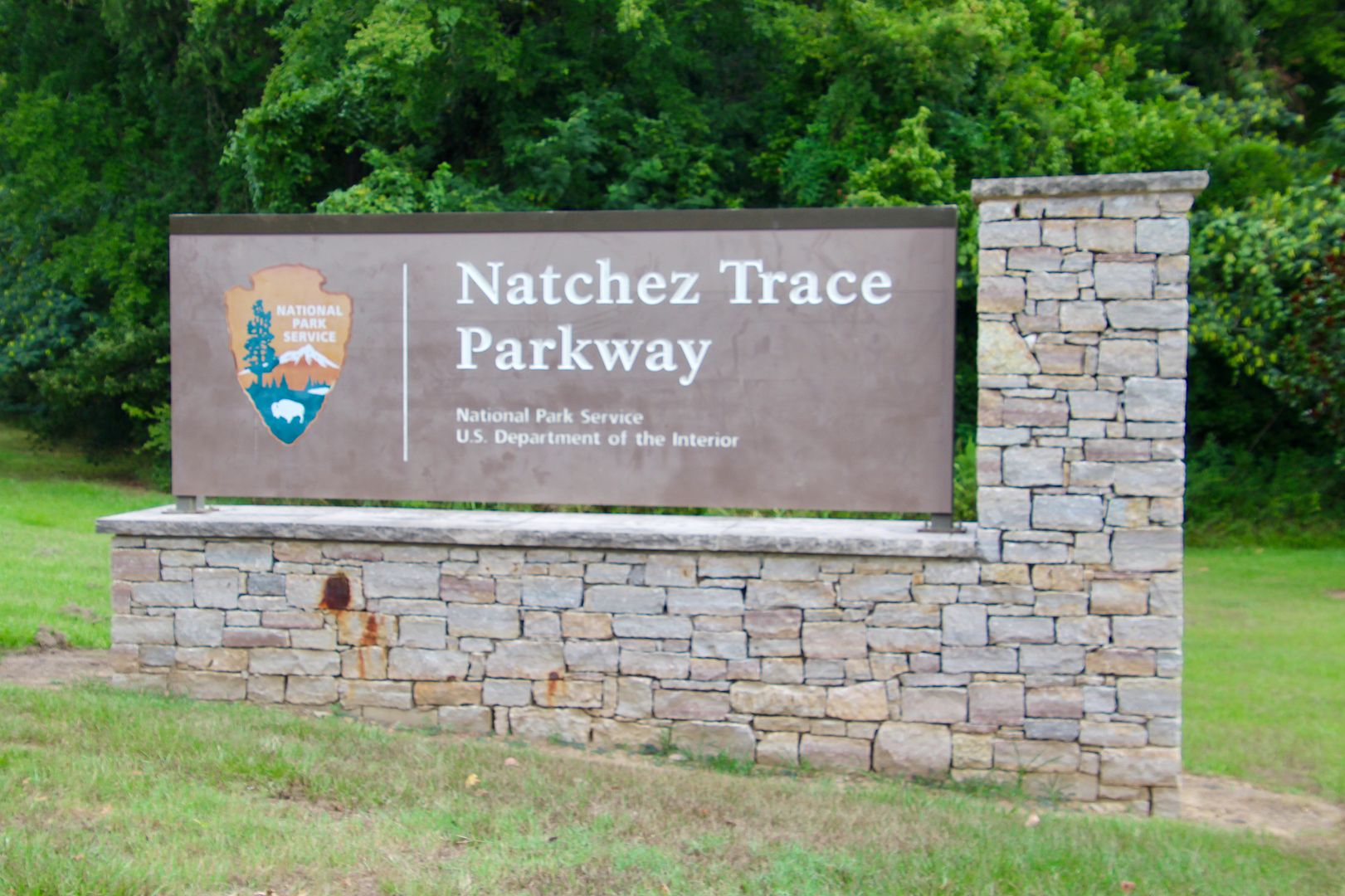
The parkway goes through the homelands of the Natchez, Chickasaw, and Choctaw Nations. It commemorates the most important highway of the Old Southwest. After the Revolutionary War, frontiersman of the Ohio Valley transported crops, livestock, and other goods on wooden flatbeds boats downstream (on the Mississippi River) to Spanish-controlled Natchez and New Orleans. After selling their goods and boats (for lumber), the frontiersmen walked (rode on horseback) along the Old Trace to their homes. In 1801, it was designated as a national post road for mail by President Jefferson. Many historic landmarks and other designated sites can be seen along the scenic parkway.
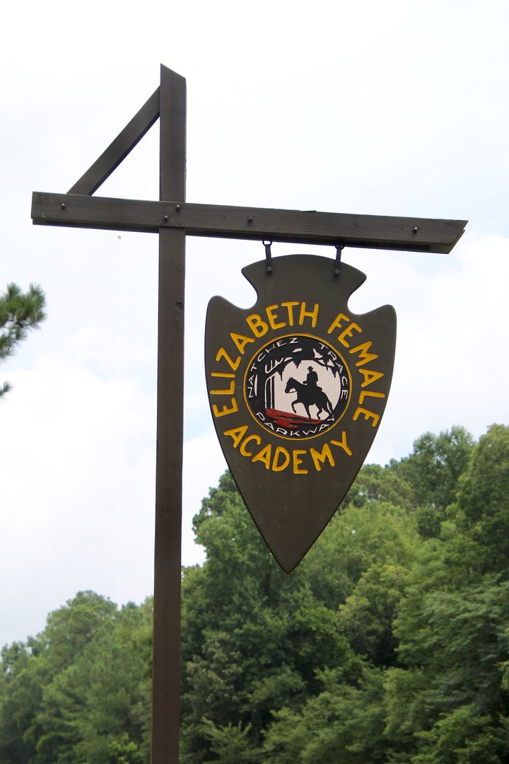
The National Park Service brochure for the Natchez Trace Parkway includes a map with points of interest (and the mile-marker locations for each). We entered the scenic byway in Natchez and made our first stop (mile 5.1) at the Elizabeth Female Academy Site. It was the first school for women in the state of Mississippi (founded in 1818).
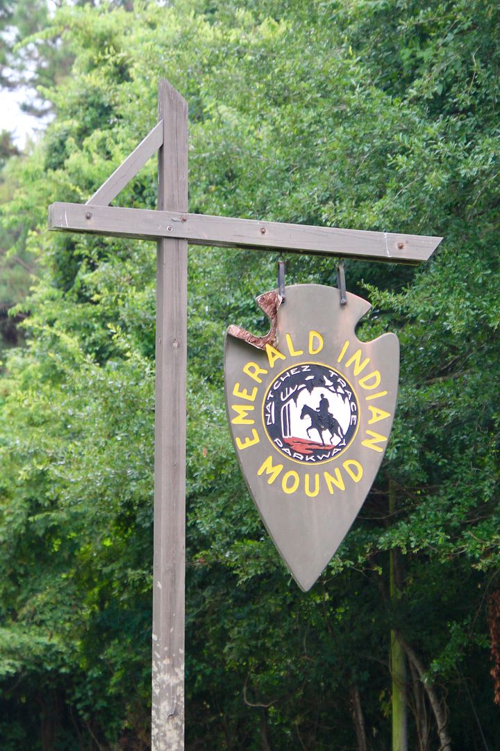
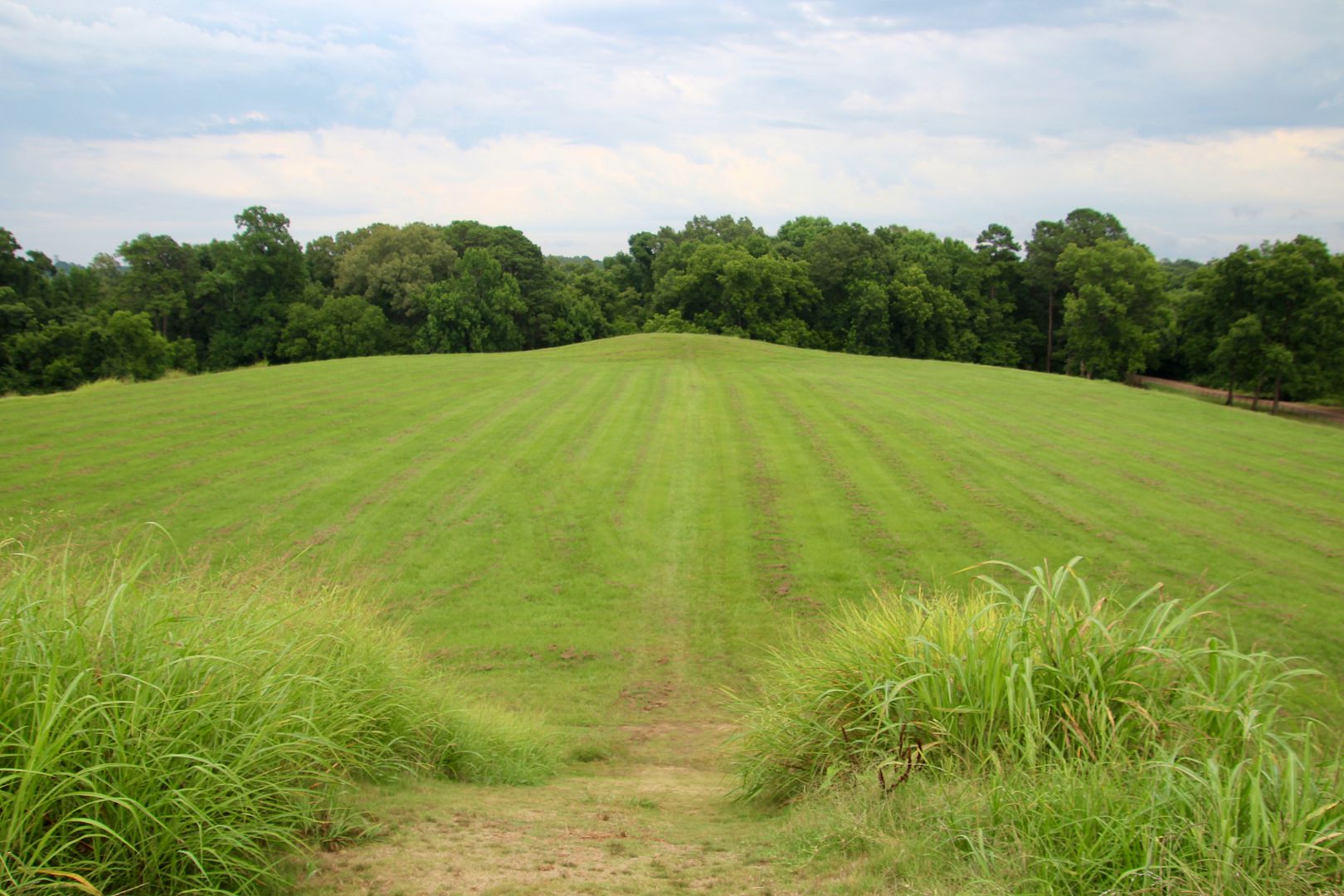
Emerald Mound (mile 10.3) is the second largest ceremonial mound in the US. Built by the Mississippians (Native Americans) between 1200 and 1730, it is 35’ high, 770’ x 435’ at its base, and covers 8 acres. Two larger mounds are on top of the primary mound and 6 smaller mounds once surrounded it. Archaeological excavations occurred in 1838 with various additional ones until 1972. The Mississippian culture had a high level of social and political organization.
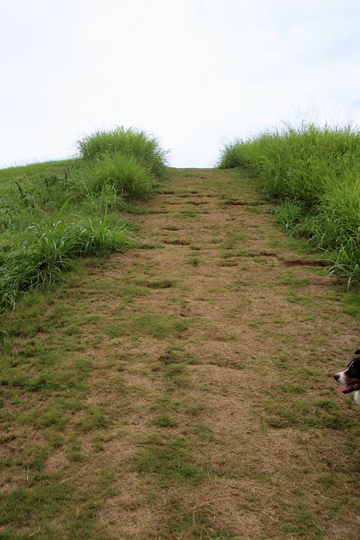
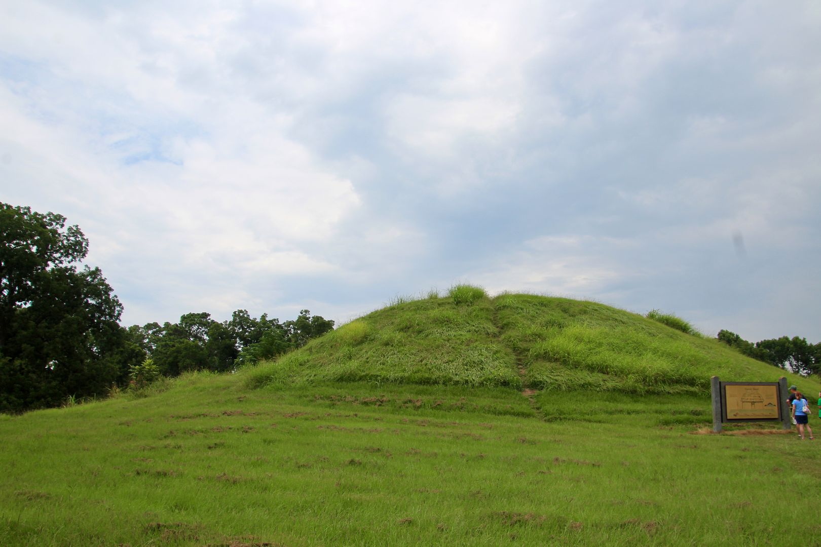
Temples and other structures were built atop the mound. This is a view from the top towards one of the mounds on top of Emerald Mound.
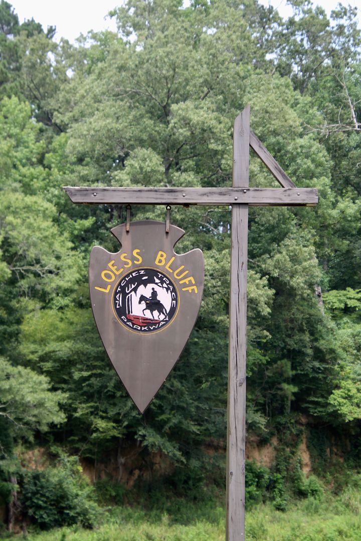
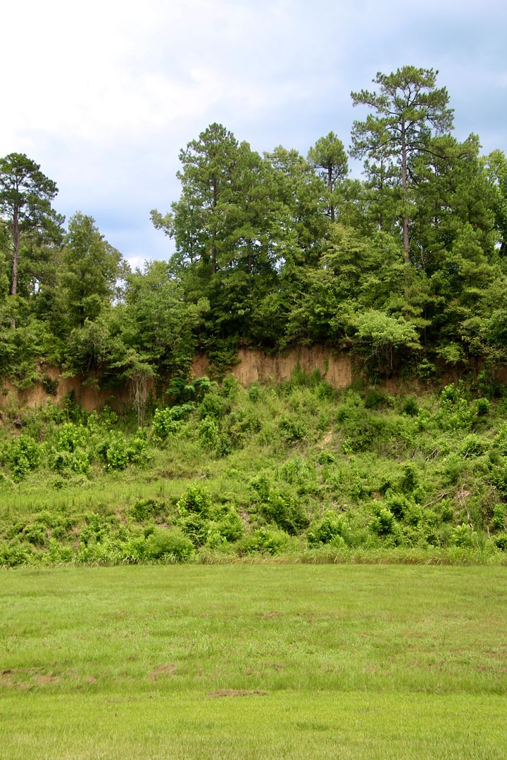
Loess Bluff (mile 12.4) provides a glimpse of the deep deposits of wind blown sand that covered this area during the last ice age. Dust storms brought sand from the Midwest plains here to a depth of 30’ to 90’. A strip of loess, 3 to 30 miles wide, still exists from Baton Rouge, LA, to Tennessee.
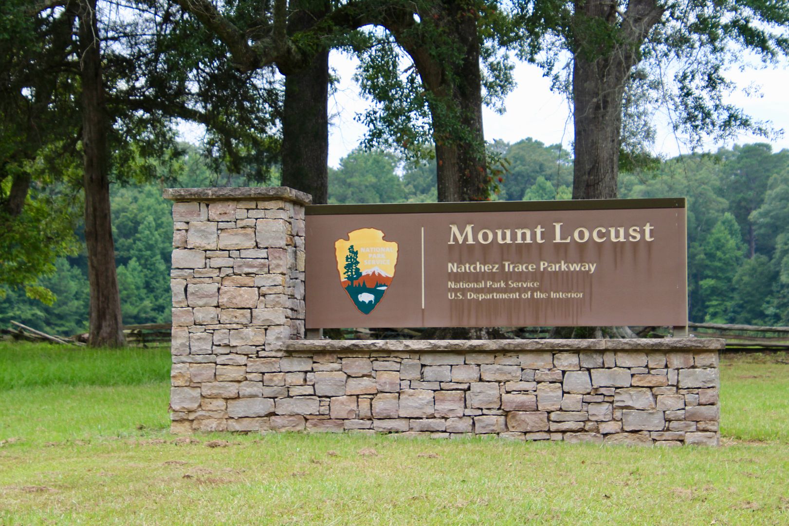
Mount Locust (mile 15.5) is a restored plantation and was once an inn for travelers along the Trace. On the day we visited, it was closed.
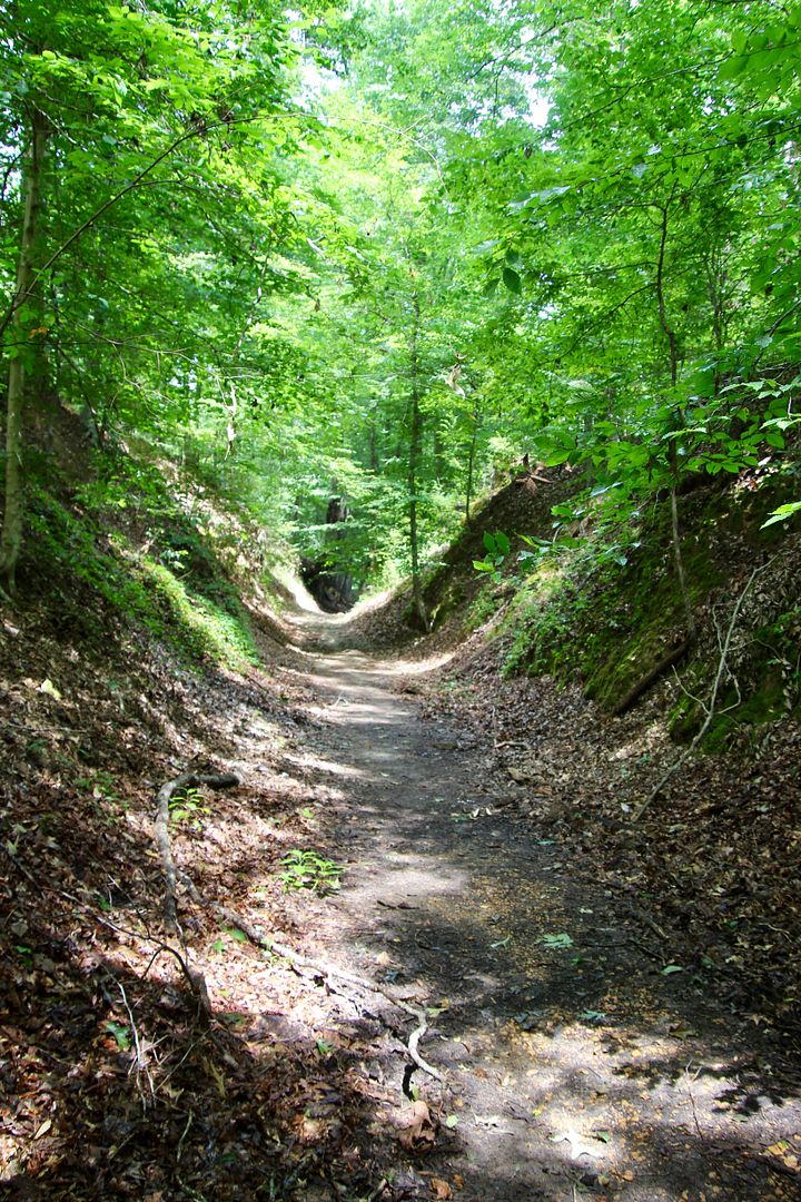
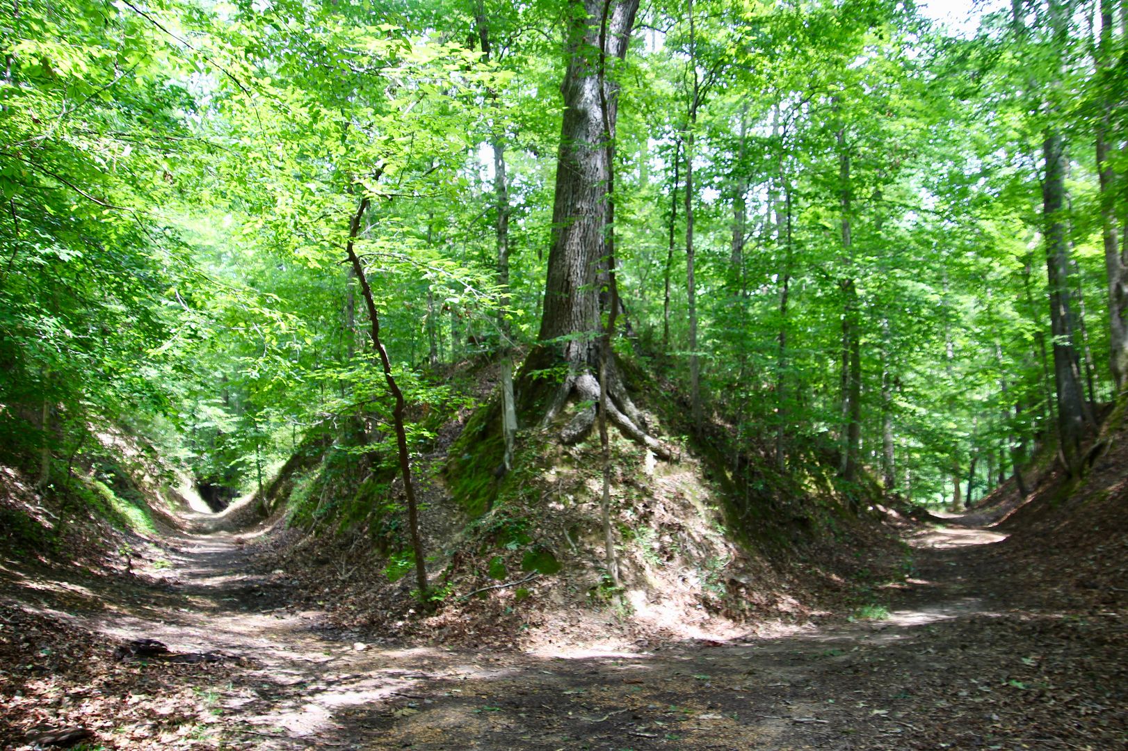
At mile marker 41.5, we explored a section of the original Old Trace that is deeply eroded (because it goes through loess).
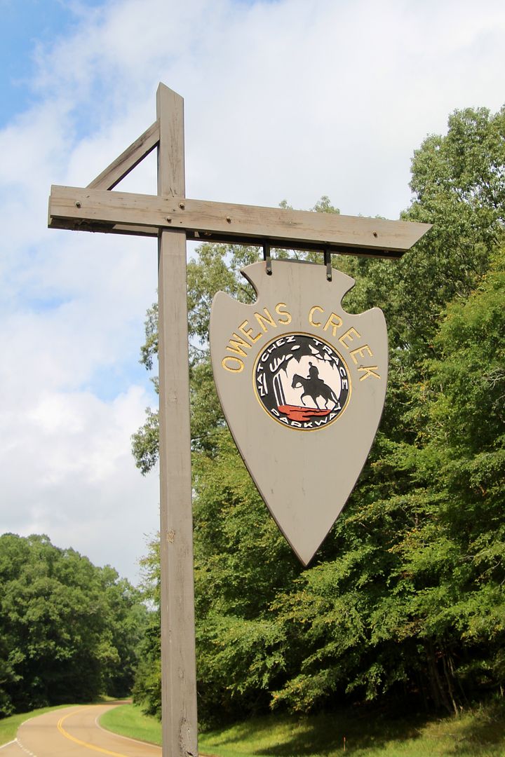
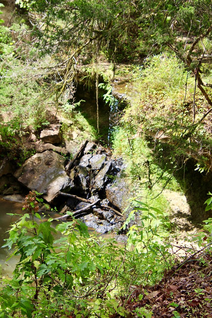
Owens Creek (mile 52.4) was once a popular spot for Rocky Springs residents. What was once a waterfall, is now just a trickle due to the water table dropping significantly in the area.
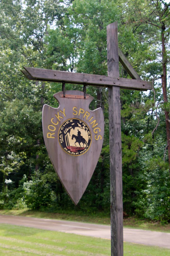
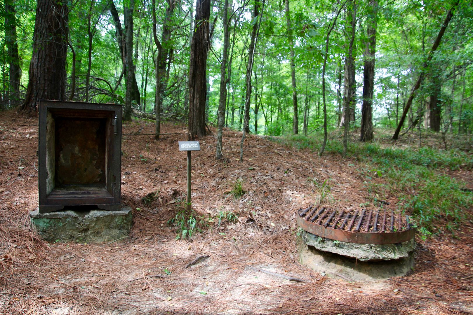
Rocky Springs (mile 54.8) was a rural community that was first settled in the 1790s. Before the Civil War, the population had grown to 2,600+ whites plus 2,000 slaves for cotton fields. Rocky Spring no longer flows. The Civil War, yellow fever, the boll weevil (that destroyed the cotton crop) and poor land management practices caused the demise of the community. Only a couple metal safes, cisterns, the church and cemetery remain today.
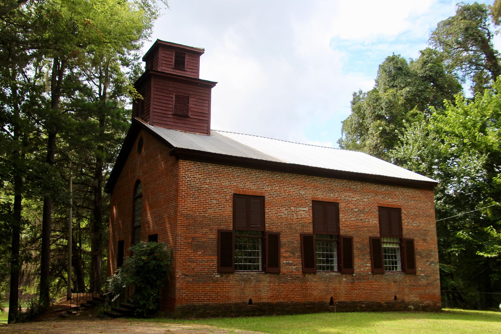
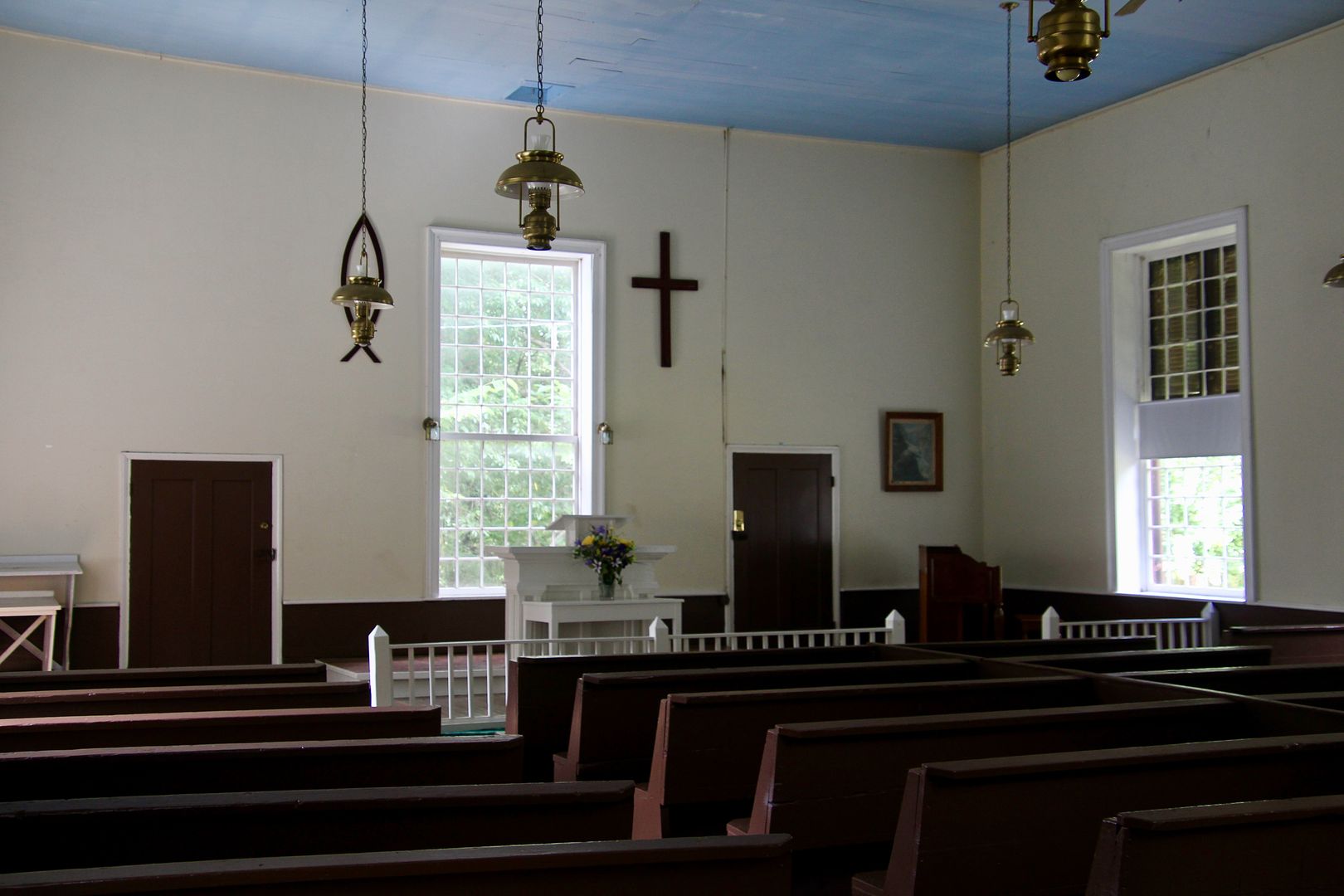
The Rocky Springs Methodist Church was built by the people of Rocky Springs in 1837 and continues to be maintained by its members. A service is held here the last Sunday of each month.
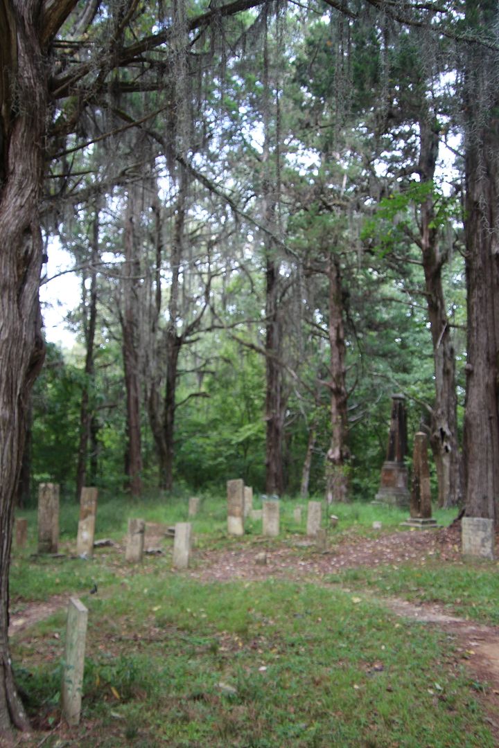
The cemetery behind the church has many old graves. Due to a large bee hive, we did not venture any closer!
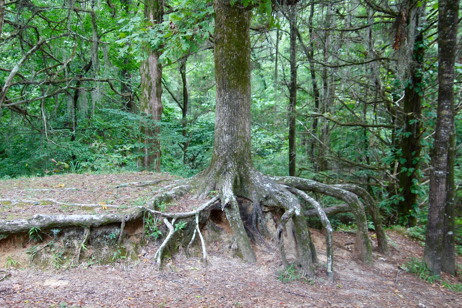
I loved the root system of this tree located in front of the church.
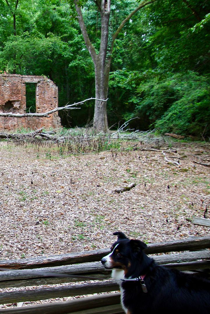
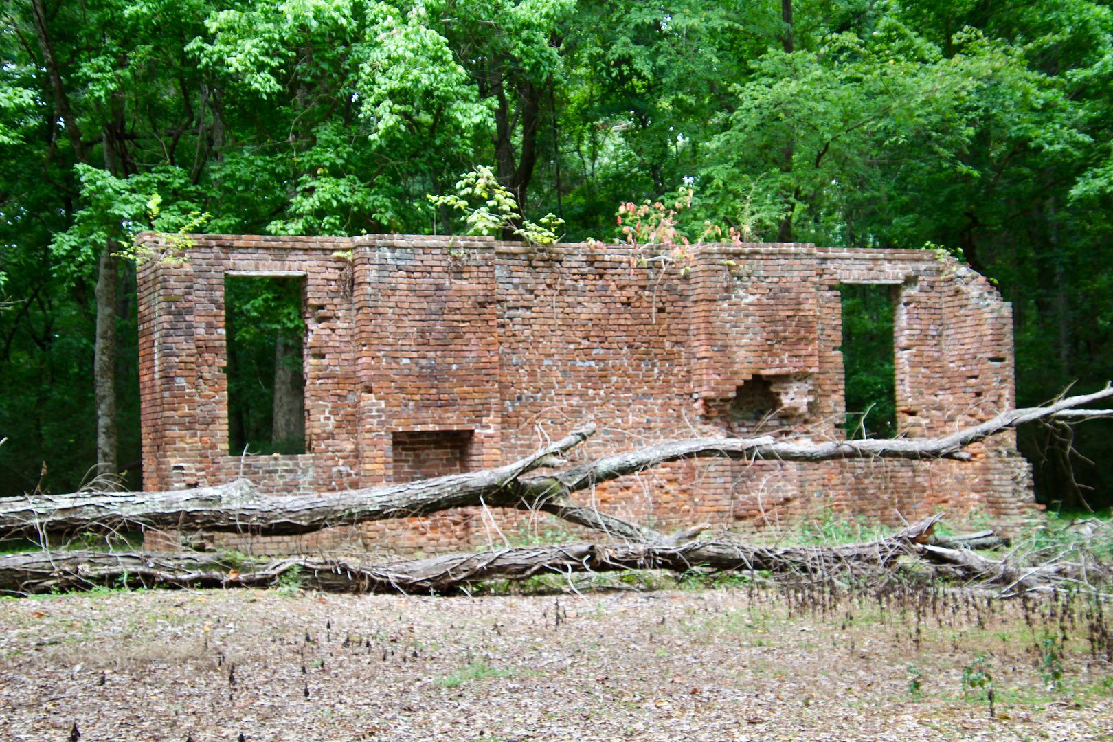
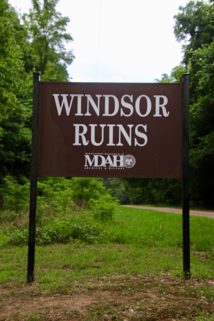
We decided to retrace our route back to Natchez, but made one detour (on Rte 552 near Fort Gibson) to see Windsor Ruins. Once a grand antebellum house, it was built by successful cotton planter, Smith Coffee Daniell, II, in 1861. The Greek Revival architecture (with some Italianate and Gothic features), had 23 rooms on two residential floors, a basement, and attic. A cupola on the roof provided views of the Mississippi River. And rainwater was stored on the roof to supply the two bathrooms.
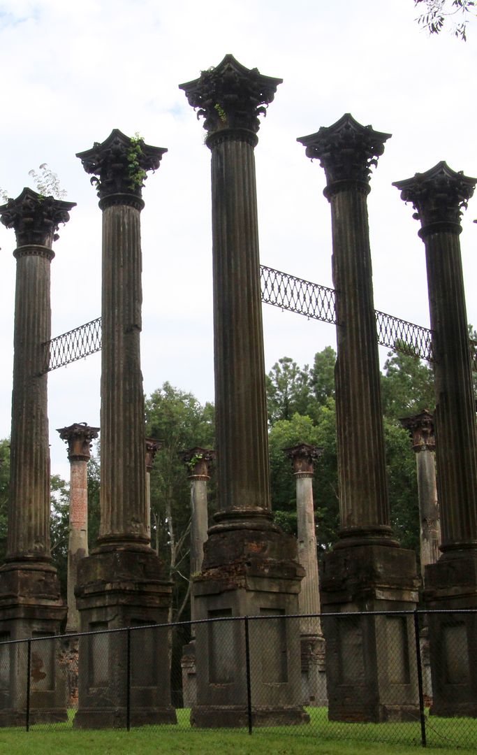
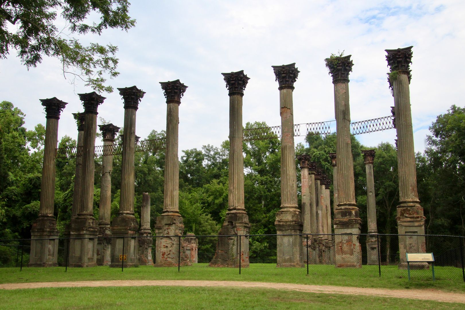
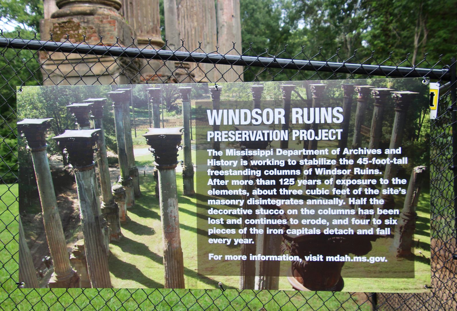
The house survived the Civil War but was destroyed by an accidental fire in 1890, leaving only the 45’ columns and ironwork. Today the Mississippi Department of Archives and History is working to preserve the ruins.
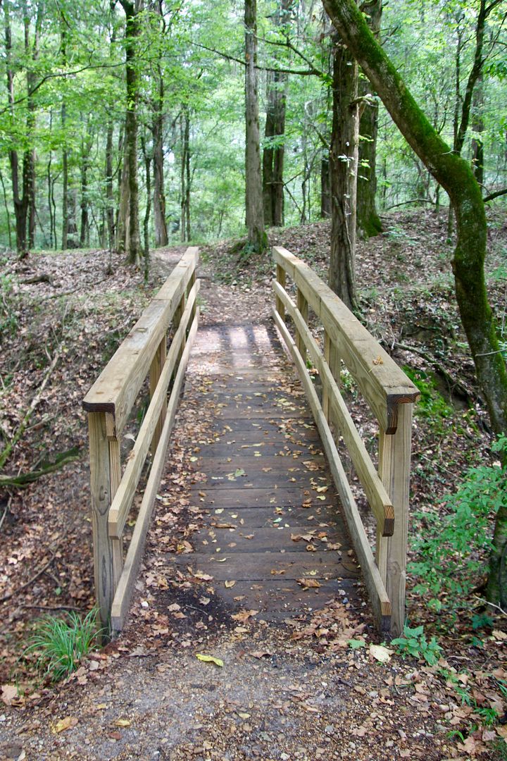
We really enjoyed this leisurely drive along this historic scenic highway. When we set out in the morning we had no specific plans other than to drive until we decided to turn back. With a picnic lunch we were able to take our time and enjoy points of interest.
We only drove about 55 miles of the 444 miles (of the Parkway through Mississippi, Alabama, and Tennessee), so there is a whole lot more to see! For additional information about the parkway, go to www.nps.gov/natr.
No comments:
Post a Comment