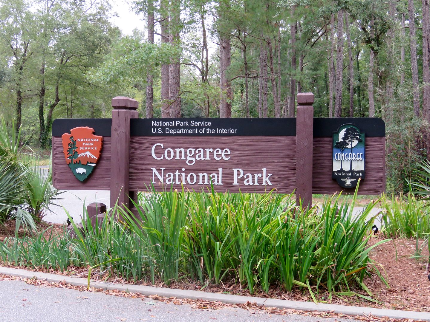
Harry Hampton, a conservationist, began efforts beginning in the 1950s to protect the Congaree. Two decades later, the Congaree Swamp National Monument was established (1976). Additional lands were set aside over the years and the area was designated Congaree National Park in 2003. The Visitor Center, our first stop, is named in honor of Harry Hampton who worked to protect the diverse plants and animals here.

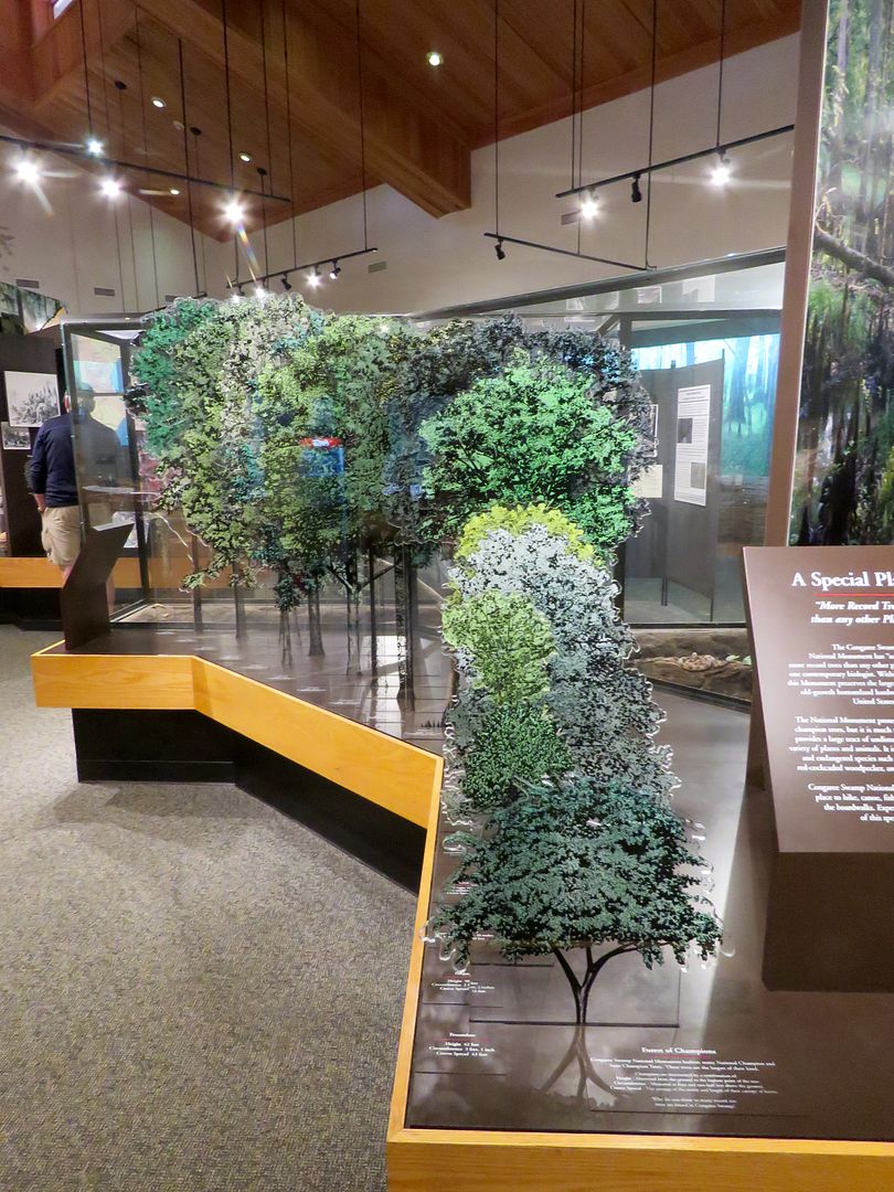
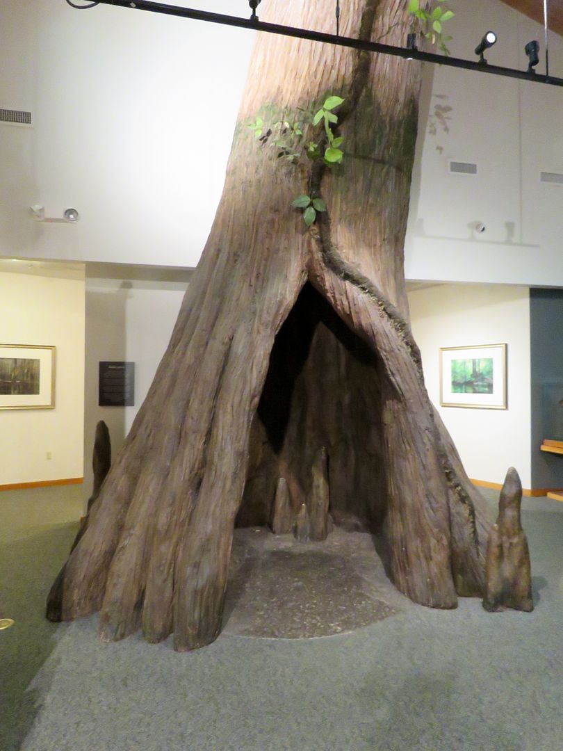
Displays provide lots of interesting info about the unusual number of giant trees that are record holders for their species: loblolly pines, hickories, and cypress. The flood plains provide the perfect conditions for them to thrive. The largest bald cypress is 27 feet in circumference! Other trees found here are the water tupelo, American elm, and cherrybark oak. Fallen trees provide homes for many animals and deposit important nutrients back into the soil.

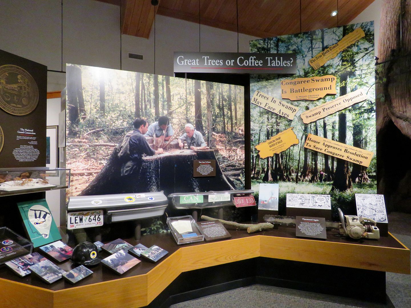
The battle to preserve the wetlands (lumber industrialists vs conservationists) is documented in the display shown below. Every time we visit a national park, there is a story about the individuals that had the passion and tenacity to preserve our national treasures! I enjoy learning about their stories...
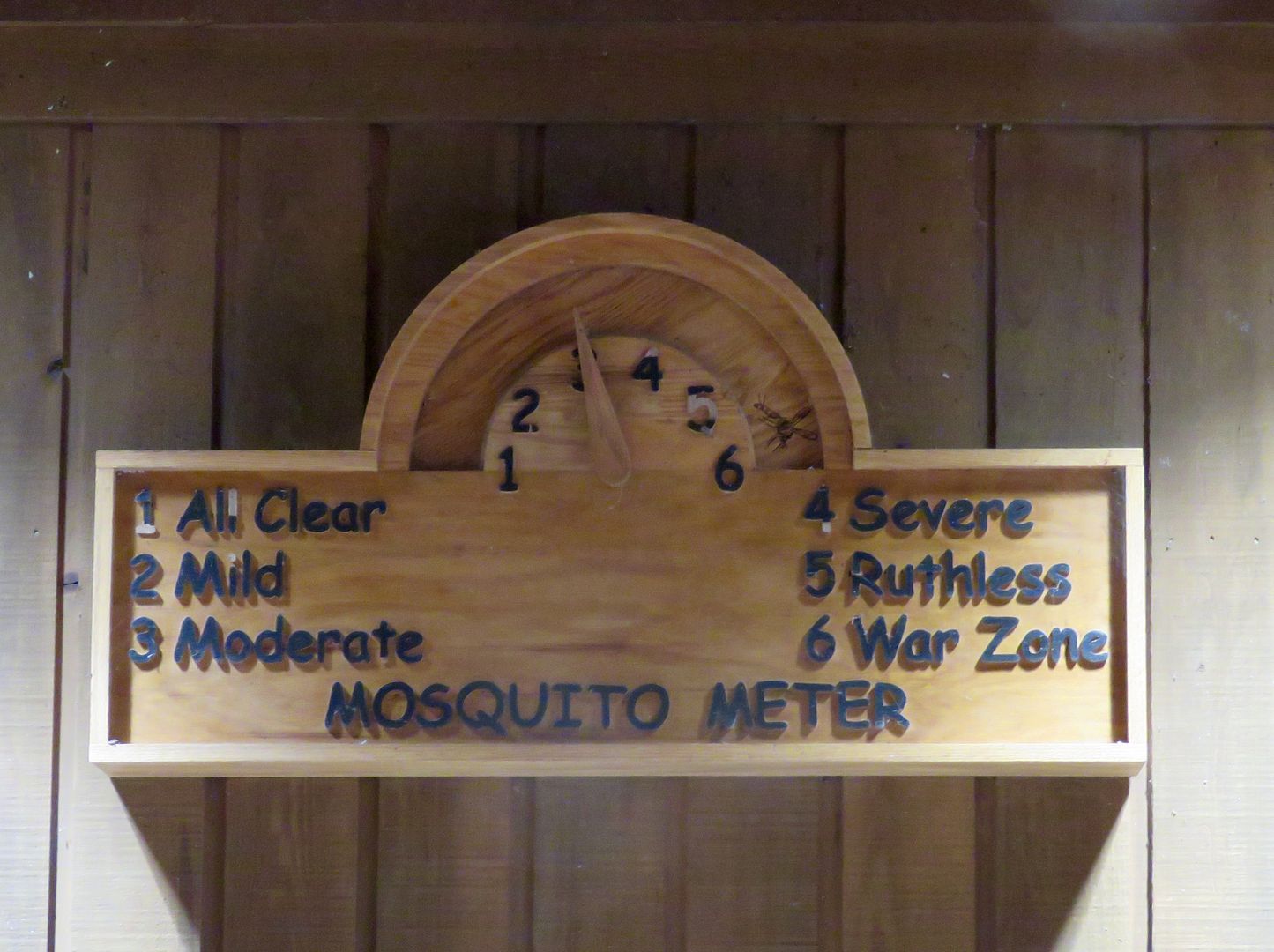
This is a good time to visit the Congaree because there were not that many mosquitos! Here's the meter...so assure you are adequately prepared before setting out on a hike.
Their are two ways to see the Congaree: hiking trails or kayak/canoe trails. A ranger-led canoe trip is offered this time of year (free) on Fridays and Saturdays (maximum of 18 per trip). Reservations can be made online, but they fill up well in advance. We were advised to check daily as there are often last minute cancellations. The week we were in the area, Hurricane Mathew caused the canoe trips to be cancelled.
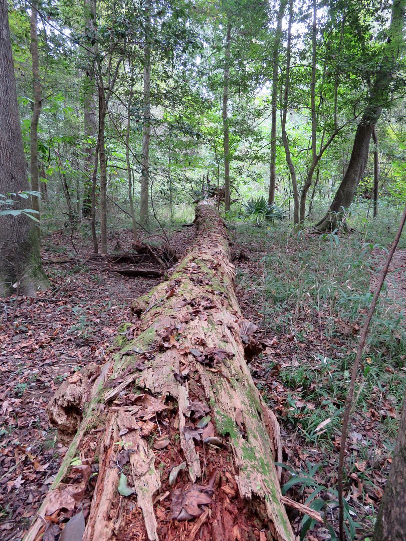
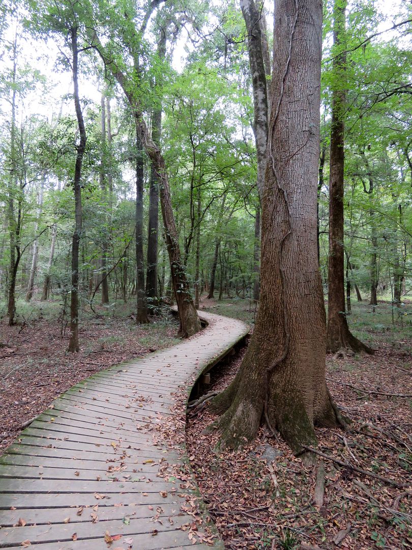
We spoke with a ranger and and decided to do both the Boardwalk Loop (2.4 miles) and Weston Lake Loop (4 mile) trails. Be sure to pick up the Self-Guided Boardwalk Tour brochure in the Visitor Center. The brochure provides interesting information at various points along the trail (20 numbers along the rail of the boardwalk). We were thrilled that our doggy, Sadie, was permitted on any trail in this national park. And so was she! Bicycles or motorized vehicles are not permitted on any of the trails.

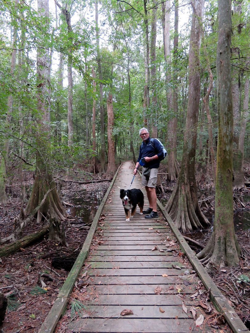
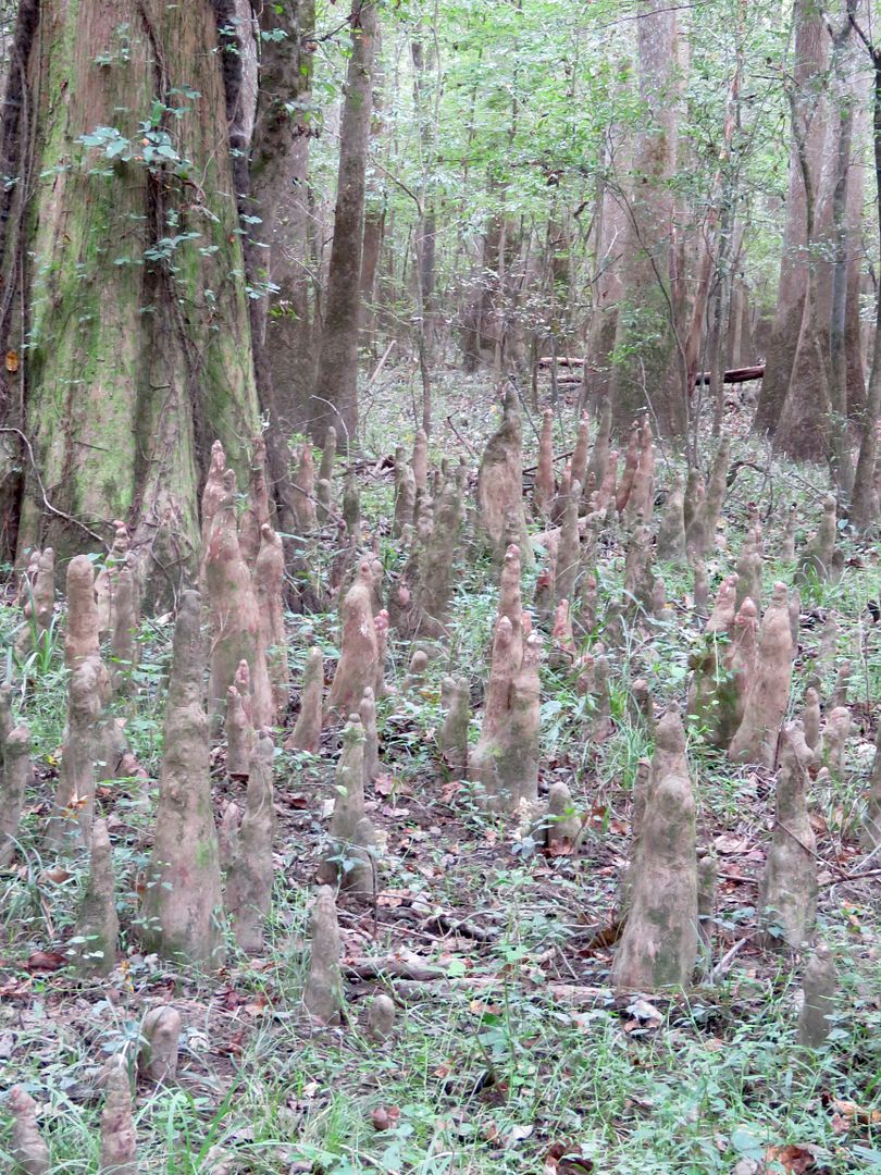
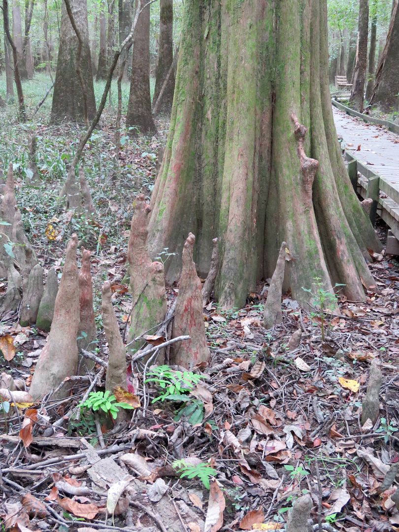
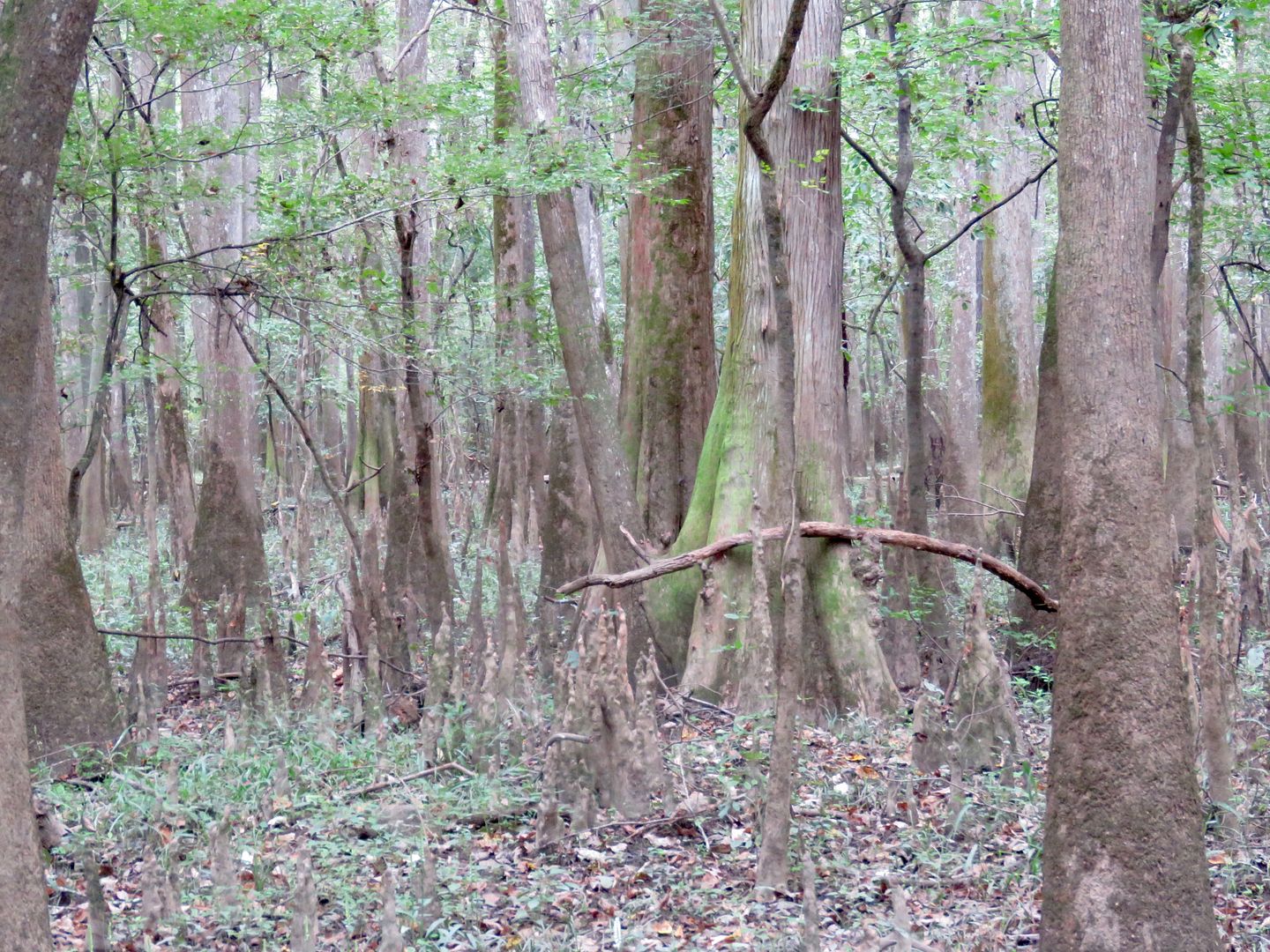
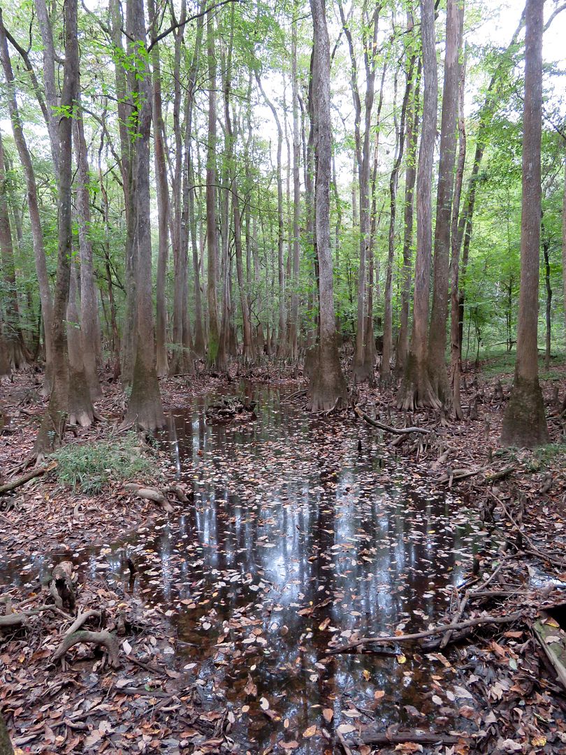
Bald cypress can be seen in abundance on the first leg of the Boardwalk Trail. Cypress knees grow all around the base of the trees. It is believed that they stabilize the trees and help them get air to submerged roots. Some of the cypress knees are 7' tall here! The tallest bald cypress trees are 150' tall and can be 600-1,000 years old.
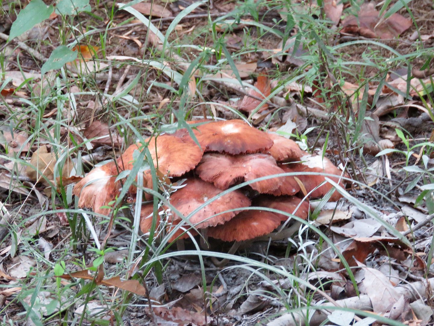
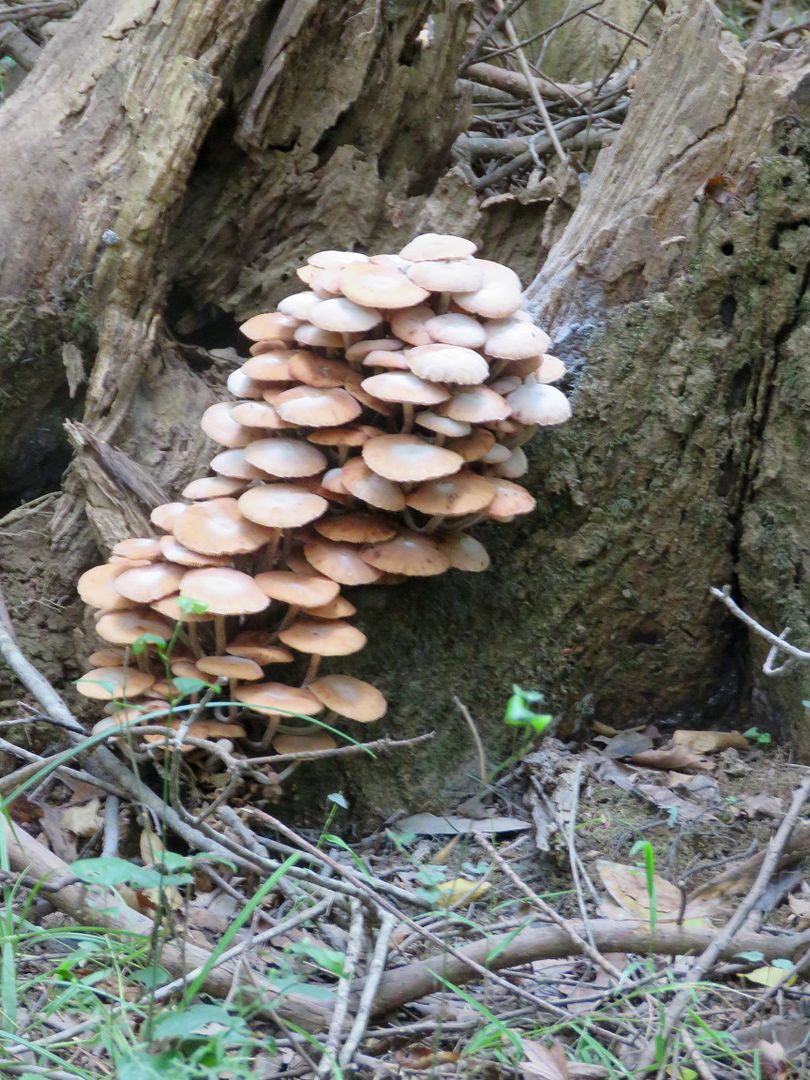
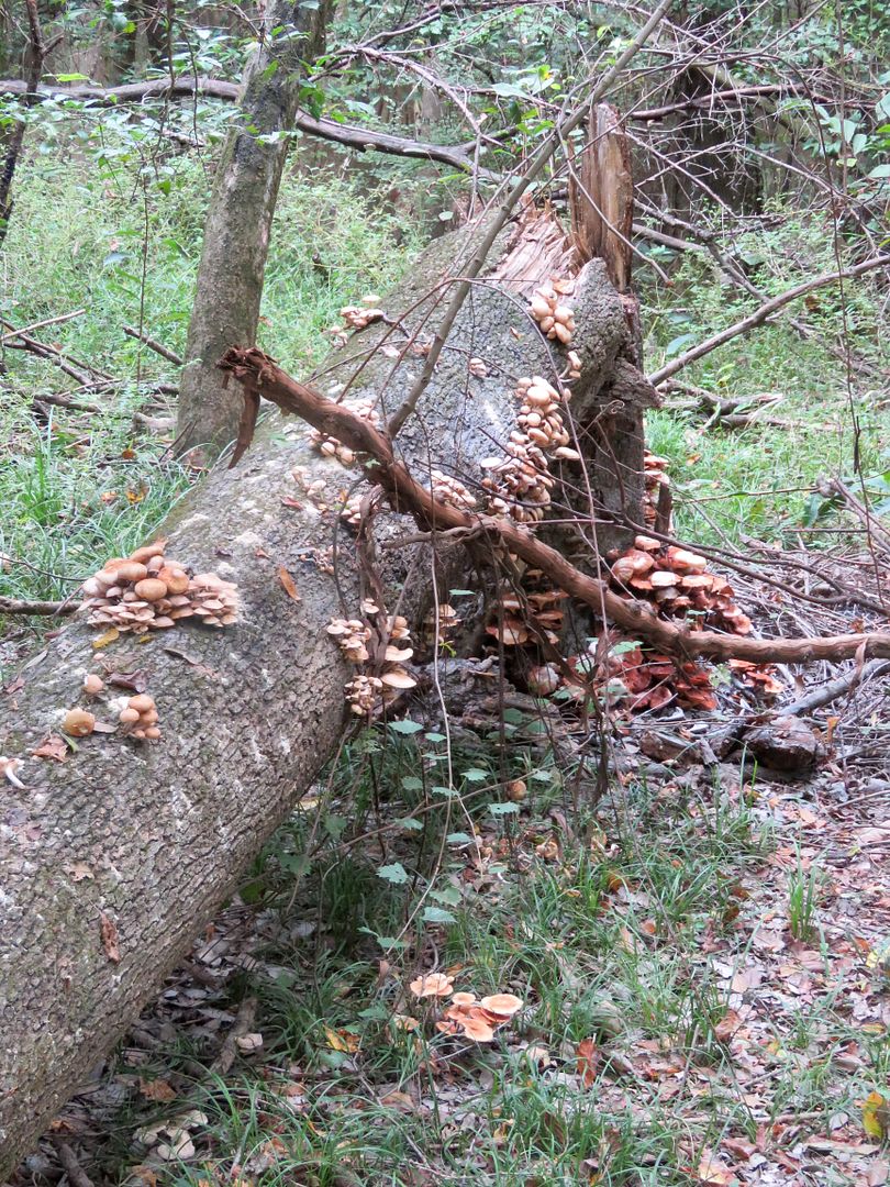
And then there were fungi...all shapes, sizes, and colors.
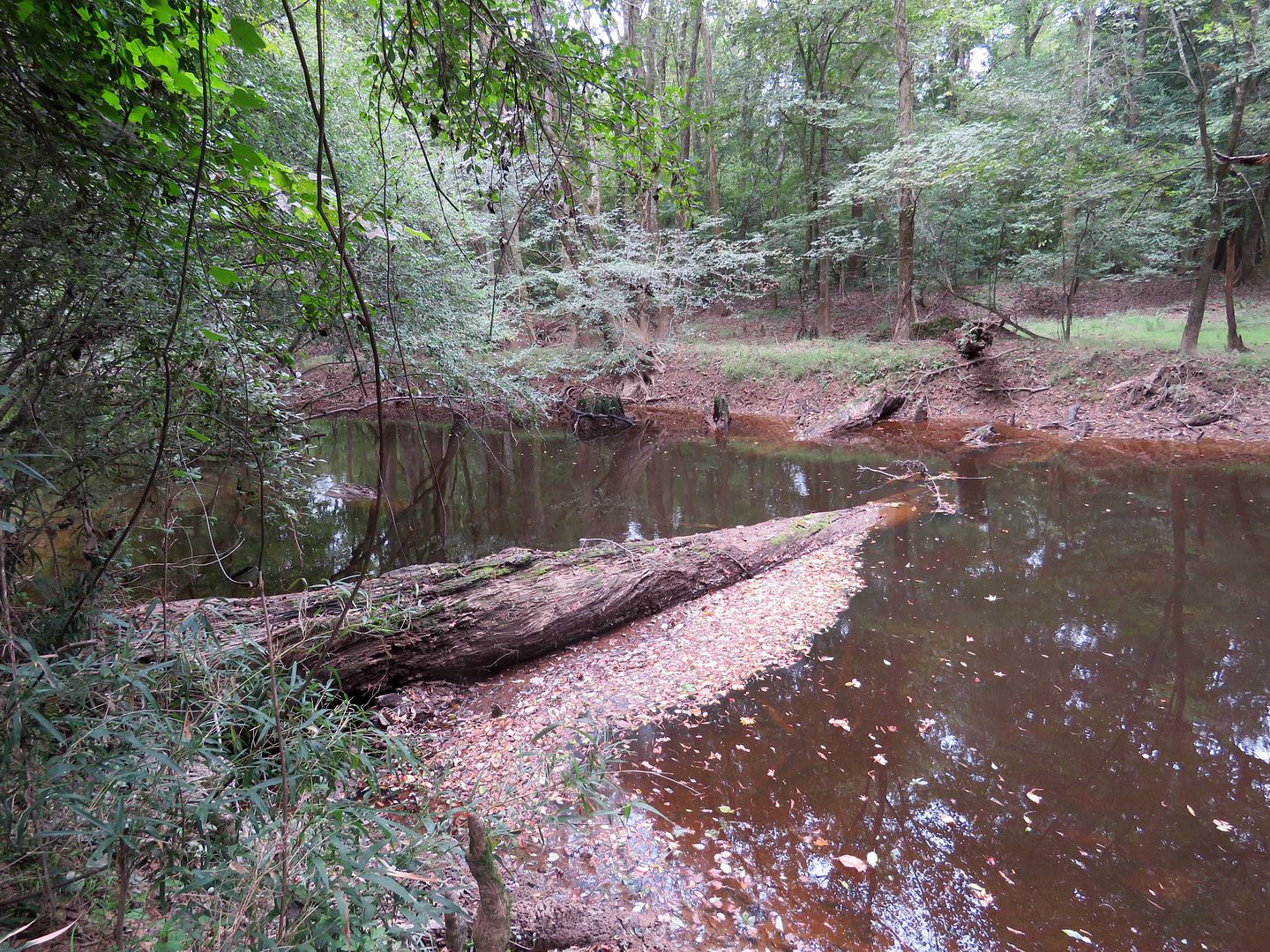
As we approached Weston Lake, we came to this low, flooded area in the forest called a "gut." The West Lake Loop trail encircles the lake.


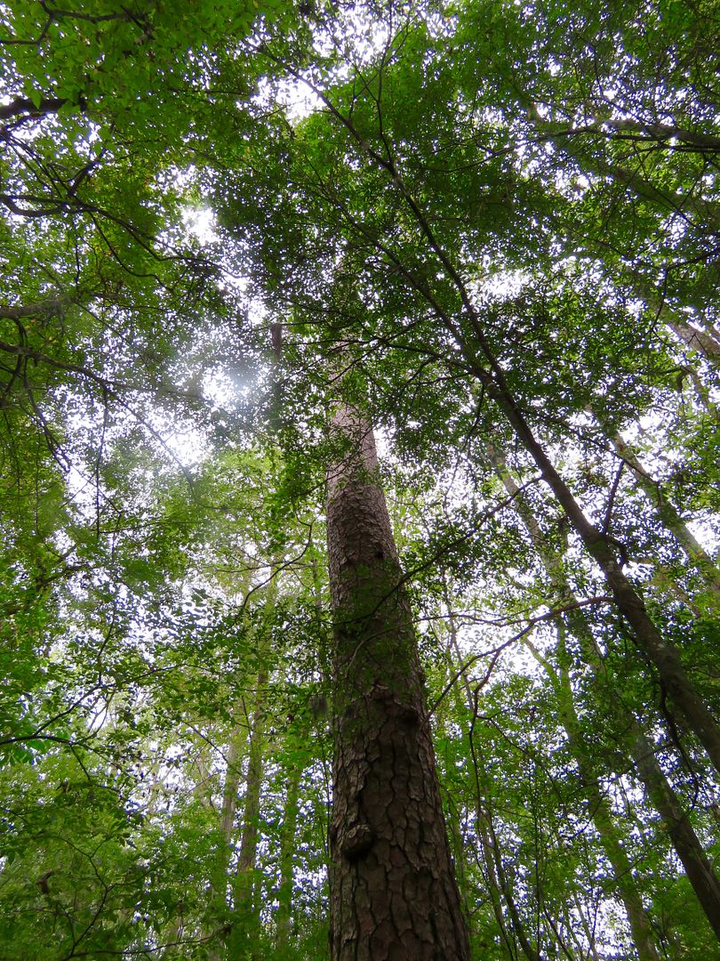
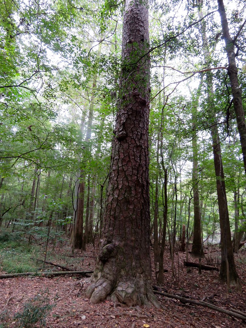
This is one of the many, large loblolly pines in this forest. It is unusual for pine trees to grow in wetland areas, but the loblollies tolerate it better than any other. This tree is over 150' tall (the average height of a loblolly is 130' here).
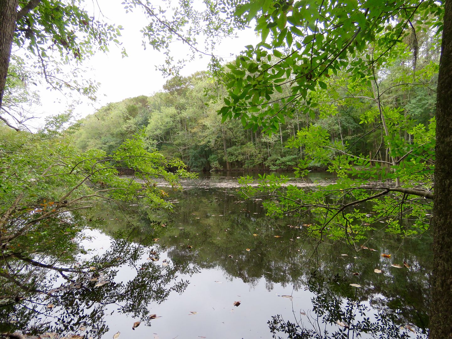
Lots of fallen trees can be seen in the forest; many of them from Hurricane Hugo. The bald cypress, though, are so well anchored by the knees that they seldom succumb to damage by wind. The loblolly pines are the tallest trees in the forest and are the primary victims of lightning strikes. Cedar Creek winds throughout the park and is seen along the Weston Lake Loop trail.


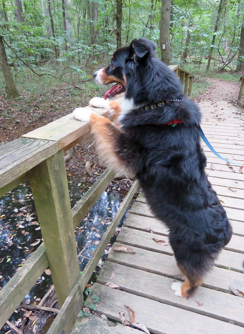
Sadie always likes to get a good view of things when we cross a bridge. Markers can be seen in the second photo that rangers use to measure the water level of Cedar Creek.

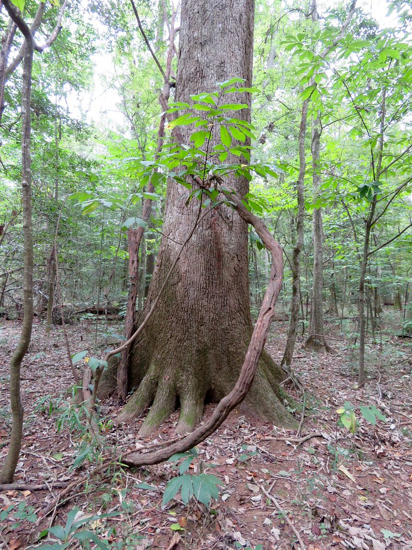
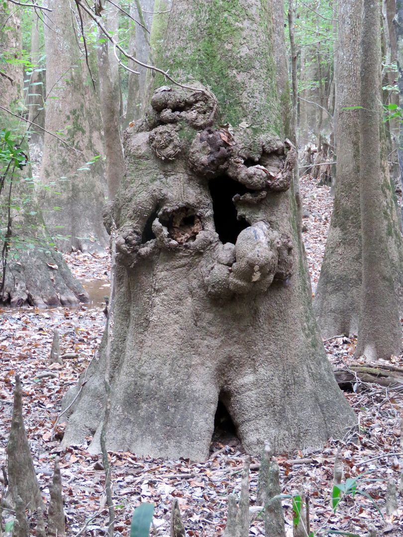
Large and small vines grow everywhere. And interesting tree formations can be seen as well.
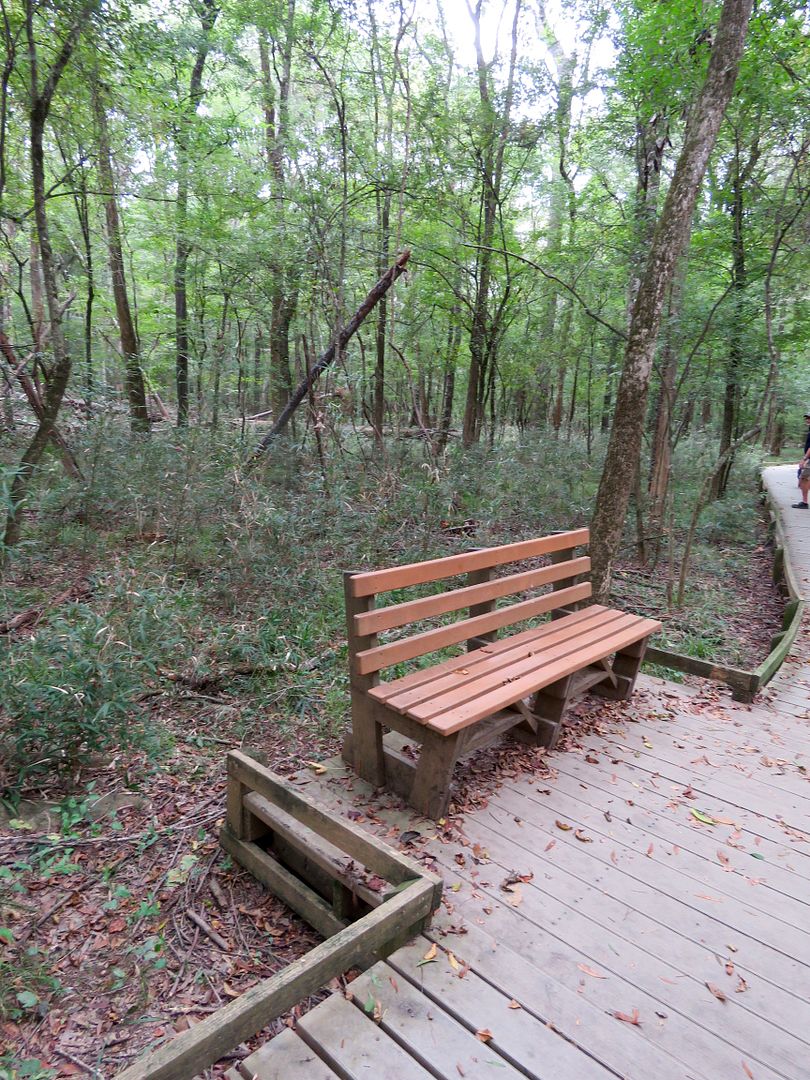
We stopped at one of the many benches along the trail for a picnic lunch and to enjoy the serene surroundings.
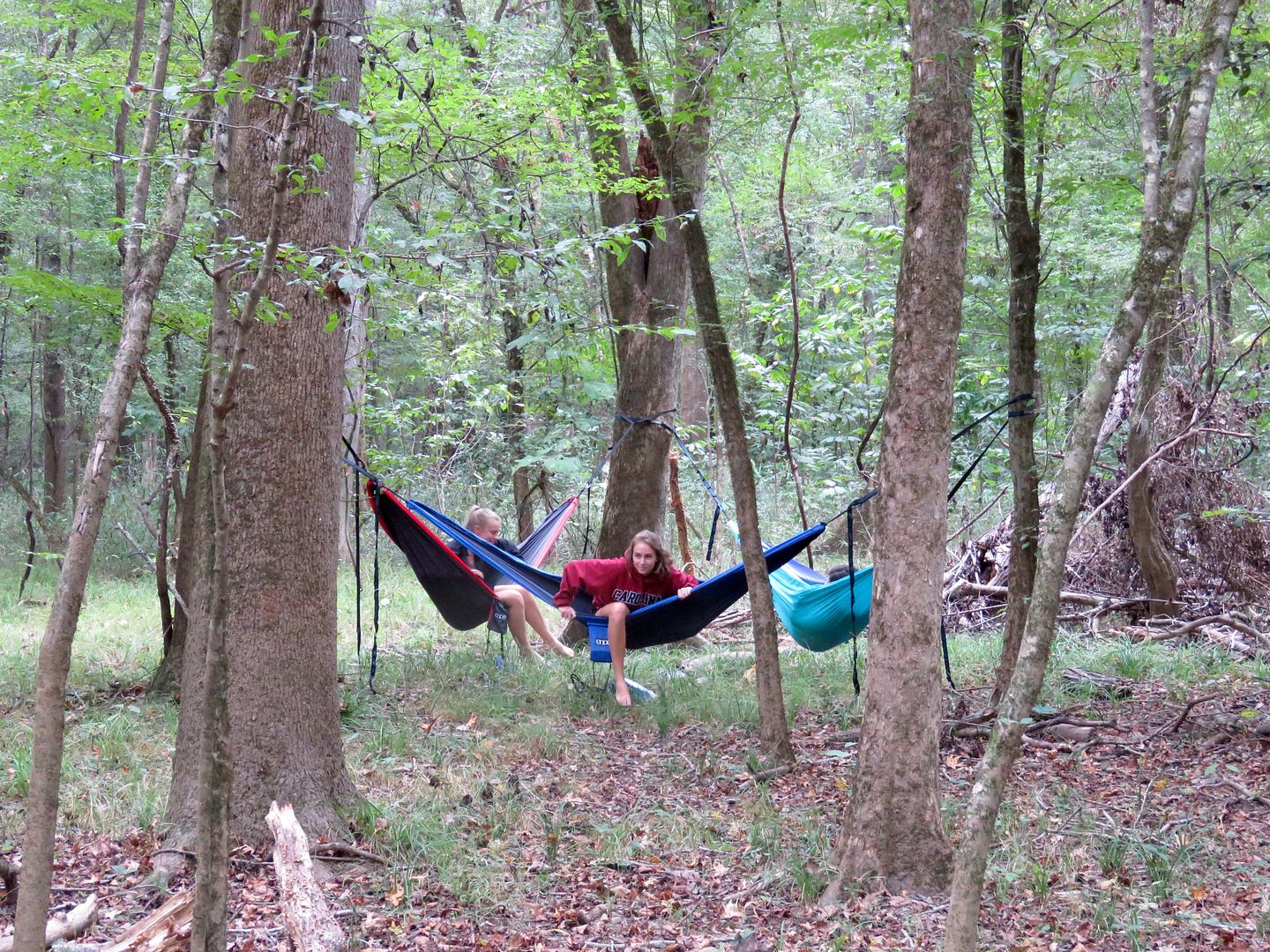
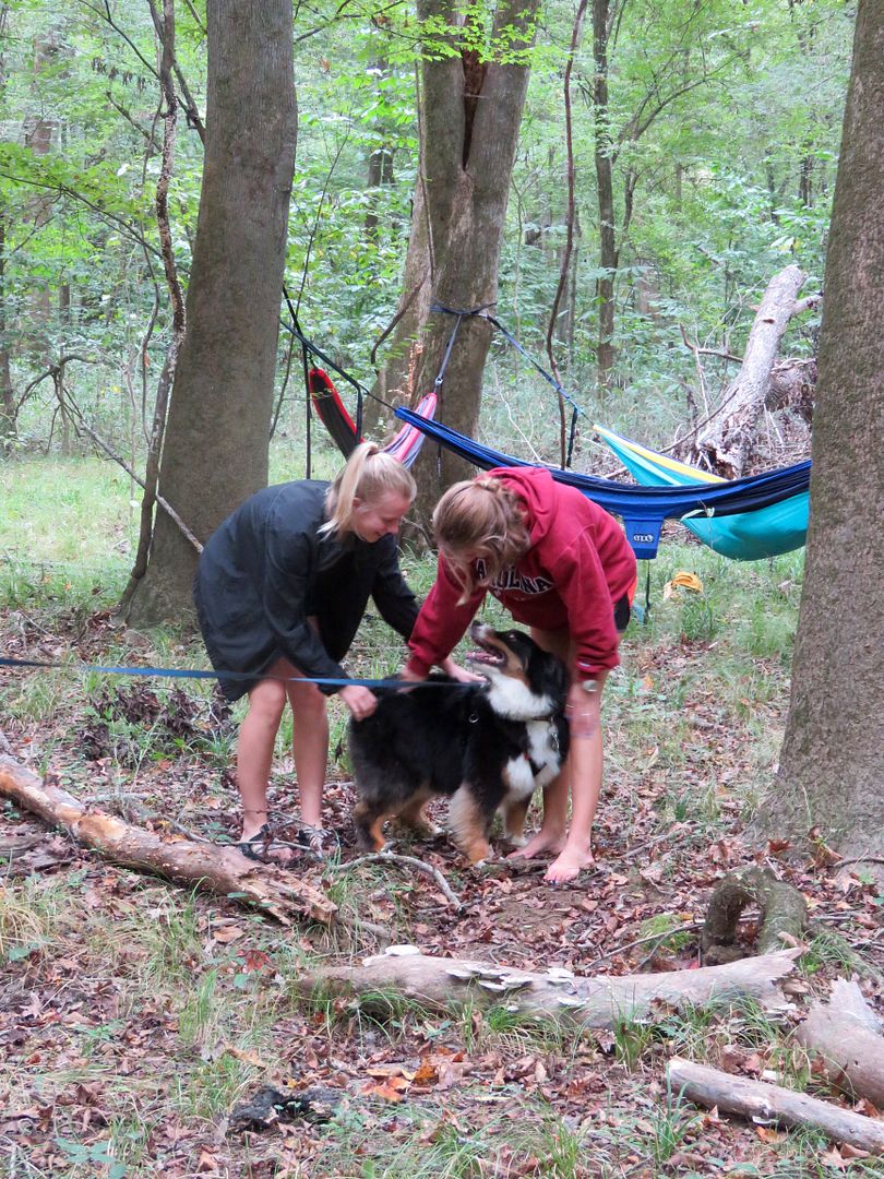
We came across several groups of University of South Carolina students enjoying the Congaree (since classes were cancelled due to the impending hurricane). Sadie made fast friends with these three who were enjoying some forest time in their hammocks.
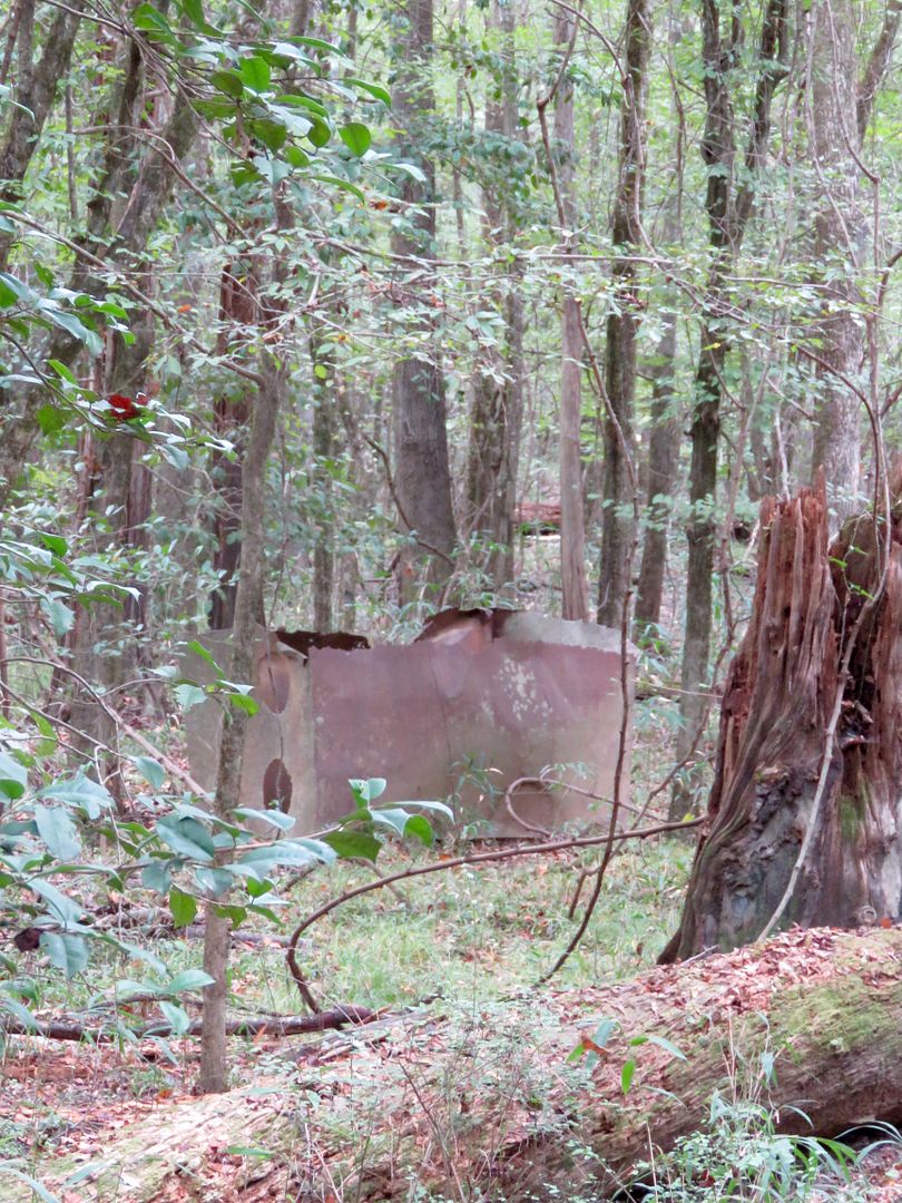
Below is a remnant of an old still that was used to make moonshine here during the prohibition years. The Congaree was such a remote location, that many profited by making and selling moonshine in the area.
Also, runaway slaves had an encampment in the forest here as it was very difficult for anyone to find them in the dense wetlands.
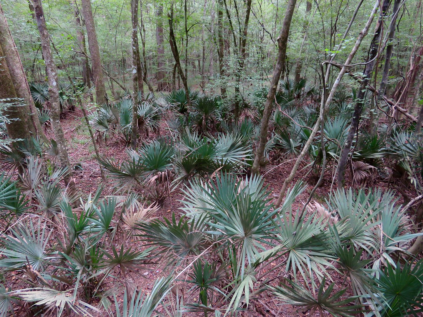
Near the end of the Boardwalk Trail is an area filled with dwarf palmettos. They are relatives of the cabbage palmetto, the South Carolina state tree.
We were disappointed that we did not see any of the beaver, otter, and wading birds that make Congaree their home. Nonetheless, the forest is beautiful and we loved spending time here. All of us (Sadie, included) were tired after our 6+ mile hike!
If you are interested in seeing some of the park by water, you can find rental equipment in the surrounding areas and bring them to the park. None are available at the national park. However, if you have reservations for the ranger-led canoe trip, the gear (canoe, paddles, life jackets, etc.) are provided.
The River Trail leads to the Congaree River and is a 10-mile round trip hike. After Hurricane Mathew, we did not return to the park to make that trip (although I thought it would have been fun to hike through the forest to reach it.)
There are two small tent-only campgrounds available for a modest fee: Longleaf (10 individual, 4 group sites, 2 vault toilets) and Bluff (no vehicle access, 6 campsites). Neither have running water so you must be prepared to carry in (and pack out) everything you need. Backcountry camping requires a (free) permit (available at the Visitor Center). Four types of poisonous snakes and alligators live here, so be aware when enjoying the trails and backcountry.
For additional information about the park or campground, go to their website: www.nps.gov/cong.
No comments:
Post a Comment